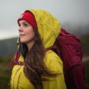
There’s nothing like hearing the sound of rushing water as you climb in the hills and mountains. It’s a thrill to round a corner and be faced with an imposing cascade, its power carving through rock and stone over many thousands of years to create a natural spectacle. Some like to visit in summer for a dip; others prefer the shoulder seasons when the flow is at its strongest and most impressive. Whatever you prefer, here’s a round up of the best hikes with waterfalls in the UK across our national parks, Areas of Outstanding Natural Beauty – and beyond – as selected by our expert contributors.
As pressure mounts on beauty spots with little infrastructure or funding to cope, we’ll also guide you to find your own waterfalls near you, lesser frequented and all the more special for the effort put it to locate them.
Our picks of the best hikes with waterfalls near you
Simply select the area you want to explore below and be guided to the best hikes with waterfalls that are local to you.
Please note: Some of these routes require scrambling skills. Please ensure your skillset is suitable and be prepared for the conditions that await you in the hills – and if in doubt, hire a local guide. When you visit, respect the local environment and leave no trace.
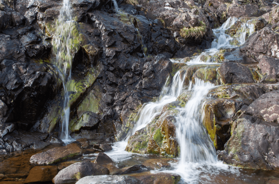
Best hikes with waterfalls in Scotland
Lochnagar, Cairngorms
Alex Roddie goes looking for the refreshment of sparkling mountain water on a hot day, and finds it on the way up (and down) Lochnagar.
START/FINISH: NO310851, Spittal of Glenmuick car park S of Ballater | MAPS: OS 1:25,000 Explorer sheet OL53 (Lochnagar, Glen Muick & Glen Clova), OS 1:50,000 Landranger sheet 44 (Ballater & Glen Clova), Harvey 1:40,000 British Mountain Map (Cairngorms & Lochnagar) | DISTANCE: 19km / 11.8 miles | ASCENT: 908m / 2,979ft | DURATION: 6 to 7 hours
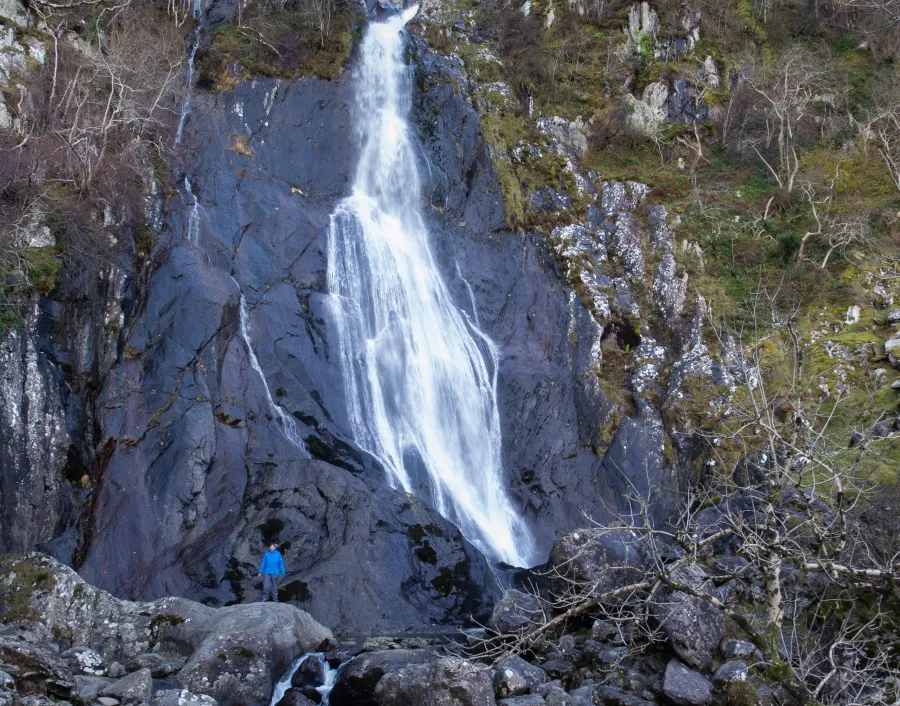
Did you know that Lochnagar was not originally the name for the mountain? Lochnagar is actually the name of the jewel-like loch held in the Corrie of Lochnagar. It’s thought that the mountain itself was originally called Beinn Chìochan or Beinn nan Cìochan, but the name Lochnagar eventually stuck. As mountain walks based around water go, this one has several points of interest. You’ve got the River Muick on the first stage. There are the bewitching deep waters of Lochnagar. Then, on the descent, you’ll come to the Falls of the Glasallt – one of the most attractive waterfalls in the area, and a lovely spot on a hot day. Finally there is Loch Muick, a large loch on the final stage of the walk. This is a cracking route up a cracking mountain – arguably the best in the entire Southern Cairngorms, and certainly the most rugged. And with good paths throughout and a starting elevation of around 400m, it isn’t too strenuous – although it’s still a Scottish mountain walk with everything that entails.
Read more: the full route description for Lochnagar
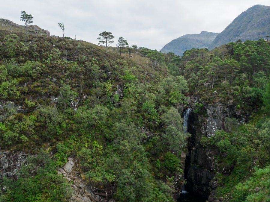
Beinn Eighe, Torridon
One of the more accessible mountains in the renowned Torridon area, Alex Roddie finds that Beinn Eighe makes for a memorable adventure visiting two Munros.
Start/Finish: Glen Torridon car park (GR: NG957568) | Distance: 19.6km/12.2 miles | Ascent: 1191m/3907ft | Duration: 7 – 9 hours | Maps: OS 1:50,000 Landranger sheets 19 and 25 (Gairloch & Ullapool and Glen Carron & Glen Affric); OS 1:25,000 Explorer sheet 433 (Torridon); Harvey British Mountain Map XT40 Torridon & Fisherfield
For hillwalkers in the Highlands who like their mountains rugged, the cluster of peaks north of Glen Torridon holds a special allure. Beinn Alligin and Liathach are shapely and distinctive. They’re also challenging, with sections of exposed scrambling. All of these factors add up to make Torridon one of the best bases in Scotland for hillwalking. But what if I told you that Torridon’s greatest mountain is neither of the above – and that it’s easier to climb than either, whilst still retaining a good level of challenge? Beinn Eighe is that mountain.
It’s huge but intricate. It has two Munro summits and a clutch more tops. There are enigmatic corries, craggy escarpments, a high-level loch and the legendary Triple Buttress with its climbing heritage. With well over 1000m of ascent and plenty of rough terrain to cover, this is a full day’s hill walk – with one short section of easy, ungraded scrambling. And the views will captivate you, especially southwest to Liathach. In my opinion, Beinn Eighe is one of Scotland’s best mountains.
Read more: the full route description for Beinn Eighe
Beinn Damh, Torridon
Torridon’s mountains may be some of the rockiest and steepest in Scotland, but Beinn Damh offers drama without the terror, says Alex Roddie.
MAPS: OS 1:25,000 Explorer sheet 428 (Kyle of Lochalsh, Plockton & Applecross), OS 1:50,000 Landranger sheet 24 (Raasay & Applecross) | DISTANCE: 11.6km / 7.2 miles | ASCENT: 951m / 3,120ft | DURATION: 5 to 6 hours
Torridon’s most famous peaks include Liathach, Beinn Alligin, and Beinn Eighe – big, serious, and (let’s say it) slightly scary mountains. If you lack scrambling skills, these mountains can be intimidating, and they’re all big days out. But not every Torridonian peak is like this. Beinn Damh is a high Corbett just a whisker below the magic Munro height, and the ascent is steep but straightforward – rocky ground and ridges with an airy feel to them yes, but outright scrambling and exposure no. It’s a compact, out-and-back climb with plenty of interest and some truly stupendous (and very wild) views from up on the ridge. Don’t let the fact that it’s ‘only’ a Corbett put you off, either. Beinn Damh packs in just as much drama as many of the finest Munros.
Read more: the full route description for Beinn Damh
Best hikes with waterfalls in North Pennines
High Force, Durham Dales
Ian Battersby tackles a route to the mighty High Force waterfall – and its little brother – in search of unburied family jewels.
Start/Finish: Bridge over the River Tees at Middleton-in-Teesdale (GR: NY947253) | Maps: OS Landranger 92 (1:50k) | Distance: 21.3 km / 13.3 miles | Ascent: 565m / 1853ft | Duration: 6 hours
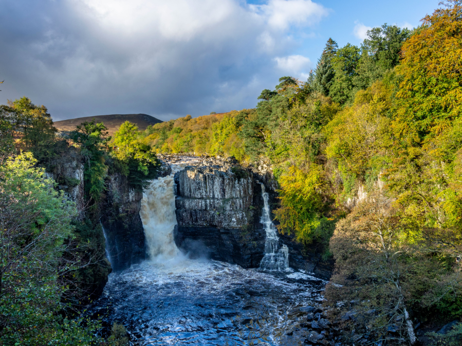
The River Tees cuts a sweeping path down a dale that has been shaped by glacial carving and meltwater scouring. The erosive conclusion has uncovered riches laid down many millions of years before the glacier was even a twinkle in the Pole’s eye. It was then that the planet’s crust yielded to pressure, leaking golden molten rock into subsequent underground voids.
There it cooled into the solid Whin Sill fault line until the glacier stripped away feeble capping layers only being halted by this durable dolerite, which now shapes the most prized diamonds of the vale. The river would be another steady stream of rippling precious stones but for this resolute band of confrontation. Instead, it is interrupted by violent torrents bellowing over Low Force – and if you think that’s good wait until you meet big brother High Force. Then you really should visit the dramatic Holwick Scar.
Here is the full route description for the High Force walk.
Best hikes with waterfalls in Yorkshire
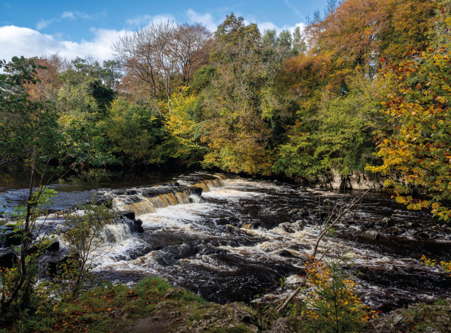
Redmire Force
Wensleydale is a grand location for the spectacle of Autumn, argues Ian Battersby.
START/FINISH: Layby at Wensley Bridge; SE092894 | MAPS: OS Explorer OL30 (1:25k), Harvey Superwalker XT25 Yorkshire Dales North East (1:25k) | DISTANCE: 18.75km / 11.7 miles | ASCENT: 445m / 1,460ft | DURATION: 5 hours
Hills deliver the thrills most of the time, but in autumn the lowlands carry the flame. Leaves are the magical food factories for plants, capturing sunlight to make sugar, but after the summer, when they have reached their ragged end, their green colour breaks down yielding regal reds, oranges and yellows. It’s a popular time of year as the effect upon the landscape is truly inspirational.
Wensleydale in North Yorkshire excels in this season. The River Ure meanders, hidden between the boughs of flourishing trees and rivers are fine locations for the autumn flush. Stop at Redmire Force where the river thunders over a series of open rocky shelves, and downstream bubbles collect in dark, hypnotic swirls. But, this vale offers so much more. Glacial deposits abound, with compelling oval hillocks flattering much of the valley floor. This rolling landform has thrown a life line for trees that might otherwise have been farmed away. These alluring curves contrast with the stepped terraces above, whose straight lines are also bolstered with the presence of trees. Walk along them to discover a stage overlooking arboreal delight.
Read more: detailed route description for Redmire Force
Best hikes with waterfalls in Wales
Cadair Berwyn
Andrew Galloway explores a Welsh village with two sixteenth-century pubs via a hike up Cadair Berwyn.
Start/Finish: The village of Llanarmon Dyffryn Ceiriog in the County Borough of Wrexham (GR: SH589218) | Distance: 25 km (15.5 miles) | Ascent: 890m | Time: 7 hours + breaks | Maps: Ordnance Survey Explorer 1:25,000 Sheet 255 Llangollen & Berwyn
The village of Llanarmon Dyffryn Ceiriog, nestled among the Ceiriog Valley’s verdant hills, is blessed with two public houses. The Hand and The West Arms were both constructed in the sixteenth century as farmhouses and later found use as watering holes for agricultural workers moving herds of livestock from rural Wales to the market towns of the Welsh Marches. Llanarmon village is at the intersection of a number of ‘drovers’ routes, ensuring plenty of passing trade. Nowadays, the hotels have a reputation for fine dining, the etymology of their unusual names deriving from the heraldry of two local families, the Myddletons of Chirk Castle and the Cornwallis-Wests of Ruthin Castle.
The drovers have hung up their boots and the historic tracks fanning out from the village square are now used by walkers to access the high cairns of the Berwyn Mountains. Lying outside the national park boundaries, these offer the discerning walker a secluded mountain experience and the opportunity to visit one of the finest waterfalls in Wales, Pistyll Rhaeadr, four miles to the west of the village of Llanrhaeadr-ym-Mochnant. That is, if they can separate themselves from the pubs’ nutty brown ales and cosy fireplaces.
Read more: detailed route description for Cadair Berwyn
Aber Falls, Eryri/Snowdonia
Andrew Galloway escapes on an easily accessible sea-to-summit Snowdonian route past Aber Falls and into the hills overlooking the Menai Strait.
Start/Finish: Parking at Bont Newydd Abergwyngregyn (GR: SH662720) | Maps: OS Explorer (1:25,000) OL17 | Distance: 14.5km/9 miles | Ascent: 500m/1640ft | Duration: 5 hours
Situated just a mile south of the village of Abergwyngregyn, and easily accessible from the A55 North Wales Expressway, the Coedydd Aber Nature Reserve is one of my favourite locations in Snowdonia. This beautiful glacial valley looks out from the foothills of the Carneddau Mountains over the waxing and waining waters of the Menai Strait, offering a truly sea-to-summit experience of Snowdonia and its Aber Falls.
At the head of the valley stands the craggy peak of Bera Mawr, a challenge for even the most experienced of walkers. Wild ponies roam free on the slopes of these hills, from where the ebullient waters of Afon Goch rise before tumbling one hundred and twenty feet into the valley floor. Rhaeadr Fawr, known as Aber Falls in English, is certainly the star attraction, but there are other treasures here. The extensive woodlands of ash and oak are a haven for a variety of birds and other wildlife. In winter dippers and grey wagtails can be seen hopping from rock to rock beneath the falls. In spring wood warblers, redstarts and crossbills make their home among the coppiced alder trees.
Read more: detailed route description for Aber Falls
Rhinog Fawr & Pistyll Gwyn
Ian Battersby finds gold on Rhinog Fawr – but not by chasing Roman ghosts.
START/FINISH: Farm and parking at Cwm Bychan; SH646315 | MAPS: OS Explorer OL18 (1:25k), OS Landranger 124 (1:50k), Harvey British Mountain Map Snowdonia South De Eryri (1:40k) | DISTANCE: 11.7km / 7.3 miles | ASCENT: 766m / 2513ft | DURATION: 5 hours
The Roman Steps above Bwlch Tyddiad on Rhinog Fawr were built and used by battalions of Roman warriors during their centuries of Welsh occupation. Their presence was so rooted here that even today it is possible – according to some – to glimpse leagues of troops marching the route, and leading those who would follow to gold. As you march the slabs and look up at the towering crags, it’s easy to imagine potential ambush, but it turns out that imagination is mostly what feeds this tall tale.
In fact the route is likely rooted in the Bronze Age, and the stepped upgrade is thought to be Medieval, but many a true word is spoken in jest. The Romans may have used the route before the “Steps” were a twinkle, long before what we now know as the Cambrian Way came to fruition, and going along with the myth is fun. Legend has it, it may also bring golden rewards that come with successfully navigating this taxing terrain to uncover waterfalls, dense woods, alluring lakes and formidable crags with far-reaching vistas.
Read more: detailed route description for Rhinog Fawr
Gwydyr Forest waterfalls
In Gwydyr Forest Andrew Galloway finds water wherever he goes.
Start/Finish: Gwydyr Car Park located on the B5106 close to the Llanrwst sports fields | Distance: 20 km (12 miles) | Ascent: 626m (2,050 feet) | Time: 5 hours | Maps: Ordnance Survey 1:25,000 Yr Wyddfa/Snowdon Dyffryn Conwy Valley OL17
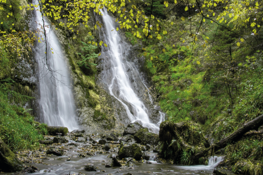
Whether in the stillness of Llyn Crafnant & Llyn Geirionydd, crashing through the Llugwy river gorge, or tumbling over the leafy crags of Coed Felin Blwm, water forms an integral part of the Gwydyr Forest landscape. The ample supply of this natural resource made these wooded foothills of the Carneddau attractive to the 19th century mining industry. The area is dotted with reservoirs, criss-crossed with meandering leats, built to feed the water wheels that powered the machinery of the metal mines, from which lead and zinc were extracted. Llyn Geirionydd is popular with water sports enthusiasts. The village of Llanrhychwyn is less than a mile away. Anyone who knows anything about the Welsh language will know that “llan” often refers to the location of a church. Rhychwyn is believed to have been one of twelve sons of Helig ap Glannog, a 6th century prince who, according to legend, lived on the isle of Llys Helig, until it was submerged by the waters of the Menai Straight in a violent storm. Established by Rhychwyn in honour of his father, this church is believed to be the oldest extant site of Christian worship in Wales.
Read more: detailed route description for the Gwydyr Forest waterfalls walk
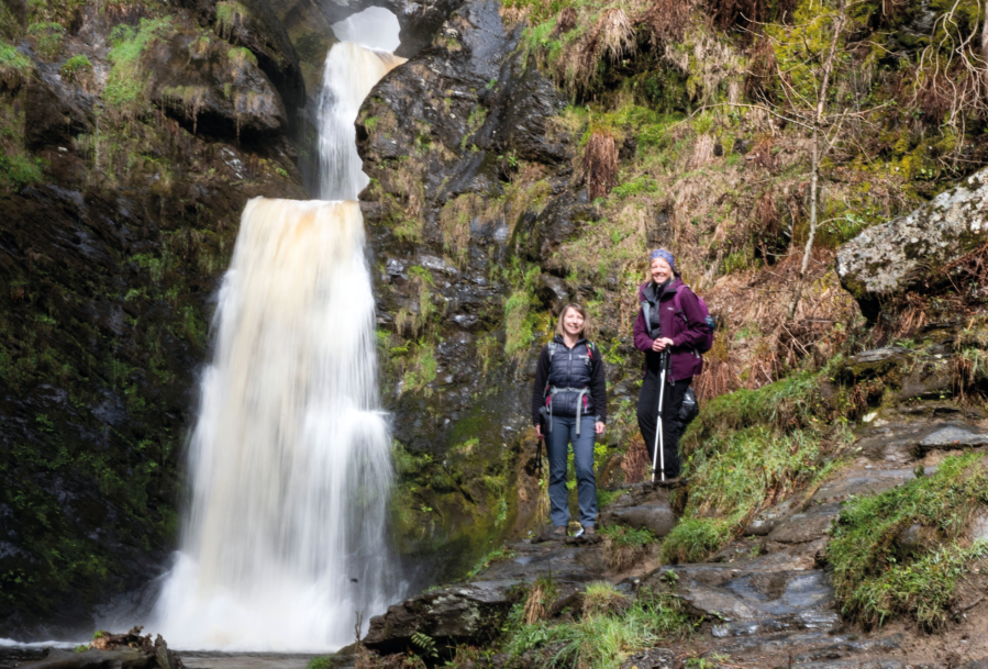
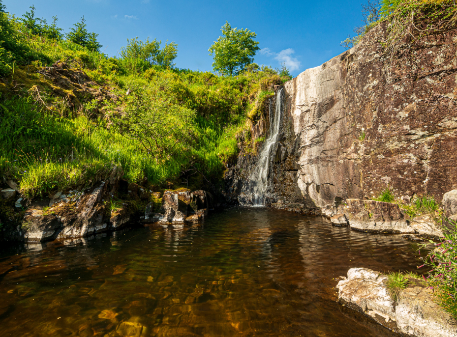
Four Falls Trail, Bannau Brycheiniog
Fiona Barltrop enjoys a walk in Waterfall Country on the Four Falls Trail in Bannau Brycheiniog.
START/FINISH: Car park in Ystradfellte (SN929134) | MAPS: OS Explorer OL12 (Brecon Beacons National Park – Western area) | DISTANCE: 10.7km/6¾ miles | DURATION: 4 hours | ASCENT: 383m/1257ft

Situated in the south of the Brecon Beacons National Park (or Bannau Brycheiniog, to use the new name), Waterfall Country, as it is popularly known, is a relatively small area through which several rivers, including the Mellte and Hepste, flow down deep wooded gorges, cascading over a series of dramatic waterfalls, before joining to form the River Neath. Not far from the village of Ystradfellte (where this walk starts) at Cwm Porth is Porth yr Ogof, the largest cave entrance in Wales, where the River Mellte disappears underground before reappearing further downstream. There are several waymarked trails, notably the Four Falls trail (incorporated in this route), which takes in the four most popular waterfalls. The trail is marked with numbered posts and there are information panels along the way at the turn offs for the waterfalls, so you can pinpoint where you are. A Waterfall Country leaflet with a very useful large scale map is available from the Cwm Porth car park shop. Note: there have been high numbers of visitors in recent years, so advisable to avoid bank holidays and weekends, especially in fine weather.
Read more: detailed route description for the Four Falls Trail
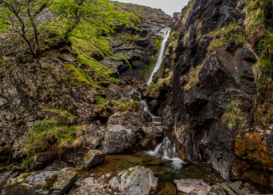
Best hikes with waterfalls in Cumbria
Cautley Spout
The Calf via Cautley Spout and The Cross Keys Temperance Inn Roger Butler treads tussocky tops to The Calf by way of a 17th century temperance inn.
Start/Finish: Lay-by next to the Cross Keys Inn, grid ref SD698969 | Map: OS Explorer OL19 (1:25k), OS Landranger 91 and 98 (1:50k) | Distance: 16km/10 miles | Ascent: 1015m/3325 feet | Duration: 8 hours

Alfred Wainwright once described the smooth contours of the Howgill Fells as ‘a huddle of squatting elephants’ and, on a good day, it’s quite easy to wander across these tussocky tops with your hands firmly in your pockets. The rolling horizons, and a complete lack of walls and fences, might encourage you to whistle whilst you walk but the skylarks will also provide a suitable serenade. This wriggling circuit includes breezy tops, deep valleys and dark crags and also passes over the broad summit of The Calf, the highest point in the range. You’ll climb over several fells, look down into the great gulch of Bowderdale, walk along the high edge of Cautley Crag and descend a steep zig-zag path next to the tallest above-ground waterfall in England. And there’s a pub. The Cross Keys Inn, from where the walk starts and finishes, dates from the 17th century but doesn’t serve alcohol since it operates as a temperance inn. Try their nettle cordial – but you can also bring a bottle of wine if you’re going to eat there!
Read more: the detailed route description for The Calf via Cautley Spout
Holme Force and the Loweswater Fells
Vivienne Crow visits a hidden waterfall while wandering Lakeland’s western fells.
START/FINISH: Large layby on minor road, about 3km north-west of Loweswater village, GR NY118224 | MAPS: OS Explorer OL4 (1:25k), OS Landranger 89 (1:50k), Harvey 1:25,000 Superwalker Lake District North | DISTANCE: 13km/8.1 miles | ASCENT: 713m/2339ft | DURATION: 4 hours
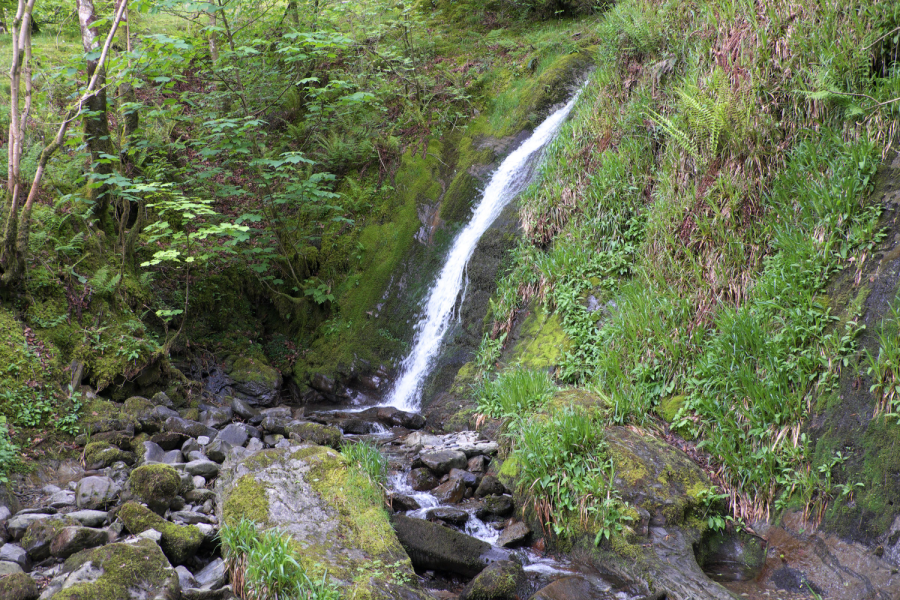
Secreted away in the woods above Loweswater is a succession of small waterfalls that culminates in a narrow ribbon of water running down a smooth-sided chute before tumbling off down the boulder-strewn bed of Holme Beck. Higher still are other cascades, including one which shoots over the lip of the bedrock and forms a graceful arc mid-air. With only deer and red squirrels for company at first, this walk pays a visit to Holme Force before climbing to the gently rounded tops of the Loweswater Fells. Gavel Fell (526m), Blake Fell (573m) and Burnbank Fell (475m) are close to the coastal edge of the National Park, enjoying views out across the Irish Sea as well as glimpses of the western lakes, including Crummock Water. While hill-walkers are irresistibly drawn to the area’s higher mountains, the Loweswater Fells retain an air of lonely isolation. It’s easy to be dismissive about these less lofty summits, but they have a character of their own that includes some surprisingly steep and rugged faces, secretive ravines and a great perspective on their more dramatic neighbours.
Here is the full route description for the Holme Force walk.
Glaramara and Bessyboot
Andrew Galloway finds hard work to reach Glaramara pays off with its 360-degree views of the central Lake District Fells.
Start/Finish: National Trust Car Park at Seatoller (GR: NY245137) | Maps: Ordnance Survey 1:25,000 Lake District North-West Area OL4 | Distance: 11.2km / 7 miles | Ascent: 778m / 2,552ft | Time: allow 6 hours
Some miles are longer than others. The rugged mountains of upper Borrowdale offer a challenge to even the most experienced of walkers. What on paper may give the impression of being a simple circuit of fells with mileage in single figures, in reality can translate into an arduous day requiring considerable physical, navigational and even emotional determination. But hard work is seldom without its rewards. In good weather the rocky summit of Glaramara offers a dramatic prospect of the valley below and a three hundred and sixty degree view of the central Lake District Fells.
A little further to the North, beyond a cluster of small tarns, the inauspicious crown of Combe Head provides a breathtaking vista over the steep-sided hanging valley of Combe Gill. Progress along the eastern ridge of the gill requires some careful route finding to locate the narrow col above Cam Crag. A little further eastwards, concealed within a natural amphitheatre between Rosthwaite Fell and Bessyboot lies a small lake known as Tarn at Leaves. The sparkling waters make for an ideal location to sit and refuel before commencing the steep descent to Seatoller.
Here is the full route description for the Glaramara and Bessyboot walk.
Black Force & Langdale Fell
Ian Battersby makes mischief to uncover a trio of remarkable waterfalls, including Black Force, thanks to a bit of navigation and the 2000 CROW Act.
START/FINISH: Gaisgill junction with A685; NY640054 | MAPS: OS Explorer OL19 (1:25k) | DISTANCE: 19.5km / 12 miles | ASCENT: 910m / 2,985ft | DURATION: 7.5 hours
The Howgills are made for explorers, especially since the CROW Act 2000. The entire region is designated Open Access. What’s more there are precious few walls to bar the way, and well-drained grassland makes being off piste a cinch. Even so, energy can be saved if unmarked paths are discovered. It’s just a matter of poring over the map, finding landmarks that set the imagination alight, then taking that research into the hills and seeing what theory and practice allow. Black Force and The Spout illustrate the point nicely.
These names, along with their tightly packed contours, are invitations for scallywag explorers that can’t stick to normal rights of way. There is little doubt an approach should be possible, but what about the gill that contains them? Would it be passable? Then what? Retreat or onward battle? It took two days of navigation and exploration along sometimes unlikely paths to find the perfect solution. On route, stumbling upon a third waterfall was a welcome bonus.
Here is the full route description for the Black Force waterfall walk.
Best hikes with waterfalls in the Peak District
Three Shires Head and Wildboarclough, White Peak
Francesca Donovan visits the popular Peak District picnic spot at Three Shires Head and another hidden waterfall perfect for a more secluded dip.
Start/Finish: Nabb Car Park, Wildboarclough (GR: SJ973 670) | Map: OS Explorer OL24 – White Peak area (1:25k) | Distance: 11km/6.8 miles | Ascent: 352m/1155ft | Time: 3 hours
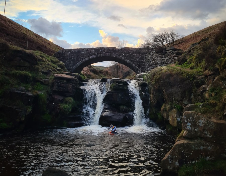
Three Shires Head is beloved for an old stone bridge that crosses over the River Dane where the counties of Staffordshire, Derbyshire and Cheshire meet. Constructed in the 18th century, the bridge had a reputation for lawlessness. Folks would evade capture in their home counties by crossing over to the neighbouring shire. Nowadays, it is a quintessentially peaceful Peak District scene. The waterfall lends a natural soundtrack to this packhorse route for the picnickers who lounge here. It’s a busy dipping spot, especially in summer.
But on the other side of Cumberland Clough, past mighty trees, awaits the smaller, secluded waterfall of Wildboardclough. This route will take you to both, along quiet lanes, past the mighty Shutlingsloe, and along wooded trails. Farmland also comprises some of this route and birds nest in the open access land, meaning it’s best to leave your four-legged friends at home.
Here is the full route description for the Three Shires Head waterfall walk.
Best hikes with waterfalls in South England
Hartland to Bude, South West Coast Path
Fiona Barltrop relishes one of the best coastal walks in the country, from Hartland to Bude along the South West Coast Path.
START: Hartland bus stop/shelter, Northgate Green (SS259245) | FINISH: Bude town centre (SS208064) | MAPS: OS Explorers 126 & 111 (1:25k), OS Landranger 190 (1:50k) | DISTANCE: 28.5km/17¾ miles | ASCENT: 1206m/3957ft | DURATION: 9 hours

Arduous though it may be, the 15¼-mile stretch of coast path between Hartland Quay and Bude, which crosses the Devon/Cornwall border part way along, is one of the most spectacular sections of the South West Coast Path National Trail. The SWCP Association’s annual guide grades it ‘severe’ with an overall ascent of some 4,000ft. Indeed, there are ten steep, deep river valleys to cross along the way. Nonetheless, any suitably fit person with plenty of stamina who takes it in their stride should enjoy a great day of coastal walking here. Fine settled weather makes all the difference, with the long days of late spring and summer being the best time for it.
There are buses between Bude and Hartland village, but no public transport to Hartland Quay. So unless you can take a taxi from Bude (none from Hartland) or two cars between you and another walking companion, bear in mind the added distance, although it is an easy 2½-mile walk to the coast and worth the extra effort to take in this linear route along spectacular coastline.
Read more: detailed route description for Hartland to Bude
The Liberty Walk
Tim Gent ponders on one of the more troubling events in our past on The Liberty Walk in Dartmoor.
START/FINISH: Free parking in Sourton close to the church, but avoiding church spaces (SX 535 903) | MAPS: OS Explorer OL28 | DISTANCE: 10.5km/6.5 miles | ASCENT: 328m/1076ft | DURATION: 4-5 hours

Aircraft 63926 transmitted its last message at 10.15 on a December night in 1943. A return to base was expected in five minutes. The plane never arrived. Setting out from RAF Dunkeswell in East Devon, the US Navy Liberator had been hunting enemy ships in the Bay of Biscay. They’d been fired upon, but pilot William Parish reported only ‘slight problems’ as a result. Perhaps the altimeter was damaged. Whatever the reason, the aircraft hit Dartmoor’s Corn Ridge, before tumbling into the West Okement valley – the location of this so-called Liberty Walk (pictured above). All ten aircrew lost their lives. Considering the complete destruction of the plane, and subsequent recovery of three of the four engines, enough still survives to mark this sorry event.
Reaching the valley edge overlooking the steep drop to the river, the topmost collection of tangled aluminium can just be made out amongst the granite boulders below. Clambering down, a second cairn lies a little lower, then the remaining engine. Despite the very pretty surrounding, perhaps because of them, the mood is sombre. Thankfully, the climb out of the valley to Shelstone Tor soon lifts the spirits, and returns us to the present day and a world in which at least this country is free from such waste.
Read more: detailed route description for The Liberty Walk