
Andrew Galloway finds hard work to reach Glaramara pays off with its 360-degree views of the central Lake District Fells.
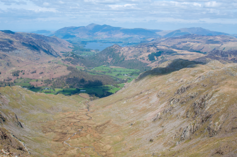
Some miles are longer than others. The rugged mountains of upper Borrowdale offer a challenge to even the most experienced of walkers. What on paper may give the impression of being a simple circuit of fells with mileage in single figures, in reality can translate into an arduous day requiring considerable physical, navigational and even emotional determination. But hard work is seldom without its rewards. In good weather the rocky summit of Glaramara offers a dramatic prospect of the valley below and a three hundred and sixty degree view of the central Lake District Fells.
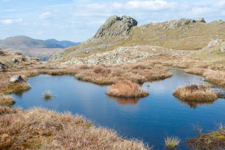
A little further to the North, beyond a cluster of small tarns, the inauspicious crown of Combe Head provides a breathtaking vista over the steep-sided hanging valley of Combe Gill. Progress along the eastern ridge of the gill requires some careful route finding to locate the narrow col above Cam Crag. A little further eastwards, concealed within a natural amphitheatre between Rosthwaite Fell and Bessyboot lies a small lake known as Tarn at Leaves. The sparkling waters make for an ideal location to sit and refuel before commencing the steep descent to Seatoller.
Glaramara, Rosthwaite Fell & Bessyboot: route description
Start/Finish: National Trust Car Park at Seatoller (GR: NY245137) | Maps: Ordnance Survey 1:25,000 Lake District North-West Area OL4 | Distance: 11.2km / 7 miles | Ascent: 778m / 2,552ft | Time: allow 6 hours
1. NY245137: From the car park at Seatoller turn left onto the B5289. Walk for 750m to Mountain View cottages.
2. NY250137: Turn right onto a narrow road for 100m. At a fingerpost marked ‘Glaramara 2 miles’ pass through a gate and take the well defined path for 600m to Combe Gill waterfall. You may wish to pause here to enjoy this pleasant cascade over rocks of a distinctly purple hue.
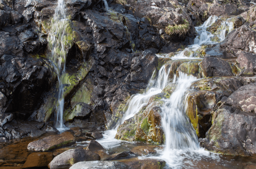
Combe Gill waterfall.
Credit: Andrew Galloway
3. NY251130: Continue southwards for 400m. Above a sheep fold the path splits into two. Take the higher path on the right.
4. NY250127: Climb the flank of Thornythwaite Fell for 1.1km to a cairn marking a height of 574m.
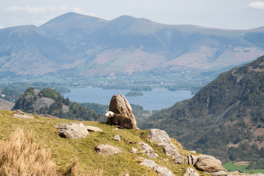
Skiddaw from Thornythwaite Fell.
Credit: Andrew Galloway
5. NY245118: The path continues for 1.3km along the broad ridge above Raven Crag, crossing boggy ground to the west of Combe Head to the base of the crag beneath the summit of Glaramara.
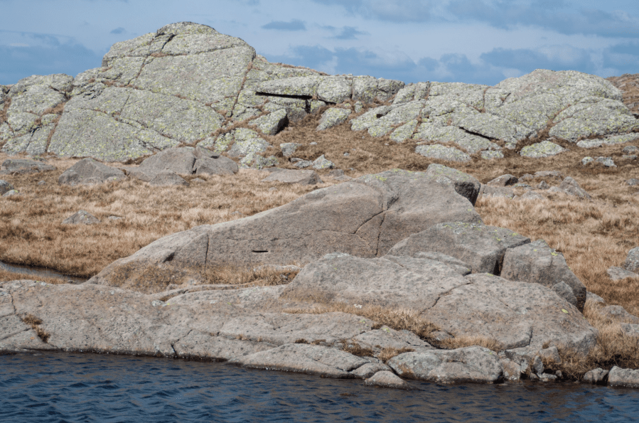
Rocks on Combe Head.
Credit: Andrew Galloway
6. NY247106: A relatively straight forward scramble of 10m brings you to the summit crown (the scramble can be avoided by passing 50m to the W). The summit cairn lies 200m to the SW.
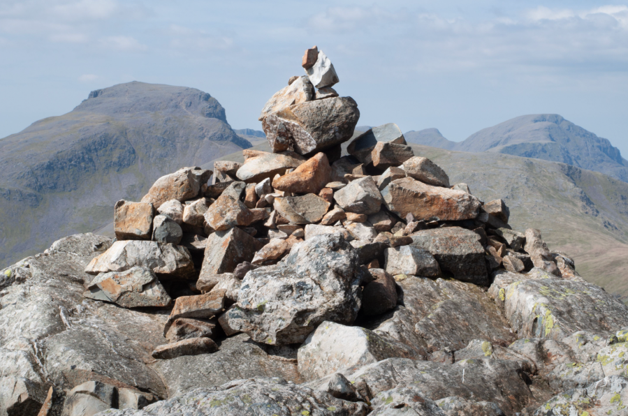
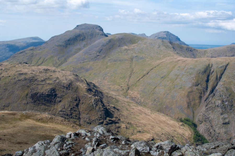
Cairn on summit of Glaramara with Great Gable.
Credit: Andrew Galloway
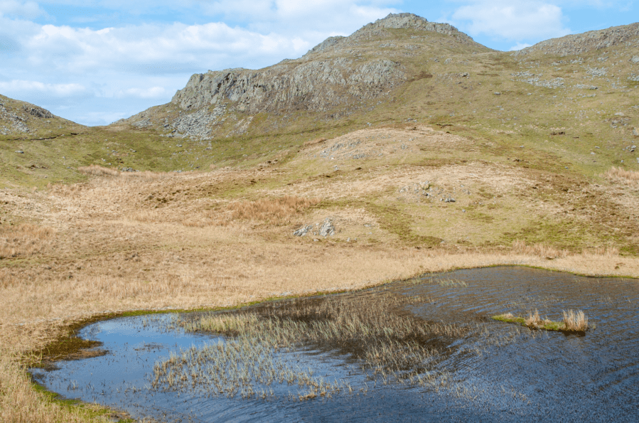
7. NY246104: In good weather conditions the summit cairn of Glaramara offers a dramatic 360 degree view of the central Lake District fells: Great Gable to the West, Esk Pike & Bow Fell to the South, High Raise to the East, Derwent Water, Skiddaw and Blencathra to the North. To avoid having to descend via the crag to the North, descend the grassy slope due west for 300m, then traverse the upper reaches of Ribby Gills northwards for 500m to the cluster of tarns on Combe Head.
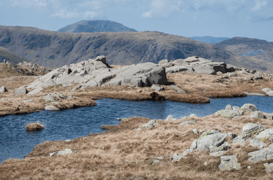
Unnamed tarn on Combe Head.
Credit: Andrew Galloway
8. NY249108: Descend to the East for 350m to Combe Door.
9. NY252108: Continue eastwards for 300m to reach a wire fence. Follow the fence to the North for 500m to the head of Woof Gill with dramatic views of Cam Crag below.
Rosthwaite Cam.
Credit: Andrew Galloway
10. NY256112: Keeping the fence on your right, contour around a rocky knoll, then northwards across the boggy depression of Great Hollow. Climb steeply to the obvious notch beside the craggy eminence of Rosthwaite Cam.
Tarn at Leaves viewed from Rosthwaite Fell.
Credit: Andrew Galloway
11. NY255118: 100m east of Rosthwaite Cam a narrow gap between crags permits descent of the northern slopes of Rosthwaite Fell to Tarn at Leaves.
Bessyboot seen from Tarn at Leaves.
Credit: Andrew Galloway
12. NY257122: The stoney top of Bessyboot lies 200m to the North, requiring the tiniest of scrambles to reach the summit cairn.
13. NY258125: Descend from Bessyboot to the south for 300m. With care take the path passing to the south of crags at the head of Rottenstone Gill, descending steeply for 1km to Combe Gill.
Combe Gill from Coombe Head.
Credit: Andrew Galloway
14. NY252130: You will find yourself above the waterfall you passed earlier in the day, now on the opposite bank. Pass through a wooden gate and follow the path through heather scrub for 400m.
15. NY254134: At a breach in the wall, rather than continuing ahead in the direction of Rosthwaite, take a faint path descending through the heather for 200m to where a footbridge crosses Combe Gill. Beyond the bridge follow the track for 300m to the B5289 minor road.
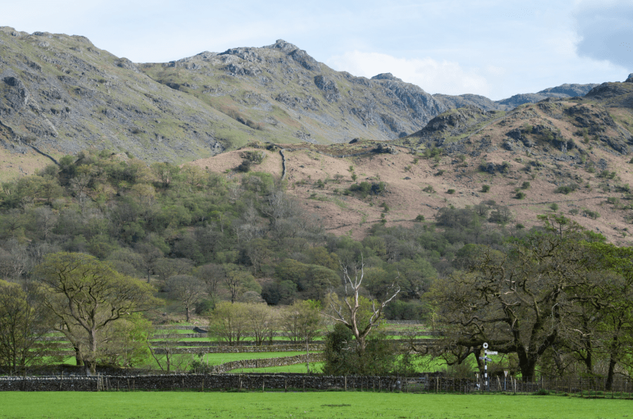
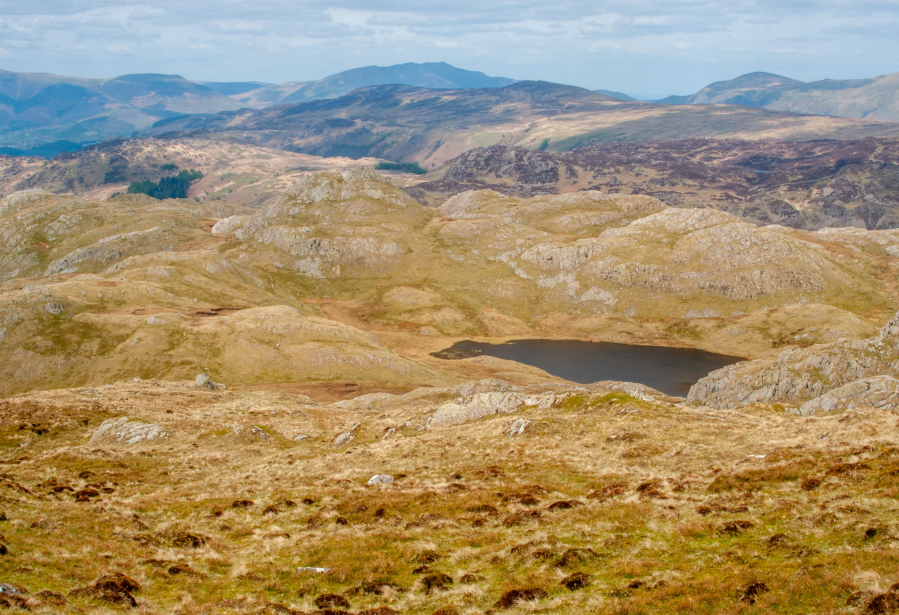
Rosthwaite Fell from Seatoller.
Credit: Andrew Galloway
16. NY251137: Walk westwards along the B5289 minor road, passing Mountain View cottages on the right, to return to the car park at Seatoller.
Further information
Public Transport: The number 78 Borrowdale Bus runs from Keswick to Seatoller every thirty minutes during the summer. Check the Stagecoach website for an up-to-date timetable.
Information: Visit Cumbria
NEAREST YHA: YHA Borrowdale
Discover more walks in the Lake District as mapped by The Great Outdoors’ expert contributors.


