
Ian Battersby makes mischief to uncover a trio of remarkable waterfalls, including Black Force, thanks to a bit of navigation and the 2000 CROW Act.
The Howgills are made for explorers, especially since the CROW Act 2000. The entire region is designated Open Access. What’s more there are precious few walls to bar the way, and well-drained grassland makes being off piste a cinch. Even so, energy can be saved if unmarked paths are discovered. It’s just a matter of poring over the map, finding landmarks that set the imagination alight, then taking that research into the hills and seeing what theory and practice allow. Black Force and The Spout illustrate the point nicely.
These names, along with their tightly packed contours, are invitations for scallywag explorers that can’t stick to normal rights of way. There is little doubt an approach should be possible, but what about the gill that contains them? Would it be passable? Then what? Retreat or onward battle? It took two days of navigation and exploration along sometimes unlikely paths to find the perfect solution. On route, stumbling upon a third waterfall was a welcome bonus.
Black Force & Langdale Fell: route description
START/FINISH: Gaisgill junction with A685; NY640054 | MAPS: OS Explorer OL19 (1:25k) | DISTANCE: 19.5km / 12 miles | ASCENT: 910m / 2,985ft | DURATION: 7.5 hours
1. NY640054: Head W along the lane through Gaisgill village and take the first no through road on the left, climbing S through birch trees to open country. From Intake Farm a dirt track forges S alongside a wall. Just before Weather Hill the track veers away from the wall and passes Weather Hill.
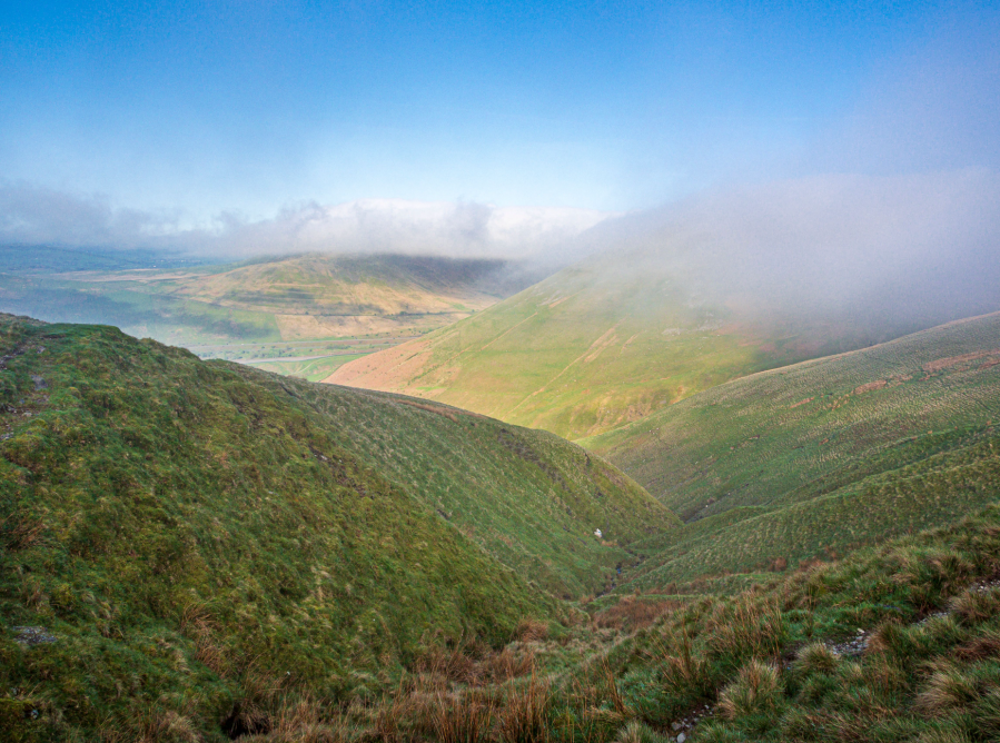
Misty Blease Fell from Weasel Gill. Credit: Ian Battersby
2. NY632031: A grassy track forks right off the main dirt track, climbing SSW up the ridge over Knott to reach a small cairn atop Hare Shaw.
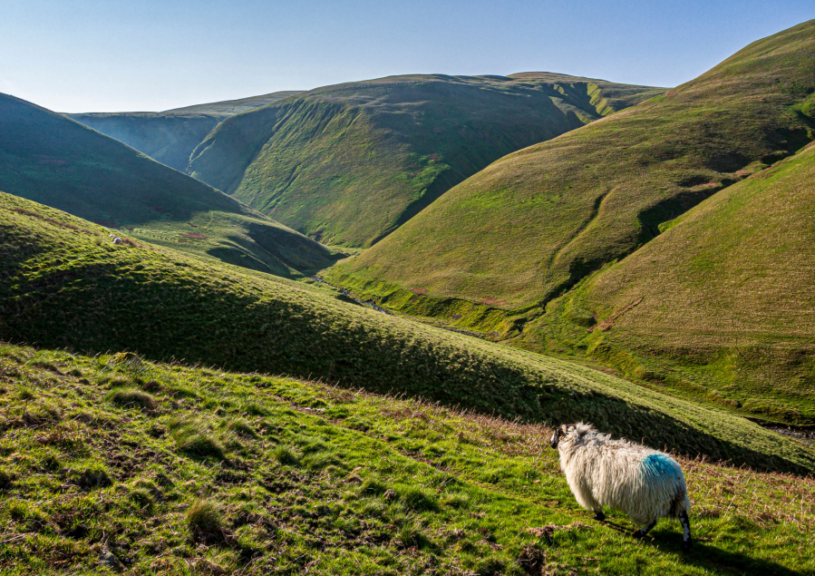
Fell Head and Carlin Gill. Credit: Ian Battersby
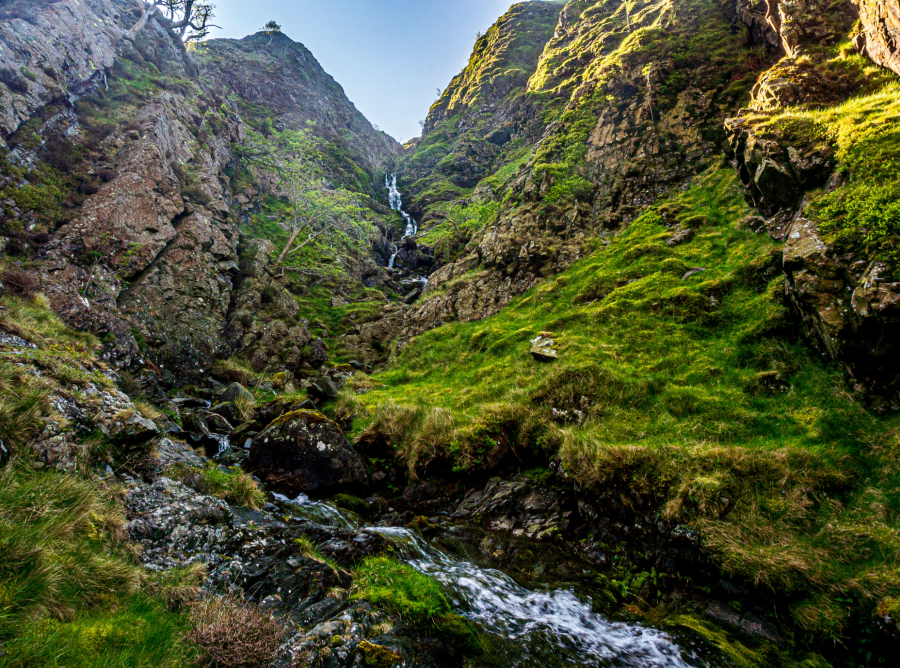
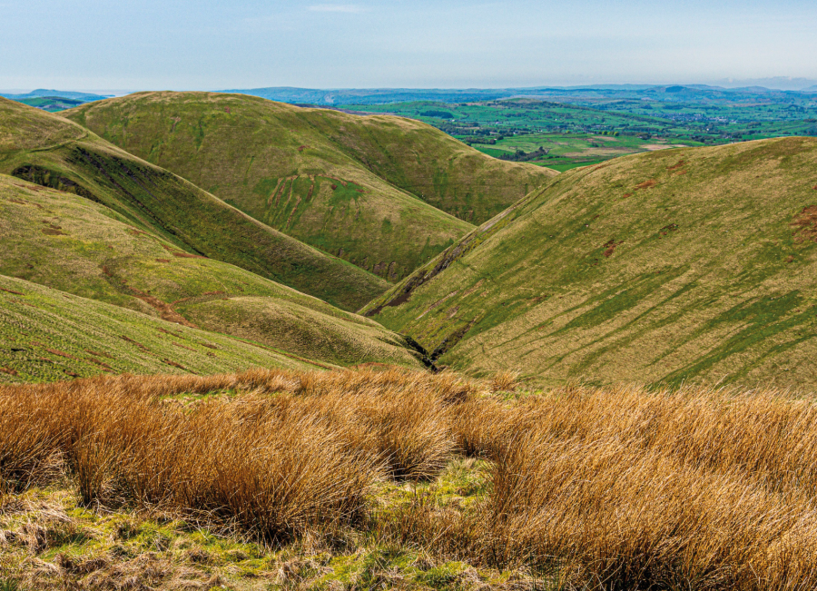
3. NY627013: Drop S into a dip, then follow sheep tracks SE, dropping to a col then climbing to Archer Moss. The southern edge brings views reaching Morecambe Bay. From Archer Moss a good path heads S past Weasel Gill. At the second stream crossing the path turns right, and a grassy track drops W along the edge of Weasel Gill down to 390m, then drops S to 300m. Now a path contours at 300m above Carlin Gill, bending SE with fantastic views of Fell Head and the narrowing cleft of Carlin Gill. After 500m the path wains after a stream crossing. Drop S into Carlin Gill and cross its beck. Follow the south bank SE to the first waterfall a stone’s throw up Small Gill. Continue E along the north bank of Carlingill Beck, contouring past the gorge it has become, and be astounded at the sight of Black Force crashing down a glorious rocky gully.
Waterfall in Small Gill. Credit: Ian Battersby
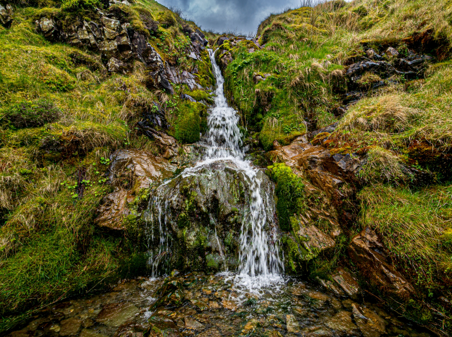
4. SD643992: Continue along the north bank. The path seems unlikely, forges on. Drop down and cross the rocky beck, continuing NE on the south bank to reach The Spout.
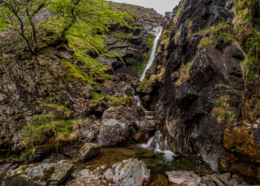
The Spout. Credit: Ian Battersby
5. SD646994: Onward scenarios include scrambling alongside The Spout (but the rock is greasy) or climbing steep, grassy rakes either side, but for the best escape retrace steps the base of Black Force. From here cross to the south bank of Carlingill Beck, and take a teeny path that climbs the eastern edge of the Black Force gully to a viewpoint of the waterfall above. Continue upward, beyond the path, on grasses cushioned with moss. The rock of the gully is exposed showing bent strata near the bottom, and great slabs higher up. The path reappears near the top to cross a delightful little arête linking with the main fell at a path junction. Continue S over the stream, where the path turns NW. After 100m a grassy track climbs S up Blake Ridge, then SE to reach the first cairn at Fell Head.
Knowles rises over Carlin Gill. Credit: Ian Battersby
6. SD646981: Continue ENE across a dip, and climbing to a second cairn at the top. Head NE along the ridge, which bends E to Breaks Head. Veer NE, away from the main path, taking another grassy track dropping gently past several pools to reach Wind Scarth.
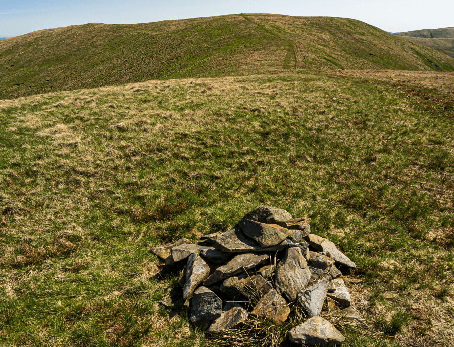
Cairn at 623m summit of Fell Head. Credit: Ian Battersby
7. SD656988: The track drops NW over Taffergill Hill, and follows a long ridge bending N to reach Docker Knott, where it turns NW, stooping into a col and climbing Hand Lake, then descends N to reach a sheepfold at the end of the ridge. Cut back SW on grassy terrain and cross Uldale Beck. A path climbs N to a wall, which it follows NW to a sweeping bend.
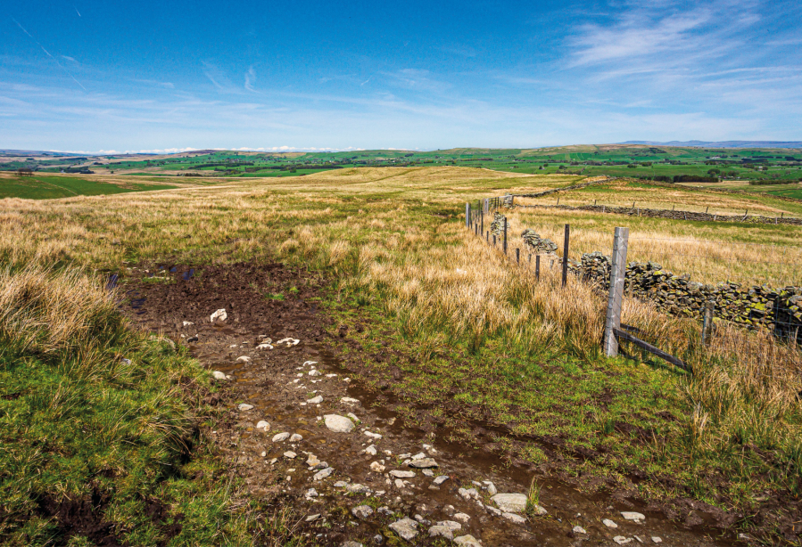
Follow the wall N from Ulldale End. Credit: Ian Battersby
8. NY643025: A grassy track continues N, alongside the wall and turning into a good dirt track, passing Low Shaw Farm, and dropping over Peatmire Hill. Go through a gate, and continue down the track to the hamlet of Ellergill. The track bends E to reach farm buildings. Keep to the right of the buildings, following the track past the farm to meet a lane. Turn left to Gaisgill.
Further information
PUBLIC TRANSPORT: None to start
TOURIST INFORMATION: Sedbergh TIC, 015396 20125
NEAREST YHA: YHA Dufton
Discover more walks in the Howgills as mapped by our expert contributors.


