
Vivienne Crow visits Holme Force, a hidden waterfall while wandering Lakeland’s western fells.
Secreted away in the woods above Loweswater is a succession of small waterfalls that culminates in a narrow ribbon of water running down a smooth-sided chute before tumbling off down the boulder-strewn bed of Holme Beck. Higher still are other cascades, including one which shoots over the lip of the bedrock and forms a graceful arc mid-air. With only deer and red squirrels for company at first, this walk pays a visit to Holme Force before climbing to the gently rounded tops of the Loweswater Fells. Gavel Fell (526m), Blake Fell (573m) and Burnbank Fell (475m) are close to the coastal edge of the National Park, enjoying views out across the Irish Sea as well as glimpses of the western lakes, including Crummock Water. While hill-walkers are irresistibly drawn to the area’s higher mountains, the Loweswater Fells retain an air of lonely isolation. It’s easy to be dismissive about these less lofty summits, but they have a character of their own that includes some surprisingly steep and rugged faces, secretive ravines and a great perspective on their more dramatic neighbours.
Holme Force and the Loweswater Fells: route decsription
START/FINISH: Large layby on minor road, about 3km north-west of Loweswater village, GR NY118224 | MAPS: OS Explorer OL4 (1:25k), OS Landranger 89 (1:50k), Harvey 1:25,000 Superwalker Lake District North | DISTANCE: 13km/8.1 miles | ASCENT: 713m/2339ft | DURATION: 4 hours
1. NY118224: From the western end of the layby, go through the gate and follow the path across three fields. Go left along at a surfaced lane. Beyond Hudson Place, go through the left-hand of two gates. The path later enters Holme Woods. Keep right when it forks.

Carling Knott above Holme Wood and Loweswater. Credit: Vivienne Crow
2. NY121217: Having walked about 300m into the woods, turn right along a track. You’ll soon cross the bridge over Holme Beck. Holme Force is just above the bridge, but off-piste exploration upstream reveals other, smaller falls. Further along the track, about 420m beyond the falls, turn sharp right, climbing steeply on a narrower path. Soon after leaving the woods via a gate, turn left on a broad path.
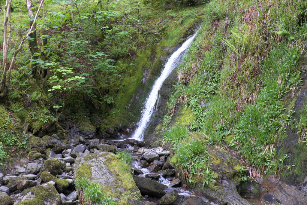
Holme Force. Credit: Vivienne Crow
3. NY124201: It drops to cross Highnook Beck and briefly becomes less clear as it swings left. About 350m beyond the bridge, take the broad path climbing right (south) – almost heading back on yourself.
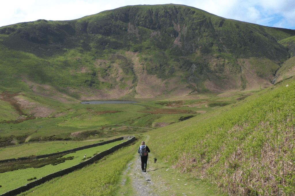
The path drops towards Highnook Beck (wp3). Credit: Vivienne Crow
4. NY128198: When the track levels off, follow a narrow trail south-west. As this emerges from a hollow, it reaches the ridge. Soon after this, take the faint trail on the right (west, quickly veering south-west along the top of Black Crag). When bilberry gives way to heather, the path swings south-south-west across the flat, often boggy fell top. Keep right at a faint fork, keeping to the highest ground. The trail leads to a cairn on an unnamed top, drops into a boggy dip and then makes for the fence-topped skyline.
5. NY116184: Cross to the fence’s western side on Gavel Fell. The summit cairn is just up to the left, but the main route goes right, following the ridge fence down to Fothergill Head and then up the other side.

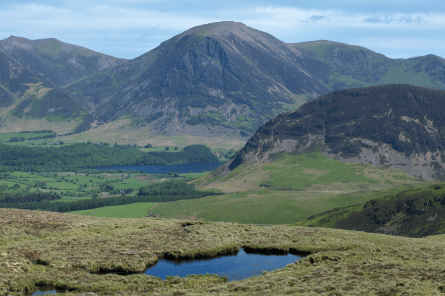
Mellbreak, right, with Grasmoor, centre stage on the skyline, and Whiteside, far left. Credit: Vivienne Crow
6. NY113191: Where two fences meet near High Pen, cross the intervening fence at a stile and turn right, continuing with the line of the ridge fence – sometimes some distance to the right. The top of Blake Fell, marked by a small shelter, enjoys far-reaching views that include the Galloway hills to the north-west. To the east are some of Lakeland’s most impressive mountains.
7. NY110196: Drop north from the shelter. Keep to the clearest path, which quickly forks. Bear right (north) to regain the fence. Follow this north across soggy ground. Go through a small gate in a dip and immediately bear right to cross a stile in the ridge fence. Continue straight up the slope to reach the fence corner on Burnbank Fell’s summit.
On Burnbank Fell. Credit: Vivienne Crow
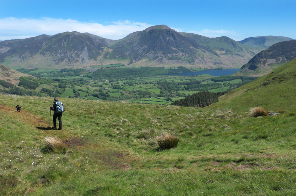
8. NY110209: You now lose the guiding fence as you turn right along a path (north-east). With the descent steepening, you pass a cairn with a magnificent outlook over Loweswater, taking in Crummock Water too. Nearing the base of the fell, as one trail goes right, keep straight on to reach a track. Turn left, through a gate.

The walk ends by crossing a series of grazed enclosures. Credit: Vivienne Crow
9. NY107225: The track swings left after another two gates. When it does so, cross the ladder stile on the right. Keeping close to the wall on the right, the path becomes more track-like. Turn right at a surfaced lane and then keep right along a track near some cottages. After a gate, follow the faint trail half-left. In the next field, walk beside gnarled hawthorn trees on the left. Beyond another gate, head towards Hudson Place. Just before the buildings, go through the gate on the left. Walk with the wall/fence on your right. Reaching a surfaced lane, turn left. Retracing your steps from earlier, remember to go through the gate on the right in 180m to join the path back to the parking area.
Further information
PUBLIC TRANSPORT: None
TOURIST INFORMATION: www.lakedistrict.gov.uk, 0845 9010845


