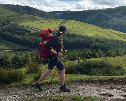
Fiona Barltrop relishes one of the best coastal walks in the country, from Hartland to Bude along the South West Coast Path.
Arduous though it may be, the 15¼-mile stretch of coast path between Hartland Quay and Bude, which crosses the Devon/Cornwall border part way along, is one of the most spectacular sections of the South West Coast Path National Trail. The SWCP Association’s annual guide grades it ‘severe’ with an overall ascent of some 4,000ft. Indeed, there are ten steep, deep river valleys to cross along the way. Nonetheless, any suitably fit person with plenty of stamina who takes it in their stride should enjoy a great day of coastal walking here. Fine settled weather makes all the difference, with the long days of late spring and summer being the best time for it.
There are buses between Bude and Hartland village, but no public transport to Hartland Quay. So unless you can take a taxi from Bude (none from Hartland) or two cars between you and another walking companion, bear in mind the added distance, although it is an easy 2½-mile walk to the coast and worth the extra effort to take in this linear route along spectacular coastline.
South West Coast Path (Hartland to Bude): route description
START: Hartland bus stop/shelter, Northgate Green (SS259245) | FINISH: Bude town centre (SS208064) | MAPS: OS Explorers 126 & 111 (1:25k), OS Landranger 190 (1:50k) | DISTANCE: 28.5km/17¾ miles | ASCENT: 1206m/3957ft | DURATION: 9 hours
1. SS259245: From the Hartland bus stop/shelter, turn right along North Road, which curves left passing the red fire station on the right corner. Continue south along the road (now North Street). At the next junction follow the road (now West Street) round to the right. Keep ahead at the following junction (road is signed for Stoke and Hartland Quay). At the edge of the village ignore the side road on the right and continue along the country lane. Keep straight on at the next junction, again following signs for Stoke and Hartland Quay, soon passing a turning for Hartland Abbey. Keep ahead through Stoke to the parish church of St Nectan, known as the Cathedral of North Devon for its size – its tower is one of the tallest in the county.
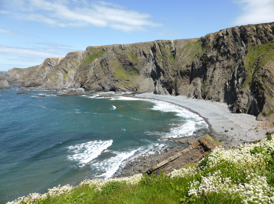
View N from Hartland Quay.
Credit: Fiona Barltrop
2. SS235247: From the far end of the church continue along the path that runs parallel to the road on its north side, rejoining the road just before a building called the Rocket House. (Now a holiday rental, it originally stored the apparatus used by rescue services, which included a breeches buoy system, giving it the name Rocket. To allow the rescue teams to practice, a mast was situated on the Warren field and the ‘Rocket’ shot at the mast, then the breeches buoy was set up and used.) Just after it, continue down the Coast Path (to the right of the toll road) which descends to the upper car park, and thence down to Hartland Quay.
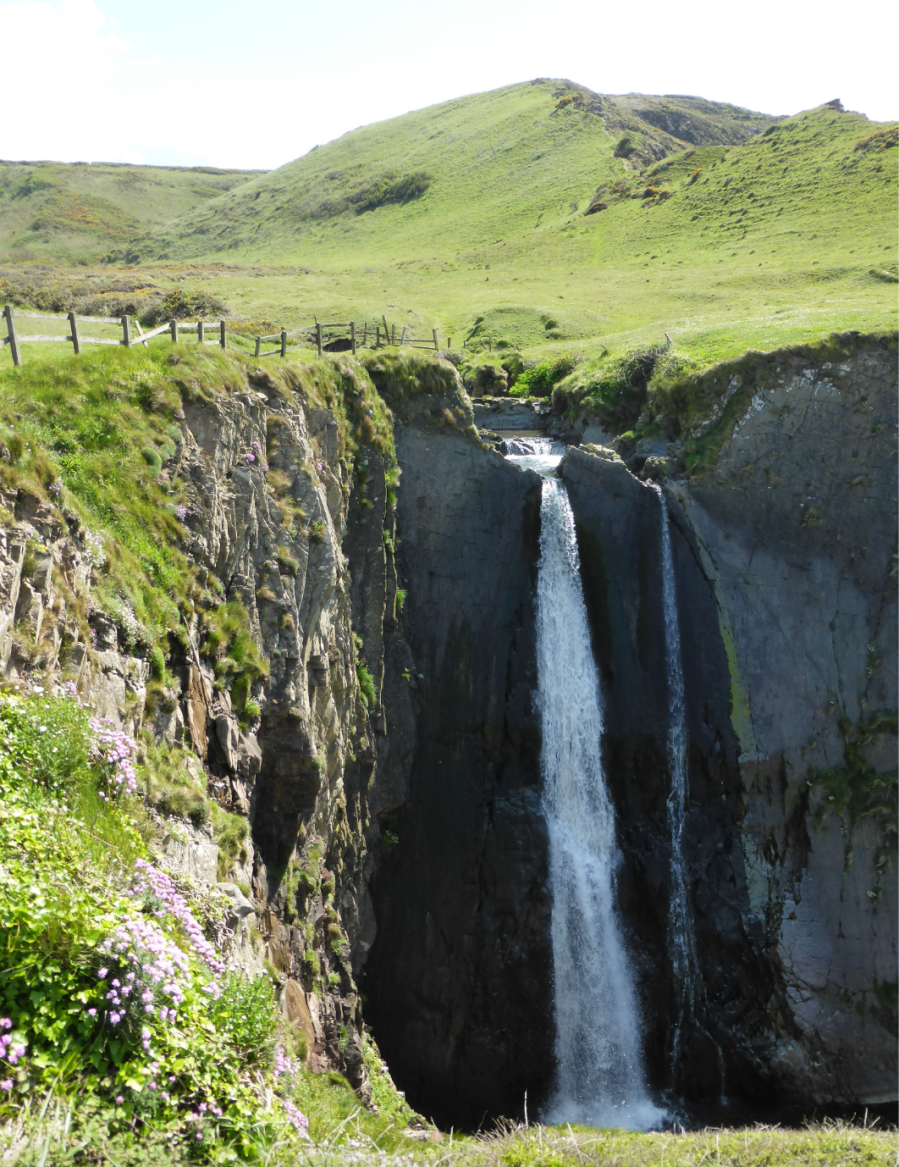
Speke’s Mill Mouth waterfall.
Credit: Fiona Barltrop
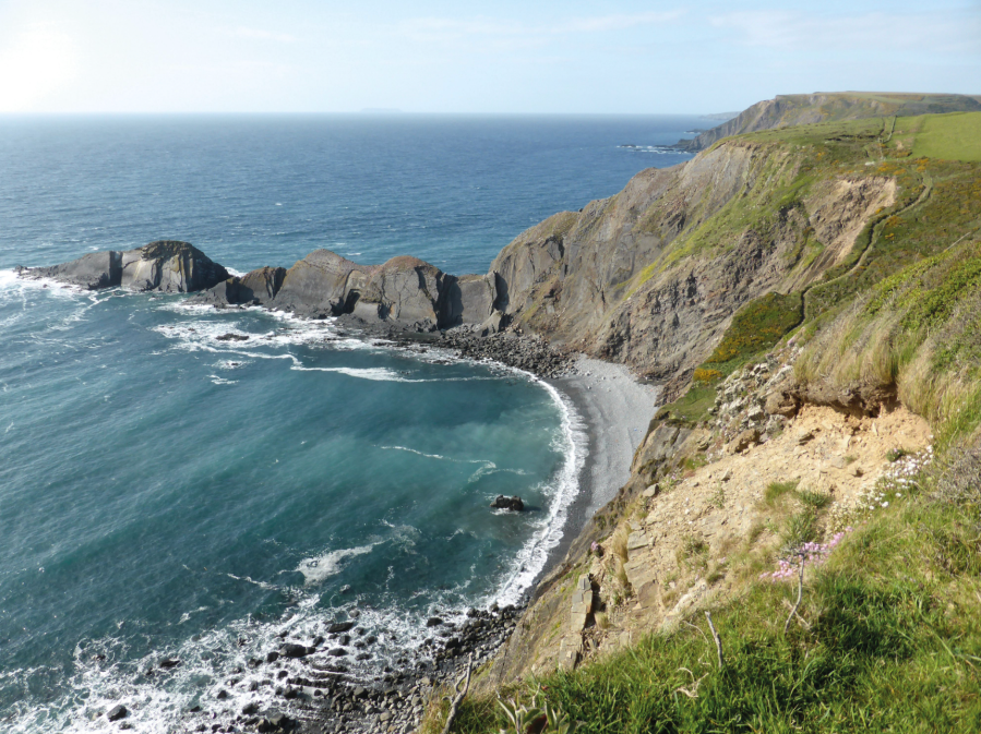
3. SS223247: There’s another car park and hotel (with bar, shop and museum) here, a popular spot with day visitors for its stunning scenery. The contorted rock layers are very striking. Looking north-northwest, assuming clear conditions, you can see Lundy island on the horizon. Built in the late 16th century, Hartland Quay was a thriving port until the pier was destroyed by storms at the end of the 19th century. From the bottom car park follow the Coast Path sign for Speke’s Mill. The path, which passes behind St Catherine’s Tor, leads to the impressive waterfall at Speke’s Mill Mouth.
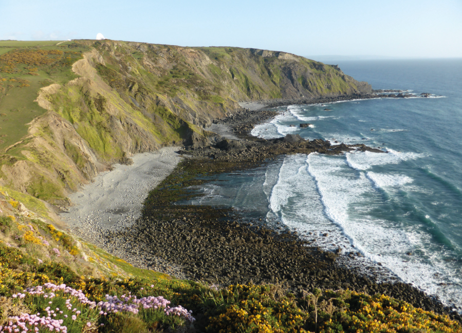
St Catherine’s Tor, Lundy Is beyond, from nr pt 4.
Credit: Fiona Barltrop
4. SS226236: Turn inland to cross a footbridge over the stream, beyond which is a junction where you can either follow the valley route or the more dramatic cliff top path up Swansford Hill – they join up again south of Swansford Hill. The next few miles along the gently undulating cliff-top path are fairly easy going (which might make wonder if this walk is really as demanding as all that….but be prepared!) Having passed Embury Beacon (visible remains of the Iron Age fort) you descend quite steeply to Welcombe Mouth and cross the stepping stones over the river to the car park.
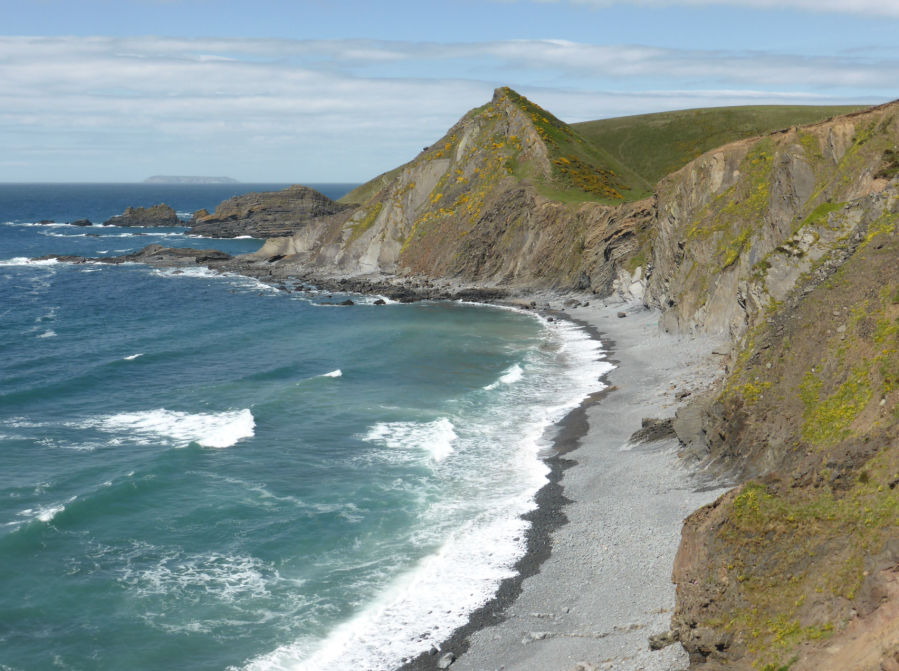
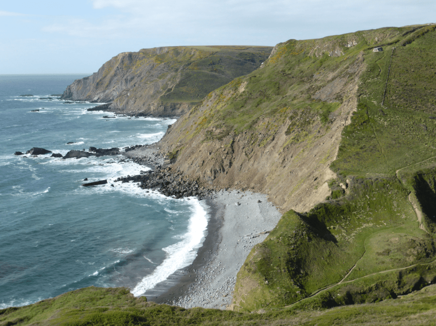
Stanbury Mouth from N, between pts 5 & 6.
Credit: Fiona Barltrop
5. SS213179: Now begins the serious work of the day with several more steep, deep river valleys to cross. Having climbed up from Welcombe Mouth you drop straight back down again to Marsland Mouth. On the way down you’ll pass a stone hut, which was built by the poet and playwright, Ronald Duncan, and restored by his daughter after his death. It’s open to passing walkers – an ideal spot to take a break and enjoy the glorious view.
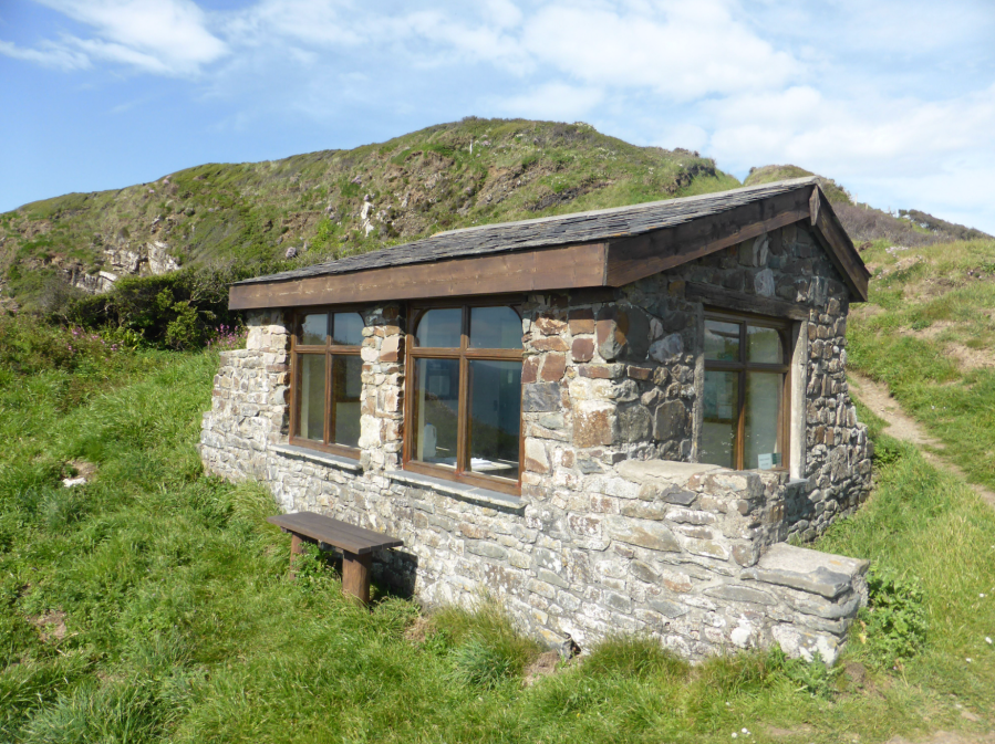
Ronald Duncan’s Hut, S of pt 5.
Credit: Fiona Barltrop
Marsland Mouth marks the boundary between Devon and Cornwall. After more ascents and descents you’ll pass another much smaller hut, Hawker’s Hut, on Vicarage Cliff, built by the eccentric Parson Hawker. Further on, as you near the GCHQ satellite dishes at Cleave Camp watch for the signed right turn towards the cliff edge. Thereafter you descend to Duckpool.
Marsland Mouth & Welcombe Mouth, S of pt 5.
Credit: Fiona Barltrop
6. SS203116: The final few miles to Bude are easier going especially from the next valley, Sandy Mouth. At Bude Haven head inland to the car park and town.
Further information
PUBLIC TRANSPORT: Go Cornwall bus service 219 between Bude (Strand) and Hartland (Northgate Green); Go Cornwall bus service 217 between Bude and Morwenstow (four times a day, Mon-Fri), about halfway along, providing an option to split length, taking two days over it.
TOURIST INFORMATION: Bude TIC (01288 354240)
NEAREST YHA: YHA Boscastle
Discover more walks on the Scout West Coast as mapped by The Great Outdoors’ expert contributors.