
Torridon’s mountains may be some of the rockiest and steepest in Scotland, but Beinn Damh offers drama without the terror, says Alex Roddie.
Torridon’s most famous peaks include Liathach, Beinn Alligin, and Beinn Eighe – big, serious, and (let’s say it) slightly scary mountains. If you lack scrambling skills, these mountains can be intimidating, and they’re all big days out. But not every Torridonian peak is like this. Beinn Damh is a high Corbett just a whisker below the magic Munro height, and the ascent is steep but straightforward – rocky ground and ridges with an airy feel to them yes, but outright scrambling and exposure no. It’s a compact, out-and-back climb with plenty of interest and some truly stupendous (and very wild) views from up on the ridge. Don’t let the fact that it’s ‘only’ a Corbett put you off, either. Beinn Damh packs in just as much drama as many of the finest Munros.
Beinn Damh: route description
MAPS: OS 1:25,000 Explorer sheet 428 (Kyle of Lochalsh, Plockton & Applecross), OS 1:50,000 Landranger sheet 24 (Raasay & Applecross) | DISTANCE: 11.6km / 7.2 miles | ASCENT: 951m / 3,120ft | DURATION: 5 to 6 hours
1. NG889542: Starting from the hotel car park, pass through a courtyard, cross a footbridge, and join a track climbing through woodland signposted ‘Hill Path’. The path crosses the road and then begins climbing more steeply through the pine forest. To your left is the gorge of Glac na Gainmhich, and the waterfalls can be heard through the trees although they are only occasionally visible at first. The trees soon begin to thin out and there are viewpoints looking down towards the torrent, with one particularly excellent view upstream to a large waterfall.
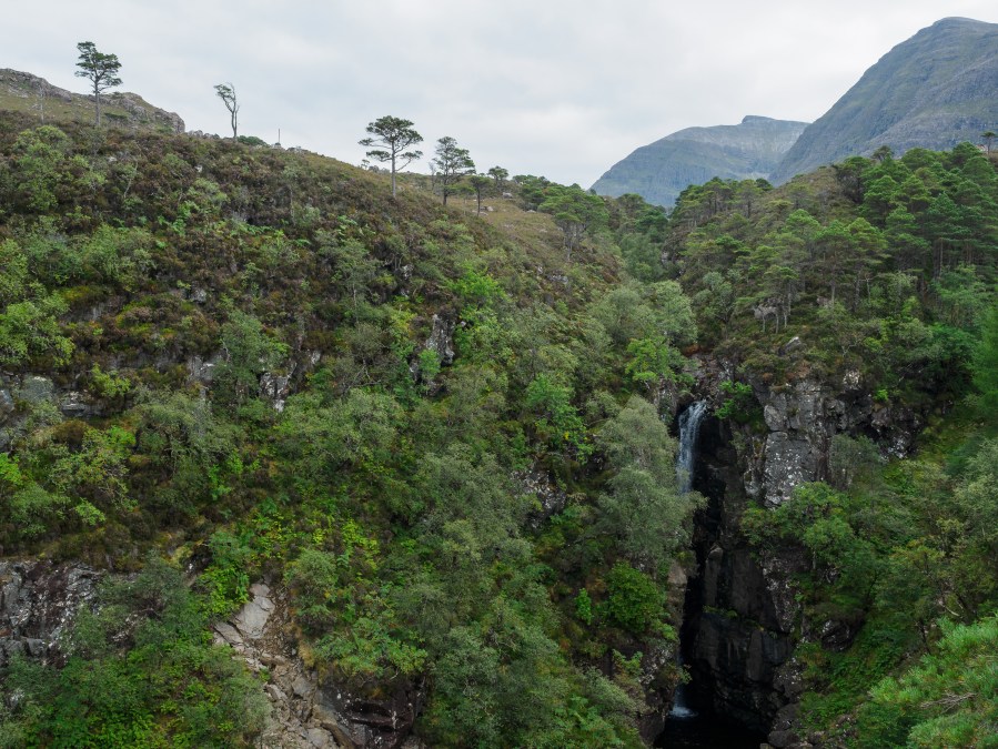
The Glac na Gainmhich gorge.
Credit: Alex Roddie
2. NG884533: The path emerges from the forest and the angle relents. There is a fork in the path; take the right-hand branch heading uphill (the left fork crosses the burn and heads into Coire Roill). Behind you, dramatic views begin to open up across Loch Torridon to Beinn Alligin and across the glen to Liathach. The path, which is firm and well-constructed underfoot, climbs through moorland – gradually at first and then more steeply as it approaches the bealach above. The path soon veers away from the burn (the Allt an Tuill Bhain).
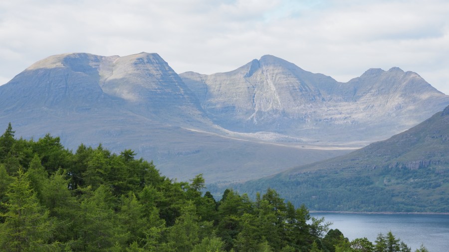
Looking to Beinn Alligin.
Credit: Alex Roddie
3. NG876518: The path levels off as it approaches a broad heathery bealach with a few patches of scree. To the right is the Meall Gorm (675m) and to the left is the broad bowl-shaped corrie of Toll Ban, rimmed by impressive crags and topped by an 868m summit marked Beinn Damh on the map. This is not, however, the main summit, merely the northwesternmost peak on a curving ridge leading to the main top, Spidean Coire an Laoigh (903m). Straight ahead, views open up down to Loch Damh. Turn SE and begin climbing the path that sticks close to the edge of the grassy ridge at first.
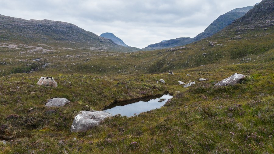
Looking to Coire Roill.
Credit: Alex Roddie
4. NG882510: The gradient eases slightly as the path veers to the right of the ridge’s crest, avoiding the rockiest ground. It becomes a rising traverse, gradually gaining height through a landscape of pale-coloured scree beneath the 868m northwestern summit of Beinn Damh. When covered in snow, this path could be difficult to follow and it may be safer to keep to the ridge itself.
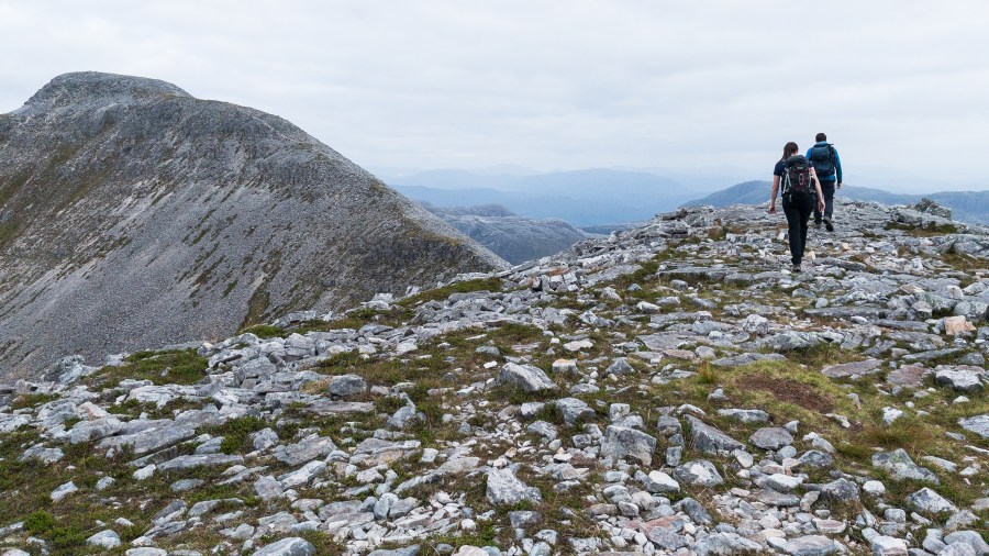
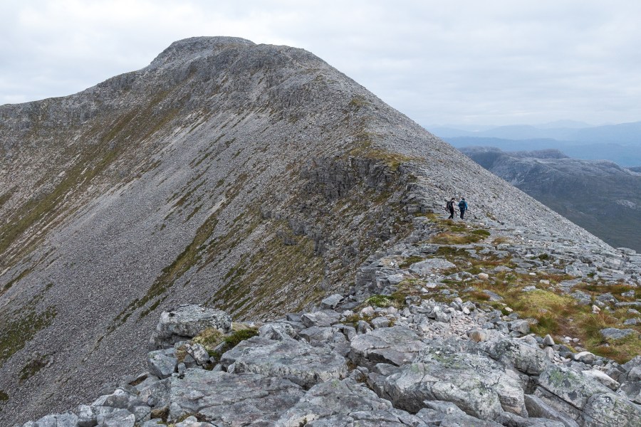
Magnificent walking on the main ridge of Beinn Damh.
Credit: Alex Roddie
5. NG888505: The path rejoins the ridge at Spidean Toll nam Biast, a minor elongated top on the ridge without a spot height marked on OS maps. The views from this point are magnificent. Ahead, Spidean Coire an Laoigh’s summit rises in an impressive summit pyramid, its NW face banded by crags and a narrow (but not exposed) final ridge. It’s also a thrilling look down into the corrie below. Continue following the obvious ridge over rocky, occasionally blocky terrain. Although the path is not always clear, the way ahead is simple: stick to the crest.
The final ascent.
Credit: Alex Roddie
6. NG893502: Reach the summit of Spidean Coire an Laoigh, the highest point of Beinn Damh. The summit is a surprisingly broad, rocky plateau with plenty of room to walk about and admire the views from its different sides. Particularly good is the vista east towards Maol Chean-dearg and An Ruadh-Stac; Beinn Eighe and the other Torridon peaks are also very well presented.
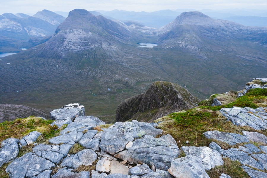
Summit panorama.
Credit: Alex Roddie
In the other direction, Beinn Bhan and the other Applecross mountains promise future adventures. Skye is visible beyond. To return to the Torridon Inn, simply follow the same route in reverse.
Further information
PUBLIC TRANSPORT: None to start. The nearest train station is Achnasheen. Limited Westerbus services from Achnasheen to Gairloch connect to Torridon village.
TOURIST INFORMATION: Beinn Eighe visitor centre, 01445 760258
Discover more walks in Scotland as mapped by The Great Outdoors’ expert contributors.


