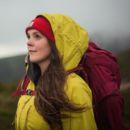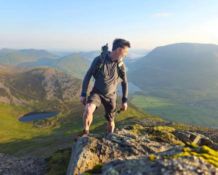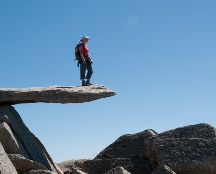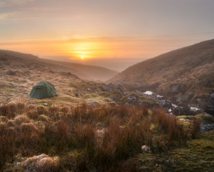


Fancy a beautiful but guilt-free walk knowing you’ve made choices that alleviate negative impacts upon the environments of our high places? These car-free walks – mapped by the experts – boast some of the finest mountain and fell walking up and down Britain. But they are all reachable by public transport. With a selection of circular and linear routes, some across mountainous terrain and others more gentle, opportunities to roam abound. Forgo the hassle of finding parking in remote places with delicate infrastructures, enjoy your big day out on foot, and settle into a relaxing return journey. Yes, you may have to wait for the bus or train – or boat! – but what freedom might it afford you in exchange?
Main image: The Five Sisters of Kintail; reachable by bus request stop! | Credit: Ian Battersby
Our pick of car-free mountain walks and hill walks: mapped
- The Five Sisters of Kintail, North-west Highlands
- Corrour Corbetts, Central Highlands
- Ben Cruachan, Southern Highlands
- The Glensax Round, Southern Uplands
- Helvellyn range end-to-end traverse, Lake District
- The Kentmere Fells linear, Lake District
- St Sunday Crag, Lake District
- Wansfell Pike, Lake District
- Ingleborough, Yorkshire Dales
- Blea Moor from Dent Station, Cumbria
- The Edale Skyline, Peak District
- Yr Wyddfa, Eryri/Snowdonia
- The Tarrens, Eryri/Snowdonia
- Foel-goch, Eryri/Snowdonia
- Beacon Hill, mid-Wales
- Box Hill by train, North Downs
Five Sisters of Kintail, North-west Highlands
Ian Battersby busses in to be led astray by the Five Sisters of Kintail.
START/FINISH: Five Sisters trail head; NH005135 (Request stop for buses) | MAPS: OS Explorer 414 (1:25k), OS Landranger 33 (1:50k) | DISTANCE: 14.1km / 8.8 miles | ASCENT: 1513m / 4,964ft | DURATION: 6.5 hours
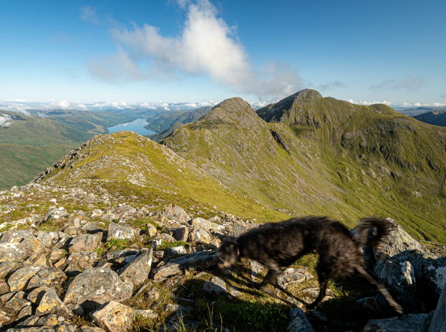
Legend tells of seven sisters, daughters of a local Kintail farmer, that made acquaintance with two visiting brothers, perhaps princes, and presumably handsome, who resumed their travels, taking the youngest sisters with them. They left the older five with a promise that their own five brothers (uh-huh) would be along soon to whisk them away too. But the promise was false, and the long-suffering sisters running out of time, so they had themselves cast into mountain peaks so that their beauty would endure until such a time as the brothers would deem to turn up. Luckily for us, and likely the sisters too, they still have yet to show.
The ridge undoubtedly embraces a certain beauty, but perhaps time has yielded additional qualities. The tops are resilient and rugged, and they stand united in accomplished independence, close knit, and facing problems together. Their heads may sometimes still be in the clouds, but for a chosen few who tackle the quest for the crest well, they may reveal their true love, parting the veil to reveal majestic surroundings, that may encourage a tentative belief in the miracle of magic after all.
Read more: the full route description for the Five Sisters of Kintail
The Corrour Corbetts, Central Highlands
Stefan Durkacz takes the train into the heart of the Central Highlands to the Corrour Corbetts.
Start/Finish: NN 356 664 Corrour station | Maps: OS 1:50,000 Landranger sheet 41 Ben Nevis; OS 1:25,000 Explorer sheet 385 Rannoch Moor & Ben Alder and sheet 392 Ben Nevis & Fort William | Distance: 28.5km/17.5 miles Ascent: 1249m/4098ft | Duration: 10-12 hours or overnight. Bothies at Staoineag (NN 296 678) and Loch Chiarain (NN 289 634) maintained by the Mountain Bothies Association.

Scotland’s West Highland Line is a boon for adventure-seekers. Without it, much of the vast country around Rannoch Moor would be hard to access. Corrour station especially is very far from the road network. It’s a welcoming oasis amidst the moors and mountains and a great place to start and finish your adventures. Refreshments can be had at the Corrour Station Teahouse, and there’s a youth hostel nearby at Loch Ossian. The options for expeditions are almost endless. The route described here squeezes a lot into a day and a half, or one long day for the super-fit in summer: the two Corrour Corbetts, a brace of bothies and some fine walking on the long-distance rights of way that traverse the area.
The landscape varies from birch-clad glens and river gorges to lonely summits. Glas Bheinn commands a particularly jaw-dropping panorama, from the Nevis range and Grey Corries to the north to the Glencoe peaks in the south. This route can be walked anti-clockwise (as described here) or clockwise. An overnight stop at, respectively, Loch Chiarain or Staoineag bothies should enable you to return to Corrour in time for the lunchtime train. There are a couple of potentially serious river crossings (the Abhainn Rath at Staoineag and the Loch Chiarain outflow) so this route is best not attempted during or immediately after very wet weather.
Read more: the full route description for the Corrour Corbetts
Ben Cruachan, Southern Highlands
Ian Battersby uncovers the power of a mountain with this walk up Ben Cruachan.
START/FINISH: Falls of Cruachan Railway Station; NN080267 | MAPS: OS Explorer OL377 (1:25k), OS Landranger 50 (1:50k) | DISTANCE: 11km / 6.8 miles | ASCENT: 1,241m / 4,072ft | DURATION: 5.25 hours

Ben Cruachan storms up from woods, lochs and glens to join an assorted bunch of near neighbours, whose pointed peaks pierce the skies of an undulating ridge, and Cruachan, at 1,126m, reigns supreme. Energy is needed to power up surging gradients further defended by an army of trees and tangled undergrowth. But once on top, with work done in a flash, enjoy the scene, and gloat in the downhill dash, converting potential energy gains into smiles.
While Cruachan is happy to display a wondrous landscape from on high, it is more reluctant to give away the resourceful secret buried within. Also known as the hollow mountain, there are few clues to give away its adopted role. There is a reservoir dam, and power lines make the climb, but hidden inside the belly of the mountain, a power station stands by, with water acting as fuel. In parallel to climbing the peak, the water here is powered up to the reservoir in quiet morning hours, and there it rests, awaiting demand and the fated downward drive through a spin of turbines there to change potential energy gained into electrical power.
Read more: the full route description for Ben Cruachan
The Glensax Round, Southern Uplands
Stefan Durkacz takes on a classic hillwalking circuit in the Scottish Borders, just an hour from Edinburgh by bus.
Start/Finish: NT254405 High Street, Peebles | Maps: OS 1:50,000 Landranger sheet 73 Peebles, Galashiels & Selkirk; OS 1:25,000 Explorer sheet 337 Peebles & Innerleithen | Distance: 26km/16 miles | Ascent: 885m/2904ft | Duration: 8-10 hours
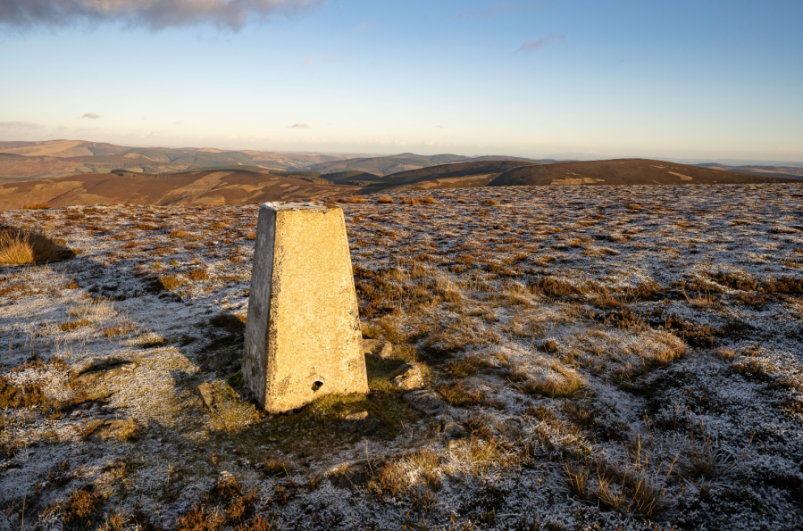
Despite being little more than an hour away by bus, the handsome old town of Peebles seems a world apart from Edinburgh’s bustle. Set by the River Tweed and surrounded by farmland, hills and forests, Peebles has a long history as a Royal Burgh and former county town of Peeblesshire. Pubs, cafes, restaurants and accommodation make it an ideal base for walking and exploration.
This is Peebles’ classic hill walk, easily doable in a day by bus from Edinburgh. This circuit of the tops around Glen Sax, which cuts deep into the hills south of town, is typical Southern Uplands walking. The first few miles follow the Cross Borders Drove Road long distance walking route, fences run along the crests for most of the way, and the route is well-trodden by runners and hillwalkers, making navigation straightforward even in murky conditions. The highest section of the route is boggy so dry weather – either in early summer or winter when the ground is frozen – is best. Wait for a clear day to appreciate the views which stretch from the wild heart of the Southern Uplands to the Pentland Hills and Arthur’s Seat.
Read more: the full route description for the Glensax Round
The Helvellyn range end-to-end traverse
Vivienne Crow climbs up to walk the Helvellyn range traverse – and walks and walks… until getting the bus home!
START: Bus stop opposite Causeway Foot Farm on A591, 3km south of Keswick, GR NY293218 | FINISH: Bus stop at start of Winterseeds’ driveway on A591, 600m north of Grasmere’s Swan Hotel, GR NY336088 | MAPS: OS Explorer OL4 and OL5 (1:25k), OS Landranger 90 (1:50k) | DISTANCE: 24.1km/15 miles | ASCENT: 1457m/4780ft | DURATION: 8½-9 hours

Want ridge walking? You’ve got ridge walking! Want to stride out for mile after mile after mile? Yup! This one’s got that too. Want to hike for hours on end without dropping below 620m? No problem! Hiking end-to-end traverse of the entire Helvellyn range traverse takes in a 12km-long line of summits, starting from the 726m Clough Head in the north, stretching to Dollwaggon Pike (858m) in the south and taking in the 950m summit of England’s third highest mountain along the way. Also bagging Great Dodd, Watson’s Dodd, Stybarrow Dodd, Raise, White Side and Nethermost Pike, it hovers around the 750m contour for much of the time.
Of course, it’s a long walk with a fair amount of ascent, but it’s straightforward – mostly on clear paths with only brief spells involving more rugged ground. Better still, this linear route doesn’t require military planning – or even the need for two cars. The 555 bus means the logistics are taken care of. So, what’s stopping you from enjoying one of the Lake District’s longest and best stretches of sustained high-level walking?
Read more: the full route description for Helvellyn end-to-end
The Kentmere Fells linear, Lake District
Ditch the car and tick off six Wainwrights (plus the dinky-but-delightful Orrest Head) on this linear walk of the Kentmere Horseshoe from Windermere train station to Patterdale.
START/FINISH: Start at Windermere train station (SD414986, LA23 1AH), finish at Patterdale Hotel (NY395159, CA11 0NN) | MAPS: OS Explorer OL05 and OL07 (1:25k), OS Landranger 90 and 96 (1:50k), Harvey UltraMap XT40 Lake District East (1:40k) | DISTANCE: 24.1km / 15 miles | ASCENT: 1,196m / 3,924ft | DURATION: 9 hours
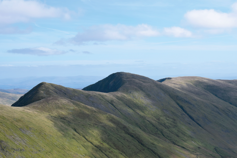
If you fancy ditching the car in favour of rail, there are two main access points to the Lake District by train – Windermere (via Oxenholme Lake District) and Penrith North Lakes. With a long weekend, you could even walk between to the two train stations on a three-day, wild camping expedition with a twist. But, if you only have a day spare, this 24km linear route is an excellent alternative.
Starting at Windermere train station, the route first climbs Orrest Head, the 238m hill where a young Alfred Wainwright first set eyes across Lakeland, sparking his lifelong passion for the landscape. After a linking section across farmland, next comes a delightful ridge walk over the Kentmere fells, including the rolling trio of Yoke, Ill Bell and Froswick, before picking up the ancient Roman Road path over Thornthwaite Crag, High Street and beyond to The Knott. The final stage descends via Angle Tarn and Boredale Hause to Patterdale, where the regular Stagecoach 508 bus will whisk you away to Penrith North Lakes train station to complete your rail journey home. Along the way you’ll tick off six Wainwrights – Yoke, Ill Bell, Froswick, Thornthwaite Crag, High Street and The Knott – but there is ample room to tick off more.
Read more: the full route description for the Kentmere Fells
St Sunday Crag via Lord’s Seat, Lake District
Vivienne Crow digs deep to discover the less-trodden ways along St Sunday Crag via Lord’s Seat – and the 508!
START/FINISH: Pay-and-display car park in Patterdale, GR NY395159 | MAPS: OS Explorer OL5 (1:25k), OS Landranger 90 (1:50k), Harvey 1:25,000 Superwalker Lake District East | DISTANCE: 11.8km/7.3 miles | ASCENT: 829m/2720ft | DURATION: 4½-5 hours
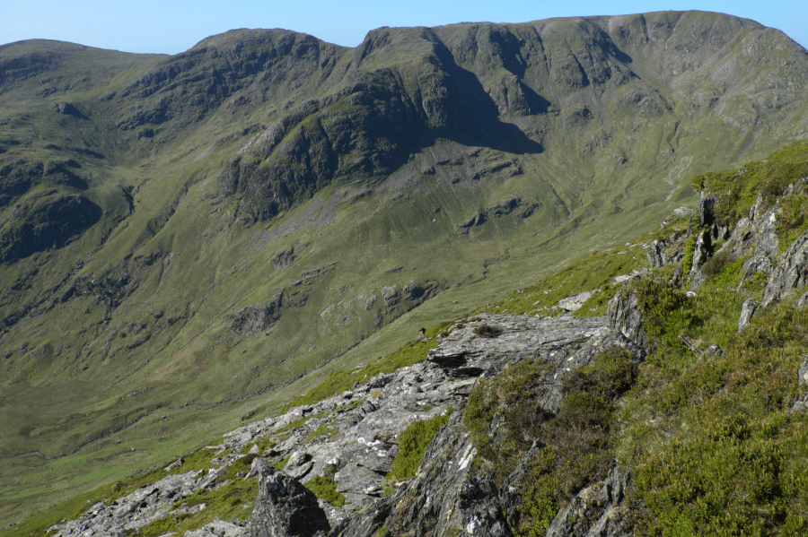
There’s just one right of way into Deepdale, and even that doesn’t venture very far into this captivating, glaciated side valley, ending long before things get interesting. Yet, for those who like their fells mostly pathless, Deepdale hides several adventurous approaches to the well-worn trails that cling to the high ridges. This route climbs the popular St Sunday Crag (841m) via its lesser-known eastern ridge, home to Lord’s Seat and the rocky knobble of Gavel Pike. You might want to use your hands on the way up Gavel Pike, but there’s no real scrambling; the satisfaction comes from knowing you’ve got this great little spur all to yourself while, just a short distance away, other walkers are keeping to the tried and tested. Those views across to Fairfield’s dark buttresses and secretive coves are for you and you alone.
After dropping from St Sunday, the route again eschews the popular paths to climb Birks and then Arnison Crag. There’s a fair chance you’ll have these tops to yourself too, but they are both Wainwrights, so play nicely if you do have to share.
Read more: the full route description for St Sunday Crag
Wansfell Pike & Baystones, Lake District
Is there a better half-day hike in the Lake District by bus? This short-but-sweet circular from Ambleside is perfect for a car-free adventure.
START/FINISH: Ambleside town centre, Rydal Road car park, LA22 9AN (NY375046) | MAPS: OS Explorer OL7 (1:25k), OS Landranger 90 (1:50k), Harvey British Mountain Map Lake District (1:40k) | DISTANCE: 12.2km / 7.6 miles | ASCENT: 634m / 2,080ft | DURATION: 4.5 hours
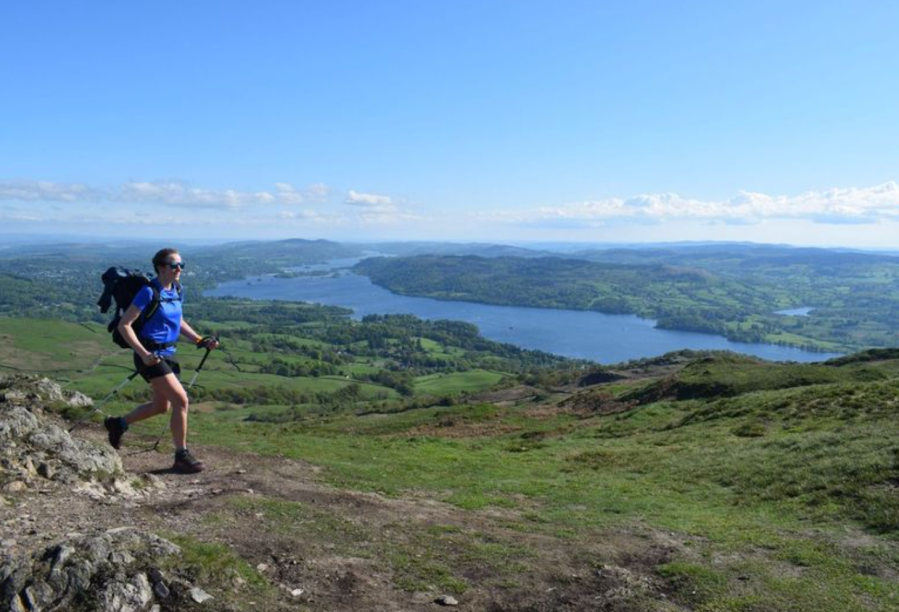
Ambleside has excellent public transport links. It is well-served by Stagecoach’s regular Lancaster to Keswick 555 bus and linked closely into the rail network via nearby Windermere train station. This makes the bustling tourist town an ideal launchpad for a car-free, eco-friendly adventure. Arguably the town’s most popular half-day hike is a jaunt up Wansfell, a popular outing which serves up glorious views over Windermere and the surrounding panorama of Lakeland peaks.
But too many tourists tackle this fell in the wrong way, trudging uphill to Wansfell Pike (which, confusingly, isn’t Wansfell’s true summit) before boringly heading down the same way. Instead we’d suggest ditching the out-and-back approach in favour of this circular route – a far more authentic and appealing way to tick off Wansfell. Our route starts with an ascent of Wansfell Pike, which Alfred Wainwright described as a “pleasant approach”, before veering north-east to the official summit of Baystones (“an unattractive place”, according to a scathing Wainwright). The return via Troutbeck and Skelghyll Wood is varied and enjoyable, thus closing the circle of an excellent half-day hike.
Read more: the full route description for Wansfell Pike
Ingleborough via the Settle-Carlisle Railway, Yorkshire Dales
Vivienne Crow uses the Settle-Carlisle Railway to visit one of Yorkshire’s Three Peaks; Ingleborough.
START: Horton-in-Ribblesdale Railway Station, GR SD803726 | FINISH: Ribblehead Railway Station, GR SD765789 | MAPS: OS Explorer OL2 (1:25k), OS Landranger 98 (1:50k), Harvey XT40 Yorkshire Dales South-West | DISTANCE: 17.7km/11 miles | ASCENT: 634m/2080ft | DURATION: 5½-6 hours
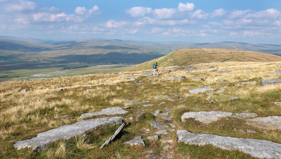
Does Yorkshire have mountains? I think we can safely conclude that many of neighbouring Cumbria’s fells, despite their altitude, look and feel like mountains, but Yorkshire? The highest point is Whernside, but it’s really only worthy of the moniker ‘hill’. (I’m sorry, Yorkshire! I love you dearly, but…) The second-highest summit, though, gives me reason to hesitate. Ingleborough. Its north face is a formidable jumble of crags, scree and shattered boulders, its distinctive, tiered outline identifiable from miles away. The flat summit plateau is a bleak place, largely bereft of vegetation and scoured by the wind. This feels like the real thing! Making use of the Settle-Carlisle Railway, I recently walked an Ingleborough linear route from Horton-in-Ribblesdale.
The meandering approach took in some magnificent geological features, including a view of the extensive limestone pavement of Moughton Scars, the dry gorge of Trow Gill, and Gaping Gill, one of Britain’s largest underground caverns. From the summit, a gorgeous path along a moorland ledge then led north-east before dropping steeply from Park Fell to end the linear journey at Ribblehead Station.
Read more: the full route description for the Ingleborough linear
Blea Moor from Dent Station, Cumbria
Ian Battersby sees what’s on offer – the summits of Blea Moor and Great Knoutberry Hill – with this walk from England’s highest mainline station.
START/FINISH: Dent Station; SD764875 | MAPS: OS Explorer OL2 (1:25k), OS Landranger 98 (1:50k) | DISTANCE: 17.9km / 11.1 miles | ASCENT: 689m / 2,261ft | DURATION: 6 hours
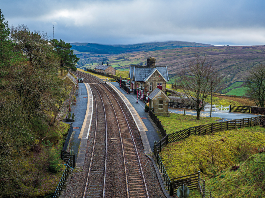
It may seem strange to disembark from the train and begin the day with a descent, but when that station is Dent, and morning cloud shrouds the tops, the vale is the place to avoid the veil, and what a magical dale it is. River Dee dippers hunt the pools between rapids churning below trees and between limestone walls softened with verdant moss. Lush pastures sweep to rougher, steeper moorland grasses, down which many streams cut their trundle, some flying down waterfalls, to augment the Dee. All this set beneath brooding railway arches.
With luck sun or wind dispense with the cloud, and we chase it up the hill. Blea Moor is not only a superlative viewpoint for the Yorkshire Three Peaks, but also further north there is Wild Boar Fell, Baugh Fell as well as a hint of the Howgills and Great Knoutberry Hill our high point for the day. Approaching from the south we lose the northern vista, which pops back into the fray from the summit with sudden surprise. Sit quietly on the stone throne and fortune may bring a trio of owls that proceed to accompany you on another magical descent.
Read more: the full route description for Blea Moor
The Edale Skyline from Hope, Peak District
Francesca Donovan guides you on a fine Peak District day challenge taking in the highlights of the Edale Valley: The Edale Skyline.
Start/finish: Hope train station (GR: SK181832) | Maps: OS Explorer OL24 (1:25k) | Distance: 32km/20 miles | Ascent: 1096m/3596ft | Duration: 9-10 hours
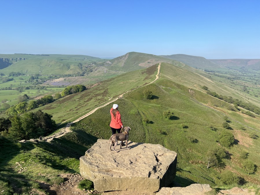
The Edale Skyline is the most fun you can have in the Peak District on two feet. That is, if you find admiring sweeping views across the most popular (read: best) hillwalking territory in our first national park fun. This route, which skirts the edges above the entire Edale valley, is a well-loved trail run; but it can be squeezed into a day of walking too. There’s only one sustained ascent and the rest of the walk involves staying high for many undulating miles.
It’s well worth the effort. On the Edale skyline, you’ll bag five trig points, enjoy views over the Ladybower Reservoir, encounter fascinating gritstone formations at the edges of the Kinder plateau, and finish along The Great Ridge. Whilst there may be more adrenaline-fuelled routes up to the Kinder Plateau – The Peak’s high point – via cloughs and falls, there are few longer full-day routes in this part of the world.
Accessible by public transport into the park, most walkers start in Hope village; but you can easily adjust the route to begin at any stop on the Manchester to Sheffield train line.
Read more: the full route description for The Edale Skyline
Yr Wyddfa, Eryri/Snowdonia
Andew Galloway finds a precarious scramble leads to an Arthurian legend on this lesser-trodden bus to hike’n’scramble of Yr Wyddfa via Yr Cribau.
Start: Pen y Pass (SH647556) | Finish: bus interchange in Llanberis (SH582598) | Distance: 14km (8.5 miles) | Ascent: 777m | Duration: 8 hours | Maps: Ordnance Survey 1:25,000 Explorer OL17 Yr Wyddfa/Snowdon

According to a Welsh legend, fabled King Arthur fought his final battle at the head of Cwm Llan beneath the precipitous southern crags of Yr Wyddfa, more commonly known in English as Snowdon. Having received a mortal wound, Arthur is said to have died in the arms of the Knight Bedwyr at the col beneath Yr Wyddfa, forever to be known as Bwlch y Saethau, the pass of arrows. In grief Bedwyr cast Arthur’s sword, Excalibur, into the waters of the lake Glaslyn beneath the col. In some accounts Bedwyr buried Arthur’s body where he had fallen, erecting there a cairn over Arthur’s remains. In other accounts Bedwyr placed his body into a wooden boat, which, accompanied by three maidens, was cast out onto the waters of Llyn Llydaw to be carried to the realm of Afalon, meaning in Welsh the land of apples. The remnants of Arthur’s army are believed to have then retreated to a cavern accessible only from the steep northern face of Y Lliwedd, where to this day they lie in magical sleep, awaiting Arthur’s return.
Read more: the full route description for Yr Wyddfa, Eryri/Snowdonia
Foel-goch, Eryri/Snowdonia
Nick Livesey is our guide to a bus-enabled linear walk away from the crowds onto Foel-goch, an Eryri hidden gem.
Start/Finish: Ogwen Visitor Centre (GR: SH649693) | Distance: 6 miles/9.7km | Ascent: 518m/1,700ft | Duration: 4 to 5 hours | Maps: OS Explorer OL17 – Snowdon/Yr Wyddfa (1:25k), OS Landranger 115 – Snowdon/Yr Wyddfa (1:50k)
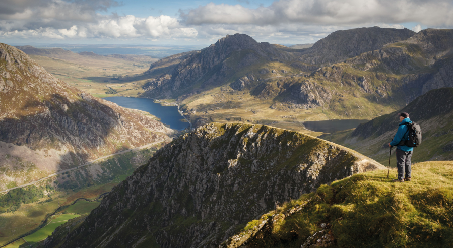
In recent years the Ogwen Valley has become almost as well known for its parking issues as it is for its incredible mountains. This is a shame, as it can put people off – especially those who seek solitude or want to avoid adding to the stresses on local infrastructure. A simple solution is to utilise public transport, and with a little imagination a full-blooded Ogwen adventure away from the crowds can be yours!
This route, which links the Ogwen Valley and Llanberis Pass, is sublime and visits three deserted cwms before topping out on an imposing but seldom-trodden peak. The return journey is similarly bereft of visitors and as you ride the bus back to Capel Curig you can feel smug – or at least content – in the knowledge that you’ve enjoyed some of Snowdonia’s hidden gems and had them all to yourself whilst at the same time avoiding the car park lottery and saving yourself a few quid in petrol as well.
Read more: the full route description for Foel-goch
The Tarrens, Eryri/Snowdonia
Fiona Barltrop recommends a fine ridge-top walk over the unfrequented Tarrens in Southern Eryri.
START: Pennal bus stop, GR: SH698004 | FINISH: Aberdovey/Aberdyfi (car park – GR: SN612959, or nearby railway station) or Tywyn | MAPS: OS Explorer OL23; Landranger 135 | DISTANCE: 19.5km/12 miles (+ 7.2km/4½ miles to Tywyn – railway station) | DURATION: 6 – 7 hours (+ 2 hours for extension to Tywyn) | ASCENT: 945m/3100ft
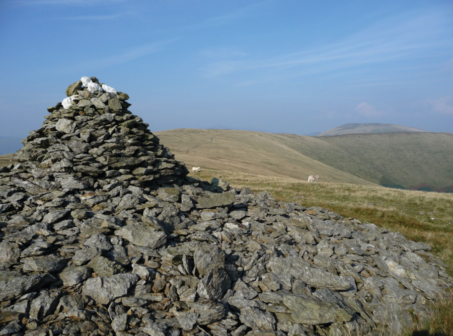
Situated in the southernmost part of Eryri National Park are the lovely, little walked Tarren hills that run down to the sea at Aberdovey. Separated from Cadair Idris by the Dysynni Valley and Tal-y-llyn Lake and from Plynlimon by the Dovey (Dyfi in Welsh), this compact range of hills provides some excellent crowd-free walking, notably along the fine ridge that extends for several miles in a south west direction from the Tarrens’ highest point, Tarren y Gesail (667m/2188ft). The only other 2000ft plus top is Tarrenhendre, to the north east of which the slopes are largely swathed in forest, while to the south west the terrain is mostly grassy and smooth rolling.
The popular seaside resort of Aberdovey is served by the scenic Cambrian coast line, with trains every two hours in each direction. From here it’s just a short bus ride to Pennal, the start of this exhilarating linear route, which ascends Tarrenhendre then follows the ridge back to Aberdovey. On a fine day the extensive views are superb. On days of low cloud, there’s a good alternative route following the Wales Coast Path along the foothills of the Tarrens.
Read more: the full route description for The Tarrens, Eryri/Snowdonia
Beacon Hill, mid-Wales
Roger Butler makes use of the train to explore the empty hills west of Offa’s Dyke.
Start: Knucklas, grid ref SO253742 | Finish: Llanbister Road station, grid ref SO174716 | Map: OS Explorer 201 and 214 (1:25k); OS Landranger 148 (1:50k) | Distance: 18.5km / 11.5 miles | Ascent: 585m / 1920 feet | Duration: 7 hours
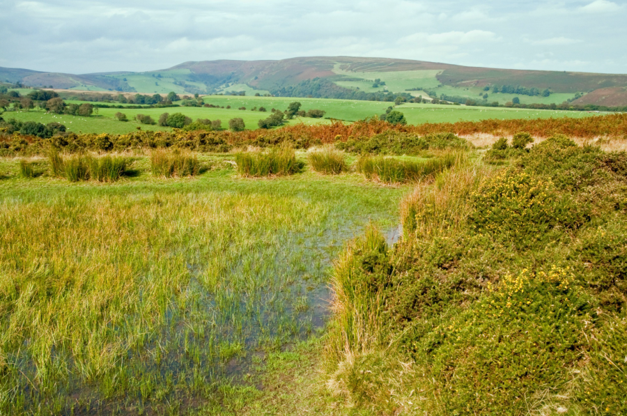
If Offa’s Dyke was part of a theme park it would be an eye-catching roller coaster but those incessant ups and downs continue to rumble and roll once you’ve crossed the Welsh border down by the River Teme near Knighton. Here, fingers of high moorland point west towards little-known hills in deepest Powys.
This long linear romp takes advantage of a couple of stops on the Heart of Wales Line and glides along tongue-twisting Wernygeufron Hill before following Glyndŵr’s Way through deep heather to the top of Beacon Hill. This broad summit, with a rim of crumbly crags, forms the centre of a sprawling upland massif criss-crossed by old drover’s tracks, some of which passed a former farmstead with the evocative name of New Invention. Something special must have happened there. The route then turns south above a steep valley, past the source of the River Lugg, which eventually leads down to the simple station at Llanbister Road. Stick your arm out to make sure the train stops for a swift return to Knucklas!
Read more: the full route description for Beacon Hill
Box Hill via the North Downs Way
Nike Werstroh marvels at stunning views on this Box Hill route via the North Downs Way – less than an hour from London by train.
Start: Gomshall train station (TQ 088 478) | Finish: Reigate train station (TQ 254 507) | Ascent: 677m / 2221ft | Duration: 6-7hr | Distance: 26km / 16 miles | Maps: OS Explorer145, OS Explorer 146
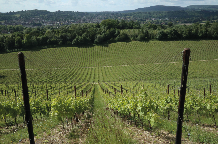
The North Downs Way long distance trail, starting from Farnham traverses the Surrey Hills and continues through Kent Downs to Dover. With frequent train service from London many sections of the North Downs Way can make a perfect day out from the capital. This route joins the North Downs Way outside of Gomshall and follows the chalky ridge dotted with pillboxes and with fine views over to the rolling hills of Surrey Hills. It then skirts around Denbies Estate, the biggest vineyard in England, where some award-winning sparkling wines are produced. You then climb the iconic Box Hill, probably one of the best-known beauty spots near London and then walk through woodland to Colley Hill, where you will be greeted with some excellent views to the south.
Before leaving the NDW allow some time to explore the remnants of Reigate Fort. It was one of the 13 fortifications built along the North Downs at the end of the 19th century as part of the London Defence Scheme. The Surrey Hills might not be a wild, remote part of England, but as you walk through dense woodland or marvel at the stunning views, it is hard to believe that you are less than an hour from London.
Read more: the full route description for Box Hill