
Andew Galloway finds a precarious scramble leads to an Arthurian legend on this lesser-trodden hike’n’scramble of Yr Wyddfa via Yr Cribau.
According to a Welsh legend, fabled King Arthur fought his final battle at the head of Cwm Llan beneath the precipitous southern crags of Yr Wyddfa, more commonly known in English as Snowdon. Having received a mortal wound, Arthur is said to have died in the arms of the Knight Bedwyr at the col beneath Yr Wyddfa, forever to be known as Bwlch y Saethau, the pass of arrows. In grief Bedwyr cast Arthur’s sword, Excalibur, into the waters of the lake Glaslyn beneath the col. In some accounts Bedwyr buried Arthur’s body where he had fallen, erecting there a cairn over Arthur’s remains. In other accounts Bedwyr placed his body into a wooden boat, which, accompanied by three maidens, was cast out onto the waters of Llyn Llydaw to be carried to the realm of Afalon, meaning in Welsh the land of apples. The remnants of Arthur’s army are believed to have then retreated to a cavern accessible only from the steep northern face of Y Lliwedd, where to this day they lie in magical sleep, awaiting Arthur’s return.
Yr Wyddfa via Yr Cribau: route description
Start: Pen y Pass (SH647556) | Finish: bus interchange in Llanberis (SH582598) | Distance: 14km (8.5 miles) | Ascent: 777m | Duration: 8 hours | Maps: Ordnance Survey 1:25,000 Explorer OL17 Yr Wyddfa/Snowdon
1. SH647556: Starting from the bus interchange in Llanberis take the S2 Sherpa service to Pen y Pass. It’s a good idea to make use of the cafe and toilet facilities here before heading off. On the southern side of the car park locate the ornate iron gate leading to the Miner’s Track. Follow this broad, well-engineered track for 2.5km around the north shore of Llyn Teyrn to the causeway crossing Llyn Llydaw. The causeway was built in 1853 by miners from the Britannia Copper Mine, the ruins of which you will pass on the far side of the lake. During construction of the causeway the remains of a prehistoric wooden boat were, allegedly, discovered by one of the mine’s engineers. Could this relic have been the origin of the myth of Arthur’s body being cast upon the waters of the lake?
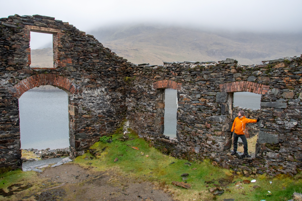
Britannia Copper Mine. Credit: Andrew Galloway
2. SH633547: Cross the causeway and continue along the Miner’s Track for 900m to the abandoned buildings of the Britannia Copper Mine that stand close by the lake shore. Beyond the buildings the track becomes steeper. Follow for 1.1km to the outflow from Glaslyn.
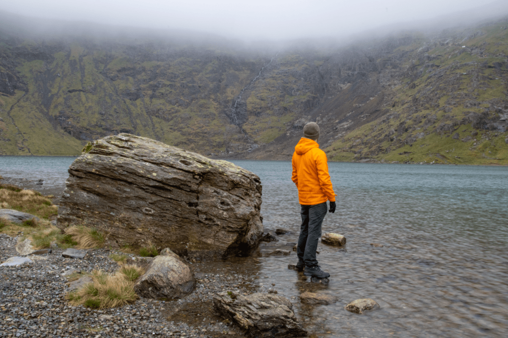
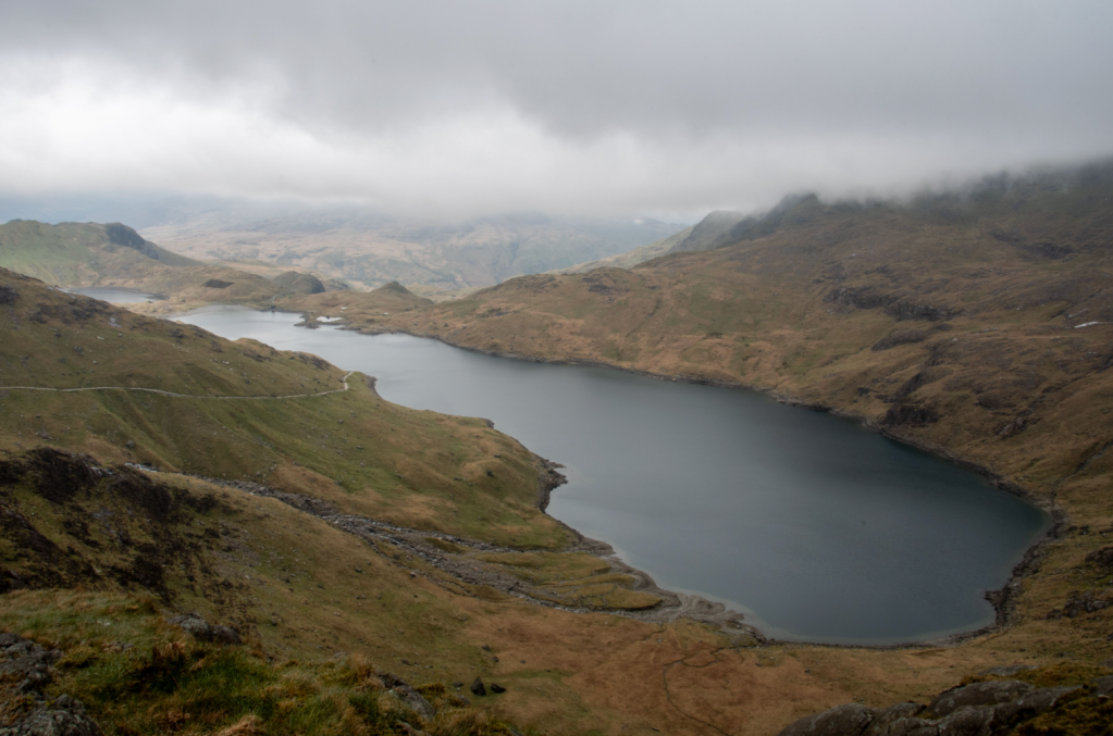
Glaslyn lake. Credit: Andrew Galloway
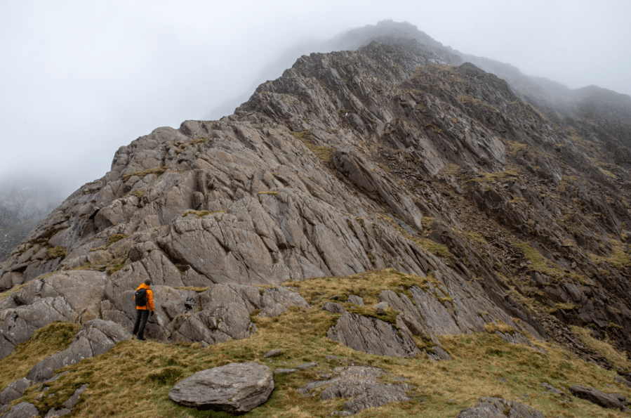
3. SH619545: Cross the stream to the south. A narrow path ascends the grassy slops to the southwest. After 300m an outcrop of rock sloping northwards at an angle of about 60 degrees. Keeping to the left climb the slabs by means of the natural crevices within the volcanic rock. After 15m of ascent the ridge begins to narrow. The most accessible route lies just to the right of the crest of the ridge. The diagonal grain within the rock provides ample flakes that make for equally beneficial hand or foot holds. After 300m locate the small cairn at the top of the ridge, beyond which all serious problems cease. Continue southeast for a further 200m, passing two small patches of water, and locate the Watkin Path, crossing Bwlch y Saethau roughly east to west. According to one version of the Welsh Arthurian myth, Sir Bedwyr buried Arthur’s body here where he had fallen at Bwlch y Saethau, erecting over the remains a large cairn. No trace of such a cairn remains.
Afon Glaslyn and Yr Cribau Ridge. Credit: Andrew Galloway
4. SH615540: Follow the Watkin Path westwards, traversing the scree slope to the south of Yr Wyddfa summit. Warning! This path is steep, loose and can be hazardous in icy conditions. Please take care! After 700m the southern shoulder of Yr Wyddfa is reached, a stone way-maker signifying the top of the Watkin Path. Head northeast along the shoulder of Yr Wyddfa for 300m, passing the Snowdon Railway station and facilities building Hafod Eryri to reach the summit of cairn (1085m). Another myth associated with Yr Wyddfa tells of a Giant named Rhita, who was slain and buried beneath a mighty cairn on the mountain top. It is believed the original cairn was dismantled in the nineteenth century to provide building materials for what was at the time a number of small summit buildings.
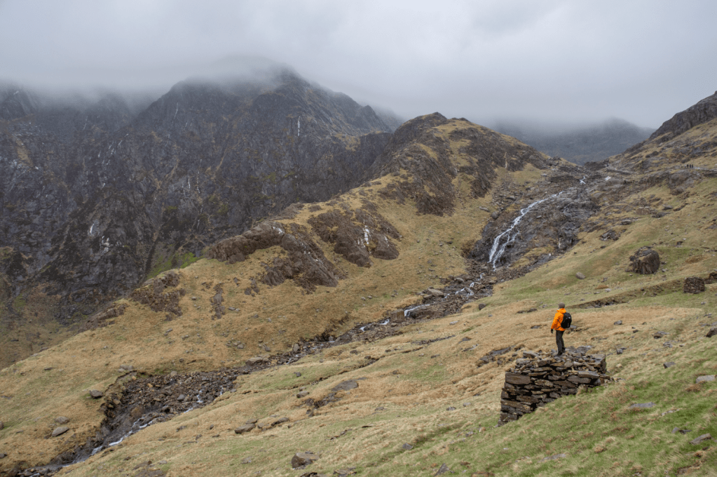
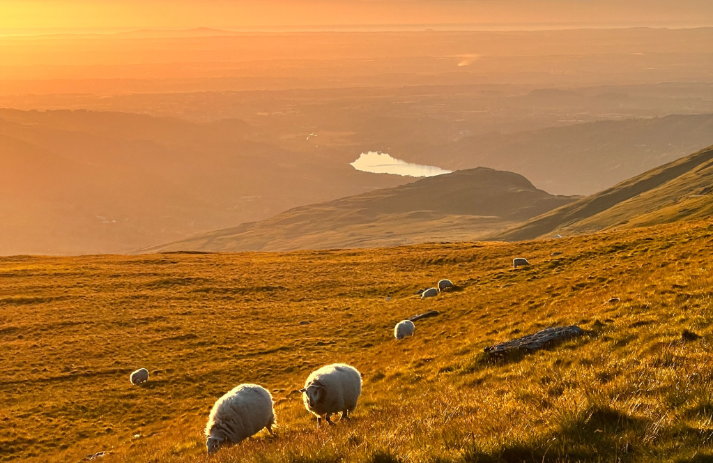
Llyn Llydaw from Yr Cribau ridge. Credit: Andrew Galloway
5. SH609543: Head north-northwest from the summit, taking the path east of the railway track for 600m to Bwlch Glas, where footpaths diverge. Continue northwards on the Llanberis Path, indicated by a stone way-marker, for 900m to where it dips under the railway track by Clogwyn station.
The view out to sea on the Llanberis Path. Credit: Alex Roddie
6. SH608560: One of the longer routes on Yr Wyddfa, the Llanberis Path nonetheless provides a gentle descent from the mountain, passing by the Halfway Café House. If you find it open why not stop for a cuppa? After 4.2 km pass through the gate at Cader Ellyll onto the minor road.
7. SH581589: Follow the minor road to the north for 1.1km to the roundabout opposite the Victoria Hotel, Llanberis. Turn to the left along the A4086 for 250m to the bus interchange.
Further information
Public Transport: Parking at Pen y Pass is limited and expensive. I chose to park near the bus interchange in Llanberis and take the S2 Snowdon Sherpa bus to Pen y Pass. On the day I did the walk the parking was £12 for the day and the bus ticket £3.50. The S2 route can also be taken from Bangor. Timetables for the Sherpa bus can be downloaded at https://www.sherparwyddfa.wales/
Information: eryri.gov.wales


