
Nike Werstroh marvels at stunning views on this Box Hill route via the North Downs Way – less than an hour from London by train.
The North Downs Way long distance trail, starting from Farnham traverses the Surrey Hills and continues through Kent Downs to Dover. With frequent train service from London many sections of the North Downs Way can make a perfect day out from the capital. This route joins the North Downs Way outside of Gomshall and follows the chalky ridge dotted with pillboxes and with fine views over to the rolling hills of Surrey Hills. It then skirts around Denbies Estate, the biggest vineyard in England, where some award-winning sparkling wines are produced. You then climb the iconic Box Hill, probably one of the best-known beauty spots near London and then walk through woodland to Colley Hill, where you will be greeted with some excellent views to the south.
Before leaving the NDW allow some time to explore the remnants of Reigate Fort. It was one of the 13 fortifications built along the North Downs at the end of the 19th century as part of the London Defence Scheme. The Surrey Hills might not be a wild, remote part of England, but as you walk through dense woodland or marvel at the stunning views, it is hard to believe that you are less than an hour from London.
Box Hill via the North Downs Way: route description
Start: Gomshall train station (TQ 088 478) | Finish: Reigate train station (TQ 254 507) | Ascent: 677m / 2221ft | Duration: 6-7hr | Distance: 26km / 16 miles | Maps: OS Explorer145, OS Explorer 146
1. TQ088478: From Gomshall train station make your way to Station Road (A25), keep right and then turn right onto Colekitchen Lane. Shortly after go right up on the Public Footpath alongside fields. Follow the signposted Walk the Chalk path that rises slowly, go through a gate and pass a pillbox. When the path splits take the right branch, and shortly after arrive on the North Downs Way (NDW) and go right.
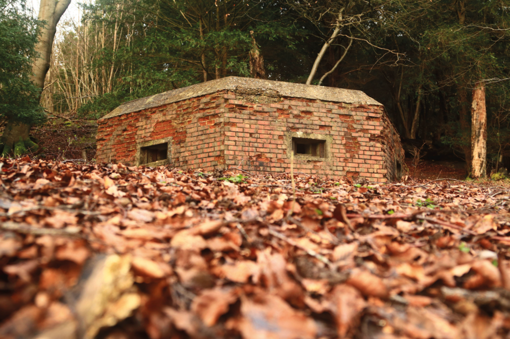
Pillbox. Credit: Nike Werstroh
2. TQ095488: Follow the North Downs Way crossing other paths and navigating through some gates. Walk across Blatchford Downs passing pillboxes and then the NDW drops down to a lane. Go right and a few paces later turn left. Follow the signposted NDW passing further pillboxes and navigating through kissing gates for about an hour. On Steers Field, head to the wooden signpost and keep left to reach a tarmac lane.
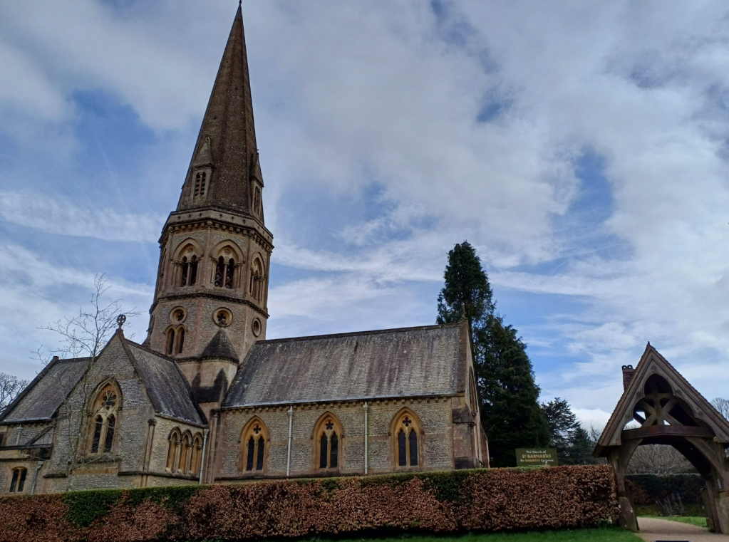
Church of St Barnabas. Credit: Nike Werstroh
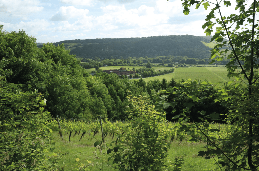
3. TQ143503: Cross the lane and continue with the Old Post Office Cottage on your left in the direction of Westhumble and shortly after pass the Church of St Barnabas. After the entrance of Ashmore Park Estate, keep right on NDW that runs between fences. As you enter the Denbies Wine Estate the views are dominated by the rows upon rows of vines spread down the slope and the iconic Box Hill. Follow the NDW signs at each path junction. The path passes beneath the railway before it reaches the A24 road.
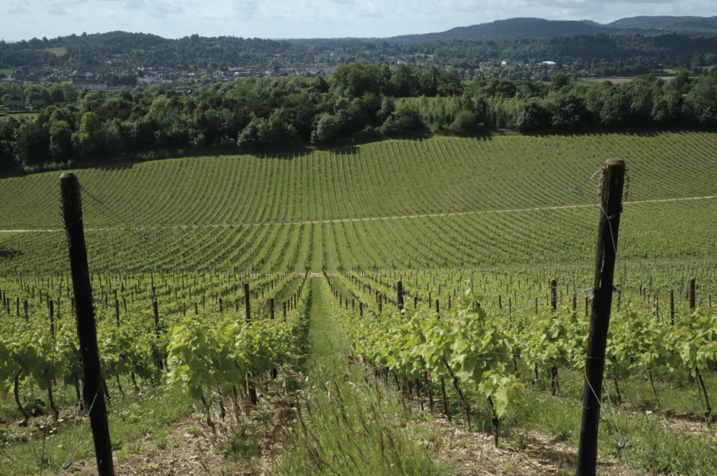
Denbies Vineyard. Credit: Nike Werstroh
4. TQ170513: The NDW continues on the other side of the A24. To cross safely, go left and a few hundred metres later, come to the subway. Emerging on the other side of A24, go right on the pavement and leave it to the left to walk across the Stepping Stones Car Park. Continue alongside the fence to the River Mole that you cross on stepping stones (if the water level is too high, go left alongside the river to locate the bridge). The steep climb starts after the river crossing. Climb steadily, often on steps through woodland to meet a path where keep right through the kissing gate. Carry straight on after the next gate to reach Salomons Memorial Viewpoint.
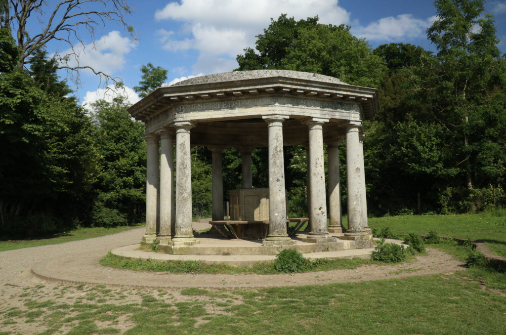
Inglis Memorial. Credit: Nike Werstroh
5. TQ179511: The grassy slope below the viewpoint is a popular picnic spot with extensive views to the south. Follow the well signposted path parallel to the road. Pass the back of the country pub and descend to meet another path. Go left down the steep steps and arrive on a wider path where bear left. Shortly after, leave the wide path to the right and walk through woodland and then with some views of the disused quarry. Shortly after, notice the lime kiln, the remnant of the Brockham lime works, on the right.
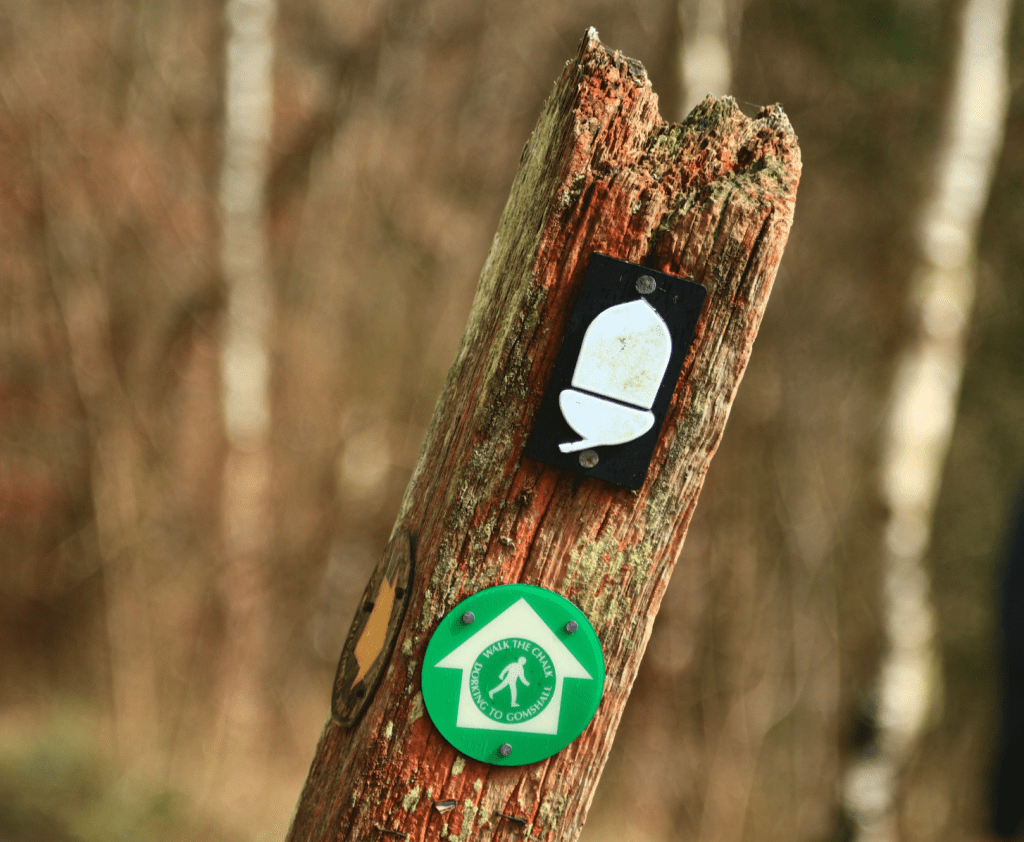
Your sign to walk the chalk. Credit: Nike Werstroh
6. TQ210516: Pass a line of cottages and on-reaching Pebblehill Road, go left. The path runs parallel to the road for a short while and then the NDW continues to the right. Go through a gate and keep left alongside a field, and then the path sandwiched between hedges rises gently. There are helpful signs at every path junction as you walk through woodland to meet a wide path where keep left uphill. Shortly after pass some cottages and go right by the signpost.
Colley Hill. Credit: Nike Werstroh
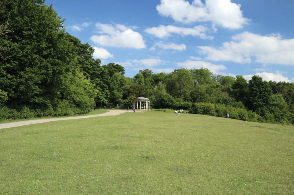
7. GTQ240522: Go through a gate to reach Colley Hill, and follow the prominent path with great views. Pass the imposing pillared Inglis memorial and go through a gate to continue along the wide path. Pass a bunker and a clearing with the memorial to a plane crash. Shortly after arrive at Reigate Fort. Explore the fort and then continue on the path passing some cottages to a junction.
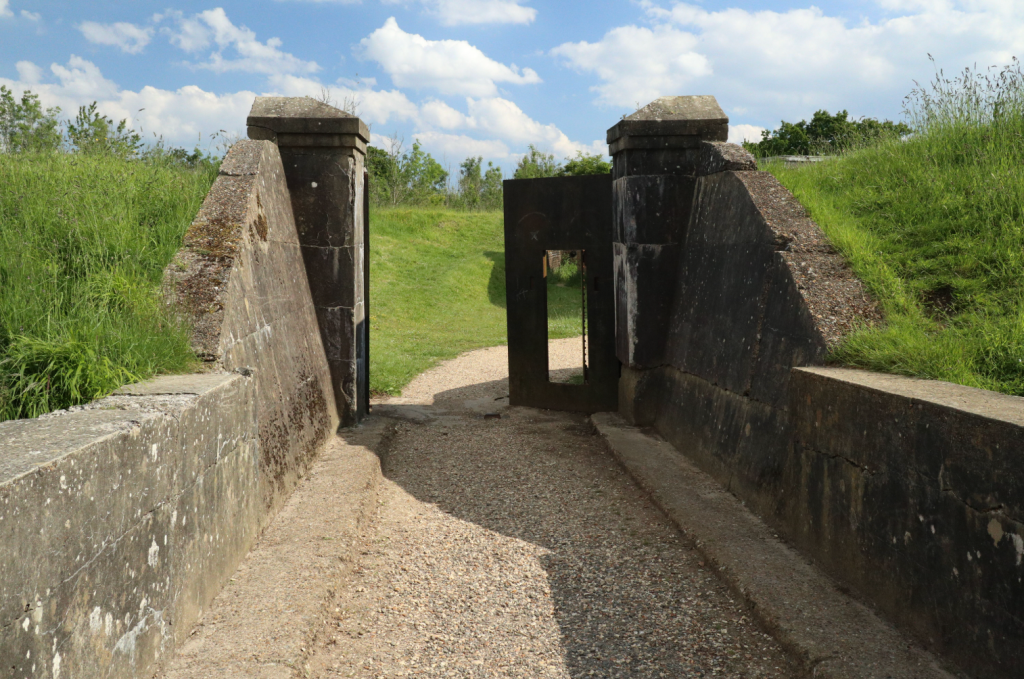
The gate of Reigate Fort. Credit: Nike Werstroh
8. GTQ258521: Leaving the NDW turn right downhill, and descend the bridleway to the A217 road. Turn right and follow the road for about 15min to Reigate train station.
Further information
Public Transport: Trains from London to Gomshall with a change in Guildford. At the end of the trail trains from Reigate to London.
Tourist Information: www.visitsurrey.com
Walk more routes in the South of England mapped by our experts.


