
Ian Battersby sees what’s on offer – the summits of Blea Moor and Great Knoutberry Hill – with this walk from England’s highest mainline station.
It may seem strange to disembark from the train and begin the day with a descent, but when that station is Dent, and morning cloud shrouds the tops, the vale is the place to avoid the veil, and what a magical dale it is. River Dee dippers hunt the pools between rapids churning below trees and between limestone walls softened with verdant moss. Lush pastures sweep to rougher, steeper moorland grasses, down which many streams cut their trundle, some flying down waterfalls, to augment the Dee. All this set beneath brooding railway arches.
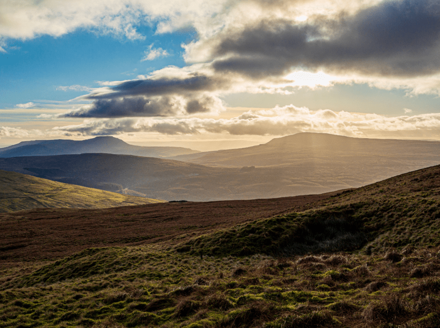
With luck sun or wind dispense with the cloud, and we chase it up the hill. Blea Moor is not only a superlative viewpoint for the Yorkshire Three Peaks, but also further north there is Wild Boar Fell, Baugh Fell as well as a hint of the Howgills and Great Knoutberry Hill our high point for the day. Approaching from the south we lose the northern vista, which pops back into the fray from the summit with sudden surprise. Sit quietly on the stone throne and fortune may bring a trio of owls that proceed to accompany you on another magical descent.
Blea Moor and Great Knoutberry Hill: route description
START/FINISH: Dent Station; SD764875 | MAPS: OS Explorer OL2 (1:25k), OS Landranger 98 (1:50k) | DISTANCE: 17.9km / 11.1 miles | ASCENT: 689m / 2,261ft | DURATION: 6 hours
1. SD764875: Leave the station and turn left down Coal Road, heading W and dropping steeply around Monkeybeck Scar, then turning S and descending to a T-junction at Lea Yeat in Cowgill. The views over Dentdale while dropping down the lane are an early bonus. Turn left, over a bridge, and continue SE alongside the Dee, passing waterfalls near the Sportsmans Inn. Arten Gill Viaduct towers on slopes opposite. The lane crosses to the east bank at Stonehouse Farm, then continues SSE, passing impressive river cascades, before arriving at a grassed over bridge on the right at Bridge End.
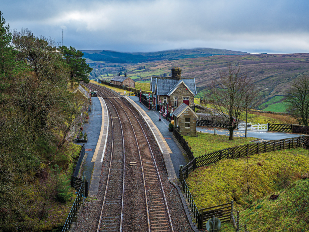
Dent Station. Credit: Ian Battersby
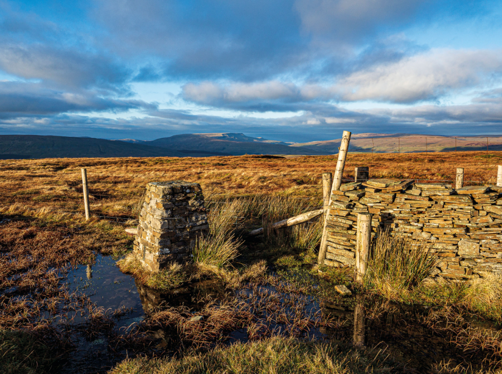
2. SD775847: Cross the bridge and follow the Blea Moor sign left through a gate, climbing SW over stream and stile. Follow a fence S to its corner, then continue S towards Dent Head Farm. Dent Head Viaduct stands out across the dale. Yellow arrows guide through a gate and over a bridge, turning right by the house guarded by enthusiastic geese, and out through another gate. Continue S left of the stream to a footbridge. Cross and continue S, now right of the stream. Pass two impressive waterfalls on the left below the railway. Go through a wall gap and follow the path as it turns SW keeping right of the railway, soon climbing above Bleamoor Tunnel that swallows the line. Climb a stile and follow boardwalks through bogs, continuing SW through the plantation to a track. Continue climbing SW to a stile (440m) and past an air shaft for the unseen tunnel below. Climb to 500m where the path levels at a stile overlooking Whernside’s soaring eastern flank. Cross and turn left into access land, following quad bike tracks right of the fence heading SE, then S to Blea Moor’s trig point.
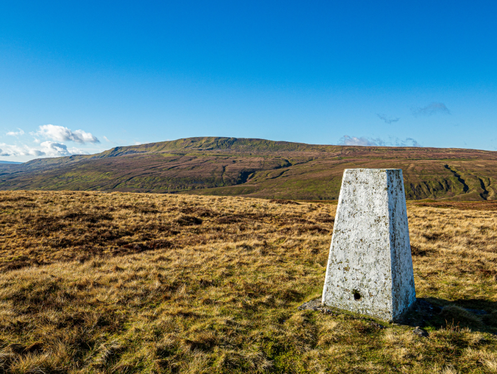
Whernside from Blea Moor. Credit: Ian Battersby
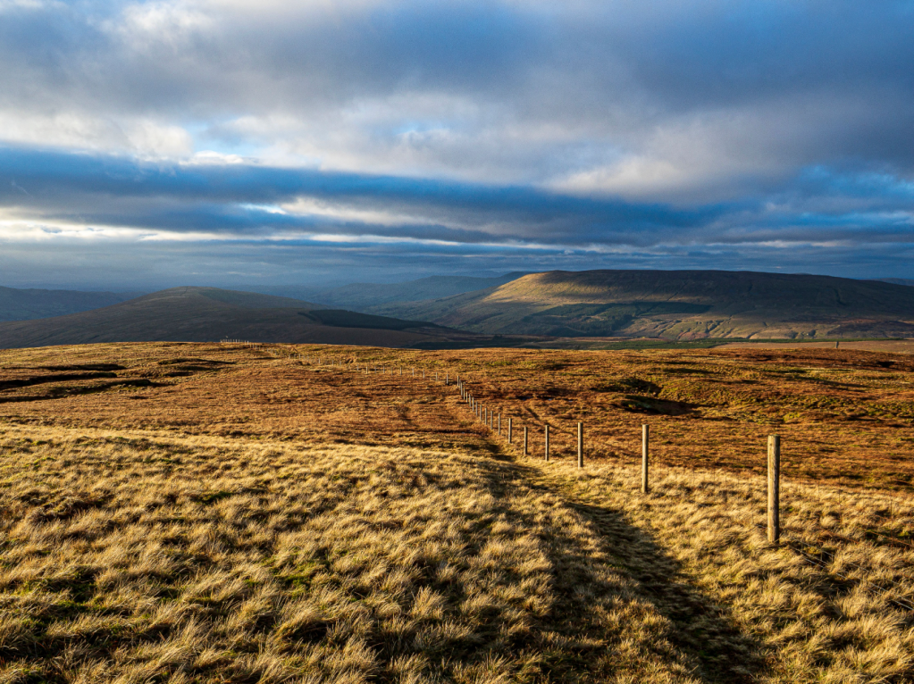
3. SD773826: Locate the fence junction E of the trig point and cross the low fence by a broken stile, dropping ESE with a fence on the right. Minor path turns to vehicle tracks in places. Cross a stream and drop E to the pools at Dike Head. Continue left of the fence, now dropping NE now to a gate and track at 425m. Turn left heading N on welcome good track across Stoops Moss to a lane. Turn right heading SE past a metal ruined hut, then turning NE to a junction with the Pennine Bridleway at Newby Head Gate.
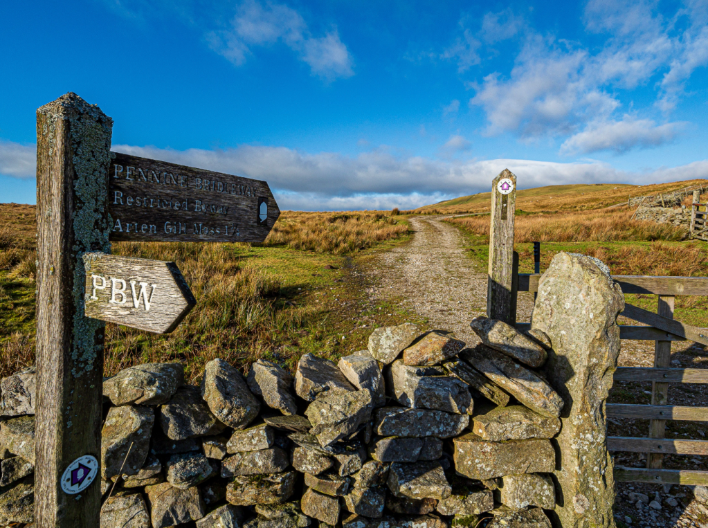
Bridleway up Wold Fell at Newby Head Gate. Credit: Ian Battersby
4. SD790835: Follow the bridleway N, climbing to a gate just below Wold Fell. Divert WNW to reach the top which is littered with thousands of little grassy hummocks, then return E to the track. Go through a gate and continue along good track wriggling N with impressive views of the Widdale Fell Edges overlooking Widdale in the northeast. Meet a junction of bridleways at Arten Gill Moss.
Wild Boar Fell from Great Knoutberry Hill. Credit: Ian Battersby
5. SD792861: Turn right, heading ENE to the top of the hill. At the top use the stone stile built into the wall on the left and climb NNW alongside a wall to reach the trig point at Great Knoutberry Hill, from where Wild Boar fell in the north has grown in stature to steal the show. There is a stone shelter from which to take it all in, before continuing the path WNW, keeping left of a fence and dropping over the gritstone at Pikes Edge to meet a bridleway by a series of gates at 510m.
Baugh Fell from Great Knoutberry Hill. Credit: Ian Battersby
6. SD777874: Turn right through the gates, heading NE on good track to meet Coal Road. Turn left down the lane heading W for around a mile to return to the station after crossing over the railway bridge.
Further information
PUBLIC TRANSPORT: Trains from Settle and Carlisle
TOURIST INFORMATION: Sedbergh, 015396 20125
Walk more routes in Cumbria mapped by our experts.


