
Stefan Durkacz takes on a classic hillwalking circuit in the Scottish Borders. Here’s how to walk the Glensax Round.
Despite being little more than an hour away by bus, the handsome old town of Peebles seems a world apart from Edinburgh’s bustle. Set by the River Tweed and surrounded by farmland, hills and forests, Peebles has a long history as a Royal Burgh and former county town of Peeblesshire. Pubs, cafes, restaurants and accommodation make it an ideal base for walking and exploration.
This is Peebles’ classic hill walk, easily doable in a day by bus from Edinburgh. This circuit of the tops around Glen Sax, which cuts deep into the hills south of town, is typical Southern Uplands walking. The first few miles follow the Cross Borders Drove Road long distance walking route, fences run along the crests for most of the way, and the route is well-trodden by runners and hillwalkers, making navigation straightforward even in murky conditions. The highest section of the route is boggy so dry weather – either in early summer or winter when the ground is frozen – is best. Wait for a clear day to appreciate the views which stretch from the wild heart of the Southern Uplands to the Pentland Hills and Arthur’s Seat.
The Glensax Round: route description
Start/Finish: NT254405 High Street, Peebles | Maps: OS 1:50,000 Landranger sheet 73 Peebles, Galashiels & Selkirk; OS 1:25,000 Explorer sheet 337 Peebles & Innerleithen | Distance: 26km/16 miles | Ascent: 885m/2904ft | Duration: 8-10 hours
1. NT254405: Head W along the High Street. At a roundabout turn L (signposted B7062 Cardrona) across the River Tweed. Take the first exit at a mini roundabout on the south side of the bridge (still the B7062), then almost immediately turn R onto Springhill Road. You’re now on the Cross Borders Drove Road for the next 7.5km. Follow the residential Springhill Road, which soon becomes Glen Road, for just over 1km to its end at the edge of town.
2. NT260392: At the end of the public road there is parking for four cars. Continue ahead onto a path signposted for Tweed Trails and Yarrow Valley (you’ll return down the private road on the R at the end of the day). The path opens into a broad avenue of beech trees before reaching a junction. Bear R downhill, cross the Haystoun Burn by a footbridge and begin the long climb into the hills. For much of the way the path runs between two old drystone walls. This channelled the drovers’ cattle herds through the farmlands and on to the open hill above.
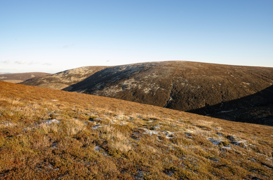
Dun Rig and Hundleshope Heights from Kailzie Hill showing the sweeping spur of Dead Side. Credit: Stefan Durkacz
3. NT269380 Just beyond a gate, the path forks. Bear L to continue on the drove road skirting Craig Head (421m). Alternatively, take the R fork to climb over Craig Head, rejoining the drove road 1km further on at another gate. The detour is worth it for the views up Glen Sax.
The hills around the head of Glen Sax from Kirkhope Law. Credit: Stefan Drukacz
4. NT273373: Go through the gate and continue up heathery crest. At Kailzie Hill the upper edge of Cardrona Forest meets the ridge. Continue to Kirkhope Law (537m) with the trees on your L. Descend to a col where the plantation ends and the Cross Borders Drove Road drops L off the crest, parting company with the route.
Preston Law across Glen Sax from Kirkhope Law. Credit: Stefan Durkacz
5. NT274344: Climb steadily S for just over 1km to reach Birkscairn Hill (661m) marked by a large cairn and junction of fences. Descend SW to a col where a green Scotways sign indicates the route to the Yarrow Valley dropping S off the ridge. From here to Dun Rig the route is boggy. Climb SW by the fence to Stake Law (681m). Stay on the level crest which merges into a long, wet slope climbing to the summit of Dun Rig (744m). Climb a wooden gate to reach the trig point on the N side of the fence.

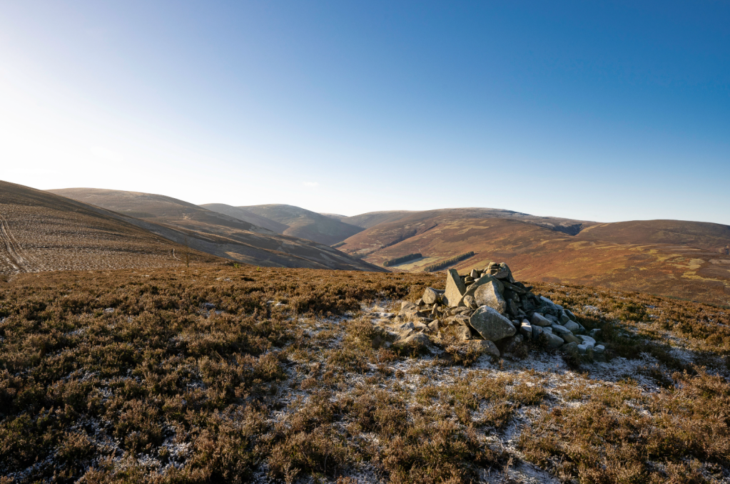
The hills around the head of Glen Sax from Birkscairn Hill. Credit: Stefan Durkacz
6. NT254316: Follow the fence SW for 1km, then veer northwards, rounding the headwaters of the Glensax Burn to a col (645m). Climb steeply northwards to reach Middle Hill (732m). Continue along the crest for 400 metres to a fence junction. Follow the fence R for 1.25 kilometres to the trig point on Hundleshope Heights (685m). Enjoy the views north over Peebles to the distant Pentland Hills. Arthur’s Seat in Edinburgh may be visible on a clear day.
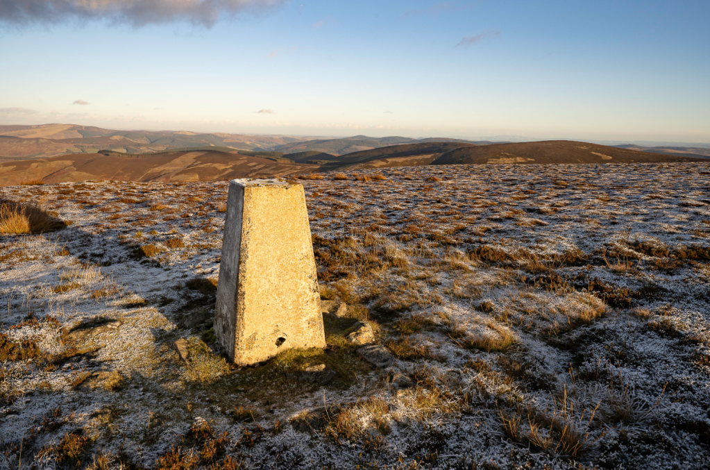
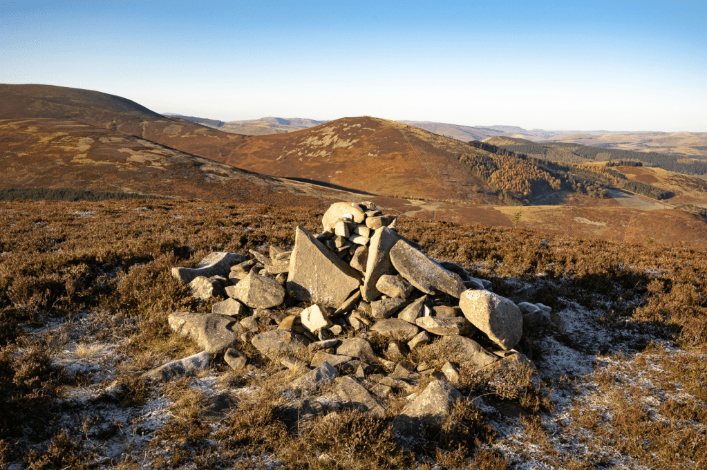
12_Trig point on Hundleshope Heights looking north east over the ascent route from Kailzie Hill to Birkscairn Hill. Credit: Stefan Durkacz
7. NT250339: A wooden arrow on a fencepost points ENE to a path down a broad slope. This becomes a Landrover track which descends Dead Side. Keep on the crest for 3.5km, ignoring a couple of tracks that branch to the R. Near the end of the spur, the track forks. Bear R down a steep switchback by a pheasant breeding enclosure to join the unmetalled road in Glen Sax.
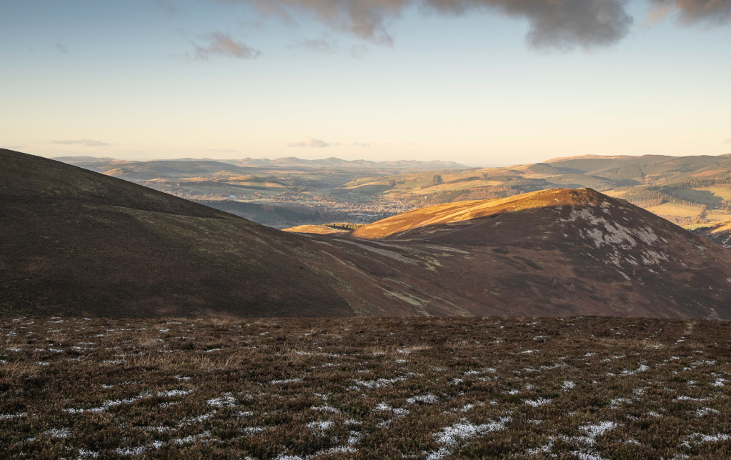
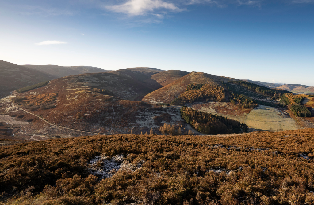
View north to Peebles and the distant Pentland Hills from Dead Side. Credit: Stefan Durkacz
8. NT272359: Turn L down Glen Sax. After 2.5km bear R onto a metalled road around a large house. In another 1.25km rejoin the outward route at the end of Glen Road. Turn L and retrace your steps into Peebles.
Further information
Public transport: Borders Buses service X62 operates frequently between Edinburgh bus station and Peebles (www.bordersbuses.co.uk)
Tourist information: www.visitscotland.com
Walk more routes in Scotland, as mapped by our experts.


