Water: that most essential, life-giving element with the capacity to permeate and carve its way through any given landscape. When combined with the rough edges of mountains, water and land create an irresistible spectacle – as any hillwalker who has scoured their map for promising spots or trails of blue will know. Here, our contributors have rounded up some of the finest water features in the UK – and the hikes that’ll take you there – in eight thrilling water walks. So, grab your waterproof jacket, reproof your boots and let’s go water hunting.
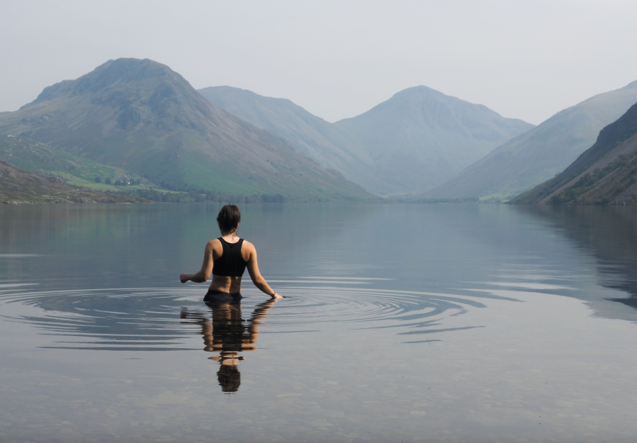
Main image: Taking a swim in an immaculately still Wastwater | Credit: Carey Davies
This feature originally appeared in the October 2023 issue of The Great Outdoors, in which we do some of the hard work for hydrophiles who seek sea to summit routes; waterfalls and long walks. Read more here.
8 of the best water walks in the UK
- Eas a’Chual Aluinn: Britain’s tallest waterfall
- Henryhd Falls and Fan Brycheiniog: Bannau Brechyniog beauty
- Braeriach via Loch Coire an Lochain: Scotland’s highest named loch
- Scafell Pike via Sprinkling Tarn and Styhead Gill: A Lake District waterworld
- High Force and Low Force: The jewels of the Pennines
- Ladhar Bheinn via Loch Hourn: A sea loch spectacular
- Yr Wyddfa (Snowdon) via the Miner’s and Watkin paths: The watery way to the roof of Wales
- The Wasdale Screes: Lakeland’s impression of Norway
1. Eas a’Chual Aluinn
Distance: 9km / 5.5 miles | Ascent: 540m / 1771ft | Start/finish: Carpark on the A894 (NC 240 292)
Eas A’chual aluinn is Britain’s tallest waterfall. Credit: Shutterstock
It is fitting that Britain’s highest waterfall is located in a remote spot in Assynt – unquestionably one of the finest landscapes in Scotland. Eas a’Chual Aluinn cascades for 200 metres, and when in spate it is an extraordinary thing to witness. The route may be only a few kilometres but it feels further than it is. A rough track passing several lochans takes you to the top of the falls. The best vantage point is a short distance to the south of where the river goes over the cliffs. Take great care here, as the terrain is serious, and crossing the river may be impossible after heavy rain.
Picked by: James Roddie
2. Henryhd Falls and Fan Brycheiniog
Distance: 30.5km / 19 miles | Ascent: 1,213m / 3,981ft | Start/finish: Henrhyd Fall car park (SN 853 121)
Waterfall country in Bannau Brycheiniog. Credit: Shutterstock
South Wales’ tallest waterfall – with a drop of 90 feet and a plunge pool which is particularly picturesque when frozen over (although not great for plunging into in that state!) – is one of the few in the UK you can walk behind. Considered a jewel in the crowd of ‘waterfall country’, Henryhd Falls is not on the well-trodden ‘four waterfalls’ walk – but is still popular, in part thanks to its starring role as the Batcave in The Dark Knight Rises. The Nant river valley boasts smaller falls nearby, sometimes frequented by jumping trout. You can easily explore the waterfalls by moseying from the adjacent car park, but if you’re looking for a challenging walk – and extra aquatic interest – to go with it, you can combine the falls with the Beacons Way ridge walk along Fan Hir to Fan Brycheiniog and Picws Du, and you’ll be treated to sweeping views over Llyn y Fan Fawr and Llyn y Fan Fach along the way.
Picked by: Francesca Donovan
3. Braeriach via Loch Coire an Lochain
Distance: 31km / 19 miles | Ascent: 1228m | Start/finish: Layby near Coylum Bridge road junction. (NH 915 107)
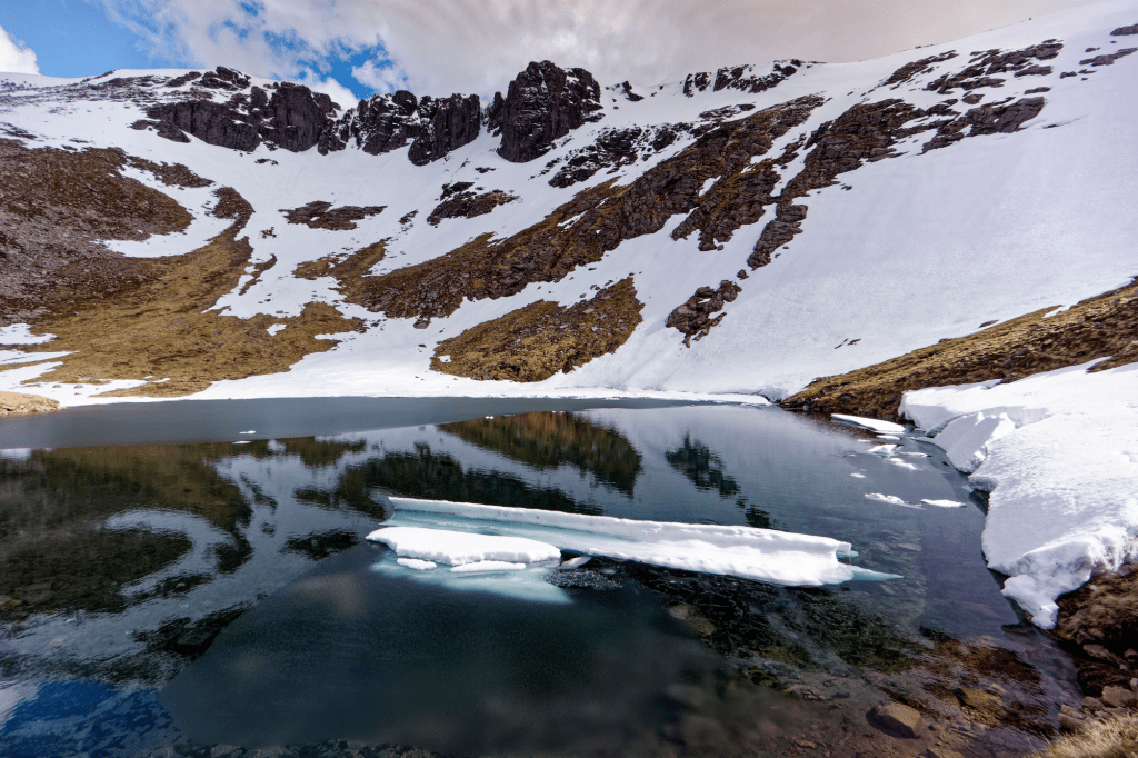
Coire an Lochain. Credit: Chris Townsend
At almost 1000m above sea level, Loch Coire an Lochain is the highest named loch in Scotland and Britain as a whole. This is a very remote spot, where snow and ice usually lingers well into early summer. An approach along the Am Beanaidh river in Gleann Eanaich, and a return over the summit of Braeriach and through the Lairig Ghru makes this a classic Cairngorms circuit, doable in a long day but also lending itself well to a wild camping two-dayer. There is a bit of everything here – ancient pine forests, tumbling rivers, a mountain loch, and the plunging corries of Britain’s third highest mountain. Loch Coire an Lochain is a superb location for a wild camp in good weather.
Picked by: James Roddie
4. Sprinkling Tarn via Styhead Gill
Distance: 14.5km / 9 miles | Ascent: 1,043m / 3421ft | Start/finish: Seathwaite Farm (NY 235 122)
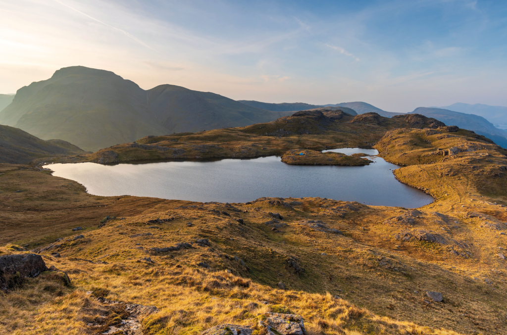
A perfect pitch at last light over Sprinkling Tarn. Credit: Shutterstock
For hydrophiles, this is almost certainly the best route to England’s highest mountain, passing as it does by two famously spectacular tarns and incorporating two gills with booming torrents and ample possibilities for a plunge. Start by heading up Styhead Gill, passing Taylorgill Force, and walking underneath the Gable giants to reach Styhead Tarn. Ascending Scafell Pike via the Corridor Route is worth it for the involving ascent and the views over Wastwater. Otherwise, it’s on to Sprinkling Tarn, which mirrors Great Gable in it waters to create an unforgettable mountain scene. The descent follows Ruddy and Grains Gill, whose roaring waters soundtrack your footsteps (look out for safe opportunities for dips in plunge pools on the way) until you cross Stockley Bridge, a picturesque packhorse bridge, still offering travellers a ticket to the rugged surrounding mountains despite its advanced age. This walk is hardly a ‘secret’ – you can expect it to be relatively busy – but it remains one of the finest in England.
Words: Francesca Donovan
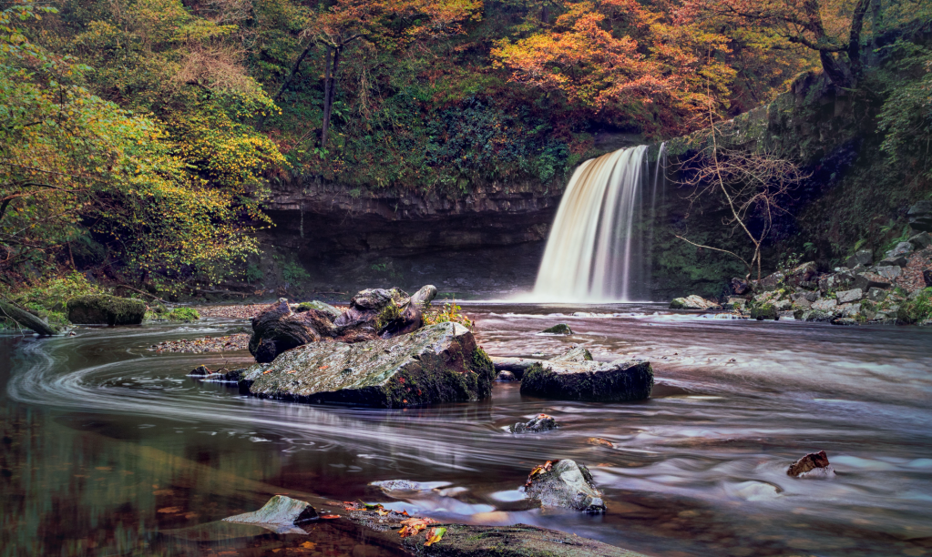
5. High Force and Low Force
Distance: 21.3km / 13.3 miles | Ascent: 565m / 1,853ft | Start/finish: Bridge over the River Tees at Middleton-in-Teesdale (NY947253)
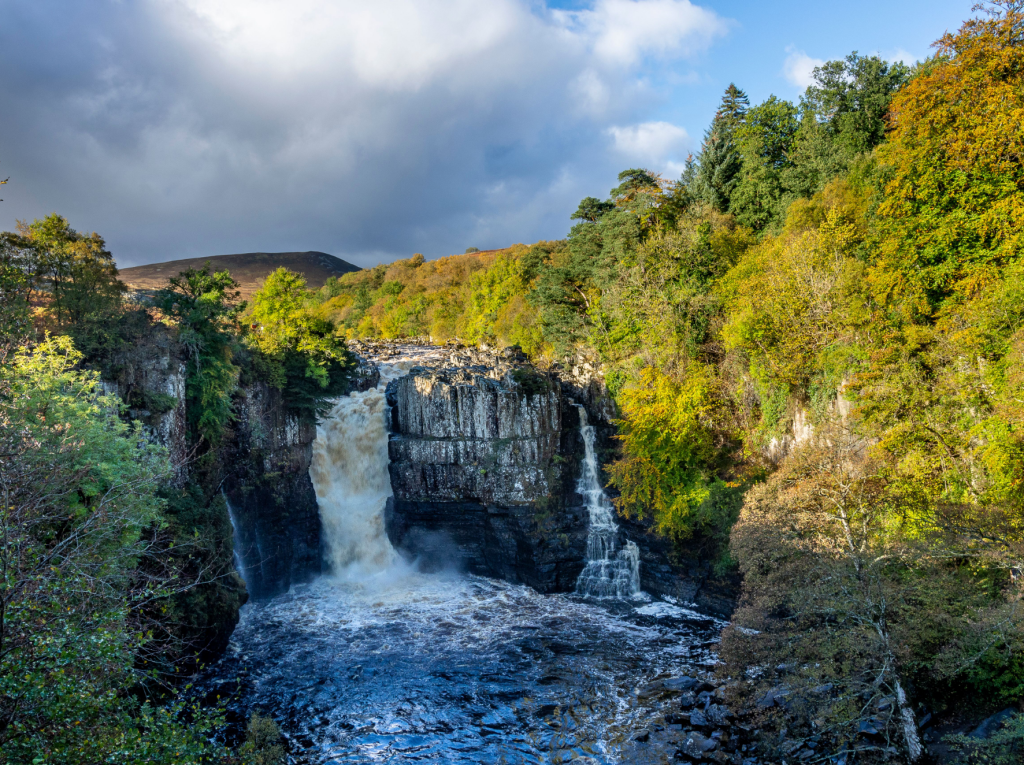
High Force on the River Tees. Credit: Ian Battersby
High Force and Low Force are unburied jewels that have been lying around, undisturbed, since the last glacial period along the River Tees, which cuts a sweeping path down a dale that has been shaped by glacial carving and meltwater scouring. The river would be another steady stream of rippling stones but for the volcanic intrusion of the Whin Sill, which cuts right across the dale, and creates these violent torrents. You can look over Low Force, as viewed from a superb suspension footbridge, and from here, you’ll hear the rumblings and tumblings of its big brother, High Force, nestled into juniper and birch woodland. Continue to the top of the falls which seethe over the resilient Whin Sill fault line and visit Holwick Scar on the way home.
Picked by: Ian Battersby
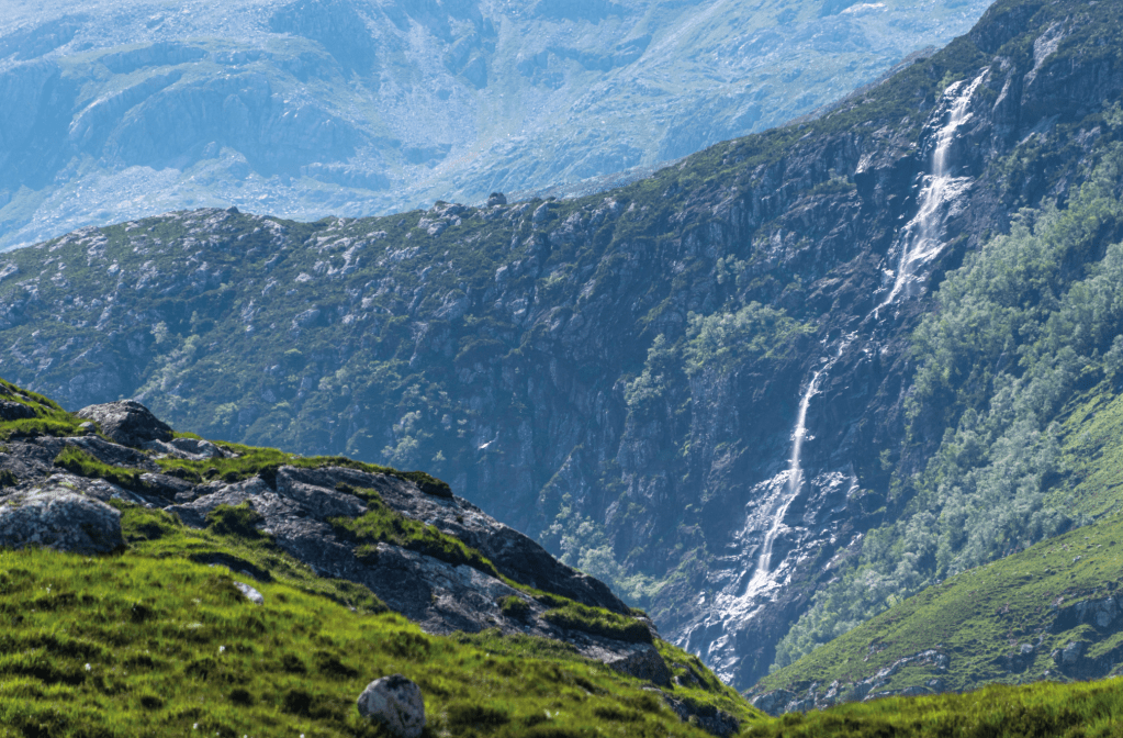
6. Ladhar Bheinn via Loch Hourn
Distance: 33.3km / 20.5 miles | Ascent: 2053m / 6735ft | Start/finish: Carpark at Kinloch Hourn (NG 950 066)
This two-day (or one very long day) route takes you to the top of one of the country’s most remote Munros with views of a spectacular sea loch. The sea lochs of the Western Highlands are renowned for their beauty, and Loch Hourn is one of the finest of them all. This is a place that feels akin to a Norwegian fjord – a remote loch flanked by steep, forested slopes, tucked between some of the most impressive hills in the area. The walk along the loch to Barrisdale Bay is a classic in itself, but by continuing over Ladhar Bheinn (one of the remotest Munros), you have a truly exceptional route. Only the extremely fit will complete this walk in a day. The campsite at Barrisdale is conveniently placed, or even better, you could wild camp on Ladhar Bheinn if the weather allows.
Picked by: James Roddie
7. Yr Wyddfa (Snowdon) via the Miner’s and Watkin paths
Distance: 14.5km / 9 miles | Ascent: 930m / 3,052ft | Start: Pen y Pass car park (SH 647 556) | Finish: Pont Bethania car park at Nant Gwynant (SH 628507)
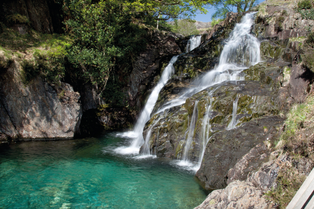
The Watkin Pools. Credit: Shutterstock
With six primary paths up to Wales’ highest peak, there are more ways up and down the massif than you can shake your poles at. This route rambles alongside the three llyns of the Miner’s track (Teyrn, Llydaw and Glasyn), reverting off course up the steep Bwlch Coch from where you have a vantage point over Llyn Glas (the most underrated on the massif featuring its own tiny island) before scrambling to the summit. For dippers, it’s well worth descending via the Watkin Path to reach the gleaming turquoise pools near Nantgwynant. Cross the stone bridge over cascading falls and claim your cooling reward at the end of this arduous mountain day. You can get back to Pen y Pass using the Sherpa’r Wyddfa (Snowdon Sherpa) bus service.
Words: Francesca Donovan
8. The Wasdale Screes

Taking a swim in an immaculately still Wastwater on a summer morning. Credit: Carey Davies
Distance: 18km / 11 miles | Ascent: 770m / 2520 feet | Start/Finish: Nether Wasdale (NY123040)
The Wasdale Screes are one of the most stark and spectacular features of the Lake District: a sheer, brutish wall of impregnable crags giving way to skirts of scree that plunge straight down Wastwater, giving a strong visual clue to that lake’s intimidating depth (the deepest in Lakeland, at 80 metres). Walking along the top of the screes, with views across to Yewbarrow and Kirk Fell, the Wasdale could almost be mistaken for the great trough of a Norwegian fjord. You can make this walk into a circuit by returning to Nether Wasdale along the base of the screes, but expect a famously demanding clamber over loose boulders, which has often been the site of accidents for the unprepared. If you don’t feel like taking it on, just return the way you came over the top of the screes.
If you’re looking for a waterfall walk with lower elevation but no less charming, why not follow along on one of these Peak District waterfall walks – plus, learn how to hunt your own hidden gems.