
Listed as one of the world’s top 10 best trails by National Geographic, the West Highland Way is an iconic long-distance walk. James Forrest guides you through almost 100 miles of classic Scottish scenery.
From the isle-dotted expanse of Loch Lomond to the towering peaks of Glen Coe, this iconic walk from Milngavie (near Glasgow) to Fort William is a wonderful introduction to the grandeur of the Scottish Highlands. More than 100,000 people walk the trail each year, but apparently only 36,000 reach the finish line – the others fall victim to blisters, midges, brutal Scottish weather and energy-sapping terrain. In other words, the West Highland Way is not for the faint-hearted.
Main image: James Forrest and the Lairig Gartain | Credit: James Roddie
But those who persevere are rewarded with superlative walking. Conic Hill serves up eye-watering panoramas across Loch Lomond, the hamlets of Crianlarich and Tyndrum look out over a towering backdrop of Munros, and the sprawling wilderness of Rannoch Moor has an eerie quality. But the real highlight is Glen Coe. The West Highland Way brings you up close and personal with this alluring valley.
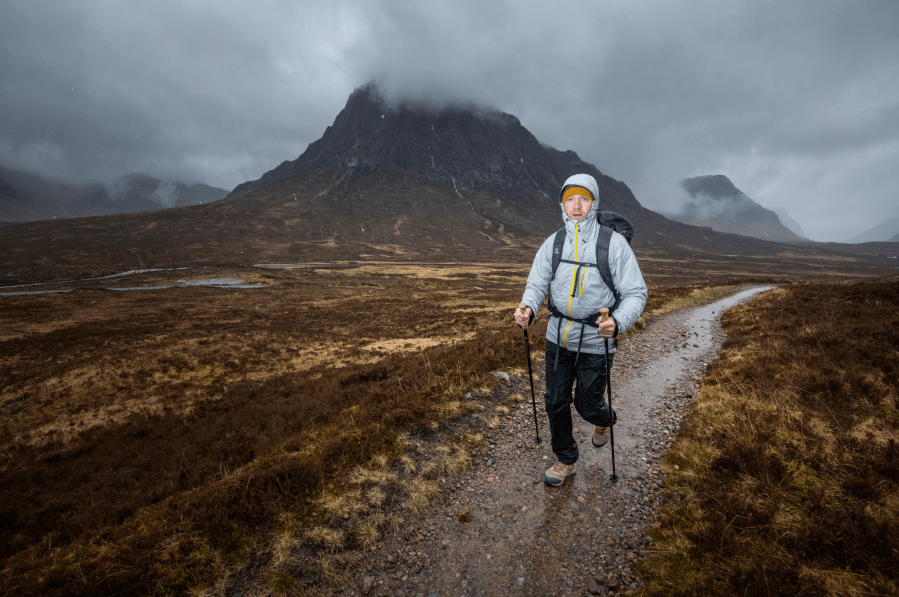
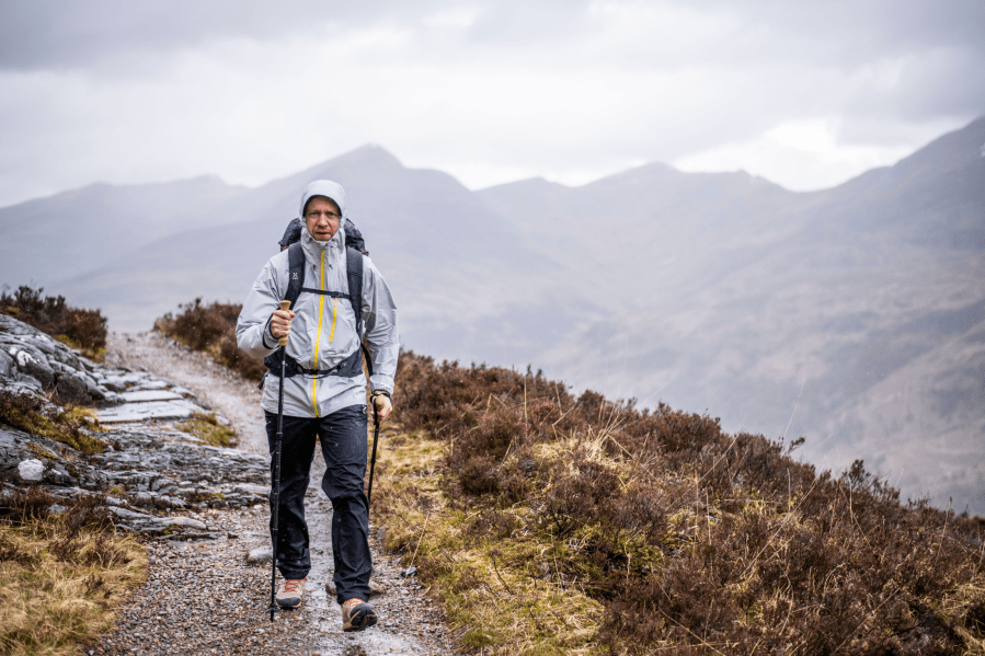
James Forrest heading towards the Kingshouse. Credit: James Roddie
From Kingshouse, you’ll climb the Devil’s Staircase towards Kinlochleven, a far-easier-than-it-sounds ascent, and feast on grandstand views of The Buachaille – a mountain fashioned from a gnarled, burly chaos of crag and cliff. It’s a truly mesmerising moment, a crescendo to this excellent walk, before the final push from Kinlochleven past the base of Ben Nevis into Fort William.
Here’s The Great Outdoors‘ guide to the West Highland Way, featuring helpful tips on the following:
- Route details
- When to go
- How to avoid midges
- Transport
- Accommodation
- Resupply
- Essential gear
- Further resources
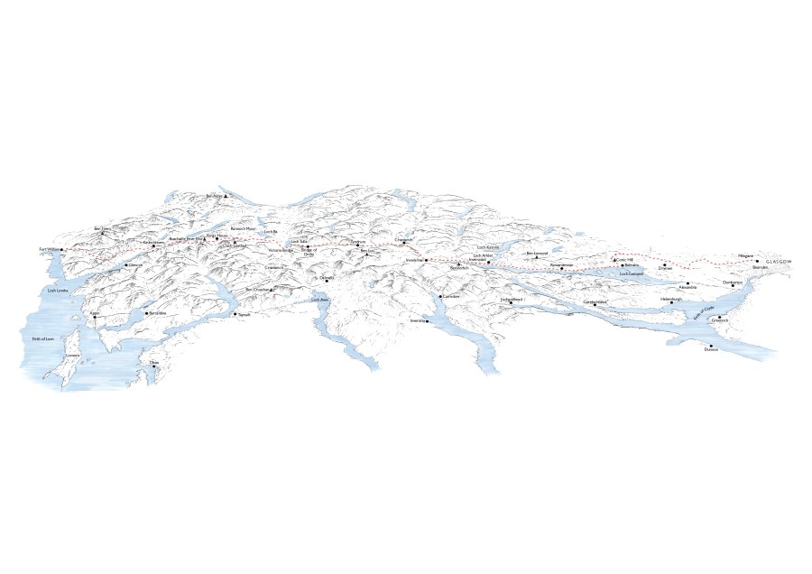
West Highland Way: at a glance
START: Milngavie | FINISH: Fort William | DISTANCE: 154km / 96 miles | ASCENT: 3,500m approx / 11,500ft approx | DURATION: Usually 5-8 days
The Route & Itinerary
Commonly walked south-to-north, the West Highland Way stretches 96 miles from Milngavie to Fort William, journeying through a medley of landscapes from boggy moorlands to towering rocky peaks. The character of the walk evolves every day, and that variety is alluring. It keeps things fresh and prevents monotony creeping in.
Hikers usually take between five and eight days to complete the trail, following set itineraries or devising their own bespoke schedules. An example seven-day itinerary is as follows: Milngavie to Drymen (12 miles), Drymen to Rowardennan (15 miles), Rowardennan to Inverarnan (14 miles), Inverarnan to Tyndrum (12 miles), Tyndrum to Inveroran (9 miles), Inveroran to Kinlochleven (19 miles) and Kinlochleven to Fort William (15 miles).
By walking south-to-north, the easiest days come at the beginning of the route – which can help your body acclimatise to the rigours of trail life. Day one from Milngavie to Drymen is a relatively flat walk through pastoral fields and rolling lowlands, a gentle warm-up. Day two is where the action really starts, featuring an ascent of delightful Conic Hill, a much-needed refuel in the hamlet of Balmaha, and your first miles along the eastern shores of Loch Lomond to Rowardennan.
Day three might just be the crux of the whole challenge – get through this and you should make it to the finish line. The path is a never-ending maze of slippery tree roots, wet rocks and undulating ups and downs, an energy-sapping route sticking to the loch’s shoreline almost all day. It feels remote and wild, and will test your mettle.
A night at Beinglas Campsite will rejuvenate your spirits for day four, as you emerge (finally) to the north of Loch Lomond and explore the great valleys of Glen Falloch and Strath Fillan. Flanked by majestic mountains, these valleys give you a real taste of what the Highlands are all about. North of Tyndrum, days five and six battle the boggy badlands of Rannoch Moor, and then comes the good stuff.
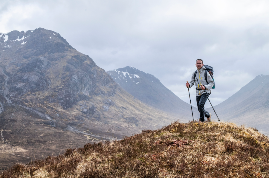
James Forrest at the top of Devil’s Staircase on the West Highland Way. Credit: James Roddie
Day seven is the Way’s pièce de résistance, passing through the ethereal Tolkien-esque landscape of Glen Coe via the wonderfully-named Devil’s Staircase, before the final triumphant leg, skirting around the Mamores to the base of Ben Nevis and beyond to the finish at the statue of a seated figure in Fort William.
When To Go
Billy Connolly once said “there are two seasons in Scotland: June and winter”. Other popular quips about Scotland’s infamously awful weather include: “I love the Scottish summer, it’s my favourite day of the year” and “I’m looking forward to the summer in Scotland, the rain gets warmer”. In other words, whatever dates you pick, there’s a good chance you’ll experience wet and wild conditions, and you should be prepared for rain, wind and even wintry blizzards at pretty much any time of year.
To evade snowy ground conditions and the coldest of temperatures, avoid the height of winter from November to March. The shoulder seasons of May and June or September and October are “most likely to offer the best and most settled weather”, according to Terry Marsh, author of Cicerone’s The West Highland Way guidebook.
Or you could opt for the warmest months of July and August. But the trail will be busy with trekkers at this time of year and – worse still – you might get eaten alive by the dreaded midges.
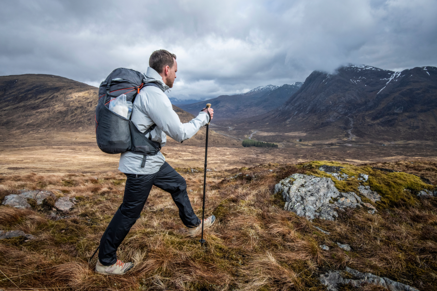
James Forrest and Mamores in background. Credit: James Roddie
How To Avoid Midges
Small but devastating, the bloodthirsty Scottish midge has the power to ruin your backpacking adventure – so how can you avoid them? Well, with difficulty is the answer. The midge season is usually from spring to early autumn (approximately May to September), so opting for an April or October hike is a good midge-avoidance strategy. Otherwise you’ll just have to stock up on repellents such as Smidge and Avon Skin So Soft, invest in a midge net head cover, and then pray for a light breeze to keep the wretched things at bay.
Transport
Unlike many other trails, this walk is very well-connected by public transport. Rail services from Glasgow Queen Street to Milngavie run twice an hour, with a journey time of about 25 minutes. Fort William also has a train station, with direct services to Glasgow Queen Street (journey time up to 4 hours), while regular CityLink coaches provide a 3-hour transfer to Glasgow’s Buchanan Street bus station.
Accommodation
From budget campsites and bunkhouses to boutique B&Bs and posh hotels, the West Highland Way is well-served with accommodation along its entire length. It’s advisable to book in advance – rooms often sell out quickly at peak times – and several guidebooks and websites publish extensive lists of accommodation en route to help with your planning.
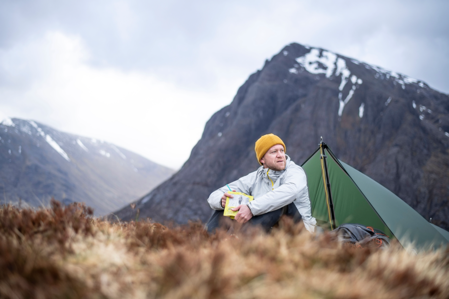
A WHW wild camp on Beinn a’Chrulaiste. Credit: James Roddie
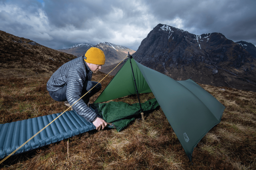
To save money, you can also wild camp along the West Highland Way. In Scotland wild camping is legal as long as you follow the Scottish Outdoor Access Code, which means leave no trace, don’t disturb people or animals, pitch out of sight of buildings and roads, only camp on open rather than enclosed land, and set up late in the day and move on early the next morning.
It’s important to note, however, that a byelaw bans camping in parts of Loch Lomond, including the south-eastern shoreline from Conic Hill to north of Rowardennan. Visit lochlomond-trossachs.org for full details. There are also two bothies along the West Highland Way too – Rowchoish and Doune Byre.
Food & Supplies
Most walkers will carry a good supply of food in their backpacks, and will have planned their re-supplies carefully to ensure they don’t run out. The West Highland Way spends a good amount of time away from services and facilities, and trekkers should ensure they are self-sufficient.
Enjoying Scotland’s Right to Roam laws on the West Highland Way. Credit: James Roddie
Having said that, cafes, pubs and small shops are available intermittently along the route, where you can pick up snacks, sandwiches, hot meals and camping supplies. Drymen, Tyndrum and Kinlochleven are good places to re-supply, particularly The Green Welly Stop.
The West Highland Way: Further resources
Cicerone’s The West Highland Way by Terry Marsh is an in-depth trail guidebook, including 1:25k Ordnance Survey mapping. Alternatively Harvey Maps produce a waterproof 1:40k map covering the entire route. The website westhiglandway.org is an excellent online resource too.
Discover more long distance trails as mapped by our expert contributors.


