
Bagging eight Wainwrights in a single walk, James Forrest takes on the iconic Coledale Round – one of the Lake District’s best horseshoe ridge hikes.
Journeying from peak-to-pub, this classic route combines one of the Lake District’s most iconic horseshoe ridge walks with one of its best pubs. The Coledale Round is a high-level, summit-bagging classic in the north-western fells, while the Coledale Inn (a former woollen mill built in 1824) is a traditional country pub with Georgian and Victorian heritage, an outdoorsy vibe and an enviable hillside perch above Braithwaite.
The pub is perfectly located for a post-hike pint, meal or coffee. But first is the small matter of completing the Coledale Round. Think of it as a tapas set menu, with tasty optional extras. The basic meal features six dishes – Outerside, Scar Crags, Sail, Crag Hill, Hopegill Head and Grisedale Pike – a gastronomic delight that will satisfy most palates. Hungrier participants won’t be able to resist ordering sides of Barrow and Causey Pike (the approach we’ve suggested here), while the greediest of all will somehow find room for Wandope, Grasmoor, Whiteless Pike and Whiteside.
The eight-dish serving starts with a wintry ascent of Grisedale Pike’s shapely eastern ridge, with panoramic views over Keswick, northern leviathan Skiddaw and ahead to the dark, brooding cliffs of Hobcarton Crag, plunging dramatically into a secret, craggy amphitheatre. And the delights keep coming. Hopegill Head has grandstand views of the Vale of Lorton; the lumpy-bumpy ridge from Scar Crags to Causey Pike’s knobbly summit is airy and delightful; and the grassy humps of Outerside and Barrow feel like two freebies for your Wainwright box-ticking. It’s a superb day out and, despite fierce competition from Mosedale, Kentmere, Deepdale and Newlands, some argue Coledale is the best horseshoe ridge walk in all of Lakeland.
The Coledale Round: route description
START/FINISH: The small car park off the B5292 Whinlatter Pass (GR: NY227237) | MAPS: OS Explorer OL4 (1:25k), OS Landranger 89 (1:50k), Harvey British Mountain Map Lake District (1:40k) | DISTANCE: 17km / 10.6 miles | ASCENT: 1,420m / 4,659ft | DURATION: 7 hours
1. NY227237: From the small car park, take the wooden steps heading north-west, marked ‘Public Footpath Grisedale Pike’ at a fingerpost sign. Climb on the good, clear path before looping sharply south over bracken-covered slopes. Go through a gate and continue on a grassy path that climbs west and then south-west to Kinn. Continue south-west on a wide grassy track, remembering to turn around to feast on the excellent views over Keswick and the Skiddaw Massif.
Views of Skiddaw from ascent of Grisedale Pike. Credit: James Forrest
Veer west as the ascent steepens, passing the Lanty Well spring to gain the Sleet How ridge. The final push south-west and west for the top is along a rocky, narrowing arête, but there are no technical difficulties. Pass old metal fence posts and arrive at Grisedale Pike’s summit.
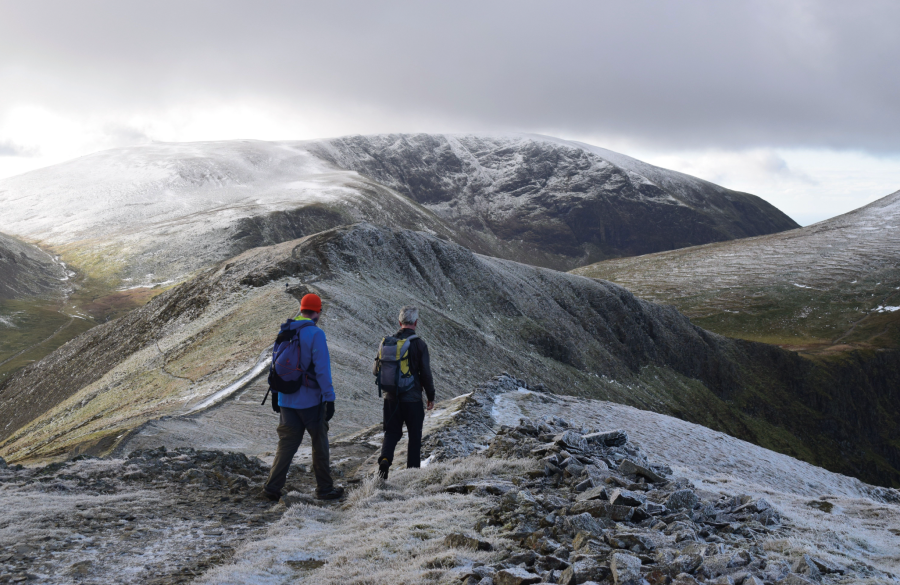
2. Ascending the eastern ridge of Grisedale Pike. Credit: James Forrest
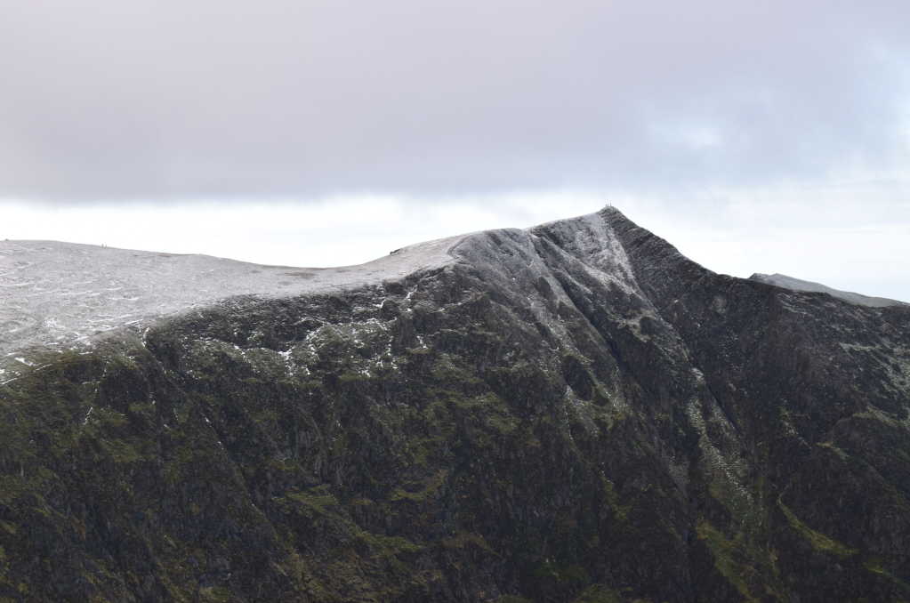
2. NY198225: Descend south-west following an old, derelict dry stone wall. The path briefly bends left and right before arriving at a col. Climb over rocky terrain – including a short section of easy scrambling – to reach the 739m top of Hobcarton Crag. Descend briefly west and, at a cairn, fork right to follow a wall to a col.
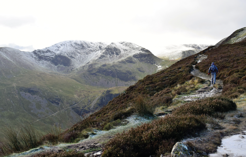
Views of Hobcarton Crag from Grisedale Pike. Credit: James Forrest
Climb the path ahead, sticking close to but safely away from the edge of the crags to the north, to reach Hopegill Head’s 770m summit.Retrace your steps down south-east briefly, fork right, descend to a mini col, and ascend easily ahead to the summit of Sand Hill. Descend south over loose, stony terrain to Coledale Hause. Directly ahead the ascent is blocked by crags, so fork right and ascend south along a stream. At a four-way junction, turn left and steadily climb north-east to Crag Hill’s trig pillar.
Fellow hikers on the wintry summit of Hopegill Head. Credit: James Forrest
3. NY192203: Veer right and descend east along The Scar ridge – including some easy scrambling – to a col. Climb easily ahead to the summit of Sail, which is located slightly to the left off the main path. Descend north-east and east on the winding, zig-zagging switchbacks of a machine-built path to reach another col. Climb north-east to the cairned summit of Scar Crags.
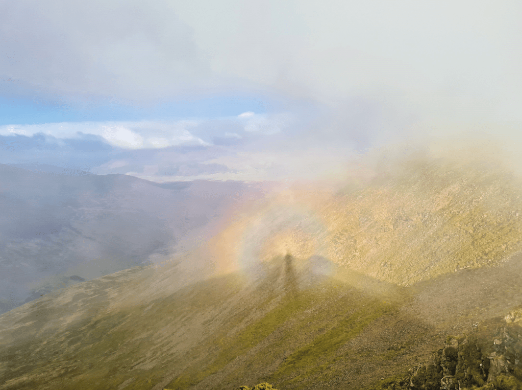
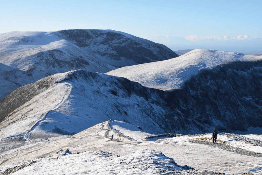
Witnessing a Brocken Spectre from The Scar ridge. Credit: James Forrest
Descend the ridge east-north-east to a col and ascend easily over undulating, lumpy-bumpy terrain to Causey Pike’s dramatic summit. Re-trace your steps back to the col and fork right on a shortcut path curving west and then north to High Moss. Climb ahead to the summit of Outerside. Descend north-east to Low Moss, skirt south-east around Stile End on narrow trods to Barrow Door, and ascend gently east and north-east to gain the summit of Barrow, the final Wainwright of the day.
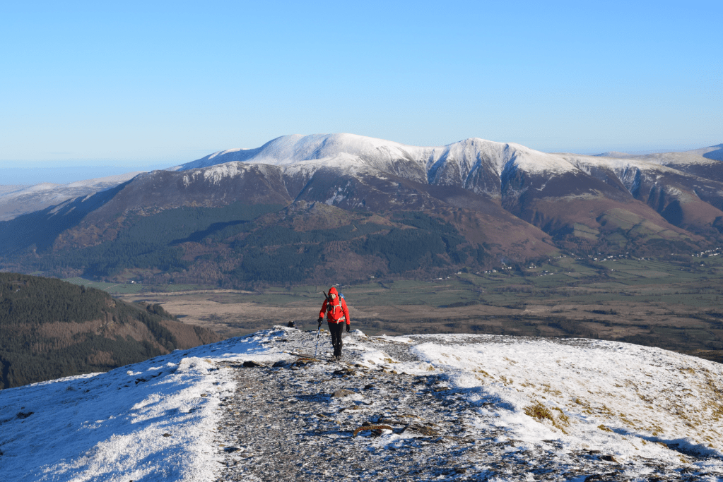
Grisedale Pike’s eastern ridge. Credit: James Forrest
4. NY227218: Descend Barrow’s north ridge on a good, well-trodden path. Ignore a turn-off to the left bearing towards Barrow Gill and instead continue north-north-east to Braithwaite Lodge. Pass through the gated farmyard and through a field to arrive at the road. Turn left and head north-north-west through the village. Cross the bridge over Coledale Beck and pass the Royal Oak pub to arrive at the B5292 Whinlatter Pass. Turn left on the narrow road, taking care of traffic, and ascend the road west and then north. As the road steepens, arrive back at the small car park at the foot of Grisedale Pike’s eastern ridge to complete the Coledale Round.
Further information
PUBLIC TRANSPORT: Take Stagecoach’s Keswick-Workington X5 bus and alight at Braithwaite.
TOURIST INFORMATION: www.visitlakedistrict.com
Discover more walks in the Lake District as mapped by our expert contributors.


