
Alex Roddie heads to the Fannichs in search of an exploratory route with a varied feel – and finds some intricate off-path navigation.
The Fannichs are situated on the edge of juggernaut Scottish mountain areas such as Torridon, Fisherfield, and Assynt, and as such they can sometimes end up feeling a bit overlooked. If you’re heading to the Northwest Highlands and are looking for a truly memorable mountain day, why wouldn’t you keep going to Beinn Eighe, An Teallach, or Suilven? Plenty of walkers on their way up the A835 to Ullapool might just keep going straight past the Fannichs.
These mountains may not be as obvious and brash as the heavy hitters, but they have a great deal to offer – and are likely to be quieter too. With sweeping ridges and a blend of easy ground and rugged off-path walking with an exploratory feel, the Fannichs are more varied than you might expect. There are nine Munros in the range, spread out over a complex series of ridges and corries in two distinct massifs. This circuit explores the central portion of the eastern massif, taking in Sgurr Mor and Beinn Liath Mhor Fannaich for some exceptional views – as well as a visit to a wild and beautiful corrie.
The Central Fannichs: route description
START/FINISH: NH228767, car park alongside A835, SE of Braemore Junction | MAPS: OS 1:25,000 Explorer sheet 436 (Beinn Dearg & Loch Fannich), OS 1:50,000 Landranger sheet 20 (Beinn Dearg & Loch Broom), Harvey 1:25,000 Superwalker (Fannichs: Seana Bhraigh & Ben Wyvis) | DISTANCE: 18.1km / 11.3 miles | ASCENT: 1,055m / 3,461ft | DURATION: 7 to 8 hours
1. NH228767: Starting from a parking area alongside the main road, head SE along the road for 1.1km. Look for a building S of the road at a fork in the river. A path is marked descending from the road, crossing the first stream via a footbridge, and passing the building. Although the path is vague, and the first footbridge no longer exists, the building (a stone structure with rusty roof) is a useful landmark.
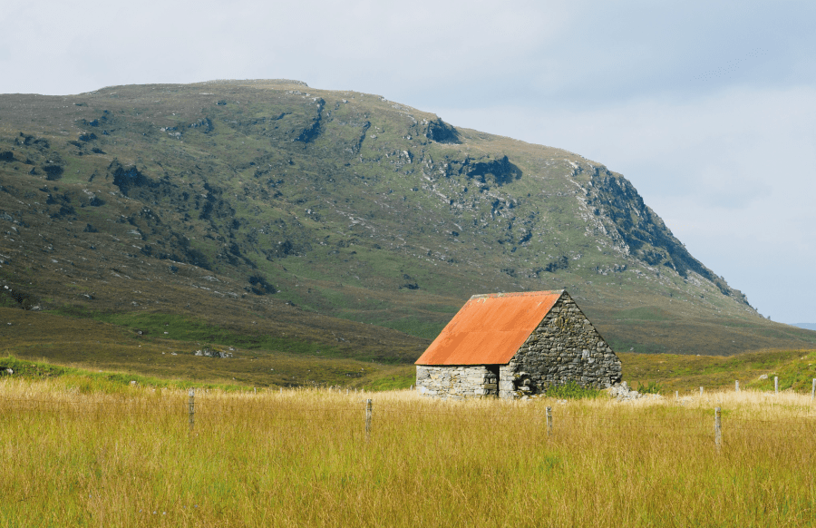
The rust-roofed building on the approach. Credit: Alex Roddie
2. NH236759: Drop to the river and cross it. This could be hazardous in spate but is easy in normal conditions. Pass the building about 70m to the W and veer SE on a vague and boggy path towards the second branch of the river; a footbridge is marked on the map and still present. Beyond, a path heads S on the right bank of the Allt a’ Mhadaidh, and soon becomes obvious as it climbs gently.
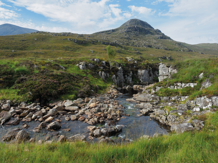
Looking across the Allt a’Mhadaidh. Credit: Alex Roddie
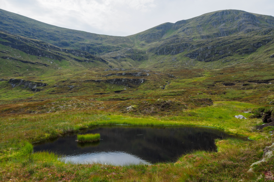
3. NH230748: After veering SW, the path joins a Land Rover track that climbs from a weir at the river. Don’t go down to the river, but note its location as this is the point to aim for on the descent. Continue following the path on the right-hand side of the river. Where it forks about 100m after a small ruin, take the right fork that heads slightly uphill and away from the river; after another 1km it descends to the river again and crosses it before climbing through heather. The path becomes increasingly vague but stays parallel to the river and about 100m away from it.
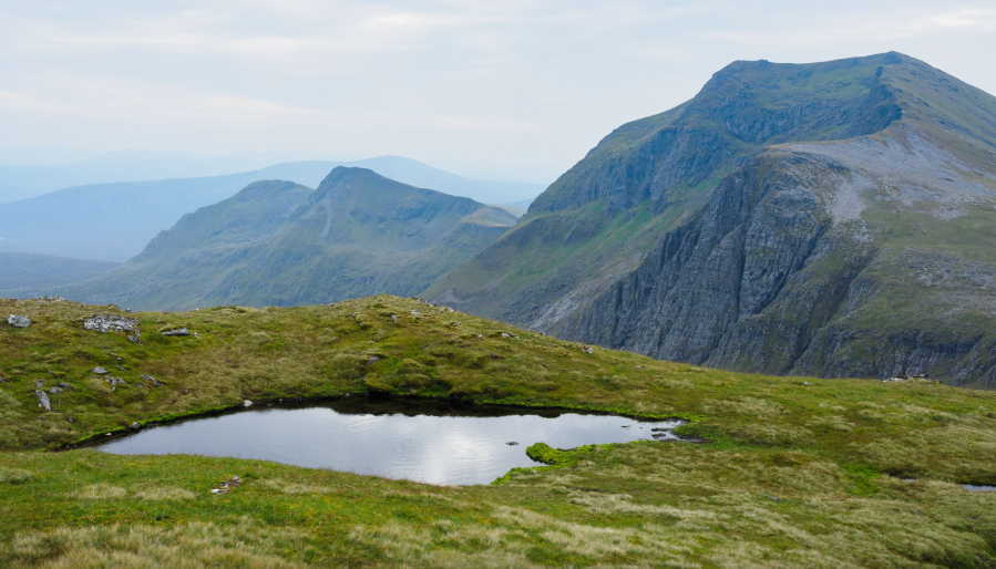
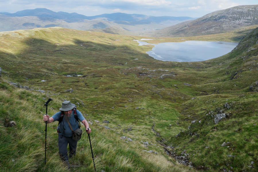
At Loch a’ Mhadaidh, looking for the easiest route into the corrie. Credit: Alex Roddie
4. NH209739: Descend to the river and cross it where safe. The route now continues to follow it until reaching Loch a’ Mhadaidh. Upon reaching the loch’s outflow (a beautiful spot), circle W around its N side – boggy terrain and no path – and begin a gradually rising traverse into the corrie.
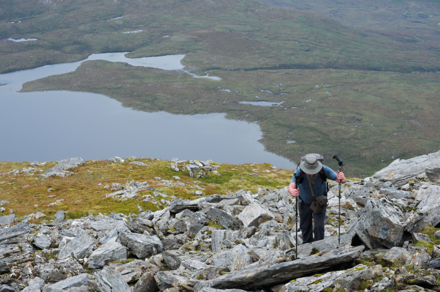
On the steep climb out of the corrie. Credit: Alex Roddie
5. NH189731: In mist navigation will be difficult here. Aim for a gap between two bands of crag midway up the slope. This is extremely steep and rough, but traces of a path can be found in places. Above this obstacle steep grassy slopes lead to the bealach at 819m.
The ascent to Sgurr Mor. Credit: Alex Roddie
6. NH188728: Climb SE and then E to the 961m summit of Carn na Criche – a gentle climb on mostly grassy slopes – and reach the top after just over 1km. Views S into Coire Mor and to Sgurr nan Clach Geala are magnificent. Ahead lies the shapely summit of Sgurr Mor. Continue along the ridge, descending increasingly rocky ground SE towards a bealach, and then climb the steep and rugged NW ridge of Sgurr Mor.
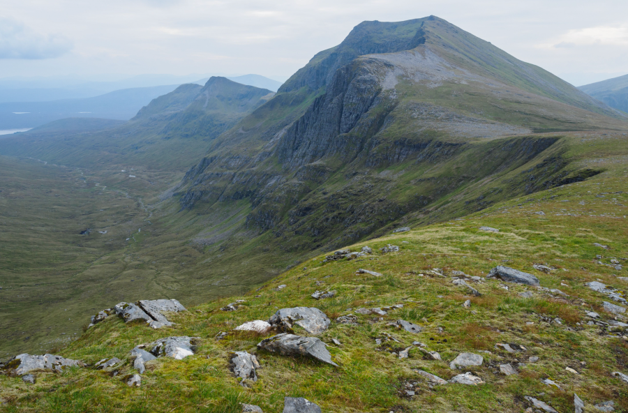
The view south to Sgurr nan Clach Geala. Credit: Alex Roddie
7. NH203718: Reach the summit of Sgurr Mor (1,108m) about 1km after Carn na Criche, then descend the E ridge by heading first S and then veering E; after about 500m you will pick up a well-made path. Ahead is the rounded hump of Beinn Liath Mhor Fannaich. Detour briefly from the path to reach its 954m summit.
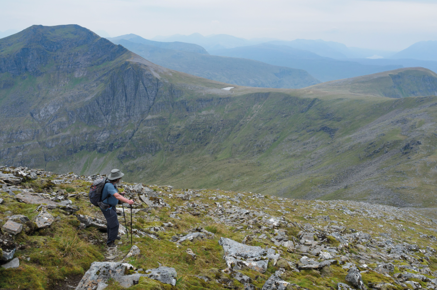
On the descent from Sgurr Mor. Credit: Alex Roddie
8. NH220724: Descend N from Beinn Liath Mhor Fannaich, aiming for the crest of a vague ridge in about 500m, then turn NE to reach a cairn marked on 1:25,000 OS maps (NH225732). From here, descend N through rocky and steep terrain, taking care not to drift too far E at first. After about 600m sections of a vague path can be followed and the terrain begins to level out. Veer NE, aiming for the weir at NH230747.
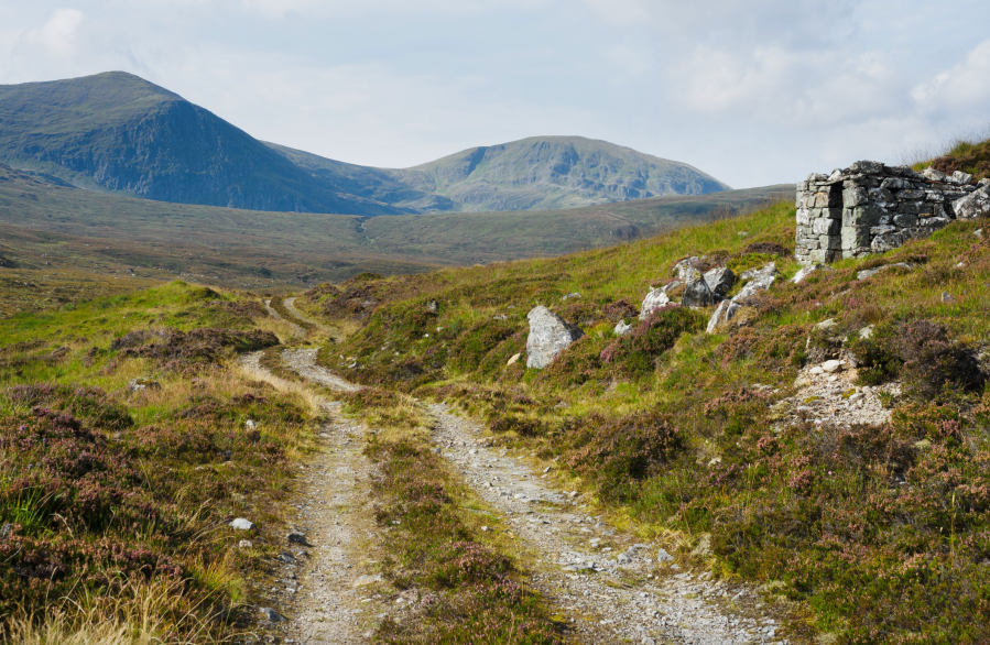
The track alongside the Allt a’ Mhadaidh on the approach. Credit: Alex Roddie
9. NH230747: Cross the river at the bridge below the weir, then return to the start via the same route used on the approach.
Further information
PUBLIC TRANSPORT: The 961 bus runs twice a day from Inverness to Ullapool; the nearest official stop is at Braemore Junction, about 2km northwest of the start
TOURIST INFORMATION: Ullapool tourist information, 01854 612486
Discover more walks in Scotland as mapped by our expert contributors.


