
This coast-to-coast crossing of Wales via its mountainous spine proved surprisingly controversial in its early days – but has since become an established, though challenging, long-distance classic. Will Renwick walks us through the Cambrian Way.
The Cambrian Way was originally conceived by Tony Drake in 1971. Having played a large role in establishing the Offa’s Dyke Path and Cotswold Way, he turned his attention to creating what he dubbed the ‘mountain connoisseur’s walk’, a route that would take in Wales’ mountainous spine in one south to north journey from coast to coast.
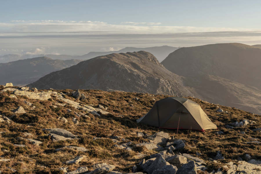
Main image: Wild camping in the Rhinogydd | Credit: Shutterstock
Unfortunately, Drake’s idea didn’t quite get off the ground in the way he’d wanted. The British Mountaineering Council’s North Wales committee was concerned about the proposed section through the tricky terrain of the Rhinogydd and subsequent resistance from the National Farmers Union, and even Snowdonia national park, ultimately led to funding for the trail’s creation being put on hold. Tired of the slow progress, Drake decided to simply launch the route himself, unofficially. He even created his own guidebook which would go on to be reprinted beyond his passing in 2012 at the age of 89.
The Cambrian Way has come a long way in recent years thanks to the continued efforts of the Cambrian Way Trust and also the Ramblers Cambrian Way Working Group. The route is now shown on Ordnance Survey maps, extensive waymarking has been carried out and the first official guidebook was published by Cicerone Press in 2019.
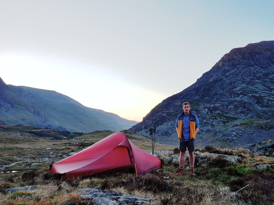
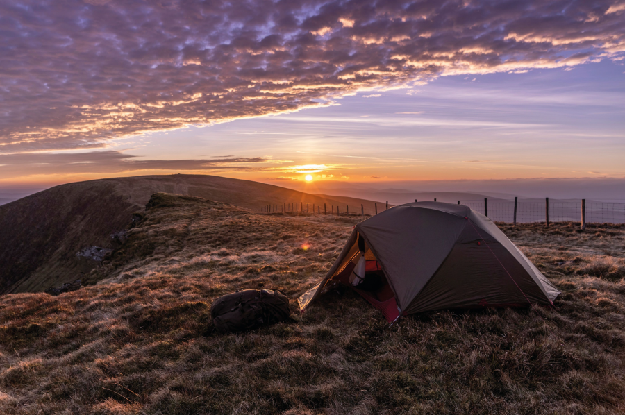
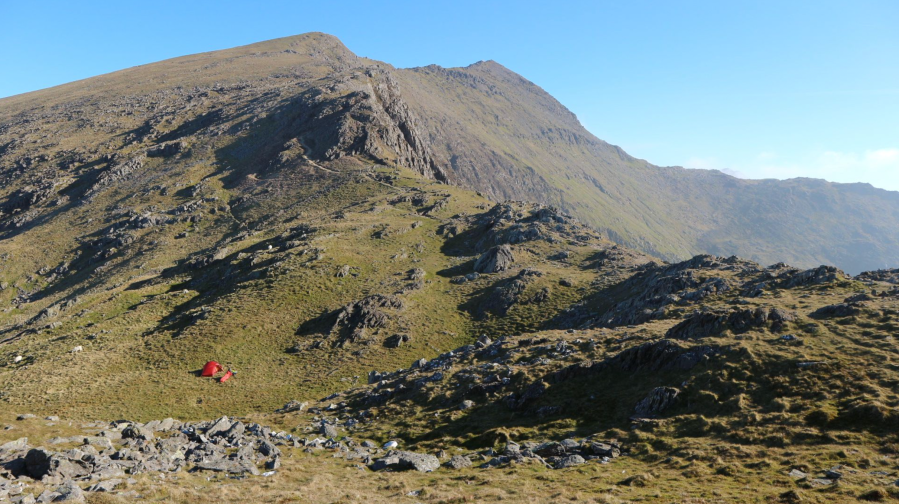
Will at camp in the Glyderau, ending day two on the Cambrian Way. Credit: Will Renwick
I walked the route in 2017, choosing to go from north to south as I liked the idea of walking back to my home just outside of Cardiff, and I was completely enamoured by the journey. I can’t think of a better way to become immersed in wild Wales and to get to witness parts that so few people get to see. Since my walk, I’ve become somewhat devoted to the trail and in 2018 I joined the Cambrian Way Trust to help to protect the legacy he created and left for all of us to enjoy.
Here’s The Great Outdoors‘ guide to the Cambrian Way, featuring helpful tips on the following:
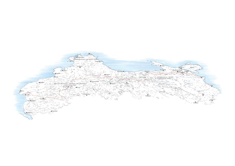
The Cambrian Way: at a glance
START: Cardiff | FINISH: Conwy | DISTANCE: 479km / 298 miles | ASCENT: 22,460m / 73,700ft | DURATION: 15 to 20 days
The route
While the Cambrian Way can be tackled in whichever direction one so chooses, Tony Drake’s recommended direction was south-north. That way, walkers could build themselves gradually towards the big mountains of Eryri, Snowdonia, with Wales’ highest mountain then forming the final hurdle, or cherry on the cake, before the final approach to Conwy.
That direction also means the sun and the prevailing wind will, by and large, be on your back.
While the route might start right in the heart of Wales’ capital city at Cardiff Castle, the first day of walking is surprisingly green. There’s little to no road or street walking, with the trail following parkland and woodland that flanks the River Taff until you’re eventually out of the city and on the edge of the South Wales Valleys.
The Cambrian Way then follows an upland course all the way to the edge of the Black Mountains where the Bannau Brycheiniog (Brecon Beacons) stretch begins.
Roughly a week will be spent curling around the broad ridges of the Black Mountains, climbing Pen y Fan and then moving over to the park’s western boundary where the towering escarpment of the Carmarthen Fans lies. This can be climbed to or you can skirt around its base if you fancy a less demanding approach to Llandovery.
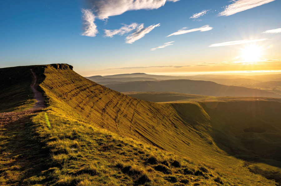
Golden hour on Pen y Fan. Credit: Shutterstock
Perhaps my favourite stretch of the Cambrian Way comes next. That’s the steep-sided Doethie valley, where verdant landscapes gradually give way, taking you up into the high moorlands of the Elenydd. The altitude gets no higher than 752 metres (Pen Pumlumon Fawr) along this roughly week-long stretch but many regard it as the hardest part of the Cambrian Way. It’s boggy country and the path often fades away leaving you with no choice but to navigate through a minefield of tussocks.
In 2019, the Ramblers allocated some of the legacy funds that Tony Drake entrusted them with to install waymarks along the Cambrian Way and while this was all completed successfully, don’t expect national trail levels of signposting. This particular stretch through Mid Wales is particularly light on signage with certain sections requiring self-navigation, particularly through the moorland that surrounds the Teifi Pools.
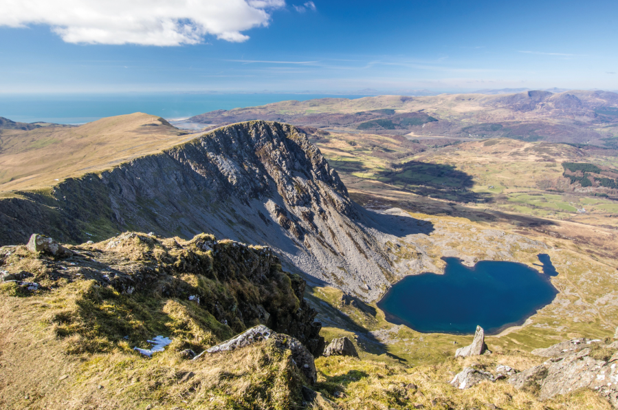
The view from Cadair Idris (Penygader or Cader Idris) down to Llyn y Gader. Credit: Shutterstock
Slightly more manicured hill country follows in the approach to Cadair Idris. The 893-metre spectacularly craggy mountain is then traversed in full before a brief visit to sea level at Barmouth.
You’ll want to make sure you’re well replenished and stocked up here because the next stage through the boulder-filled mountains of the Rhinogydd is demanding and remote. It should take around two days before you’re out the other side at Llyn Trawsfynydd.
The Cambrian Way then journeys into the thick of Eryri where the mountains might now be higher but the paths are at least well-trodden and easier to follow. The Moelwynion and the shapely top of Cnicht come next with an opportunity to restock in the village of Beddgelert, then it’s up to the summit of Yr Wyddfa, taking a crowd-dodging route via Bwlch Main.
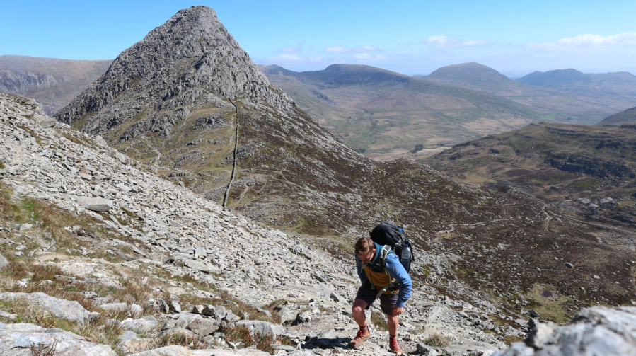
Tryfan and the Ogwen Valley, climbing to the Glyderau. Credit: Will Renwick
The North Wales coastline should come into full view here, depending on the weather, but there’s still a lot of walking to come – two days-worth for many – including the bouldery tops of the Glyderau, a sharp descent to the Ogwen Valley and a sharp ascent up to the Carneddau in reply.
The final stretch then bobs along the long row of 3000-footers before Tal y Fan, the final mountain, and the beginning of your triumphant descent down to the sea.
Accommodation
Drake’s route always seeks the higher ground and that means accommodation options aren’t in the same kind of supply that you’d find along other popular trails like the West Highland Way or Pennine Way. For this reason, many of those who hike the Cambrian Way, myself included, will choose to camp, be that in campsites or on a good enough patch of grass along the trail.
Wild camping is a must on the Cambrian Way. Credit: Shutterstock
It wouldn’t be absolutely impossible to walk the whole route and enjoy the comfort of a bed every night, but it would take some very detailed planning, some diversions and perhaps some very long days, particularly when it comes to getting through the Elenydd and Rhinogydd.
There are a few bothies along the way and one or two not far from the trail – including the non MBA-affiliated one at Claerddu, near the Teifi Pools. Ty’n-y-cornel, one of the two basic hostels which are set in fantastically wild locations in the Elenydd, is certainly worth a visit, even if it’s just for a chat over a cup of tea and a Welsh cake with the volunteer warden.
Food and supplies
Cardiff, Pontypool, Abergavenny, Crickhowell, Llandovery, Barmouth and Conwy form the main towns along the route. Between them hikers must rely on village shops and pubs. On my own Cambrian Way walk, there wasn’t a stage where I needed to carry more than three days’ worth of supplies.
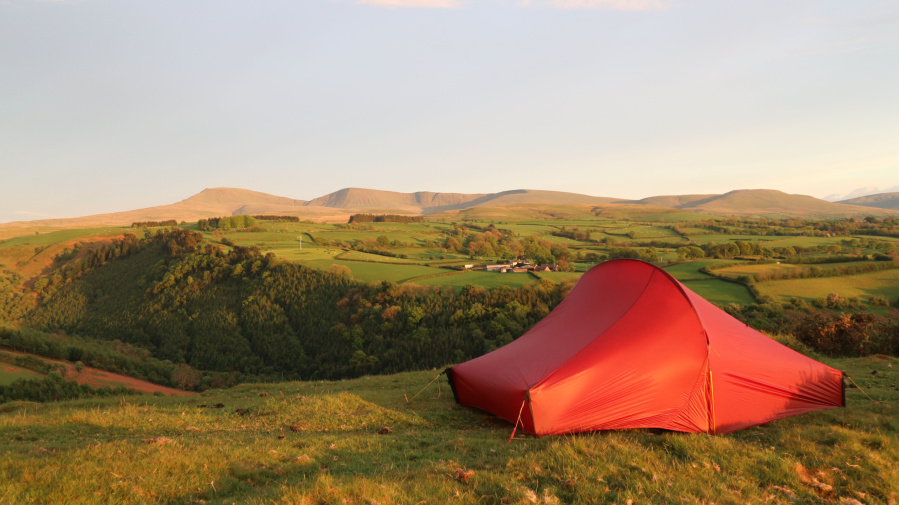
Pitched near Llandovery on the edge of the Brecon Beacons. Credit: Will Renwick
Llandovery to Pontarfynach, also known as Devil’s Bridge, is perhaps the most barren stretch, but a slight detour off the trail to the small shop at Pontrhydfendigaid can solve any supply headaches here.
Essential gear
With the intensity of sheep farming in the uplands of Wales, you can’t quite be sure that any natural water sources along the trail are going to be clean and, as such, a good water filter will be a very handy thing to have with you. Gaiters would also be an asset, especially through the tufted grasses in those pathless stretches in Mid Wales.
For expert advice on everything from hiking boots and waterproof jackets to tents and sleeping bags, check out The Great Outdoors‘ reviews, buying guides and recommended products.
Will’s tent and sleeping bag drying out in the morning sun under Bwlch Main. Credit: Will Renwick
The Cambrian Way: Further resources
The official Cambrian Way website, which is run by the Cambrian Way Trust, has an excellent list of accommodation providers along the route as well as free GPX downloads for each stretch.
As for a complete guide to the trail, Tony Drake’s book is no longer in production but his knowledge and wisdom has been carried into Cicerone’s guidebook which was written by George Tod and Richard Tyler, two of the Cambrian Way Trust’s long-standing members. Then there’s the Facebook Group, Walking the Cambrian Way, which is always busy with useful information and insights from those who have walked or are walking the trail.
Discover more long distance trails as mapped by our expert contributors.


