
Roger Butler discovers hills and history at Roystone Rocks and Minninglow in the pastoral White Peak.
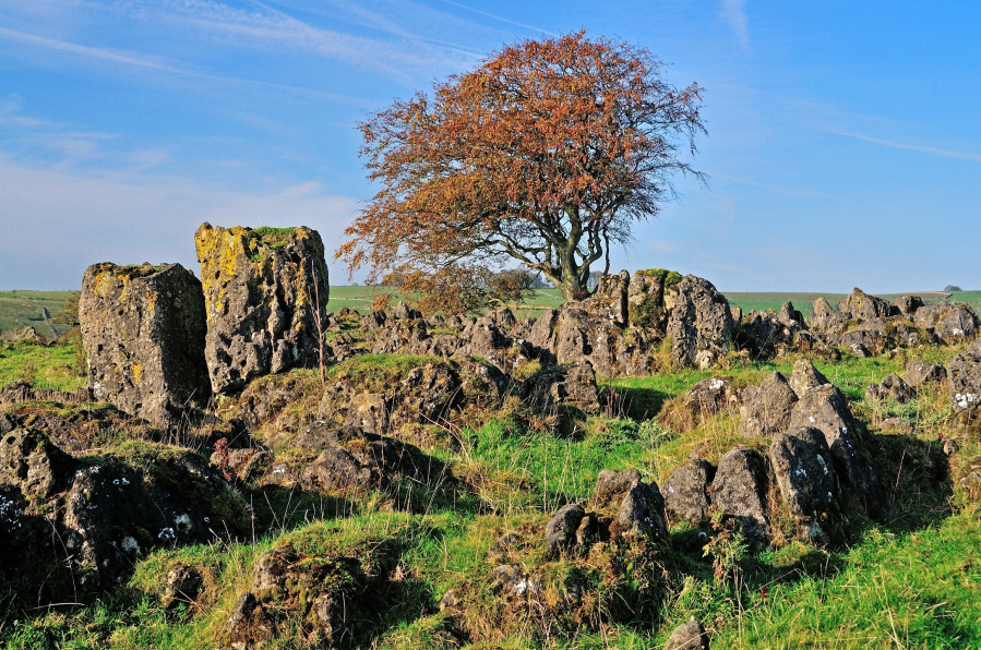
Our hills and dales never fail to surprise and the unexpected stone-splattered top known as Roystone Rocks is unlike anywhere else in the White Peak. This is the sort of place where you are allowed to use your imagination: it’s a ruined village; it’s a mini-Utah; it’s the cover of a famous Pink Floyd LP; it’s a jumble of boulders that must have been melted and moulded by a malevolent wizard. Chequerboard walls and crumpled shallow valleys stretch in every direction but, from the low ragged summit, the real eye-catcher is the distant clump of trees on top of Minninglow Hill.
This resembles a crown topped with half a dozen jewels – the result of new planting which encloses tall over-mature beech trees – and it marks the location of important tombs which date back to 4,000BC. Take the path to the top and you’ll soon be asking yourself questions. Who was buried here? Was there a grand ceremonial march up the hillside? And did those Neolithic peoples appreciate the distant views and ever-changing horizons? You certainly will!
Roystone Rocks and Minninglow, White Peak: route description
Start/Finish: Lay-by parking on A515, 1km south of Newhaven, grid ref SK165592 | Map: OS Explorer OL24 (1:25k); OS Landranger 119 (1:50k) | Distance: 13.5km / 8½ miles | Ascent: 280m / 920 feet | Duration: 5 hours
1. SK165592: From the parking lay-by next to the A515, south of Newhaven and close to Ivy House, take the broad track leading south-east (named Cardlemere Lane) with fine views across classic White Peak country. Walk ahead over a crossroads of tracks after 1.5km, go through a gate with a plantation on R and keep straight ahead at next junction. Pass a cottage on R (The Nook), go straight over the lane and walk east for 600m along narrow Minninglow Lane.

View looking east along Cardlemere Lane to the distinctive clump of trees on Minninglow Hill. Credit: Roger Butler
2. SK197576: Turn R onto a track, go through gate by Roystone Cottages and after 250m take the small gate on R (signed Open Access), with hillside rising ahead. Climb south-west (no path) to the rough plateau at the top of Roystone Rocks and explore the outcrops and jumbles of boulders. The dark-coloured rocks are the result of an unusual dolomitic outcrop and, though not much more than a metre high, they rise above the tussocky grassland like a series of punky haircuts. Strangely shaped trees wriggle through cracks and crevices and one even manages to run its trunk along the ground in the style of a stealthy boa constrictor. Then descend east to a gate by a barn.
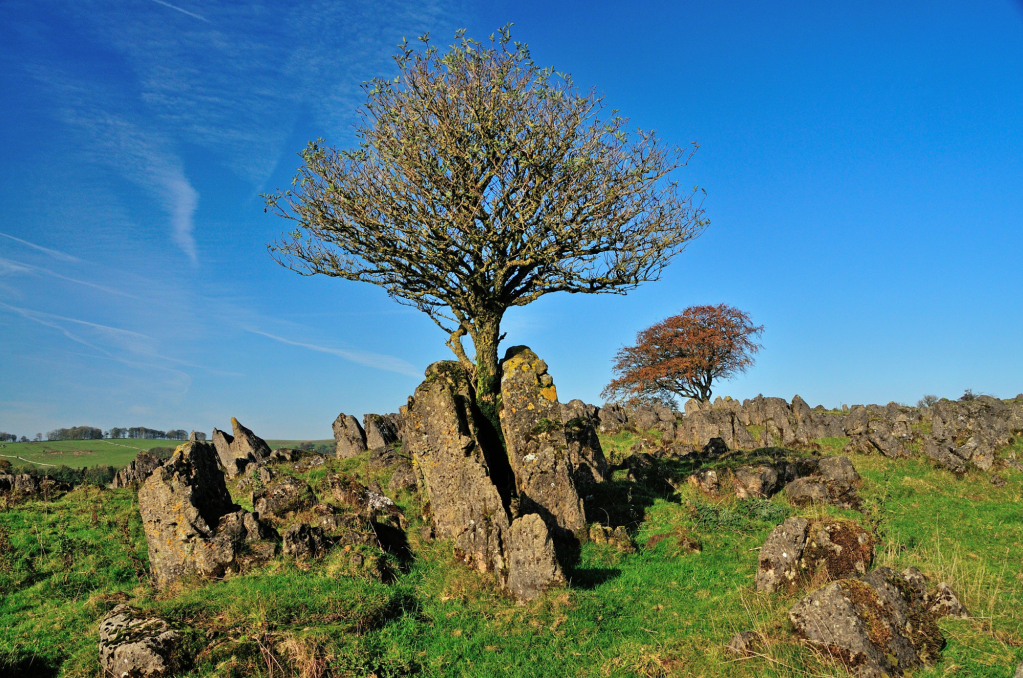
Trees sprout from the cracks and crevices in the bizarre landscape on Roystone Rocks. Credit: Roger Butler
3. SK200569: Turn R on the track through the farm at Roystone Grange. Relics of Romano-British agriculture have been discovered here and archaeological work has uncovered rudimentary sheep pens, old field systems and the footings of a Cistercian manor house. Little further on, there’s industrial heritage too: a stark building which looks like an old chapel once contained an engine which pumped air up to embryonic pneumatic drills in local quarries. Continue down the dale and take a grass track rising on L – turn sharp L at top to follow a wall down to fingerpost.
Panorama looking north-west on the descent from Minninglow Hill – the great railway embankment now carries the popular High Peak Trail. Credit: Roger Butler
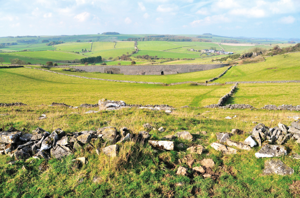
4. SK203566: Cross a step stile, turn R and walk uphill through the tunnel below the High Peak Trail. Until the mid-1960s, this was the route of the Cromford and High Peak Railway which was built to carry minerals and goods across the Peak District. Cross a step stile onto the track, go over to a gate and follow the permissive path towards Minninglow Hill. Go through a gate to access the circular tree-lined enclosure – leave on the north side side and descend another permissive path back to the old railway.
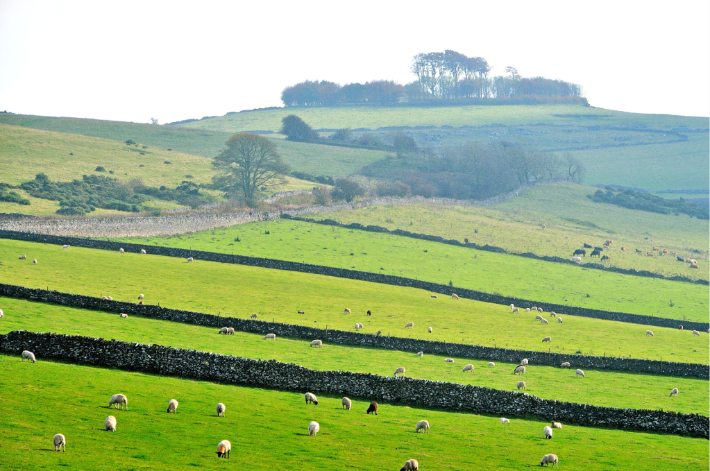
Minninglow Hill seen from the High Peak Trail – the circular clump of trees encloses Neolithic burial chambers. Credit: Roger Butler
5. SK205575: Turn R and now simply follow the trail for 3.5km. You’ll initially cross a colossal stone-built embankment and, 1km further on, the great 80° bend at Gotham was the tightest curve on any British rail line.
6. SK181592: Turn L on track/footpath opposite Upperhouse Farm signed to Biggin. Cross stile on R after 150m and walk uphill to a step stile at wall. Continue on right of way, via more stiles and with clump of trees at Aleck Low on R, to return to the A515, close to the start.
Further information
Public transport: Nearest station Buxton, with no 442 bus to nearby Biggin – see highpeakbuses.com for timetables
Tourist Information: Ashbourne Visitor Information Centre, 01335 343666
Nearest YHA: Youlgreave
Discover more walks in the Peak District as mapped by our expert contributors.


