
Daniel Neilson delves into the past on the South Downs
ABOVE STEYNING on the South Downs is Chanctonbury Ring, a small copse on the ridge between Steyning and Washington. It offers vast views over the Weald and back south over the English Channel, and can be seen from so far away that flaming beacons were sited on Chanctonbury Ring to warn of the oncoming Spanish Armada. But there are also other ways in which this is more than just your average clump of woods. The remains of an Iron Age hill fort have been found here, as they have all along this stretch of the South Downs Way. And Neolithic finds include a polished flint axe and an arrowhead.
Today, there’s a circle of trees. Legend has it (legend always does) that the Devil can be called by running around it seven times. And those interested in paranormal activities frequently spend a night sprinting around the trees and scaring themselves stupid. But when Lucifer does grace us with his presence, apparently he offers a bowl of soup. Not something you’d expect from the Prince of Darkness. Rather disappointingly, the Devil had no hand in the trees’ presence (well, what do I know?). The ring was instead created by the eccentric landowner Charles Goring, who carried each sapling, one by one, to the spot in the 1760s. He even saw some grow to maturity; writing in his adage:
Oh! Could I live to see thy top
In all its beauty dress’d
That time’s arrived; I’ve had my wish,
and lived to eighty-five.
I’ll thank my God who gave such grace,
as long as e’er I live.
Good old Goring may have been no poet, but he left a charming place to visit, and when most of the trees blew down in the Great Storm of 1987, one of his descendants replanted the area.
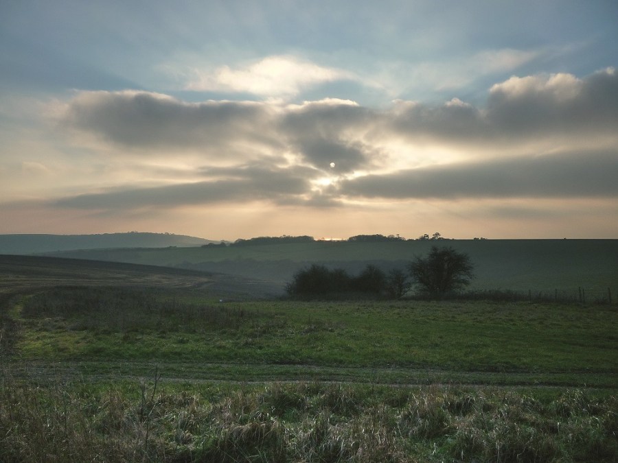
I saved the best view until last and set off from Steyning, an impossibly charming Sussex village – all antique shops, expensive cafés and ancient pubs (The Chequer Inn has stood on this spot since 1440) with a friend. We climbed straight up to the ridge of the Downs and joined the Monarch’s Way – a 990km long-distance path that purportedly follows the route of the fleeing Charles II after the Battle of Worcester. After briefly going through No Man’s Land (a couple of trees and some stern cattle) we walked down towards Findon, before climbing back north to Chanctonbury Hill. It was a stunning winter day, cloudless and crisp. Farmers were busy farming, and birds of prey busy preying. At Chanctonbury Ring we saw no evidence of the devil, but I did consider returning at night for that bowl of soup.
ROUTE DESCRIPTION
- From the High Street walk SW down Sheep Pen Lane, then on to Newham Lane, taking a R fork up a gravel track onto a bridleway SW. At a seat and T-junction, bear L to meet Monarch’s Way.
- Walk W and then SW to area marked as No Man’s Land. Turn off Monarch’s Way S along track to meet another track. Turn R and head W towards Findon. At the first building on R, turn N taking the middle bridleway.
- Cross a lane and then turn R at bridleway and onto a track NW towards Pest House. Follow marked bridleway NW to another track.
- Turn NNE along the ridge towards Chanctonbury Ring, joining the South Downs Way (SDW) at the top.
- From Chanctonbury Ring, follow South Downs Way E back to the junction with the Monarch’s Way and return back in to Steyning the way you came.

Daniel Neilson delves into the past on the South Downs
ABOVE STEYNING on the South Downs is Chanctonbury Ring, a small copse on the ridge between Steyning and Washington. It offers vast views over the Weald and back south over the English Channel, and can be seen from so far away that flaming beacons were sited on Chanctonbury Ring to warn of the oncoming Spanish Armada. But there are also other ways in which this is more than just your average clump of woods. The remains of an Iron Age hill fort have been found here, as they have all along this stretch of the South Downs Way. And Neolithic finds include a polished flint axe and an arrowhead.
Today, there’s a circle of trees. Legend has it (legend always does) that the Devil can be called by running around it seven times. And those interested in paranormal activities frequently spend a night sprinting around the trees and scaring themselves stupid. But when Lucifer does grace us with his presence, apparently he offers a bowl of soup. Not something you’d expect from the Prince of Darkness. Rather disappointingly, the Devil had no hand in the trees’ presence (well, what do I know?). The ring was instead created by the eccentric landowner Charles Goring, who carried each sapling, one by one, to the spot in the 1760s. He even saw some grow to maturity; writing in his adage:
Oh! Could I live to see thy top
In all its beauty dress’d
That time’s arrived; I’ve had my wish,
and lived to eighty-five.
I’ll thank my God who gave such grace,
as long as e’er I live.
Good old Goring may have been no poet, but he left a charming place to visit, and when most of the trees blew down in the Great Storm of 1987, one of his descendants replanted the area.
I saved the best view until last and set off from Steyning, an impossibly charming Sussex village – all antique shops, expensive cafés and ancient pubs (The Chequer Inn has stood on this spot since 1440) with a friend. We climbed straight up to the ridge of the Downs and joined the Monarch’s Way – a 990km long-distance path that purportedly follows the route of the fleeing Charles II after the Battle of Worcester. After briefly going through No Man’s Land (a couple of trees and some stern cattle) we walked down towards Findon, before climbing back north to Chanctonbury Hill. It was a stunning winter day, cloudless and crisp. Farmers were busy farming, and birds of prey busy preying. At Chanctonbury Ring we saw no evidence of the devil, but I did consider returning at night for that bowl of soup.
ROUTE DESCRIPTION
- From the High Street walk SW down Sheep Pen Lane, then on to Newham Lane, taking a R fork up a gravel track onto a bridleway SW. At a seat and T-junction, bear L to meet Monarch’s Way.
- Walk W and then SW to area marked as No Man’s Land. Turn off Monarch’s Way S along track to meet another track. Turn R and head W towards Findon. At the first building on R, turn N taking the middle bridleway.
- Cross a lane and then turn R at bridleway and onto a track NW towards Pest House. Follow marked bridleway NW to another track.
- Turn NNE along the ridge towards Chanctonbury Ring, joining the South Downs Way (SDW) at the top.
- From Chanctonbury Ring, follow South Downs Way E back to the junction with the Monarch’s Way and return back in to Steyning the way you came.


