
Roger Butler takes a long loop over snowy summits, including part of Glyndŵr’s Way
I HAD ONLY left Llanbister a quarter of an hour earlier but my hands were already numb. The sing-song skylarks didn’t seem to mind the cold, but I swiftly dropped into a sheltered dell to benefit from some warming sunshine. Three dozen sheep followed, no doubt hoping for a bag of new feed, and gathered around me like puppies waiting for a special treat.
A couple of pied wagtails gingerly dipped their toes into a trickle of water by the gate leading on to the open hillside. A notice explained that the byway over Moelfre Hill had recently been closed to traffic and, given the ugly off-roading ruts, this was definitely one more victory for common sense. A hare, looking just as cold and tired as the sheep, hopped slowly away as I reached the deeper snow on Tynybryniau Hill where the drifts had been swirled in the style of an enormous lemon meringue pie.
A sign pointed the way down to a farm called Sign, beyond which my track became a narrow lane. Tractors had sliced through the snow, leaving layers of green turf, dark mud and orangey brown dust that together resembled small-scale geological sections. I took lunch beneath a clump of larch trees and enjoyed surprising a van driver who was carefully negotiating his way uphill. At the next farm I heard this was the first vehicle to come this way for more than a week!
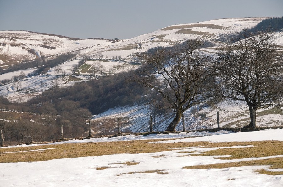
A hazy peak, glistening like Kilimanjaro or Kangchenjunga, caught my eye to the south and for at least an hour I assumed this must be part of the Plynlimon range until I suddenly realised I was looking at the distant Brecon Beacons. Nearer to hand, the fields in the valley looked like giant zebra crossings as patches of snow followed the hedge lines from one enclosure to another.
I felt I’d arrived in the tropics when I reached the River Ithon down at Llanbadarn Fynydd, where the sun felt hot and any snow suddenly seemed a million miles away. Glyndwr’s Way continued due west and a flurry of jeeps brushed past me on their way to rescue more sheep from the higher tops. Castle Bank was surprisingly free of snow but gave a sweeping panorama over the twisting hills leading back to Llanbister.
The wind whipped up the sap from a row of spruce trees on Yr Allt and I welcomed their sweet aroma after being blown about on top of Moel Dod. An isolated cottage then marked the snowbound track down to Tynypant, from where a fine little ridge bumped up to an airy trig point with views towards Llandrindod Wells and a sea of unknown summits. So many hills, so little time…
The sun had long disappeared over the horizon as I descended into the narrow valley below Ysgwd-ffordd. A very old Ford Cortina, now half-buried under a willow tree, had been left to slowly disintegrate in the stream. Quite how it got there is anyone’s guess, since even caterpillar tracks would have struggled to manoeuvre across the boggy hillside. May you rust in peace.
ROUTE DESCRIPTION
- From Llanbister walk E by church on path leading uphill to common land. Join lane after 900m, walk E for 900m then turn N across open common to cross next lane and descend to minor T junction.
- Take next track on L, go through gate on to open access land. Walk NNE over tops then drop NE to reach fence and low pass.
- Follow fence NW to meet farm track. Track turns to lane and descend along this for approx 2.5km into Llanbadarn Fynydd. Cross A483 and walk S to church, then turn R on lane.
- Walk uphill and take track on R (signed Glyndŵr’s Way). Go W for 2km towards prominent plantation then climb to Castle Bank. Descend SE to col, continue S onto Moel Dod then follow ridge S to Yr Allt.
- Go through gate by cottage, walk E downhill to Tynpant Farm. Go S on narrow lane, after 300m turn R by trees and walk S onto Ysgŵd-ffordd.
- Walk across tops then descend E into valley, take choice of paths leading to lane and continue to reach A483. Turn L for 400m, take lane on R to return to Llanbister.

Roger Butler takes a long loop over snowy summits, including part of Glyndŵr’s Way
I HAD ONLY left Llanbister a quarter of an hour earlier but my hands were already numb. The sing-song skylarks didn’t seem to mind the cold, but I swiftly dropped into a sheltered dell to benefit from some warming sunshine. Three dozen sheep followed, no doubt hoping for a bag of new feed, and gathered around me like puppies waiting for a special treat.
A couple of pied wagtails gingerly dipped their toes into a trickle of water by the gate leading on to the open hillside. A notice explained that the byway over Moelfre Hill had recently been closed to traffic and, given the ugly off-roading ruts, this was definitely one more victory for common sense. A hare, looking just as cold and tired as the sheep, hopped slowly away as I reached the deeper snow on Tynybryniau Hill where the drifts had been swirled in the style of an enormous lemon meringue pie.
A sign pointed the way down to a farm called Sign, beyond which my track became a narrow lane. Tractors had sliced through the snow, leaving layers of green turf, dark mud and orangey brown dust that together resembled small-scale geological sections. I took lunch beneath a clump of larch trees and enjoyed surprising a van driver who was carefully negotiating his way uphill. At the next farm I heard this was the first vehicle to come this way for more than a week!
A hazy peak, glistening like Kilimanjaro or Kangchenjunga, caught my eye to the south and for at least an hour I assumed this must be part of the Plynlimon range until I suddenly realised I was looking at the distant Brecon Beacons. Nearer to hand, the fields in the valley looked like giant zebra crossings as patches of snow followed the hedge lines from one enclosure to another.
I felt I’d arrived in the tropics when I reached the River Ithon down at Llanbadarn Fynydd, where the sun felt hot and any snow suddenly seemed a million miles away. Glyndwr’s Way continued due west and a flurry of jeeps brushed past me on their way to rescue more sheep from the higher tops. Castle Bank was surprisingly free of snow but gave a sweeping panorama over the twisting hills leading back to Llanbister.
The wind whipped up the sap from a row of spruce trees on Yr Allt and I welcomed their sweet aroma after being blown about on top of Moel Dod. An isolated cottage then marked the snowbound track down to Tynypant, from where a fine little ridge bumped up to an airy trig point with views towards Llandrindod Wells and a sea of unknown summits. So many hills, so little time…
The sun had long disappeared over the horizon as I descended into the narrow valley below Ysgwd-ffordd. A very old Ford Cortina, now half-buried under a willow tree, had been left to slowly disintegrate in the stream. Quite how it got there is anyone’s guess, since even caterpillar tracks would have struggled to manoeuvre across the boggy hillside. May you rust in peace.
ROUTE DESCRIPTION
- From Llanbister walk E by church on path leading uphill to common land. Join lane after 900m, walk E for 900m then turn N across open common to cross next lane and descend to minor T junction.
- Take next track on L, go through gate on to open access land. Walk NNE over tops then drop NE to reach fence and low pass.
- Follow fence NW to meet farm track. Track turns to lane and descend along this for approx 2.5km into Llanbadarn Fynydd. Cross A483 and walk S to church, then turn R on lane.
- Walk uphill and take track on R (signed Glyndŵr’s Way). Go W for 2km towards prominent plantation then climb to Castle Bank. Descend SE to col, continue S onto Moel Dod then follow ridge S to Yr Allt.
- Go through gate by cottage, walk E downhill to Tynpant Farm. Go S on narrow lane, after 300m turn R by trees and walk S onto Ysgŵd-ffordd.
- Walk across tops then descend E into valley, take choice of paths leading to lane and continue to reach A483. Turn L for 400m, take lane on R to return to Llanbister.


