

Paul Richardson finds a circular walk taking in a section of the Cleveland Way and Coast to Coast trail
Round Hill is the highest point on the North York Moors. It doesn’t boast craggy rock faces to strike fear into the nervous scrambler; in fact you’d be hard pressed to fall off it (you might manage a sluggish tipple-over-tails down it). Instead, its 454m allows it to maintain a modest loftiness over the surrounding fells, and is a surprising 134m higher than the outwardly more majestic Roseberry Topping.
As I left the car park at Chop Gate with my two walking buddies, we showed our age by comparing injuries. Les had an injured ankle from falling off his push bike, Simon had an injured shoulder from falling off a ladder and I was recovering from a damaged ankle caused by showing young people how to dance at a wedding (yes – I’d had a couple). Today’s hillwalking adventure was already less ‘The Three Musketeers’ and more ‘Last of the Summer Wine’. Ah well, you can’t escape the aging process.
By the time we were climbing Black Intake, we had gained enough height to get a great view over Bilsdale to the ridge of the Cleveland Hills beyond, making distant memories of our aches and pains. After Nab End Moor we were soon dropping into Tripsdale and crossing the delightful Tripsdale Beck before making the ascent onto Todd Intake Moor.
For me, this is a fantastic area of open heather moorland. This ribbon of comparatively high ground forms a peaty plateau between the valleys of Bilsdale and Bransdale, and walking across Black Hill towards Crook Staff Hill creates a tremendous feeling of isolation that belies its location so close to civilisation. We still had the fells to ourselves as we ambled steadily downhill into Badger Gill and the rock outcrop that would provide comfortable and perfectly timed seating for our lunch break.
Suitably refuelled and refreshed, we continued towards Cockayne Head. Although the heather covering much of the visible terrain had lost its late summer colour, it had lost none of its charm, and we headed northwards with a spring in our step.
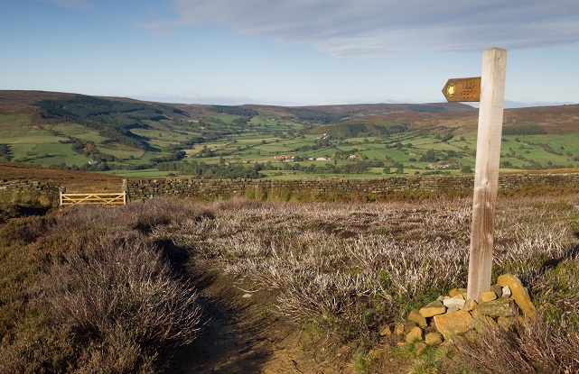
As soon as we joined the Cleveland Way track, we began to meet other walkers; something of a new experience for us so far today. This section is also part of the Coast to Coast route, and we chatted with a backpacker who was on the latter stages of the long distance path. He was no younger than us and he’d wild-camped the whole route, alone, in what had been largely atrocious weather. Whilst it had been great talking to him, we knew we had to continue our walk carrying the shame of our earlier self-pity and pathetic ailments.
A short detour off the main path took us to the trig point on Round Hill, where we could survey the surrounding moors in every direction; the clear air and blue sky serving as an extra bonus. Dragging ourselves away from our vantage point, we continued along the Cleveland Way to the edge of Carr Ridge. From here the steep slopes leading from the lowlands of the Tees Valley to the northern edge of the North York Moors are clearly visible, highlighting the marked contrast in terrain between the two areas.
Leaving the Cleveland Way to head south along the edge of Urra Moor, we were now looking down along Bilsdale, and as we began to wind our way down from the upland plateau at Medd Crag, I felt a pang of regret that we were leaving these expansive heather moors behind. I would have suggested going round again – but you don’t want to push your luck where aging joints are concerned.
ROUTE DESCRIPTION
- From the car park, turn R on the road for about 100m, turning L up the track to William Beck Farm. At the farm buildings, turn R then veer L through the gate to head back uphill. Continue to head directly uphill before turning R onto the rough vehicle track for about 50m. Turn L leading over the brow of the hill then keep to the main path leading down to Tripsdale Beck.
- Stay on the rough vehicle track as it leads uphill over Hagg House Moor, then take the track L over Todd Intake Moor. When the path splits, take the L track N. Just past Badger Gill turn L, keeping to the main path for about 1km, where it meets the Cleveland Way.
- Turn L and follow the well-signed Cleveland Way past Round Hill and over Carr Ridge.
- At the signpost overlooking Clay Bank, turn sharp L to follow the hill-top S. Cross the beck on Urra Moor and continue on the hill-top track until Medd Crag.
- At the signposts, turn R downhill towards Bilsdale Hall. Turn L onto the small road, then L at the next road junction. Follow the road back through Chop Gate to return to the car park.
Paul Richardson finds a circular walk taking in a section of the Cleveland Way and Coast to Coast trail
Round Hill is the highest point on the North York Moors. It doesn’t boast craggy rock faces to strike fear into the nervous scrambler; in fact you’d be hard pressed to fall off it (you might manage a sluggish tipple-over-tails down it). Instead, its 454m allows it to maintain a modest loftiness over the surrounding fells, and is a surprising 134m higher than the outwardly more majestic Roseberry Topping.
As I left the car park at Chop Gate with my two walking buddies, we showed our age by comparing injuries. Les had an injured ankle from falling off his push bike, Simon had an injured shoulder from falling off a ladder and I was recovering from a damaged ankle caused by showing young people how to dance at a wedding (yes – I’d had a couple). Today’s hillwalking adventure was already less ‘The Three Musketeers’ and more ‘Last of the Summer Wine’. Ah well, you can’t escape the aging process.
By the time we were climbing Black Intake, we had gained enough height to get a great view over Bilsdale to the ridge of the Cleveland Hills beyond, making distant memories of our aches and pains. After Nab End Moor we were soon dropping into Tripsdale and crossing the delightful Tripsdale Beck before making the ascent onto Todd Intake Moor.
For me, this is a fantastic area of open heather moorland. This ribbon of comparatively high ground forms a peaty plateau between the valleys of Bilsdale and Bransdale, and walking across Black Hill towards Crook Staff Hill creates a tremendous feeling of isolation that belies its location so close to civilisation. We still had the fells to ourselves as we ambled steadily downhill into Badger Gill and the rock outcrop that would provide comfortable and perfectly timed seating for our lunch break.
Suitably refuelled and refreshed, we continued towards Cockayne Head. Although the heather covering much of the visible terrain had lost its late summer colour, it had lost none of its charm, and we headed northwards with a spring in our step.
As soon as we joined the Cleveland Way track, we began to meet other walkers; something of a new experience for us so far today. This section is also part of the Coast to Coast route, and we chatted with a backpacker who was on the latter stages of the long distance path. He was no younger than us and he’d wild-camped the whole route, alone, in what had been largely atrocious weather. Whilst it had been great talking to him, we knew we had to continue our walk carrying the shame of our earlier self-pity and pathetic ailments.
A short detour off the main path took us to the trig point on Round Hill, where we could survey the surrounding moors in every direction; the clear air and blue sky serving as an extra bonus. Dragging ourselves away from our vantage point, we continued along the Cleveland Way to the edge of Carr Ridge. From here the steep slopes leading from the lowlands of the Tees Valley to the northern edge of the North York Moors are clearly visible, highlighting the marked contrast in terrain between the two areas.
Leaving the Cleveland Way to head south along the edge of Urra Moor, we were now looking down along Bilsdale, and as we began to wind our way down from the upland plateau at Medd Crag, I felt a pang of regret that we were leaving these expansive heather moors behind. I would have suggested going round again – but you don’t want to push your luck where aging joints are concerned.
ROUTE DESCRIPTION
- From the car park, turn R on the road for about 100m, turning L up the track to William Beck Farm. At the farm buildings, turn R then veer L through the gate to head back uphill. Continue to head directly uphill before turning R onto the rough vehicle track for about 50m. Turn L leading over the brow of the hill then keep to the main path leading down to Tripsdale Beck.
- Stay on the rough vehicle track as it leads uphill over Hagg House Moor, then take the track L over Todd Intake Moor. When the path splits, take the L track N. Just past Badger Gill turn L, keeping to the main path for about 1km, where it meets the Cleveland Way.
- Turn L and follow the well-signed Cleveland Way past Round Hill and over Carr Ridge.
- At the signpost overlooking Clay Bank, turn sharp L to follow the hill-top S. Cross the beck on Urra Moor and continue on the hill-top track until Medd Crag.
- At the signposts, turn R downhill towards Bilsdale Hall. Turn L onto the small road, then L at the next road junction. Follow the road back through Chop Gate to return to the car park.


