
Graham Uney pays a return visit to the quiet and gentle Hirnant hills
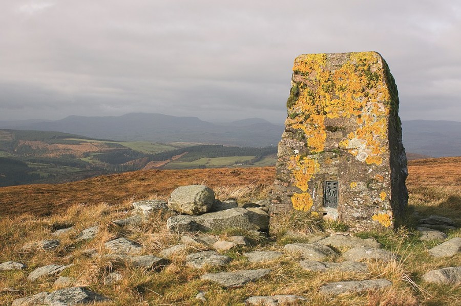
I’VE WALKED THE summits of the Hirnants many times over the years, and the more I explore this forgotten range of moorland hills, the more I grow to love their wildness, their gentle ridges, and the spectacular views you get of the higher ranges that lie all around. On a recent rediscovery of the range I was blessed with good weather and enjoyed spectacular views east to the main Berwyn peaks and west deeper into Snowdonia to the Aran, Rhinog and Arenig mountains.
Technically speaking the Hirnants belong to the better-known Berwyn range – the moors and cwms here are included in the Berwyn National Nature Reserve, but talk to any hillwalker about the Berwyn and they’ll immediately picture the higher tops of Cadair Berwyn, Cadair Bronwen and Moel Sych to the east. The Hirnants do get ignored, it hasto be said, but that is just one of the many charms of the range – you’re unlikely to share a summit here with anyone else, and on most walks in the Hirnants the only other signs of life will be cackling red grouse, cronking ravens and, if you’re lucky, the odd hunting hen harrier. Underfoot you’ll find ling, bell and cross-leaved heath, along with cloudberry, here at its most southerly place in the UK – it’s known locally as the Berwyn berry!
It is possible to walk the six highest peaks of the Hirnants in one very long day, but as you come off Moel y Cerrig Duon, way out in the south-west where the Arans begin at Bwlch y Groes, you invariably find yourself a long way away from your start point, so a car at each end is needed. Better instead to take on a circuit from Cwm Hirnant itself, giving you five of them in one walk, but leaving Moel y Cerrig Duon for another day.
Let it be said, there is a lot of very rough ground to cover here. Thigh-deep heather lies on the tops, and there are some very impressive boggy miles too. There are paths over the Foel y Geifr ridge, which are easy to follow, and the two middle peaks, Pen y Boncyn Trefeilw and Cyrniau Nod, have a wide track passing close by their summits, so the route is never too arduous. Only the final top, Foel Cwm Sian Llwyd, requires a bash through the heather, but once its summit is reached and you head down into the forests, easy tracks guide you on your return to the hidden depths of Cwm Hirnant and the end of a beautifully wild walk.
ROUTE DESCRIPTION
- Climb steeply SW to gain Foel Goch.
- Follow ridge S to Foel y Geifr.
- Head E to minor road, pick up track going NE.
- Follow this track, making detours to climb
- Pen y Boncyn Trefeilw and Cyrniau Nod.
- Head N over Trum y Sarn to Foel Cwm Sian Llwyd.
- Go SW to pick up forest tracks down Cwm Gwyn, then SW back to Cwm Hirnant.

Graham Uney pays a return visit to the quiet and gentle Hirnant hills
I’VE WALKED THE summits of the Hirnants many times over the years, and the more I explore this forgotten range of moorland hills, the more I grow to love their wildness, their gentle ridges, and the spectacular views you get of the higher ranges that lie all around. On a recent rediscovery of the range I was blessed with good weather and enjoyed spectacular views east to the main Berwyn peaks and west deeper into Snowdonia to the Aran, Rhinog and Arenig mountains.
Technically speaking the Hirnants belong to the better-known Berwyn range – the moors and cwms here are included in the Berwyn National Nature Reserve, but talk to any hillwalker about the Berwyn and they’ll immediately picture the higher tops of Cadair Berwyn, Cadair Bronwen and Moel Sych to the east. The Hirnants do get ignored, it hasto be said, but that is just one of the many charms of the range – you’re unlikely to share a summit here with anyone else, and on most walks in the Hirnants the only other signs of life will be cackling red grouse, cronking ravens and, if you’re lucky, the odd hunting hen harrier. Underfoot you’ll find ling, bell and cross-leaved heath, along with cloudberry, here at its most southerly place in the UK – it’s known locally as the Berwyn berry!
It is possible to walk the six highest peaks of the Hirnants in one very long day, but as you come off Moel y Cerrig Duon, way out in the south-west where the Arans begin at Bwlch y Groes, you invariably find yourself a long way away from your start point, so a car at each end is needed. Better instead to take on a circuit from Cwm Hirnant itself, giving you five of them in one walk, but leaving Moel y Cerrig Duon for another day.
Let it be said, there is a lot of very rough ground to cover here. Thigh-deep heather lies on the tops, and there are some very impressive boggy miles too. There are paths over the Foel y Geifr ridge, which are easy to follow, and the two middle peaks, Pen y Boncyn Trefeilw and Cyrniau Nod, have a wide track passing close by their summits, so the route is never too arduous. Only the final top, Foel Cwm Sian Llwyd, requires a bash through the heather, but once its summit is reached and you head down into the forests, easy tracks guide you on your return to the hidden depths of Cwm Hirnant and the end of a beautifully wild walk.
ROUTE DESCRIPTION
- Climb steeply SW to gain Foel Goch.
- Follow ridge S to Foel y Geifr.
- Head E to minor road, pick up track going NE.
- Follow this track, making detours to climb
- Pen y Boncyn Trefeilw and Cyrniau Nod.
- Head N over Trum y Sarn to Foel Cwm Sian Llwyd.
- Go SW to pick up forest tracks down Cwm Gwyn, then SW back to Cwm Hirnant.


