
Dartmoor needs no introduction to British wild campers, but you don’t need a long visit to benefit from those excellent camping opportunities – such as this one on Wild Tor – suggests Tim Gent.
There are countless multi-day camping opportunities spread out across Dartmoor. All very enticing, but perhaps you don’t have a week to spare, or even a weekend. That’s when a lightning camping sortie comes into its own. Even a relatively short walk can be utilised, simply by stopping for the night at some pleasant spot along the way. In summer, when the days are long, you can even set off after work on a Friday, walking into the moor for a few miles before pitching a tent. Up early the next morning, you could make the most of the new day and still be back to meet up with family for lunch. This, on Wild Tor and bypassing Cranmere Pool, is one of these short yet ever so satisfying Dartmoor camping walks.
Wild Tor and Cranmere Pool: route description
START/FINISH: The carpark just to the north of Belstone (GR: SX621938) | MAPS: OS Explorer OL28 | DISTANCE: 19.6km / 12.2 miles | ASCENT: 373m / 1,225ft | DURATION: 6 hours (or overnight)
1. SX621938: Head south along the road into the village, turning left at the headless stone cross on the village green, and then left again at the T-junction. Take the right fork in the road just before the second abandoned tractor, and then head out through the gate onto the open moor. Follow the track south, veering off to the left as it bends right to follow a clear footpath lying parallel with the river. A tight bend in the river, and clear scars in both banks, mark the ford. A concrete apron makes crossing possible in all but higher water conditions.
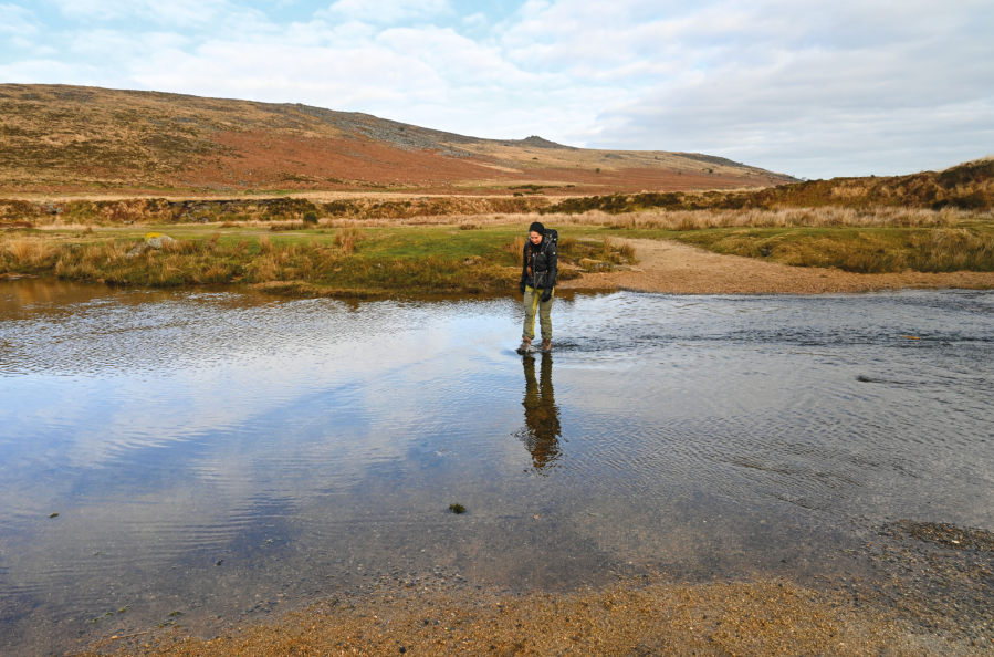
Crossing the Taw.
Credit: Tim Gent
2. SX620914: Once across the infant Taw, follow a fairly clear path that climbs gently to make for the left side of the Small Brook cwm ahead (this path lies higher up the lower slope of White Hill than the marked route on the OS sheet). As the ground steepens, the path becomes clearer, eventually reaching the stone circle just to the south of Little Hound Tor, where you turn right (south-west) to pass Hound Tor. The path then leads on beyond, climbing to Wild Tor, where you could camp.
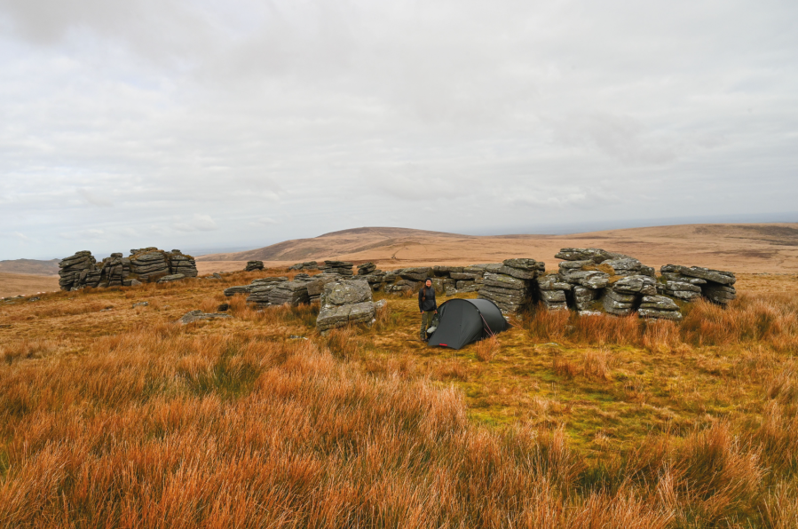
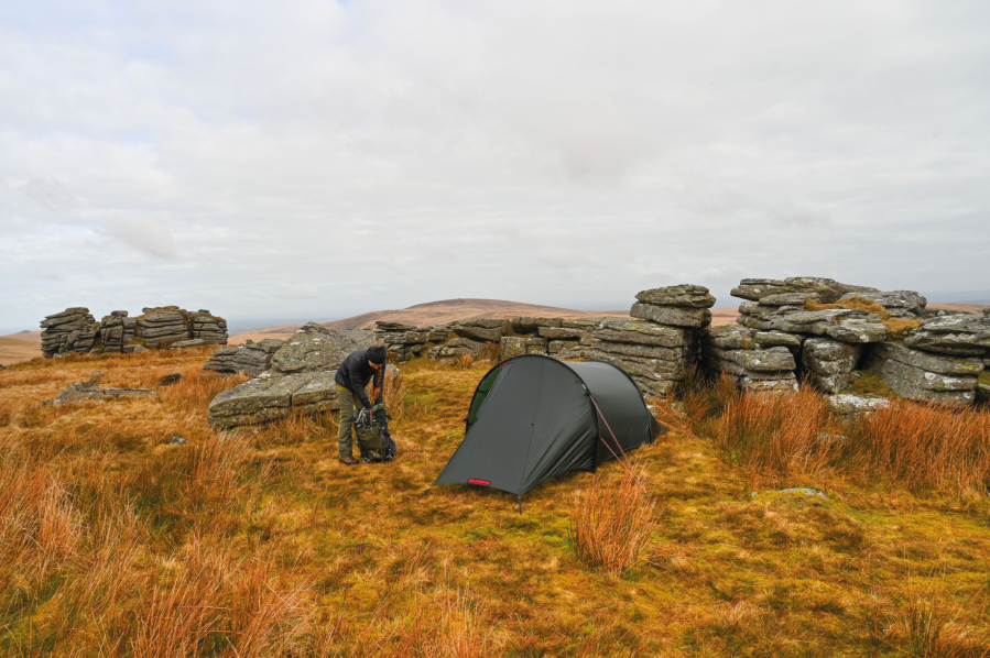
Our camp at Wild Tor.
Credit: Tim Gent
3. SX623876: From Wild Tor, in clear weather, Hangingstone Hill is visible a little to the west of south, and a fairly clear path heads in that direction. Hanginstone will disappear for a while on the ascent.
4. SX617861: On reaching Hangingstone Hill, the route now heads properly off-piste. If you can see Great Links Tor, way off to the west, you may be able to spot a slight path climbing a slope in the mid ground just to the left (it’s often a touch darker than the surrounding, very uniform vegetation). This is your objective. If the path is not visible, take a bearing on the pool and set out in that direction. However, walking this bearing is going to be hampered by a myriad of small pools, the water held back by the peat here to feed a number of Devon Rivers. You should be able to find a dry, firmish, route, making first for the small cleft holding Taw Head, and then on over flat and boggy ground to the pool (which isn’t a pool, but a small depression in the landscape with small a stone and steel obelisk/box).

Heading towards Cranmere Pool.
Credit: Tim Gent
5. SX603858: From the Pool, follow a bearing that takes you south to the track on Okement Hill (aim for the tight southernmost bend). Turn left onto the track to climb Okement Hill, turning right at the next junction (with an army observation post) to follow the tarmac road east around East Okement Head.
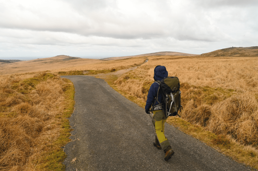
The turning to Oke Tor.
Credit: Tim Gent
6. SX609884: After a little over 1km, take a turn to the right to follow a track up to an old army observation post, and then on beyond to meet a clear path that heads for Oke Tor. Beyond the tor, the low Knattaborough Tor lies just beyond a firing range marker post (this tor is not named on OL28, but marked by a 438m spot height). Veer right off the path here, dropping below a second low rocky outcrop to follow a very faint path that drops north-east into the Taw valley. This path becomes clearer as you descend, but the slope is fairly fee of hazards if you miss it. At the foot of the slope, turn left (north) onto a good track that leads back along the Taw valley to Belstone.
Further information
PUBLIC TRANSPORT: Devon Bus 670 from Okehampton (01409 221 237)
TOURIST INFORMATION: Okehampton TIC (01837 53020)
NEAREST YHA: YHA Okehampton
Discover more walks in Dartmoor as mapped by The Great Outdoors’ expert contributors.


