
Enjoy a walk down the western side of the Lizard Peninsula to the most southerly point on the British mainland, recommends Fiona Barltrop.
Cornwall’s wonderful coastline is a pleasure to walk at any time of year, but especially so in spring (which starts early here) when it’s at its most colourful, the cliff edges fringed with pink thrift and other wild flowers. This glorious stretch of the coast path along the western side of the Lizard peninsula takes you to the British mainland’s most southerly point. Scenic gems en route include picture postcard Mullion Cove and beautiful Kynance Cove with dramatic cliff scenery all the way. The name Lizard, incidentally, has nothing to do with reptiles, being most probably a corruption of the Cornish ‘Lys Ardh’ meaning ‘high court’. Coincidentally, much of the peninsula is composed of a rock called serpentine, named for its scaly reptilian texture and long used for ornaments. The Lizard peninsula is also renowned as the birthplace of modern communication, where Marconi undertook some of his pioneering radio experiments. From Helston, the walk heads through the National Trust’s Penrose estate beside Cornwall’s largest natural freshwater lake, Loe Pool, joining the Coast Path at Loe Bar. There are regular buses back at the end.
The Lizard Peninsula: route description
START: Large free Fairground car park (opposite Boating Lake), Porthleven Road, Helston (SW654270) | FINISH: Lizard village green bus stop (SW704125) | MAPS: OS Explorer 103 (1:25k), OS Landranger 203 (1:50k) | DISTANCE: 24.5 km /15¼ miles | ASCENT: 686m/2250ft | DURATION: 7 – 8 hours
1. SW654270: From its entrance walk along the right-hand side of the car park to a footbridge on the right, cross and turn left alongside the River Cober. Follow the path to its end, turning right to a T-junction. Turn left and continue along the wide surfaced bridleway past Helston Lodge.
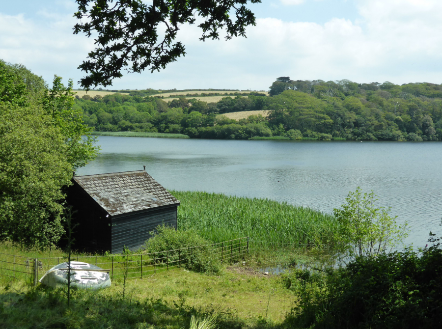
View over The Loe from nr Helston Lodge.
Credit: Fiona Barltrop
2. SW644257: At the next junction turn left, signed for The Stables, Loe Bar and Porthleven. Follow the bridleway which swings round past the Stables Café and walled garden on the right. Continue alongside The Loe, glimpsed through trees on the right, ignoring all turns and eventually emerging into the open at Bar Lodge. Below lies Loe Bar, the large shingle bank which separates The Loe, originally the estuary of the River Cober, from the sea. The National Trust’s Penrose estate surrounds The Loe, a haven for birds. Owned originally by the Penrose family, in the 18th century the estate was sold to the Rogers family, who gifted it to the National Trust in 1974. Penrose House (not open to the public) remains the family home.
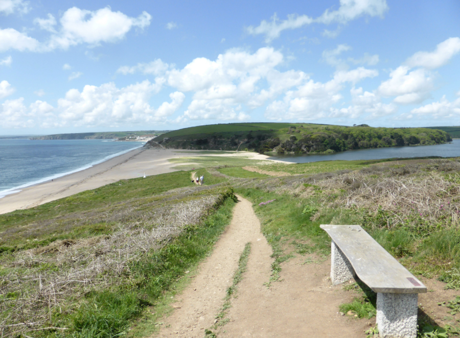
Loe Bar & The Loe.
Credit: Fiona Barltrop
3. SW641243: Turn left and follow the Coast Path across Loe Bar continuing along the grassy cliffs past the Anson memorial. This was erected in memory of the crew of HMS Anson, who were drowned when their ship was wrecked on Loe Bar in 1807. The tragedy prompted a Helston man, Henry Trengrouse, to invent a life-saving rocket apparatus, which subsequently saved thousands of lives. Carry on along the Coast Path to Gunwalloe Fishing Cove – there is a short signed official Coast Path diversion on a higher parallel path shortly before Gunwalloe. Note: swimming is dangerous both here and at Loe Bar. A brief detour up the lane to the left leads to the historic Halzephron Inn (a good refreshment stop).
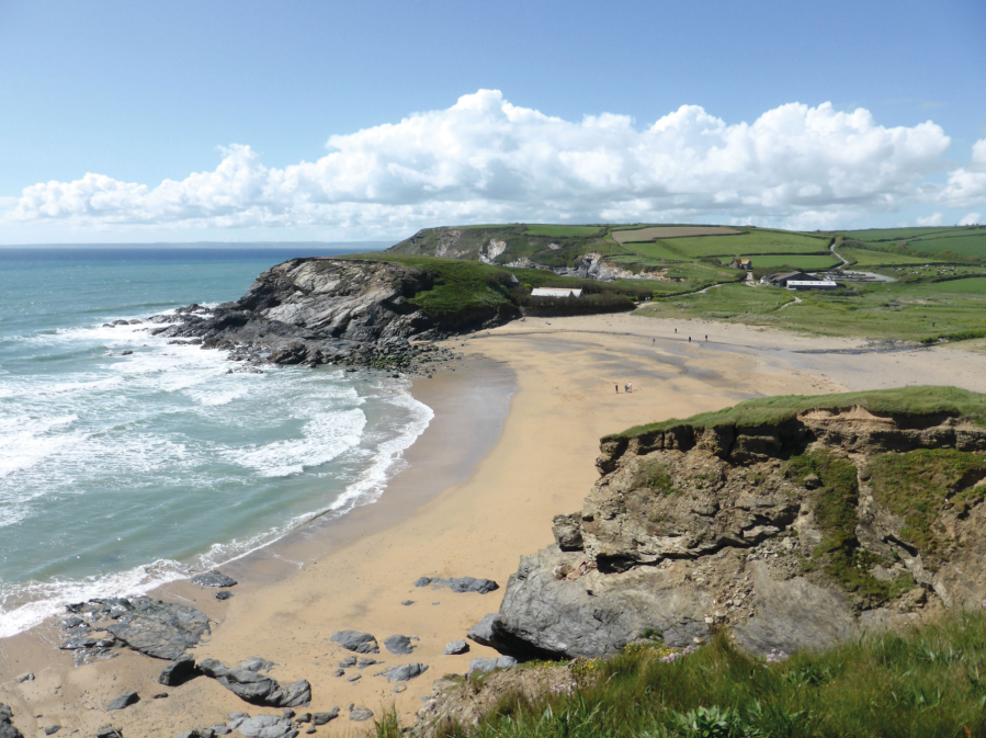
Church Cove.
Credit: Fiona Barltrop
4. SW654223: Heading on southwards the Coast Path takes you onto Halzephron Cliff and descends from there to Church Cove, where the picturesque 15th century church of St Winwaloe is tucked into the cove on its north side. The next cove is Poldhu and beyond this you’ll come to the Marconi monument on the cliffs. It was from Poldhu Point on 12 December 1901 that Marconi sent the first transatlantic radio signal. The Marconi Centre is nearby. After Polurrian Cove you’ll reach the Mullion Cove Hotel, splendidly situated on the cliff top above the cove. Descend to the cove and harbour.
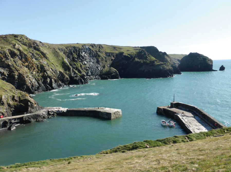
Mullion Cove & harbour.
Credit: Fiona Barltrop
5. SW667179: The final section to Lizard Point provides more splendid cliff scenery. At Kynance Cove – one of Cornwall’s beauty spots and duly popular – you can cross the beach if the tide is out; otherwise use the high tide route.
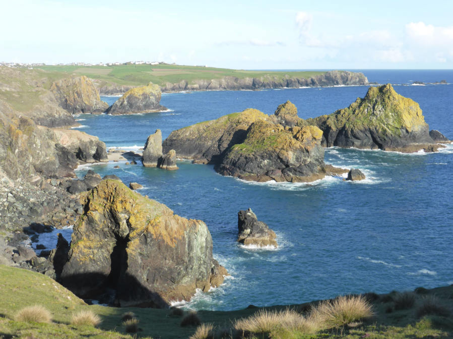
Kynance Cove.
Credit: Fiona Barltrop
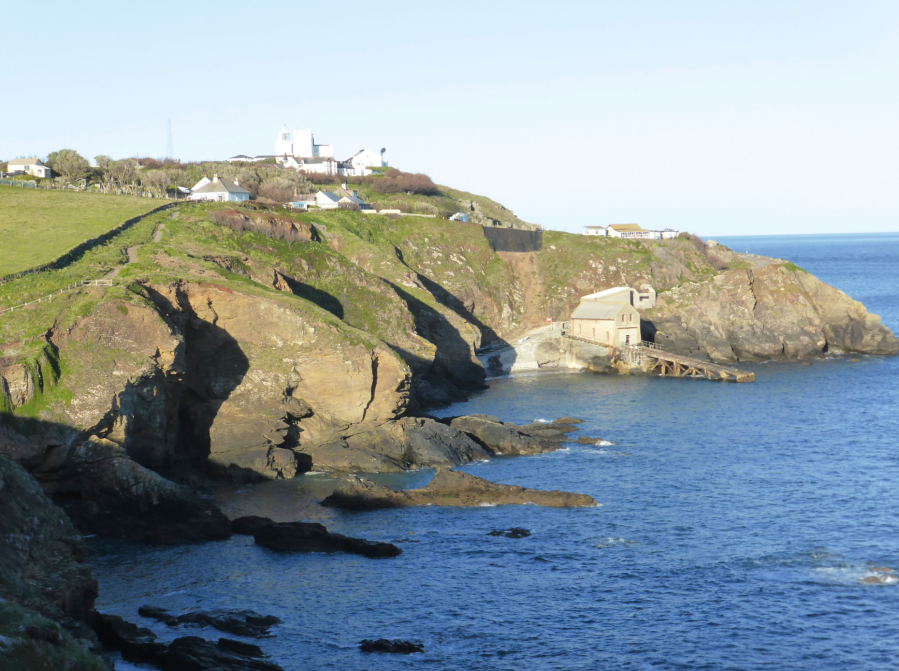
Once round Old Lizard Head and approaching Lizard Point, you’ll see the disused lifeboat house at Polpeor Cove on the west side of the Point. The present-day Lizard Lifeboat Station is at Kilcobben Cove, on the more sheltered eastern side of the Lizard Peninsula headland. The original station here was opened in 1961, replaced by a second station that opened in 2012. It is located at the foot of a high cliff, with a cliff railway above that carries the lifeboat crew down to the boathouse.
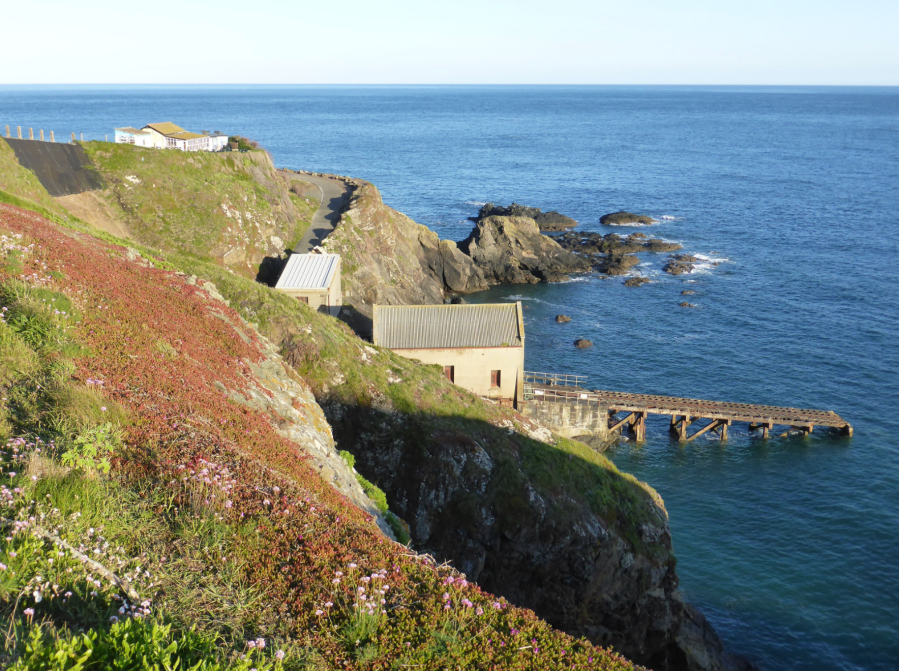
Old lifeboat station, Polpeor Cove, Lizard Point.
Credit: Fiona Barltrop
6. SW701115: From Lizard Point turn left to head inland to the village (path alongside the road), passing the lighthouse over to the right.
Further information
PUBLIC TRANSPORT: Go Cornwall bus 34 (hourly service) from Lizard village to Helston.
TOURIST INFORMATION: Penzance National Trust Visitor Centre, Station Approach (01736 335530)
NEAREST YHA: Lizard Point
Discover more walks in South England as mapped by The Great Outdoors’ expert contributors.


