
Although the long ridges of Glen Coe get all the attention, Emily Woodhouse argues that the isolated mountains of the Ballachulish Horseshoe are well worth your time.
Stuck out on the side of Glen Coe, the Ballachulish Horseshoe is often forgotten by all but the Munro baggers. The two summits of Beinn a’ Bheithir: Sgòrr Dhònuill and Sgòrr Dhearg both make the list and smaller Sgòrr Bhan is so close it would be rude not to. With water on three sides, this horseshoe has quite a different feel to the summits of Glen Coe.
Attentive readers will notice that this is not quite a horseshoe, despite taking in all the classic horseshoe summits. A longer extension of the route could be created in a more circular line. However, the variation we’ve chosen skips any down scrambling (or down climbing in winter) and includes a very pleasant, sheltered valley descent into the forest on return to Ballachulish. The main ascent is via Schoolhouse Ridge, so named after the primary school that you pass on the way out of Ballachulish. It is a Grade 1 route in winter conditions and a scramble in summer.
The Ballachulish Horseshoe: route description
START/FINISH: Co-op car park in Ballachulish; NN 083 584 | MAPS: Explorer 384 Glen Coe & Glen Etive (1:25k), OS Landranger 41 Ben Nevis (1:50k), Harvey British Mountain Map Ben Nevis & Glen Coe (1:40k) | DISTANCE: 15km / 9.2 miles | ASCENT: 1300m / 4200ft | DURATION: 6 hours
1. NN 083 584: Exit the main car park in Ballachulish and follow the road south west into town, taking the left fork at the first junction. Cross the metal-railed footbridge over the River Laroch and turn immediately left, continuing up the lane past the primary school.
2. NN 080 576: At the end of the lane, the path continues alongside the last house and through a gate onto open land. Continue along this track, past a stream and over a wall, turn right and make your way uphill towards the distinctive edge on the hillside above. There is a small path that winds its way up through boggy ground to the foot of the crags.
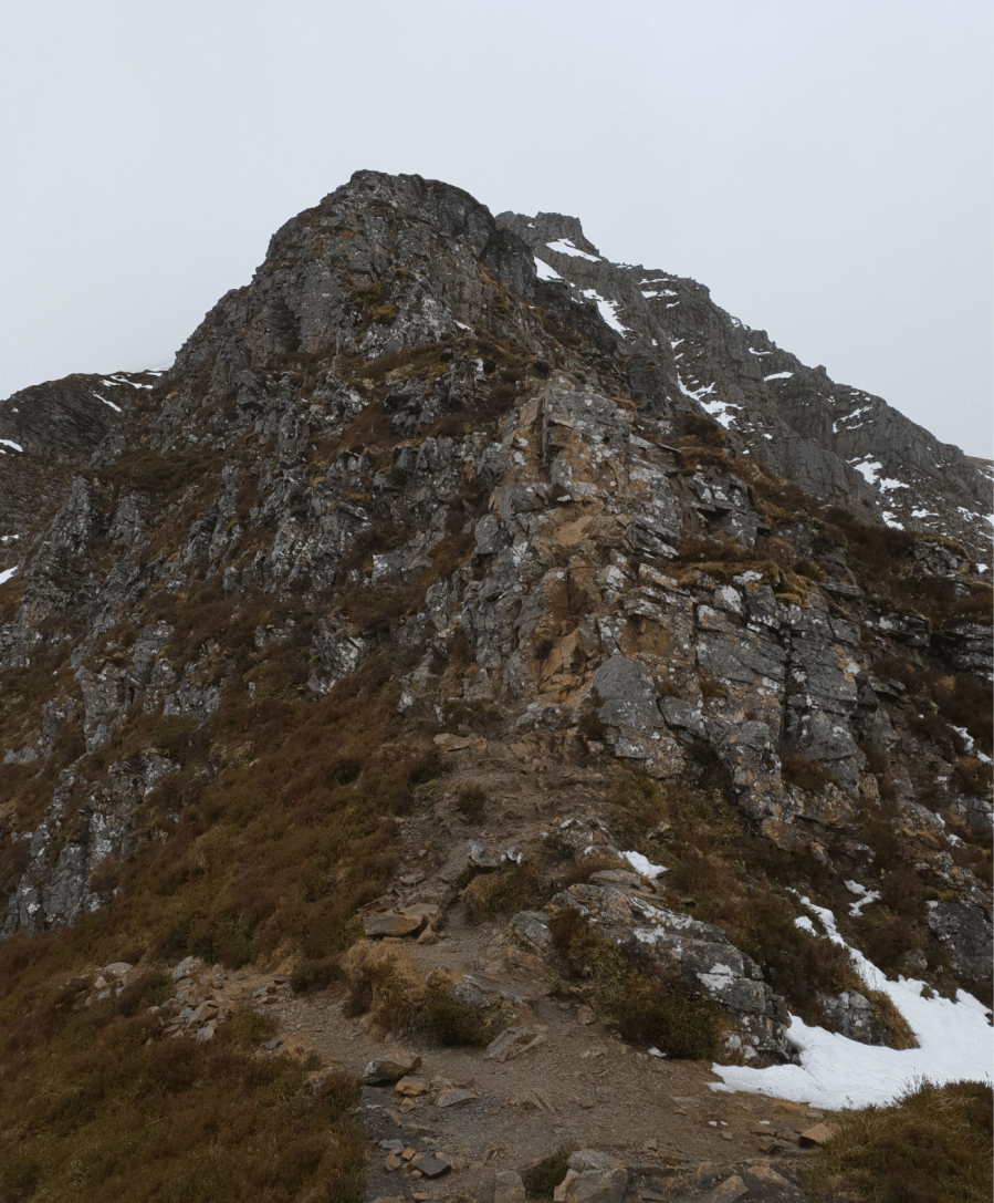
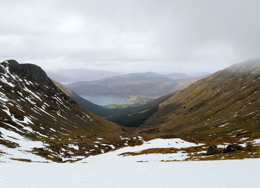
At the foot of Schoolhouse Ridge scramble.
Credit: Emily Woodhouse
This craggy edge is Schoolhouse Ridge, made up of a series of blocky steps.
Although only Grade 1, the scrambling cannot be avoided and there is one particularly airy step.
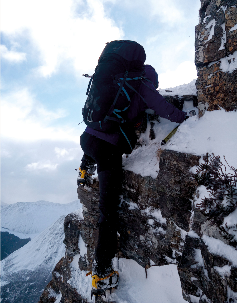
The author scrambling on Schoolhouse Ridge. Credit: Andy Wrayford
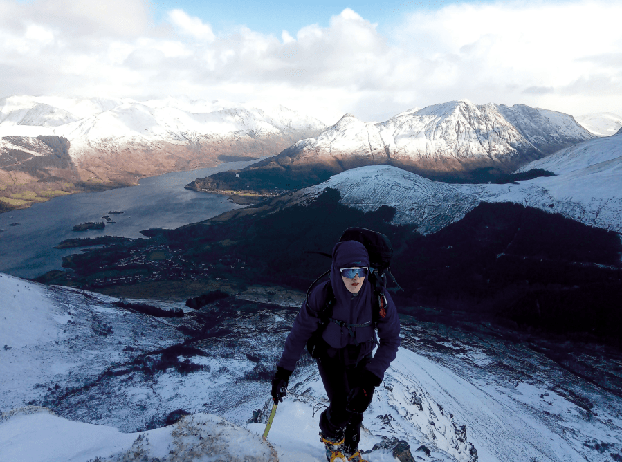
Don’t forget to look back down as a huge view of Loch Leven and Glen Coe, from the Pap and across the Aonach Eagach, opens out behind you.
3. NN 064 562: At the top of the scramble, the rocky summit of Sgòrr Bhan is only 200m away.
View from the first ascent of the horseshoe.
Credit: Mark Schofield
Climb the last little bit to the summit cairn and continue on around the sweeping curved ridge to Sgòrr Dhearg. At 1024m, it is the first Munro of the day. Descend along the south west spur to the next col. The old fence line, marked so clearly on the map is far less obvious on the ground. Cross it and make the final ascent up Sgòrr Dhònuill, staying on the southern side of the slanting ridge – the closer to the edge, the more exposed you’ll feel. The last section of climb to the top is steep and a little narrow, so you might need to use your hands for a couple of steps.
4. NN 040 555: From the summit of Sgòrr Dhònuill, take in the huge views over the sea loch below and back at the rocky peaks you’ve climbed (if you’ve been given any). Then retrace your steps back to the fence line in the wide col you just crossed.
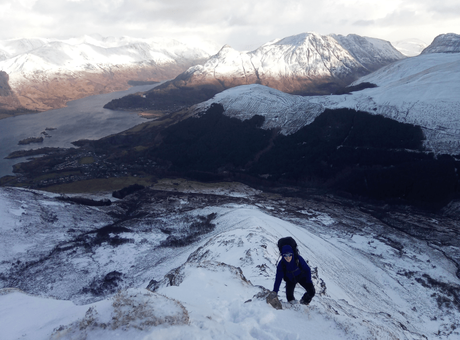
Looking down the descent route from col Credit: Emily Woodhouse.
5. NN 048 554: Back at the col, turn north and follow the muddy path that descends into the valley and on into the forest. High above to your left, you’ll see the inviting rocky outline of the Dragon’s Tooth at the end of Sgòrr Dhònuill’s north ridge. Follow the most obvious path downhill, staying on the eastern slope and as far out of the bog as you can. Crossing many little streams and following a line of old metal fence posts, you’ll eventually reach the edge of the forest. Continue along the path between the pine trees, crossing the first forestry path you reach and joining the second. Follow this wide track north initially, curving east around the foot of Sgòrr Dearg, on a gentle descent back to civilisation. You’ll pop out on the main road just before the chapel and war memorial. A short section of pavement beside the A82 before you can take a right into Ballachulish and return to the car park.
Further information
PUBLIC TRANSPORT: Trains to Glasgow, selection of Scottish Citylink buses from Glasgow to Ballachulish (914, 915, 916).
TOURIST INFORMATION: Discover Glencoe, 01855 811866
Discover more walks in Scotland as mapped by The Great Outdoors’ expert contributors.


