

Andrew Galloway visits the Pennine Way’s ‘Little House on the Prairie’ – Stott Hall Farm.
Stott Hall Farm, the eighteenth-century farmhouse sitting between the lanes of the trans-Pennine M62 motorway, has become an icon of Yorkshire resoluteness, known affectionately by thousands of HGV drivers and fans of the BBC Radio 2 traffic correspondent “Sally Traffic” as “The Little House on the Prairie”. The location of the farm, sandwiched between the carriageways of the motorway, gives the impression of inaccessibility. Determined walkers may, however, approach the dwelling by descending into Booth Dean Clough and passing below the concrete dam of Booth Wood Reservoir. The crest of the dam includes an outlet over which excess water spectacularly cascades one hundred and fifty feet into the clough below, a dramatic sight for motorists on the westbound carriageway of the motorway. Climbing the steep wooded slopes to the south of the dam one is transported into a scene reminiscent of a Philip Pullman novel, where worlds of striking contract exist in parallel.
The incumbent tenant of Stott Hall Farm, Paul Thorp, is keen to practice traditional livestock practices that have changed little in three hundred years, not a stone’s throw from one of the busiest motorways in Britain, on which a hundred thousand motorists wiz past the windows of the little house each day.
Stott Hall Farm and Rishworth Moor: route description
Start/Finish: layby on the A672 at Windy Hill GR: SD982141 | Maps: Ordnance Survey 1:25,000 South Pennies OL21 | Distance: 19.5 km (12 miles) | Ascent: 420m | Duration: 5 hours
1. SD982141: Follow the Pennine Way N passing the transmitter tower at Windy Hill, then crossing the M62 motorway by means of the foot bridge.
2. SD983148: Continue NW along the Pennine Way for 2km to reach the triangulation pillar on Blackstone Edge.
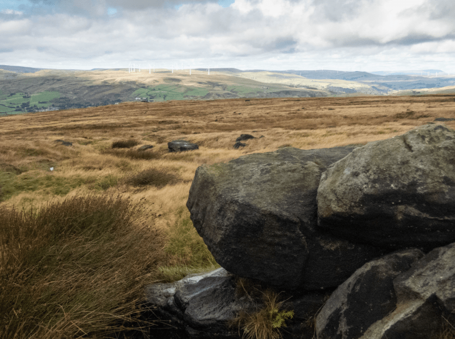
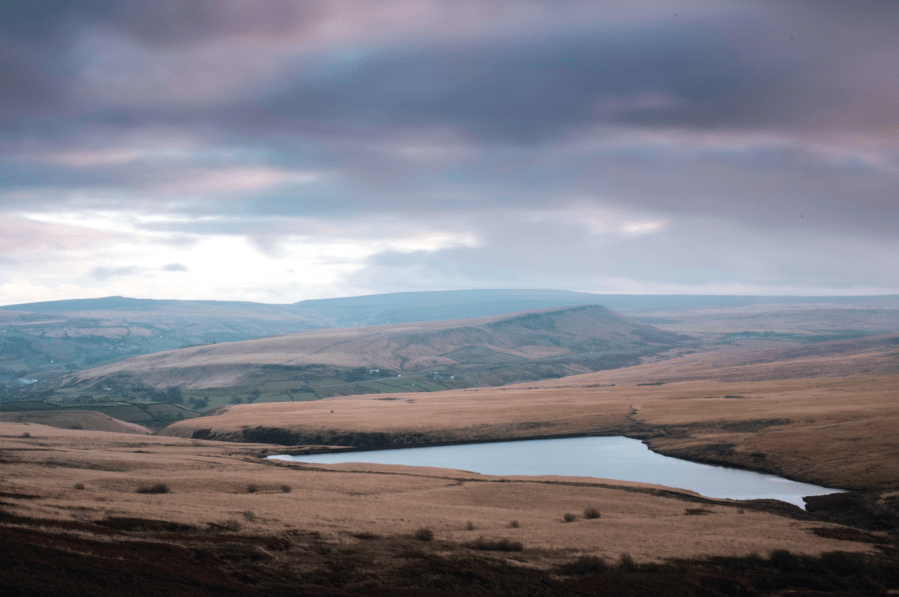
Blackstone Edge Moor.
Credit: Andrew Galloway
3. SD972163: Now head N, still keeping with the Pennine Way, for a further 700m to reach the Aiggin Stone.
4. SD973170: Follow the Old Packhorse Road NE for 1km to a footbridge over a drainage channel.
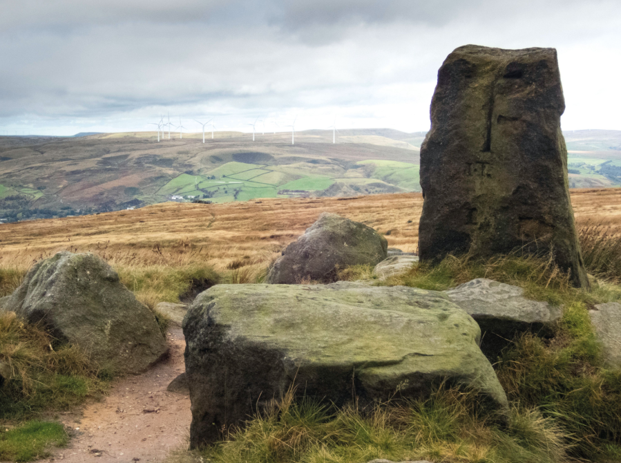
The Aiggin Stone, ancient county boundary stone.
Credit: Andrew Galloway
5. SD981176: Cross the bridge and head S/SE along the permissive path for 600m to where a finger post marks a division in the path.
6. SD985172: Follow the path towards Green Withens Reservoir for 400m then leave the path, crossing the small water channel, and climb NW to the top of Flint Hill.
7. SD989171: Head across open moorland due W for 1.4km to reach the triangulation pillar on Dog Hill.
8. SE002170: Head SSE for 300m then follow the Blackwood Edge Road for 1.7km due E to reach Blackwood Edge.
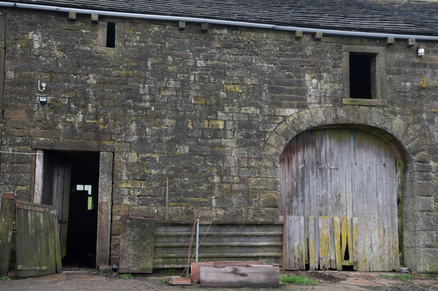
Boan Cottage, Eighteenth Century farm house on Rishworth Moor.
Credit: Andrew Galloway
9. SE020172: Turn SSE keeping with the stone wall and then across open meadow for 400m to Boan Cottage, here taking the farm track SE for a further 400m to Rishworth Lodge.
10. SE025165: Keep to the lane at the rear of the Ledge due E for 500m, then cross a field to reach the A672 road.
11. SE030165: From a small car park at the north abutment of Booth Wood dam, locate a footpath that descends into Booth Dean Clough. Pass the reservoir overflow then climb steeply through coniferous woodland to where the footpath passes beneath both carriageways of the M62.
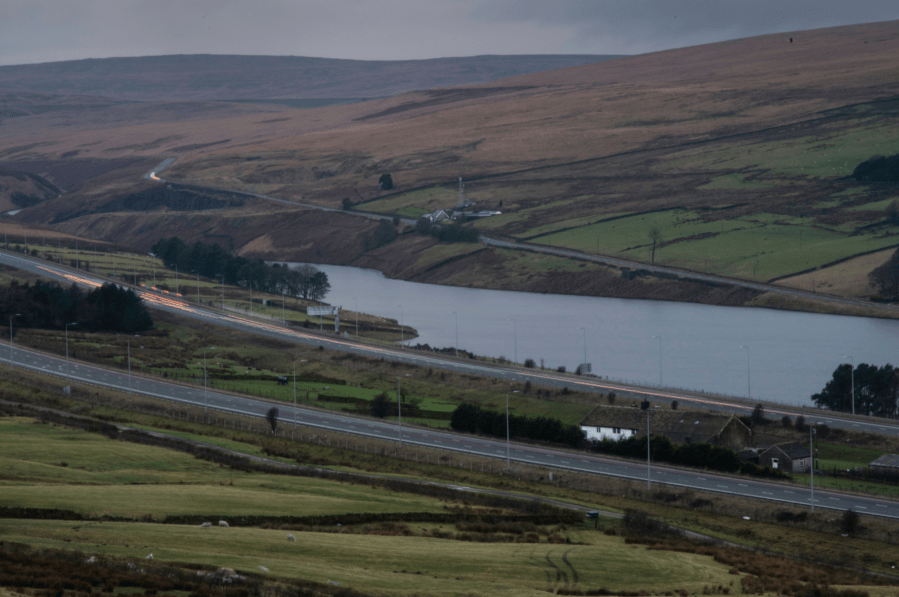
Stott Hall Farm, between the lanes of the M62 motorway.
Credit: Andrew Galloway
12. SE034161: Follow the farm track at first parallel with the M62 for 300m then climbing via High Moss to Grey Stone Quarry.
13. SE033155: 50m short of the Saddleworth Road turn SW, following the district and county boundary for 1km to Doe Holes. From here a line of eight boundary stones leads across Deanhead Moss for 1.5km to Foxstone Moss.
March Haigh Reservoir From Buckstones Moss.
Credit: Andrew Galloway
14. SE014140: From the final boundary stone Strike out W across open moorland to reach a wire fence on Moss Moor Edge. Follow the fence W for 1km then turning to SSW for 800m to reach Linsgreave Head (Warning: this watershed is boggy at most times of the year).
15. SD994133: Follow the line of a wire fence WSW for 500m to the triangulation pillar at White Hill. From White Hill follow the Pennine Way for 1.5km to return to the layby on the A672.
Further information
Public Transport: 586 bus from Halifax to Rishworth or 902 bus from Huddersfield to Rishworth.
Visitor Information: South Pennines Park
Discover more walks in the Peak District as mapped by The Great Outdoors’ expert contributors.


