
Scafell Pike may be the highest mountain in England, but there are better ways to get to it than slogging up and down the shortest route, argues Emily Woodhouse.
So you want to go up Scafell Pike to stand on the highest point in England, but you want to make a day of it on a full mountain outing that takes in more of the Lake District’s beautiful fells. You’re not scared of doubling the amount of distance you must walking uphill to get there – in fact, that sounds like your idea of fun.
I have heard this route described as a monster. Personally, I find it a very pleasant day out – albeit long – which happens to take in Scafell Pike. If your only objective is to stand on the highest summit in England then there are far more straightforward ways to do it. But if you want ridges, gullies, gills, tarns then look no further than the Corridor Route.
As this is a very full day out, it’s important to start early to provide as much chance as possible to complete it in daylight. Although much of the route is on a clear path, it is easy to lose the cairns between Esk Hause and Scafell Pike in bad weather.
Scafell Pike via Esk Hause: route description
START/FINISH: Parking lay-by at Seathwaite (there may be extra field parking available in summer) | MAPS: OS Explorer OL4 & OL6 (1:25k), OS Landranger 90 Penrith and Keswick (1:50k), Harvey British Mountain Map Lake District (1:40k) | DISTANCE: 13.5km / 8.5miles | ASCENT: 950m / 3100ft | DURATION: 7 hours
1. NY235121: From the end of the road, walk through Seathwaite Farm and out along a track, following the main river along the bottom of the valley. The way is fairly flat, crossing a few small streams coming off the fells to your left.
Climbing up towards Ruddy Gill.
Credit: Emily Woodhouse
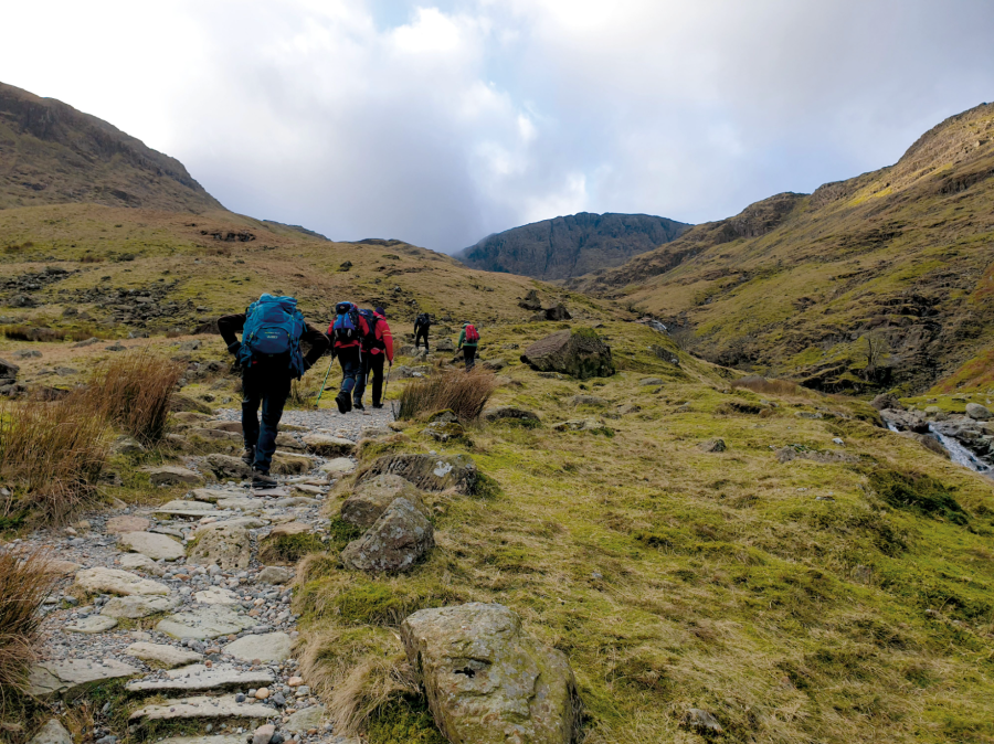
2. NY234109: In the shadow of Glaramara’s black crags, the path takes you to Stockley Bridge – a Grade II listed stone bridge, part of an old packhorse route. Cross it and, through the gate on the other side, turn immediately left, following the drystone wall uphill beside Grains Gill. As the wall drops away, stick to the path, climbing higher and higher into the fells. It is well made with couple of big steps, narrowing towards Ruddy Gill. The way opens out of the gill to meet the main path between Sprinkling and Styhead Tarns. After walking south east on this path for only a hundred meters, take the path bearing right and uphill towards Esk Hause.
Looking back towards Borrowdale, Ruddy Gill foreground.
Credit: Emily Woodhouse
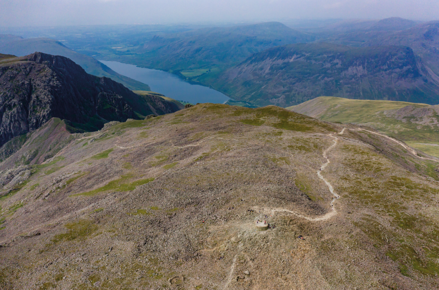
3. NY232080: At the col, hopefully with grand views down towards Eskdale, you should see the craggy top of Esk Pike to your left and the way ahead to your right: Ill Crag, Broad Crag and maybe even a glimpse of what’s behind. The path initially is not very obvious, but head for the col below Great End and follow the line of cairns – these lead all the way to Scafell Pike. Cross the boulder fields on the flanks of Ill Crag and Broad Crag, then descend a disappointing distance to the col – bracing for loose ground underfoot and a possible wind funnel in the middle. Then clamber up the final rocky slope onto Scafell Pike.
Start of the Corridor Route.
Credit: Emily Woodhouse
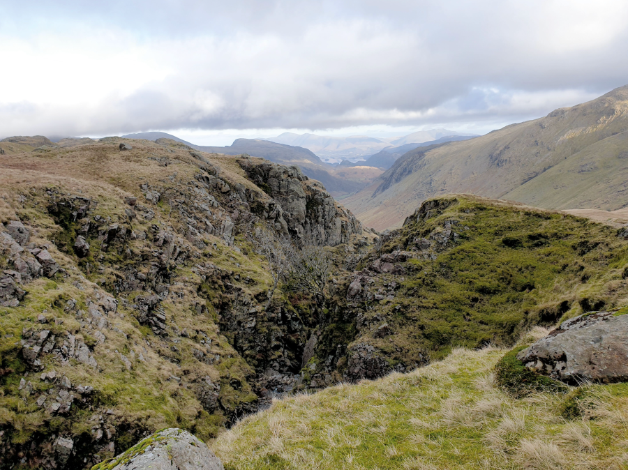
4. NY214072: After summit parties and packed lunch in the shelter, descend north west (may need a bearing in cloud) to pick up a well worn path downhill. Beware steep crags in all directions not on a path. Just before Lingmell Col, a path splits off right. Take it and traverse around the top of Piers Gill, an impressive scar in the landscape. This is the start of the Corridor Route, a high level contour path which traverses around the foot of Great End. It is steep and exposed in places, and involves a very small section where hands on rock are required.

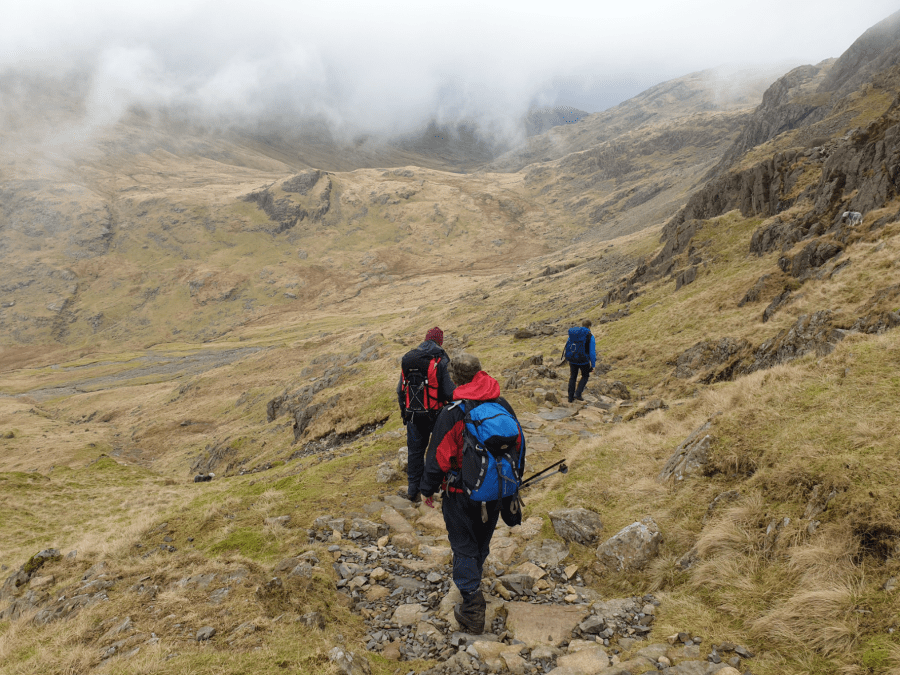
Descent route beyond Styhead Tarn looking north.
Credit: Emily Woodhouse
5. NY221094: The Corridor Route drops you off on the open hillside before Styhead Tarn. Walk up the grassy slopes until you can see the tarn and the clear path that at curves around its western bank. Follow this path to the footbridge across Styhead Gill then, crossing, onwards beside the river and ever downhill. The path scoops around the edge of the woodland and steeply back down towards Stockley Bridge. Retrace your steps to the car park.
Further information
PUBLIC TRANSPORT: Trains to Windermere then Bus 555 to Keswick and 78 to Seatoller. The most direct route is then to walk down the narrow road to Seathwaite.
TOURIST INFORMATION: www.lakedistrict.gov.uk, 01539 724555
Nearest YHA: YHA Wasdale Hall or YHA Eskdale
Discover more walks in the Lake District as mapped by The Great Outdoors’ expert contributors.


