
Vivienne Crow enjoys solitude on an overnighter beyond Skiddaw bypassing the basic but secluded Lingy Hut.
Lingy Hut, sometimes also called Great Lingy Hut, is about as basic as bothies get. Little more than a large wooden shed, it contains a sleeping platform, a spade and a visitors’ book. But it sits in a wonderfully secluded spot, high up in the heart of the Lake District’s quiet Northern Fells. Starting from Keswick, this walk first climbs the busy ‘tourist path’ up Skiddaw before heading for the relative solitude of Great Calva and Knott, two peaks that feel like they’re an awfully long way from anywhere.
After an overnight stop at the hut, nearly 19km into the 36km route and 580m above sea level, the second day is easier. It follows the route of the Cumbria Way through the trench carved by the infant River Caldew and then leaves the fells via a balcony path clinging to the side of the Glenderaterra gap before rejoining the outward route to return to Keswick.
Lingy Hut: route description
START/FINISH: Moot Hall in Keswick town centre, GR NY266234 | MAPS: OS Explorer OL4 and OL5 (1:25k), OS Landranger 90 (1:50k), Harvey 1:25,000 Superwalker Lake District North | DISTANCE: 36km / 22.4 miles | ASCENT: 1,631m / 5,350ft | DURATION: 2 days
1. NY266234: With your back to the Moot Hall information centre’s entrance, take the lane to the left of Greggs. Leaving the pedestrian area, turn left. Go straight over at the crossroads and, when Station Road bends right, keep left. Almost immediately, take the footpath on the left and pass to the right of the old leisure centre. Exit the car park at the mini roundabout, bear left and, in 370m, take the track on the right. As this climbs, ignore all paths to the right.
2. NY280253: On reaching Gale Road, turn right and then left after the gate at the road end. Bear left at a fork beyond a gate, soon passing the memorial to the Herdwick breeders, the Hawells. The climb proper begins after the next gate. Keep to the constructed path at all times. The gradient finally eases as you go through a gate on Jenkin Hill.
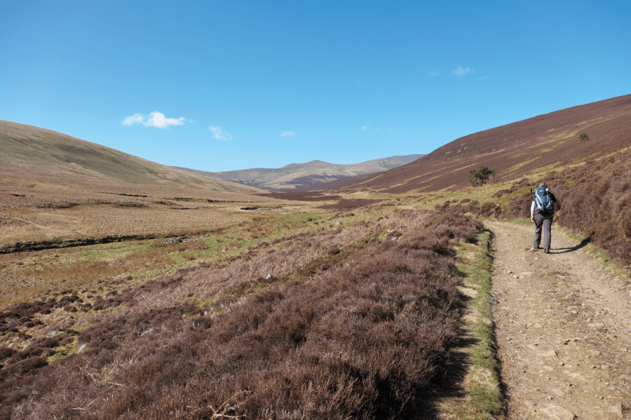
Looking back down Skiddaw’s ‘tourist path’.
Credit: Vivienne Crow
3. NY264283: After the next gate, a stony path climbs to a cairn at the southern end of Skiddaw’s bare summit plateau. It’s now a short walk north to the trig pillar, shelter and toposcope. From the top, return to wp3. A few strides beyond the gate, head north-east on a grassy trail. The path, boggy at times, goes up and over Sale How, and then drops towards Skiddaw House. Keep the hostel’s boundary wall on your right and follow it to a vehicle track. Turn left and walk along the track for 800m.
4. NY283298: Take the trail climbing north-east through heather. From Great Calva’s summit, descend north-west with the fence. Cross a stile at a kink in the fence and head north, veering north-west on a wet, peaty path. About 450m beyond the stile, watch carefully for a bend to the north – ignoring the trail straight ahead.
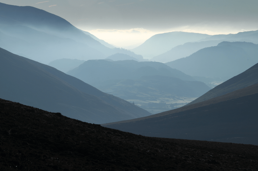
Looking south through the Glenderaterra gap from Great Calva.
Credit: Vivienne Crow
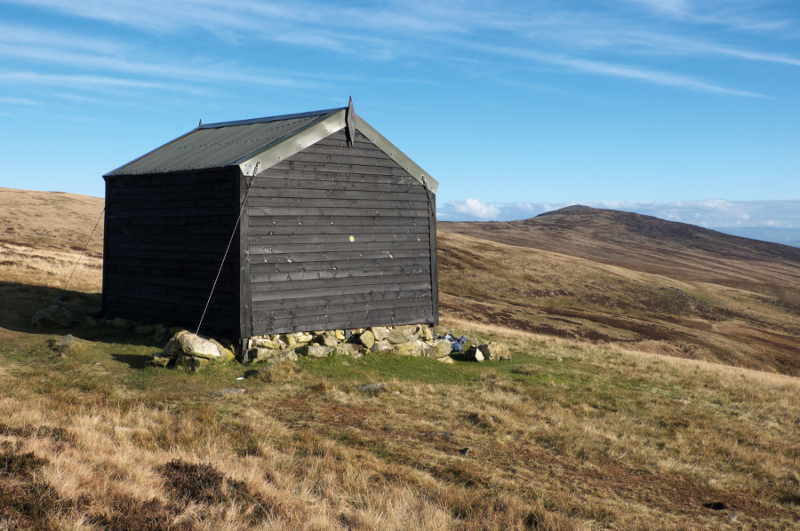
5. NY287323: Having dropped north-east into the saddle between the Calvas and Knott, keep straight on to climb the grassy slope. The path leads directly to Knott’s rounded summit. Two paths head down the eastern side of the fell. Take the clearer one to the left (slightly south of east). The two tops straight ahead are Carrock Fell, to the right, and High Pike. Between them – and a little way below the brow of the hill – there is a small building. This is Lingy Hut, the wooden bothy where today’s walk ends. Drop north-east from Knott’s eastern ridge, crossing swampy ground before picking up a clearer path again. Follow this up to Lingy Hut.
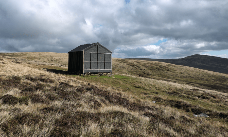
Lingy Hut.
Credit: Vivienne Crow
6. NY311335: On day two, take the grassy path descending south-east from the bothy. This later accompanies Arm o’ Grain downstream, fords the beck and then follows the line of Grainsgill Beck.

The River Caldew forms a trench through the middle of the Northern Fells.
Credit: Vivienne Crow
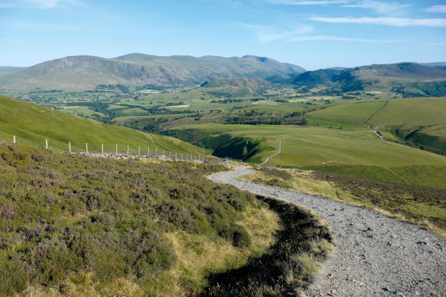
7. NY327326: At the road, turn right. This soon becomes a track – the route of the Cumbria Way – heading upstream beside the River Caldew. Before long, Skiddaw appears ahead. Later, the Caldew is crossed on a footbridge and the path climbs to Skiddaw House. On reaching the hostel’s perimeter wall, turn left. After a gate about 700m beyond Skiddaw House, the path makes directly for the pyramid-like peak of Lonscale Fell.
Returning via the Cumbria Way.
Credit: Vivienne Crow
8. NY292279: As the wall on the left swings away, keep right at a fork. The path soon contours the fellside, high above the Glenderaterra Beck, which has carved a narrow, steep-sided valley between Lonscale Fell and Blease Fell. Later, after emerging from the gap, ford Whit Beck and then rejoin the Skiddaw tourist path at a gate. Retracing your steps from the previous day, follow this back to the end of Gale Road and then down into Keswick.
Further information
PUBLIC TRANSPORT: Keswick is served by buses 78, 554, 555, X4/X5 and the summer-only 77/77A
TOURIST INFORMATION: www.lakedistrict.gov.uk, 0845 9010845
NEAREST YHA: YHA Skiddaw Bunkhouse
Discover more walks in the Lake District as mapped by The Great Outdoors’ expert contributors.


