
Francesca Donovan makes a night of it on a Kinder traverse between train stations, taking in the Peak District heights atop Win Hill and Kinder Low.
The Kinder plateau comprises some of the highest points and most rugged views in the Peak District (Kinder Scout sits 2,087ft above sea level). You can’t help but admire the natural forces that created the formations of gritstone, akin to a monsters’ graveyard, and the cloughs carved into the side of the landscape.
Yet, the walkways that cling to its edge between the Win Hill honeypot and the mouth of Grindsbrook Clough – from which sweaty scramblers are spat out – are also relatively quiet. We shared hellos with perhaps ten other walkers here even on this (very) Good Friday bank holiday. It’s quite a treat to watch the steady stream of footfall along The Great Ridge from your vantage point of peace. Best of all, this linear train-to-train route allows you to skip dropping down into Edale to face the perils of parking.
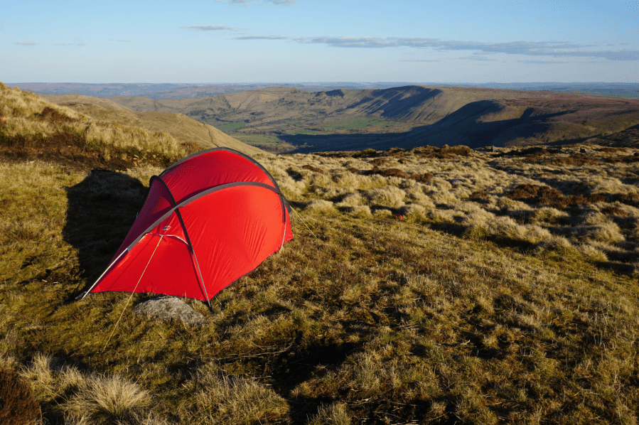
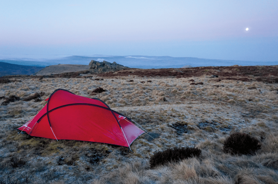
Kinder’s wide plateaus also provide plentiful space for a tent or two. On this good weather window, complete with sunrise temperature inversion, I knew of at least three other backpackers who chose to pitch on this Peak District high place. But, with enough nooks, crannies and quiet corners for everyone, we barely saw a soul besides one woman bivvying on Kinder Low.
Kinder traverse: route description
Start: Hope train station (GR: SK180 832) | Finish: Chinley train station (GR: SK038 826) | Maps: OS Maps Explorer OL1 – Dark Peak Area (1:25k) | Distance: 25km / 15.5 miles | Duration: 9 hours with an optional overnight camp | Ascent: 858m / 2,815ft
1. SK180 832: From Hope station follow the footpath directly from platform two and go through the gate. Skirt the field boundary heading N and take the clear path to through another gate and over one stile, reaching Aston Lane. Take a L and then immediately R onto Free Range Lane, followed by a L onto Ruin Edge Lane. Follow this for 0.3 miles before veering R in a NE direction up the grassy verge and onto the sandy footpath. Follow it to the summit of Win Hill where you can take a breather and enjoy the views over Ladybower Reservoir and to the edges in the E.
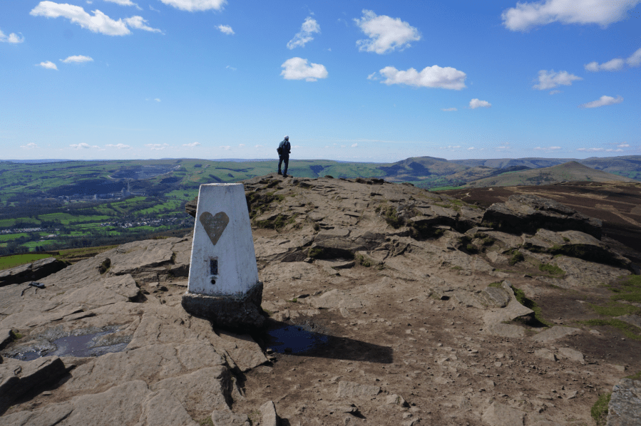
The trig point on Win Hill with Mam Tor in the distance.
Credit: Francesca Donovan
2. SK 186 850: From the trig point at Win Hill, retrace your steps back down to the footpath for 450 yards. Continuing straight along the path tracing the edge above Thornhill and Hope Brink. Enjoy the views of The Great Ridge and down into the Edale valley. Follow the footpath for 1.75 miles until you join the old Roman Road. Take this rocky route for 0.8 miles.
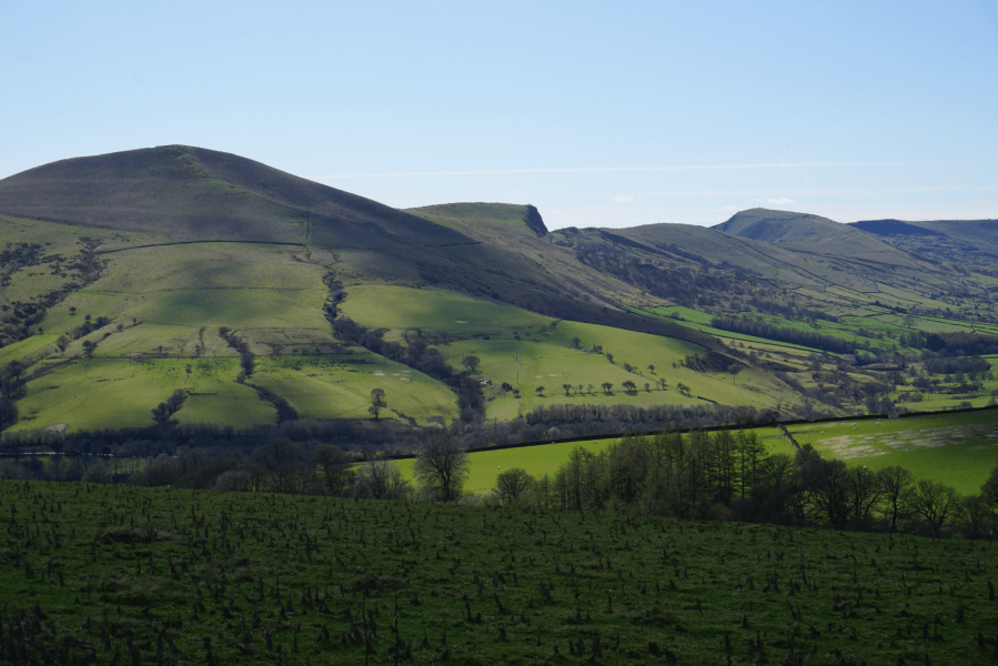
Mam Tor and The Great Ridge in cloud shadow.
Credit: Francesca Donovan
3. SK 158 878: Turn off the Roman Road heading W over the gentle slope of Crookstone Hill, gradually veering NW past the cairn and then looping SW as you ascend Crookstone Out Moor via your first taste of the paths that cut through the Kinder gritstone. It’s easy, engaging walking and you’ll arrive at Jaggers Clough in 0.3miles.
Jaggers Clough.
Credit: Francesca Donovan
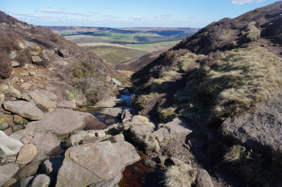
4. SK 139 877: Ford the stream. This won’t be your first skip over the waters coming off the plateau today. From here, walk 4.2 miles W skirting the Kinder edge. You’ll have passed through some fine Peak landscapes; otherworldly – sometimes grotesque – gritstone formations emerging from the woolpack peat bog, views down the Pennine Way to Edale, and perhaps 40 or more paragliders launching from Mam Tor.
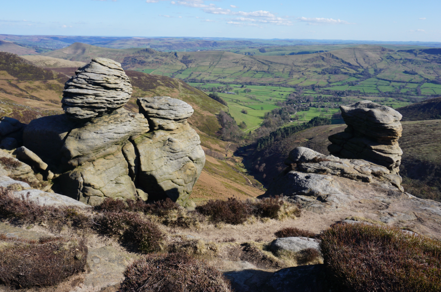
Views through the Nether Tor rock formations down to Edale.
Credit: Francesca Donovan
5. SK 081 868: From Noe Stool, pick your way NW towards Kinder Low where the trig point crowns a mass of gritstone, awaiting your arrival and ensuing selfies as the sun sets over Manchester. This is a good chance to select your pitch off the well-trodden path between the trig and Edale Rocks. The ground can be boggy and rocky, but there’s plenty of room for manoeuvre.
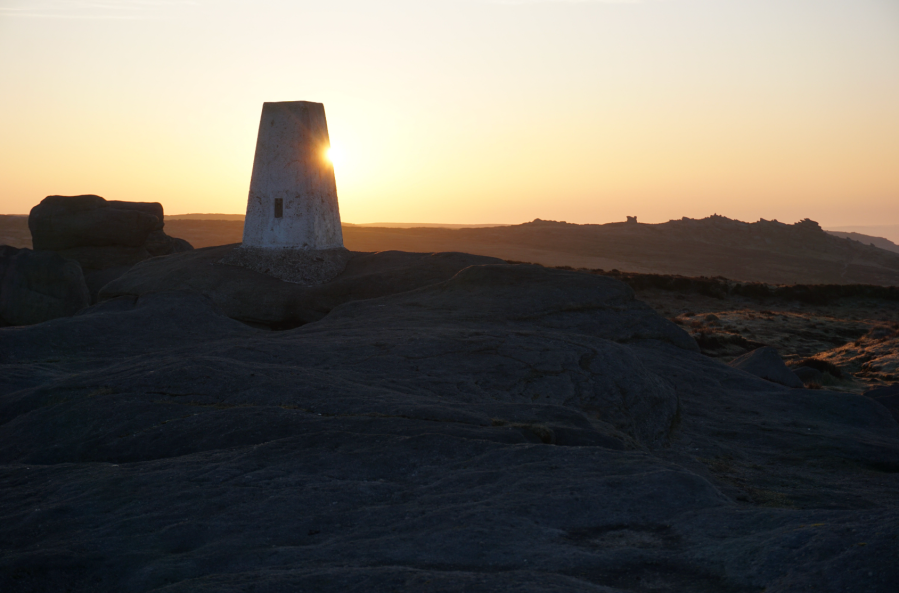
Sunrise at Kinder Low.
Credit: Francesca Donovan
6. SK 079 870: Picking up the route next morning from the trig point, which also provides a vantage point of the sun rising behind Edale Head, head S towards Edale Rocks. Skirt Swine’s Back on the east and continue along the footpath descending in a S direction for 0.7 miles.
A morning cloud inversion sits below Edale Rocks and the moon.
Credit: Francesca Donovan
7. SK 081 853: Instead of taking the path to Brown Knoll (unless you’re in the trig bagging business in which case it’s only a short diversion), continue 1.5 miles up to South Head.
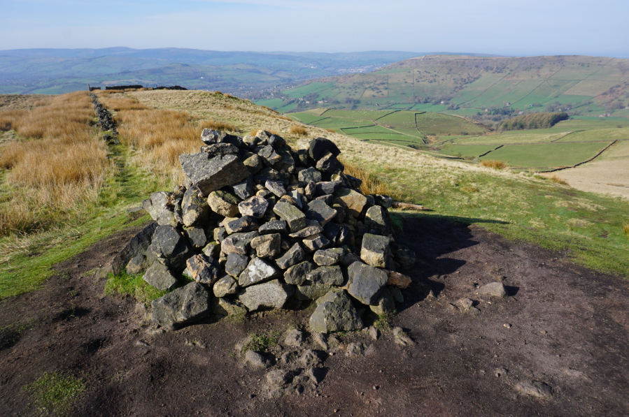
The cairn on South Head.
Credit: Francesca Donovan
8. SK 060 845: From the cairn, head down the path W for 600 yards. You can take a short detour up to Mount Famine but the pints at The Old Hall in Chinley were calling so we hoped over the stone stairs in the wall and marched onwards along the footpath heading SSW through Andrews Farm for 1 mile.
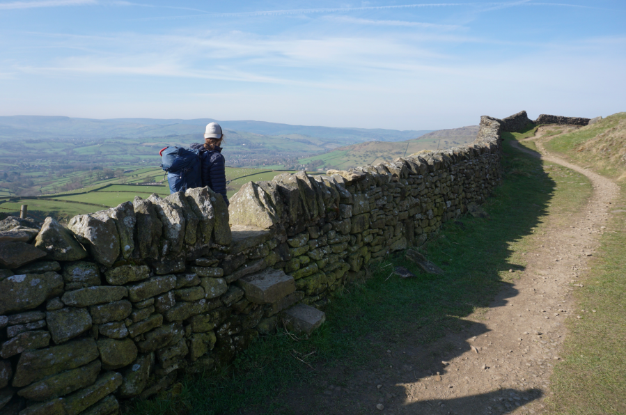
Beginning the descent into Chinley. Credit: Francesca Donovan
9. SK 051 834: Cross Hayfield Road and follow the woodland path. It leads to a footpath first skirting a field heading W and then straight through a second field heading SSW through Alders Farm. Then take Alders Lane and its archway under the train tracks until you’re back in Chinley ‘proper’. Follow the street signs along first Buxton Road and then Station Road to Chinley Station (Finish: SK 0381 8260).
Further information
Public Transport: Hourly Northern Trains service run between Manchester and Sheffield stopping at both Chinley and Hope stations
Tourist Information: Edale TIC (The Moorland Centre), 01629 816587 or email [email protected]
Nearest YHA: YHA Edale Activity Centre
Discover more walks in the Peak District as mapped by The Great Outdoors’ expert contributors.


