
Hindscarth can all too easily be ticked-off as an incidental waypoint, from the back. But Norman Hadley argues it deserves a dedicated ascent via the spectacular heathery crest of Scope End.
The Newlands triptych of Dalehead, Hindscarth and Robinson forms a familiar backdrop looking south from the Vale of Keswick. In particular, the conical of Scope End stands as a spectacular bookend to Hindscarth’s northern ridge. This is the key to our ascent and every step is a pleasure, with delight to be found both under the feet and over the shoulder. In clear weather, your route plan should allow significant stoppage time for photography.
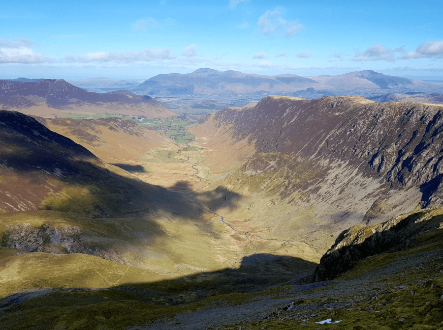
Once you’ve reached Hindscarth’s summit, there is mercifully little re-ascent required to reach Dale Head. Here, the view north towards Skiddaw and Blencathra is foregrounded by the birds-eye view of the upper Newlands trench. To the south, the Gable and Scafell groupings also look magnificent.
After descending to Dalehead Tarn, there’s a bit of a pull up to High Spy but thereafter, you’re presented with a gloriously swoopy ridge over Maiden Moor and Catbells back down to Newlands.
Dalehead, Hindscarth and Robinson: route description
START/FINISH: Stair Village Hall NY237213. There’s an honesty box system for parking | MAPS: OS Explorer North-western Lake District OL4 (1:25k), Harvey Ultra Map Lake District West (1:40k) | DISTANCE: 16.6km / 10 miles | ASCENT: 1000m / 3285ft | DURATION: 6 hours
1. NY237213: From the village hall car park, take the lane heading south to Little Town. This a public highway but it is generally quiet and walker-friendly.
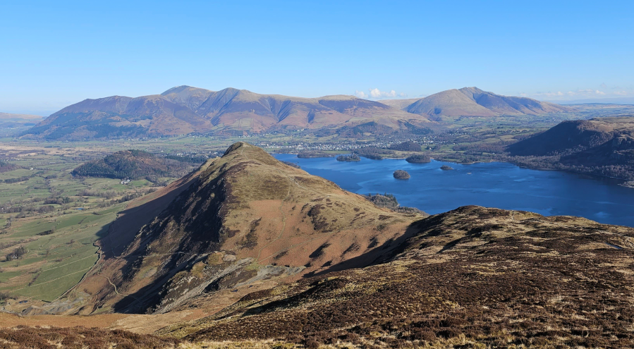
2. NY234196: At Little Town, you’ll see two tracks forking left in quick succession. Take the first of these, quicky gaining a lovely terrace where you’ll turn right and cure gently to the south. In clear weather, the view in front is gorgeous: especially the improbable pyramid of Scope End, where we’re heading. The effect is slightly illusory: Scope End appears as a wholly separate fell but is in fact connected by a rising ridge.
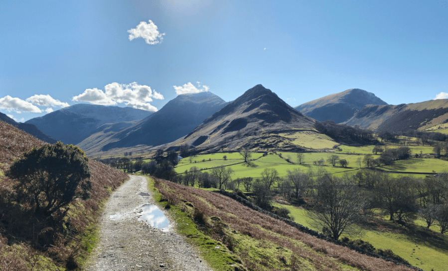
The beckoning trail, leading to Dale Head, Hindscarth, the cone of Scope End, and Robinson.
Credit: Norman Hadley
3. NY230185: At the crook of the wall, you’ll see a footbridge over the beck on your right. Cross this. There’s plenty of spoil left behind by Goldscope Lead Mine here but almost every part of the name is misleading: its primary wealth came from neither gold nor lead but copper. So impressed were itinerant German miners by its riches, they called it “Gottesgab” meaning “God-given” which became Anglicised to Goldscope. After the bridge, curve round to the right. Just before Low Snab farm, gain a slight zig zag rising up to the crest of the Scope End ridge.
The view north from Hindscath, with Skiddaw central.
Credit: Norman Hadley
4. NY228188: Turn left to follow the crest itself, rising in a delightful series of rock steps as richly embellished with heather beds as any garden rockery. This keeps going and going, with the rearward views getting better and better with height. Eventually it will bring you to Hindscarth’s summit.
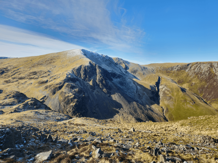
Dale Head’s northern prow, which rejoices in the name Great Gable.
Credit: Norman Hadley
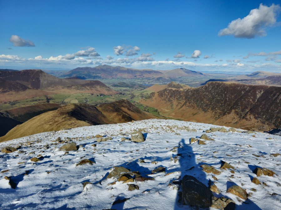
5. NY216165: From the summit, head south-south-west but curve gently south then southeast on the old fence line to the finely-perched cairn marking the top of Dale Head.

The finely-poised cairn of Dale Head, with Skiddaw beyond.
Credit: Norman Hadley
6. NY223153: Descend eastwards to Dalehead Tarn. Listen out for frogs early in the year. Cross the beck then pick a rising track on a north-north-east bearing up to High Spy. Once you’re ensconced on this ridge the navigation is straightforward down to Maiden Moor then veering north-east down to Hause Gate before the final short climb to Catbells. In fine weather, the views along here are among the loveliest in Lakeland. If you’ve never seen Catbells from the back, it’s a revelation: a little Sugar Loaf foregrounding the bulk of Skiddaw.
Catbells’ tiny turret guarding the end of the High Spy-Maiden Moor ridge.
Credit: Norman Hadley
7. NY244201: Just after the steep, rocky descent from Catbells’ main summit, a slanting path through the bracken (not shown on OS maps) should be visible on your left. This will take you down to join a substantial bridleway taking you to the settlement of Skelgill.

Looking down from Catbells to the Vale of Keswick. The slanting descent can be seen in the lower left corner.
Credit: Norman Hadley
8. NY242208: Zigzag through Skelgill and head down the quiet lane back to the start.
Further information
PUBLIC TRANSPORT: The 77 or 77A bus services will get you to the Swinside Green Road (about a kilometre shy of Stair) from Keswick in British Summer Time.
TOURIST INFORMATION: Visit Lake District, 01539 822222
NEAREST YHA: Hawse End Bunkhouse
Discover more walks in the Lake District as mapped by The Great Outdoors’ expert contributors.


