
Ian Battersby heeds the lessons of history and hurries to make the most of Mardale Head with a walk to High Street and Thornthwaite Crag.
An inconsequential lane meanders through walled pastures south of Penrith, easing into the minor foothills of north-east Lakeland, and arriving at a valley flooded by Haweswater Reservoir to service Manchester 100 miles away. The head of the dale is crammed with craggy corries that rise over 800m at High Street. Historical narratives abound. Glaciers shaped the valley and man came to hill and dale after their retreat; High Street is so named because it transported Romans between strongholds at Ambleside and Brougham before they withdrew; and smallholders sought a living from their hamlet at the foot of this ring of mountains, but when the Manchester Corporation flooded their homes they also took flight.
Now the valley is occupied by outdoor leisure lovers. Among the steep crags there are two tarns to enjoy, and above them extensive panoramas. Let’s hope it will be eons before we too must let it go.
High Street and Thornthwaite Crag: route description
START/FINISH: Car Park at the head of Haweswater; NY470107 | MAPS: OS Explorer OL5 (1:25k), OS Landranger 90 (1:50k), Harvey British Mountain Map Lake District (1:40k) | DISTANCE: 10.2km / 6.3 miles | ASCENT: 670m / 2,200ft | DURATION: 4 hours
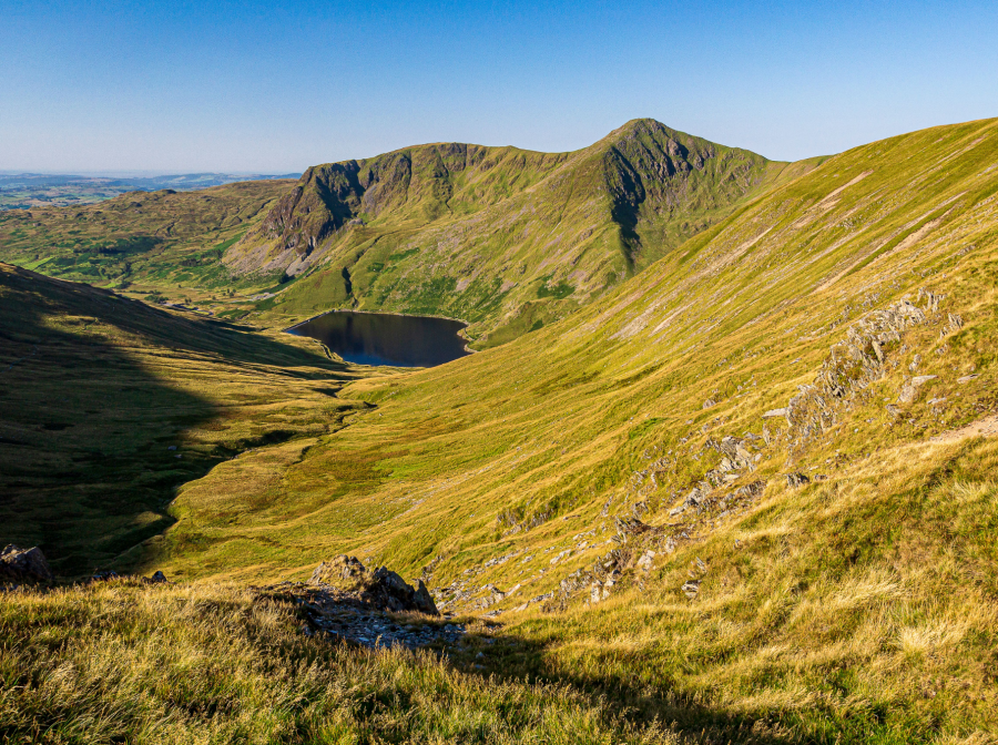
1. NY470107: Go through the gate at the end of the car park turning circle and follow the track by the wall to the wall corner where the track splits into two bridleways and a footpath. Take the middle bridleway south-west, climbing up through hillocks of grass and occasional heather that border the track that runs parallel with Mardale Beck and closes in on Small Water Beck to the right.
Mardale Head from Small Water Beck.
Credit: Ian Battersby
Verdant crags circle through sky above, crowding around the head of the valley. As the ground gets steeper the beck fills with cascades large and small until respite comes when the land eases into a steep sided hollow hiding Small Water. The tarn brings tranquillity after the turmoil of the beck. Cross the stream at the outlet to the tarn and follow the bridleway west along the north shore, passing by stone shelters.
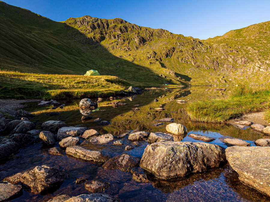
Campers at Small Water.
Credit: Ian Battersby
Now the path takes the corrie at an easy tangent, heading south-west and rising to 550m before climbing south straight to the top of Nan Bield Pass. Views extend past Small Water and Haweswater to the lowlands beyond and to the south the diminutive Kentmere Reservoir nestles below the green crags of Ill Bell and Yoke.
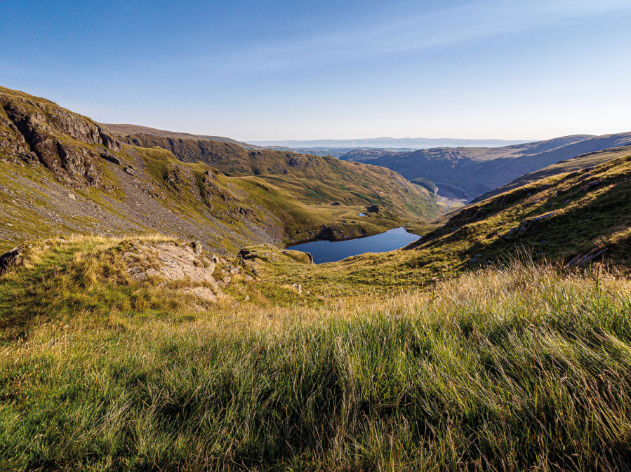
Small Water from Nan Bield Pass.
Credit: Ian Battersby
2. NY452096: Follow the ridge west, soon veering north-west and climbing more steeply to 720m where a minor path branches left, heading west to the southern side of the ridge with a view down to Kentmere Common. The path contours north-west, gradually bending around to the west as it traverses around the head of the Kentmere valley to meet a junction of bridleways. Take the bridleway heading south-west then west around the head of the Hayeswater valley, then climbing gently to Thornthwaite Beacon, a remarkable 4m stone column on the summit of Thornthwaite Crag.
Ill Bell from Thornthwaite Crag beacon.
Credit: Ian Battersby
From here the massive Helvellyn range reaches north towards Blencathra and Skiddaw, while further west the Sca Fell range is in full profile and leading south to the southern fells. Windermere shines under sunlight, its long length leading the eye out to the distant haze of Morecambe Bay.
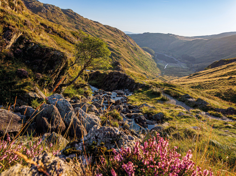
3. NY431100: Retrace steps east then north-east to the bridleway junction. Follow the bridleway north, along the western edge that accelerates down into Hayeswater Gill. High street is a wide and grassy ridge, and hosted gatherings from neighbouring valleys in times gone past, hence its supplementary name – Racecourse Hill. Leave the bridleway at your convenience and cross east to the summit marked by a trig point, then continue north-east to the eastern rim of High Street. Follow the edge north-east to a prominent point that juts out towards the Riggindale Crag ridge.
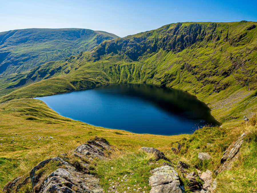
Harter Fell and Blea Water from Long Stile.
Credit: Ian Battersby
4. NY443113: Riggindale Crag plummets eastwards from High Street along a beautiful ridge that delivers arguable the most dramatic views of the route, with the dark crags of Harter Fell and Blea Water skulking in shadow, having seen the last of their meagre share of direct sun. The usual route climbs over Rough Crag before descending, but misses the jewel of Blea Water. Instead follow a tiny path south-east down to the small dam at the outlet of a cool and clear tarn.
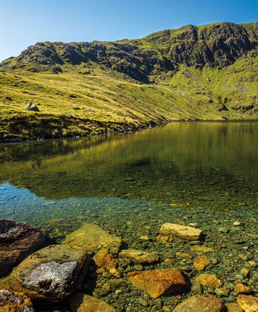
Blea Water Crag from Blea Water.
Credit: Ian Battersby
5. NY452108: The path leads north-east, but soon turns east, dropping through bracken into a grassy valley, and back to Haweswater. Drop gently, heading east south-east to join Mardale Beck, then follow the beck north-east to a footbridge at the head of Haweswater. Cross the bridge heading south-east to the wall corner with the car park down to the left.
Further information
PUBLIC TRANSPORT: None to start
TOURIST INFORMATION: Keswick TIC, 0845 9010845
Discover more walks in the Lake District as mapped by The Great Outdoors’ expert contributors.


