
Despite the ascents, descents and re-ascents, James Forrest delights in a high-level loop around beautiful Crummock Water, ticking off four Wainwrights on his way.
Crummock Water has always lived in the shadow of its neighbour Buttermere. The prettier, more popular and more photogenic of the two lakes, Buttermere is forever lavished with praise and attention, while poor old Crummock Water goes somewhat unnoticed and unloved. But this is an injustice. Flanked by the shapely outline of Mellbreak to the west and the domineering bulk of Grasmoor to the east, Crummock Water is a place of beauty and intriguing dichotomy. With typical wordsmith flair, Alfred Wainwright described Crummock Water as “gay with life and colour” on its eastern shore, but a place “where loneliness, solitude and silence prevail” to the west.
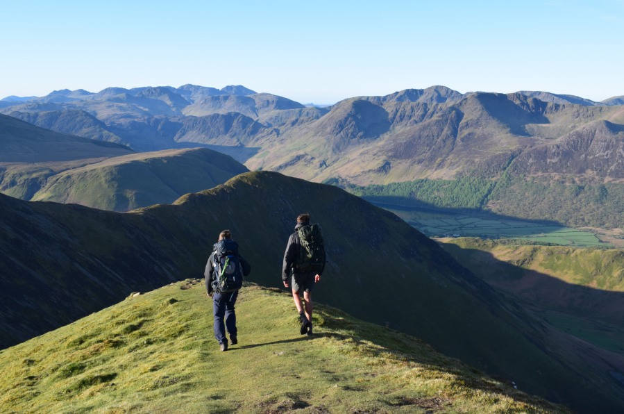
The common way to explore Crummock Water is around its low-level shore paths, but I’ve always favoured high-level horseshoe hikes. Such an established route doesn’t exist around Crummock Water – due to the necessity for so many ups and downs – but I’ve taken it upon myself to create one. Why not? From Loweswater, my route climbs the dramatic north ridge of Mellbreak before looping along the shoreline for lunch in Buttermere. The afternoon is spent ascending Whiteless Pike, quickly bagging Wandope, standing atop the mighty Grasmoor, and completing the circuit via Gasgale Gill and Lanthwaite Wood.
Crummock Water loop: route guide
START/FINISH: The very small layby (space for a few cars only) at Church Bridge in Loweswater (GR: NY140208) | MAPS: OS Explorer OL04 (1:25k), OS Landranger 89 (1:50k), Harvey Maps UltraMap XT40 Lake District North (1:40k) | DISTANCE: 21.7km / 13.5 miles | ASCENT: 1,372m / 4,501ft | DURATION: 8 hours
1. NY140208: Take the road south and pass Kirkgate Farm. Continue on a walled lane through fields and arrive at a gate. Ignore the bridleway veering right and instead head straight up through trees to open fellside. At the scree ahead take an obvious rake, which zig-zags uphill on steep, eroded ground. This section is somewhat confusing, with multiple lines created by walkers. Stick to the line of a prominent scree chute, heading generally south-east, and arrive at the nose of the ridge. Here a clearer path appears, ascending south to emerge at the twin cairns of Mellbreak’s north top.
2. NY143195: Continue south into the depression, sticking to a path over flat ground, before veering left and climbing briefly to Mellbreak’s south top. Descend a good but steep path over grassy slopes to reach a fence to the south of Scale Knott. Cross the fence and take a trod south-west, trending right to avoid steeper ground and arrive at the bridleway alongside Black Beck.
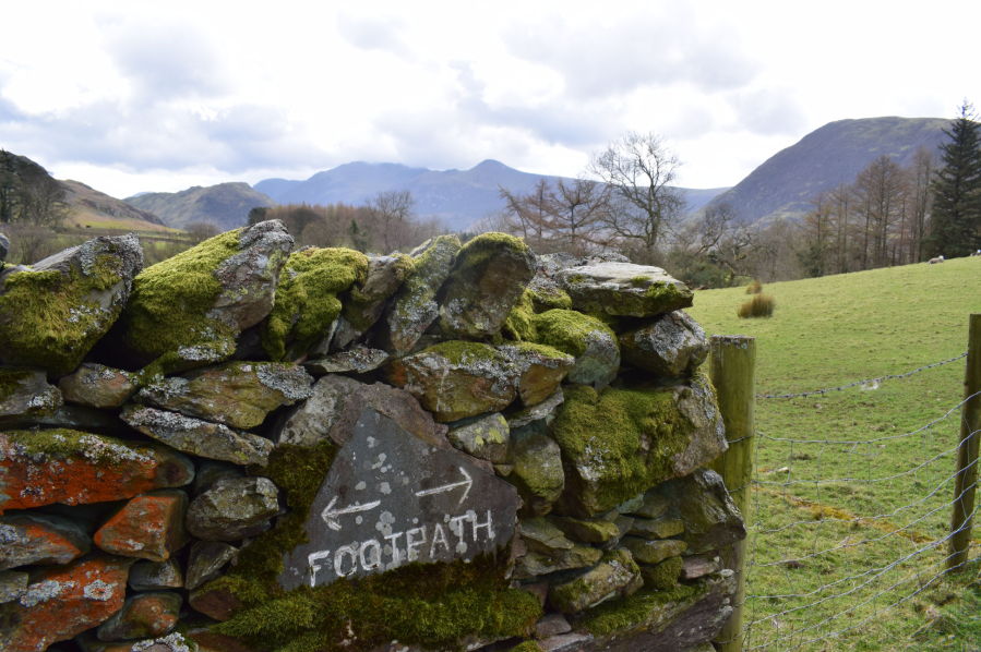
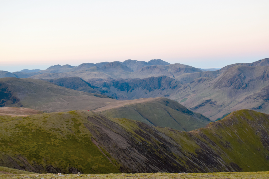
Footpath sign near Crummock Water.
Credit: James Forrest
3. NY148173: Turn left onto the bridleway. Veer left at a fork and descend east. Pass to the left of a footbridge and join a path continuing east alongside Scale Beck. Turn right over a footbridge and go through a gap in a wall. Go through a gate and cross another footbridge to emerge at the lakeshore. Head south-east, crossing a series of footbridges. Beyond the southern tip of the lake, follow Buttermere Dubs, turn left across Scale Bridge, and head north-east on a lane through fields. Go through a kissing gate, turn left and enter Buttermere village.
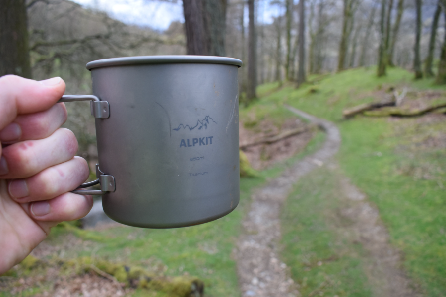
Taking a break for a brew in Ghyll Wood near Buttermere.
Credit: James Forrest
4. NY175169: Next to Bridge Hotel, turn left on the road before immediately turning right through a gate into Ghyll Wood, next to a National Trust sign. Head north-east on a path meandering above Mill Beck. Climb steps to cross a wall and emerge onto open fellside. Turn left momentarily and then right up a narrow trod heading north. Reach a wider path and turn right, ascending to merge with the main footpath. Climb steadily to the west of Whiteless Breast and continue north as the terrain steepens. Press on over intermittent stone pitching, exposed bedrock and a final pull on loose scree to summit Whiteless Pike.
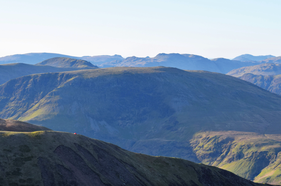
Solitary wild camper on Wandope.
Credit: James Forrest
5. NY180189: Descend briefly before climbing steeply north-north-east up Whiteless Edge. Beyond the ridge’s nose, veer right at two forks and head east for Wandope’s summit. Turn left and head north along the cliffs above Addacomb Hole. Turn left on a faint trod that cuts a corner to join a stony track. Turn left and climb steeply to a prominent cairn. Continue west over the plateau top to summit Grasmoor. Head east on a trod above Dove Crags. Veer left and descend steeply north-east to rejoin a good footpath. Turn left, cross a stream and arrive at Coledale Hause.
Views from Grasmoor.
Credit: James Forrest
6. NY188211: At a large cairn, turn left and descend west along Gasgale Gill, taking care where the path is eroded and unstable. After passing around a rock face, veer right to take a higher path traversing above Liza Beck. Scramble briefly over a rocky outcrop and contour around the base of Whin Ben. Drop down left to cross a footbridge. Head south-west to the road. Climb the steps over a wall, take the lane through Lanthwaite Green Farm, go through two gates and arrive at Lanthwaite Wood. Turn left on a track that swings north-west and arrives at a car park. Turn left on the road, cross Scalehill Bridge, and head south-west back into Loweswater.
Further information
PUBLIC TRANSPORT: There are no bus services direct to the start of the walk, but the 77/77A Honister Rambler connects Keswick with Buttermere (summer timetable only).
TOURIST INFORMATION: www.visitlakedistrict.com
NEAREST YHA: YHA Buttermere


