
Roger Butler finds moorland heaven on the border of Somerset and Devon along Cheriton Ridge and the Chains.
The lonely and wild moors at the heart of Exmoor are known as The Chains and their soggy reputation has been gained from a combination of heavy rainfall and poor drainage. A 19th century landowner once poured (that’s probably the right word to use) his fortune into ambitious plans to reclaim these hillsides but, thankfully, not much changed and, today you can wander – and sometimes wallow – in every direction along this county borderland. Cheriton Ridge and the Chains extend over a series of high tussock-ridden plateaux and their pale brown horizons often resemble giant sheets of cardboard.
But in August 1952 these moors were quite simply unable to hold any more water and the consequent liquid eruption crashed northwards through steep wooded ravines to wreak devastation down by the coast at Lynmouth. Floods would have tumbled along a twisting river known as Hoaroak Water, but on a fine dry sunny day this snake-like valley is one of the highlights of a long but straightforward upland circuit.
Cheriton Ridge & the Chains: route description
Start/Finish: Lay-by to east of Goat Gill Bridge on the B3358 near Simonsbath (GR: SS724403) | Maps: OS Explorer, 1:25,000, Sheet OL9 – Exmoor | Distance: 20.5km / 13 miles | Ascent: 520m / 1700 feet | Duration: 9 hours
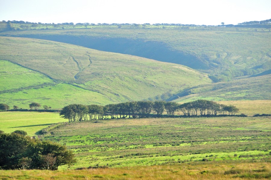
1. SS724403: From the parking lay-by on the B3358 walk west along the road to Goat Hill Bridge. Go through the gate on R and walk up the track towards an isolated outdoor centre. Fork L at a fingerpost, just before the buildings, pass a wind turbine on R and continue north on a path up a shallow valley, with the infant River Barle on L. Go through a gate onto Open Access land and keep ahead for 800m to a gate by the dam at Pinkery Pond. No one is quite sure why this small artificial lake was created here – some say it provided the water for a bizarre contour canal which was built as part of agricultural improvements.
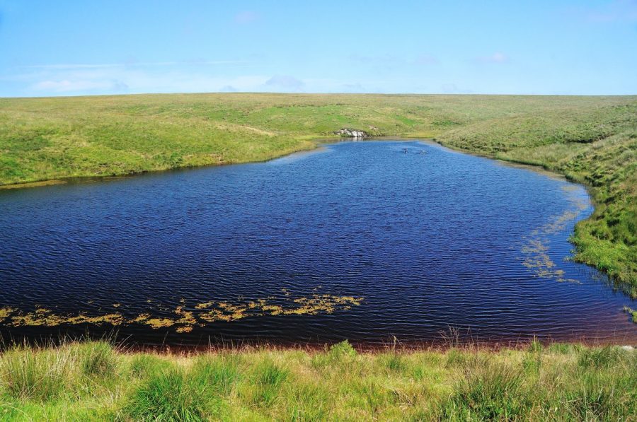
High up on the Chains, man-made Pinkery Pond may have been built to supply a strange upland canal.
Credit: Roger Butler
2. SS723422: Turn L along the old dam, go through a gate after 325m and bear R, over flat terrain, on a grass track to a junction of boundaries, including hedge banks, at Woodbarrow Gate. Follow the fingerpost pointing N to Saddle Gate and continue downhill to walk bang along the border of Somerset and Devon. Go through a gate near a clump of beech trees and continue downhill on a track, now in Devon, across Thornworthy Little Common, to the house at Shallowford.
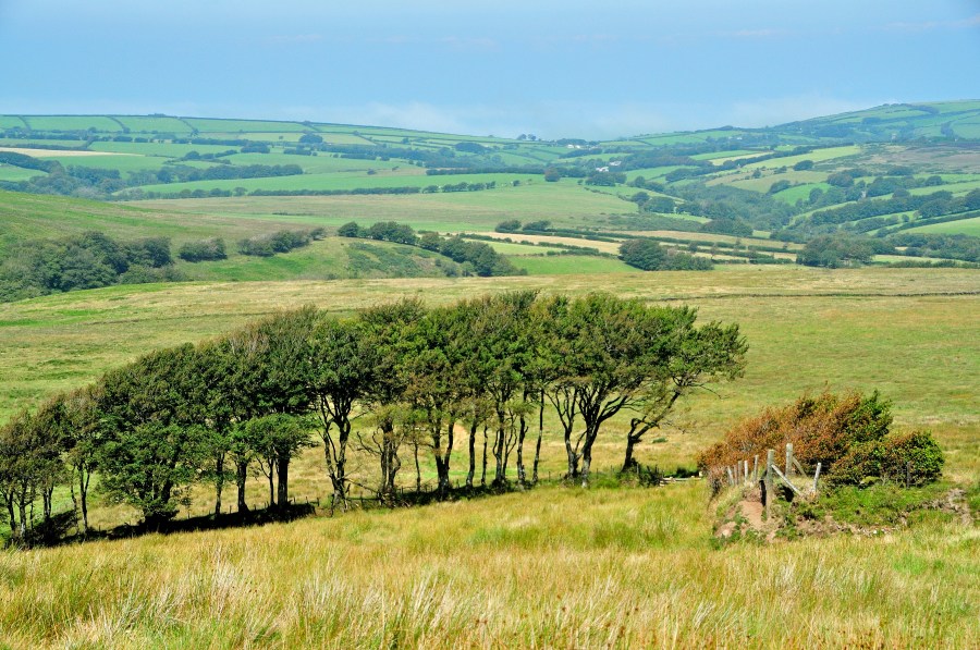
View north looking towards the Devon coast from Saddle Gate.
Credit: Roger Butler
3. SS714449: Turn R here on a grass path over Ilkerton Ridge and after 950m head towards a gate by a white house. Take the track downhill at North Furzehill, cross the bridge and continue on the lane, initially uphill and past an extensive garden. The lane bends R – continue ahead to a sharp L bend after 1.3km.

View north along the valley of the Hoaroak Water with Furzehill Common on the left.
Credit: Roger Butler
4. SS722462: Go R on a bridleway, through gates, and keep ahead at a path junction after 300m to descend towards a rough wooded track to a bridge over Hoaroak Water. Continue steeply uphill to the hamlet of Cheriton, go R on the lane and bear R on a track after 100m.
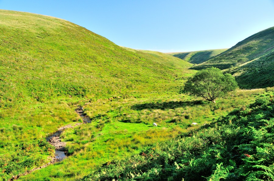
Hoaroak Water enters a beautiful narrow valley which cuts south into the moors known as the Chains.
Credit: Roger Butler
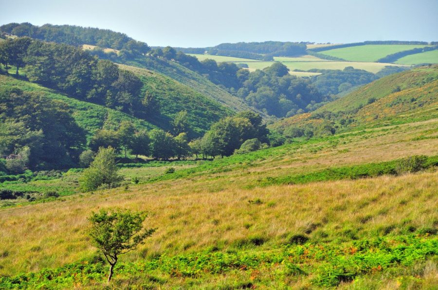
5. SS737463: A gate leads to the long broad spur of Cheriton Ridge, where you’re back on Open Access land. Walk ahead (now following the line of the Two Moors Way) for 2km, then bear R, roughly along the 350m contour, to go through a gate above the river. You’re now back in Somerset. Turn R, cross the footbridge and climb up to a good path. Turn L along the twisting valley, around spurs and past a sheepfold on R by the junction with Long Chains Combe. Follow the path/track up towards the narrowing head of the valley, with fine views back down towards Cheriton and beyond.

View south from the crest of the Chains looking to the moors beyond the River Barle.
Credit: Roger Butler
6. SS751415: After 2km, as the path levels onto the plateau known as The Chains, go a through gate close to the source of the River Exe. Turn R on the track to the next gate and keep ahead along the open ridge, with fence on R. Pass through two more gates to reach a fingerpost/gate, near the trig pillar at Chains Barrow (487m). Go through the small gate on R to access the high point, set on an ancient tumulus mound – though a sign warns ‘Caution: deep bogs’ these are some distance to the north.
Looking south down Goat Hill on the descent from Chains Barrow, with Little Vintcombe in the background.
Credit: Roger Butler
7. SS732417: Leave the ridge and descend due S for 1.75km on a permissive bridleway, across the indistinct line of the bizarre canal (SS730411) and through a couple of gates. Continue downhill to a gate at the road and turn R for 500m to return to start.
Further information
Public Transport: Nearest station Barnstaple – but no buses to start of walk
Tourist Information: Lynmouth National Park Centre, 01598 752509
Discover more walking routes in the South of England as mapped by The Great Outdoors’ expert contributors.


