
Stefan Durkacz spends twenty-four hours in the Cairngorms foothills exploring the twin Corbetts of Carn Liath and Culardoch.
The fringes of the high Cairngorms are easy to overlook. This is a shame because there’s a lot of scope for exploration in the swathes of hill country around the main massif. The perspectives on the high tops afforded by the lower summits that surround them are often dramatic and unusual. The twin Corbetts of Carn Liath and Culardoch set between Deeside to the south and the high plateaux of Beinn a’ Bhuird and Ben Avon to the north exemplify this.
Carn Liath especially is a great vantage point for Ben Avon’s undulating plateau and its weird granite tors. Culardoch’s summit encompasses the eastern hinterlands of the Cairngorms, from lonely Loch Builg to the north around to the great outlier of Morven (872m) to the east overlooking the rich farming country of Aberdeenshire. South across the forests of Deeside, Lochnagar and the White Mounth dominate the scene. It’s possible to climb Carn Liath and Culardoch more quickly and directly than the route described here, but the circuitous route via Gleann an t-Slugain works well for a long, varied summer tramp or even a night out. Some nice pitches can be found by the uppermost reaches of the River Gairn.
Carn Liath and Culardoch: route description
Start/Finish: Car park at Keiloch just off A93 E of Invercauld Bridge. Charge payable. (GR: NO188913)| Maps: OS 1:50,000 Landranger sheet 43 Braemar & Blair Atholl; OS 1:25,000 Explorer OL58 Braemar, Tomintoul & Glen Avon | Distance: 29km/18 miles | Ascent: 1055m/3461ft | Duration: 11-12 hours or overnight
1. NO188913: Leave the car park and bear L, heading NW on a track past a saw mill and Keiloch buildings, and skirting the policies of Invercauld House. After a mile or so the track passes behind the ‘big house’ itself where the right of way to Tomintoul climbs uphill through the forest on the R, which you’ll come down on your return. Keep on the main track westwards towards Alltdourie hamlet.
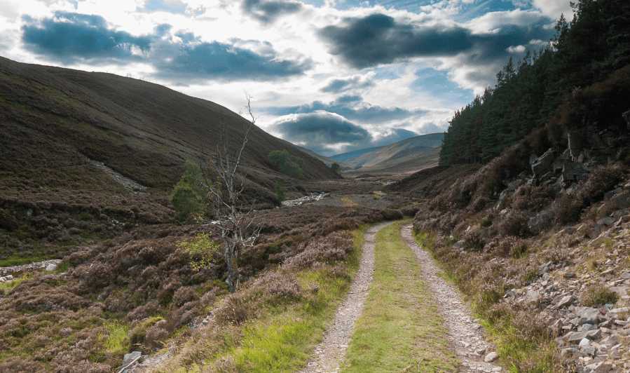
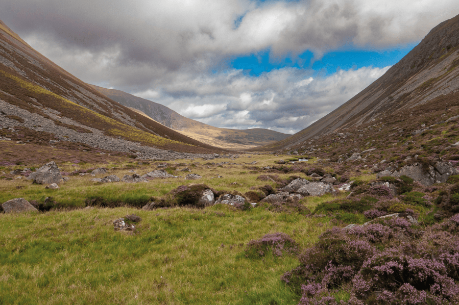
The long walk up Gleann an t-Slugain.
Credit: Stefan Durkacz
2. NO166932: Just past the houses at Alltdourie, turn L. Some micro-navigation is needed to stay on course as tracks branch off to L and R. Keep heading generally WNW. About 500 metres beyond Alltdourie at grid ref. NO 161 933 ignore a track that branches L. Instead, keep on the main track through the pine woods, eventually running along the N side of the Allt an t-Slugain. Catch a distant glimpse ahead of the rocky fin of A’Chìoch on Beinn a’ Bhuird. Leaving the woods behind, the way continues into the ever-narrowing Gleann an t-Slugain, dwindling from a track to a path and eventually squeezing through a rocky slot by the strange breeze-block remains of Slugain Lodge.
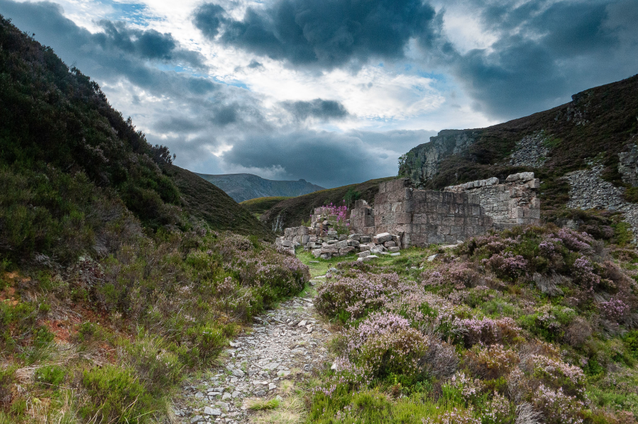
The ruins of Slugain Lodge with A’ Chioch of Beinn a’ Bhuird ahead.
Credit: Stefan Durkacz
Emerge onto a high moor, following the well-made path as it turns N into upper Glen Quoich between Beinn a’ Bhuird and Ben Avon. A fine view of the lower glen with its venerable Scots pine woods opens up westwards. A path branches L down to the Quoich, but unless you want a detour into the woods to find a campsite, keep on the northbound path.
Looking back to distant Lochnagar from upper Gleann an t-Slugain.
Credit: Stefan Durkacz
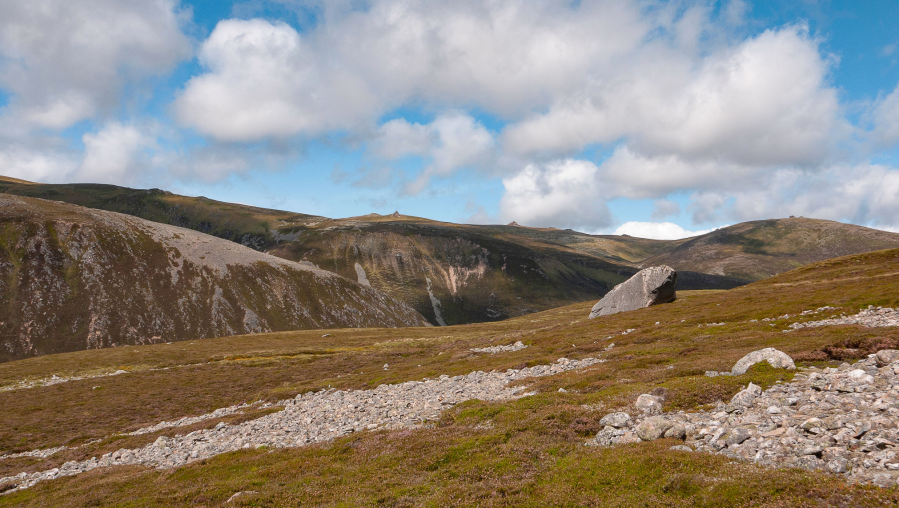
3. NO117967: Turn R on to a rougher, less-frequented path that climbs E across a peaty watershed to the headwaters of the River Gairn. The path descends gradually to meet the burn, where it gets a little lost.
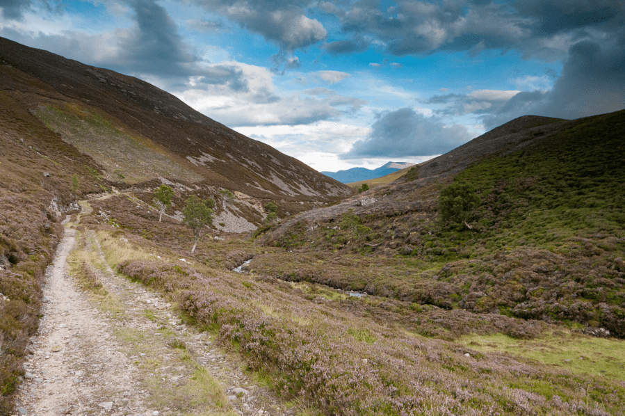
Looking east to upper Glen Gairn en route from Glen Quoich.
Credit: Stefan Durkacz
4. NO141977: Cross the infant Gairn, which flows NE between the steep, craggy and scree-cloaked hillsides of Creag an Dail Mhòr and Creag an Dail Bheag. Immediately climb E up heathery slopes, keeping well S of the crags, to reach the summit of Carn Liath (863m). The climb is enlivened by an engrossing close-up view of Ben Avon’s tor-studded plateau, whilst from the top the view S over Deeside to Lochnagar and the White Mounth is equally captivating. Carn Liath’s summit is somewhat rough with much exposed granite.
The tors of Ben Avon from Carn Liath.
Credit: Stefan Durkacz
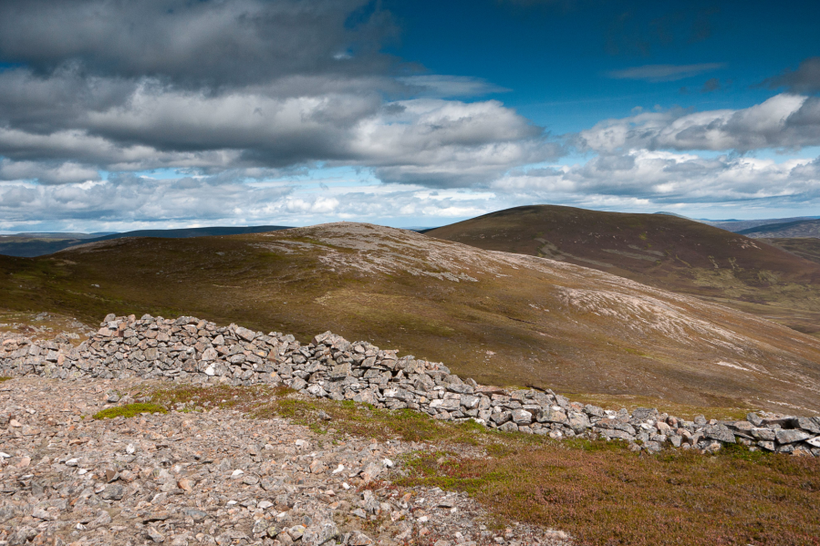
5. NO157981: Continue SE then E across Carn Liath’s east top (861m). Note the drystone wall that runs over the crest of the hill, something of a rarity in the Highlands. Descend E to the Bealach Dearg where the right of way between Deeside and Tomintoul crosses between Carn Liath and Culardoch. Follow the track NE uphill then along a broad, flat shoulder towards the heathery dome of Culardoch.
Lochnagar and the White Mounth from Culardoch.
Credit: Stefan Durkacz
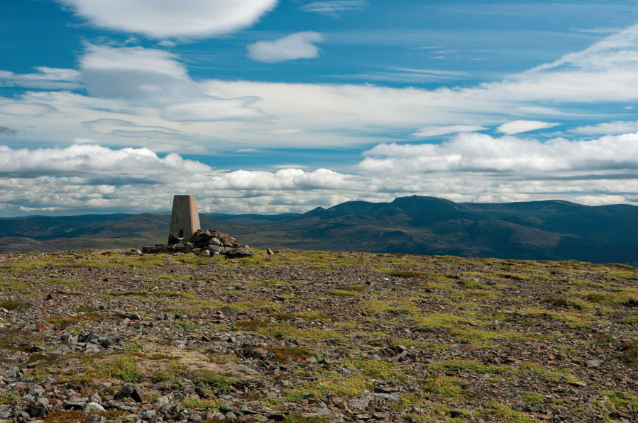
6. NO186988: After about 750 metres the track bears sharply L to descend to Glen Gairn. Leave it here and climb E to reach the broad summit of Culardoch (900m), marked with a trig point. Pause to admire the panoramic views – look for the lonely blue jewel of Loch Builg cradled in the hills to the north. Descend SE at first with Lochnagar filling the view ahead across the woods of Deeside. As the descent steepens, bear S then SW. With any luck you’ll pick up a line of grouse butts that can be followed down to a track.
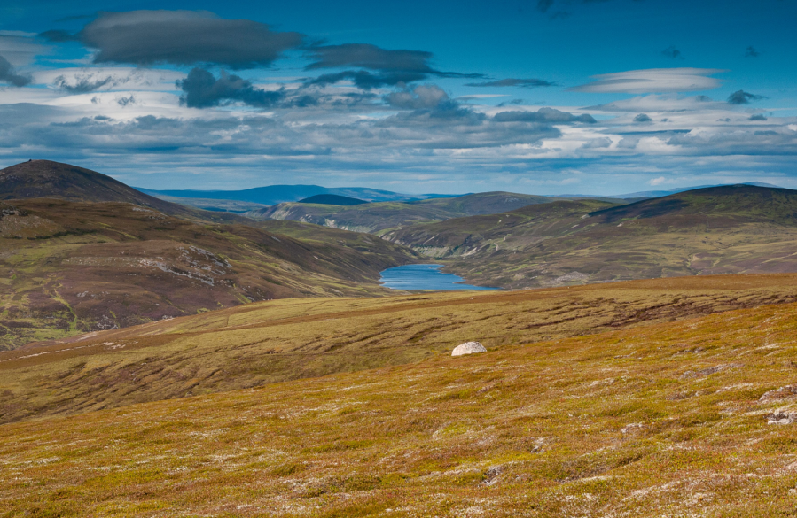
Looking north to Loch Builg from Culardoch.
Credit: Stefan Durkacz
7. NO191972: Turn R and follow the track across the Stable Burn, ignoring another track that branches off to the L. Bear SE then E around the base of Tom na h-Eilrig to meet the Deeside-Tomintoul track.
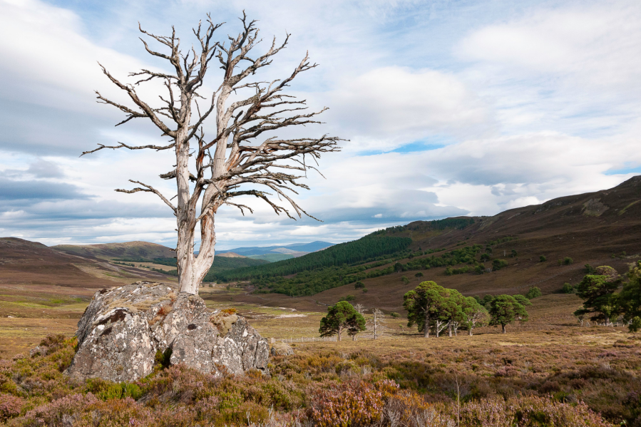
Geriatric Scots pines on the track south to Invercauld.
Credit: Stefan Durkacz
8. NO178962: Turn L and follow the old right of way S. After about a mile the track forks; take the left hand fork down into the woods towards Invercauld House. Lower down, breaks in the trees offer fine views westwards up the strath towards Braemar.
9. NO175924: Re-join the outward route close to Invercauld House, turning L and following the track back to Keiloch and the start.
Further information
Public transport: Stagecoach service 201 (Aberdeen to Braemar) stops at Invercauld Bridge.
Tourist information: Ballater VisitScotland iCentre (Tel: 01339 755306)
Discover more walks in Scotland as mapped by The Great Outdoors’ expert contributors.


