
While The Cobbler commonly attracts the plaudits (and crowds), James Forrest prefers Ben Vorlich for his Arrochar Alps adventure.
Complex, steep and dramatic, the Arrochar Alps are a compact group of peaks in the Loch Lomond and The Trossachs National Park. There are four Munros here – Ben Vorlich, Ben Vane, Beinn Narnain and Beinn Ime – but it is a Corbett that steals the limelight. The Cobbler is a weirdly-shaped, craggy-topped mountain that entices throngs of visitors, particularly weekend hikers from Glasgow and its surrounding suburbs. To dodge the crowds without compromising on the hillwalking experience, perhaps a better option is the simple but superlative ascent of Ben Vorlich to the east of Loch Sloy.
At 943m, Ben Vorlich (Mountain of the Bay) is small by Munro standards, but its steep-sided flanks still make for a lung-busting, calf-burning climb. Handfuls of Haribo will get you through the seemingly never-ending slog up Lag Dubh from the Loch Sloy access track, and once you top out onto the south-eastern ridge your efforts will be amply rewarded. The views across isle-dotted Loch Lomond – which stretches out sumptuously into the distance – will remedy even the achiest of muscles, and before you know it you’ll be eying up neighbouring Ben Vane (916m) across the valley. Maybe I’ve got the energy for another Arrochar Alps adventure tomorrow, after all?
Ben Vorlich: route description
START/FINISH: Inveruglas car park (G83 7DP) off the A82, to the north-east of the power station (NN322098) | MAPS: OS Explorer OL39 (1:25k), OS Landranger 56 (1:50k), Harvey British Mountain Map Southern Highlands (1:40k) | DISTANCE: 13.1km / 8.1 miles | ASCENT: 962m / 3,156ft | DURATION: 5 hours
1. NN322098: Exit Inveruglas car park, turn left on the A82 and pass the power station. Head south-west on a path running parallel to the road. Climb some steps, turn left through a vehicle barrier and turn right, continuing along the road. Just before a sharp left bend in the A82, turn right up a driveway, go through a gate next to a vehicle barrier and head under the railway bridge. Fork left on a shortcut path that bypasses the tarmac road’s wide switchback. Rejoin the road, which runs parallel to Inveruglas Water, and follow it west. Pass under electricity pylons and continue west, ignoring a turn-off to the right. At Coiregrogain, the road veers north-west to reach a junction marking the splitting of the main routes up Vane and Vorlich.
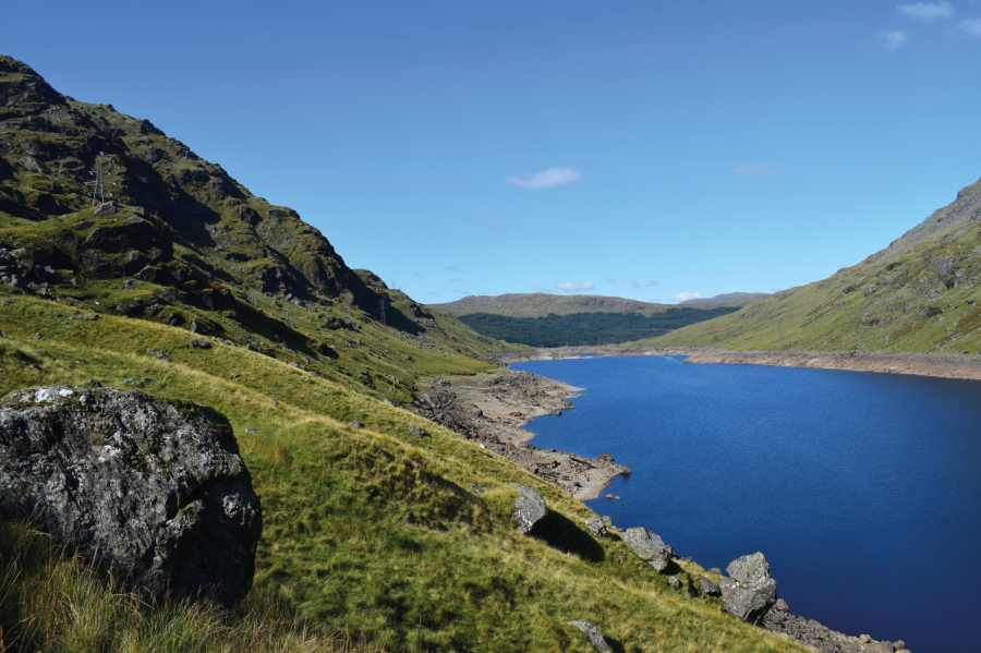
Views of Loch Sloy to the west of Ben Vorlich.
Credit: James Forrest
2. NN299095: Turn right and head north-north-west on the road towards the Loch Sloy dam. After 850m turn right on a stone-pitched path that climbs north-east. The path, which is clear underfoot and easy to follow, takes advantage of a gentler, grassier side to Ben Vorlich, away from craggier ground. The path is boggy in parts, crossing several small streams.
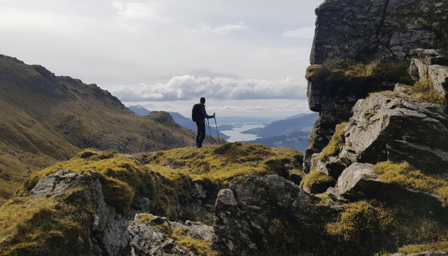
Views from the ascent of Ben Vorlich.
Credit: James Forrest
As it veers north, glorious views back to Loch Lomond come into play, and beyond the 800m contour line you gain the ridge. The most strenuous climbing is now over. Continue north over the airy ridgeline, ascending easily over undulating, rocky ground to Ben Vorlich’s trig pillar. Continue further north briefly to a cairn marking the true summit.
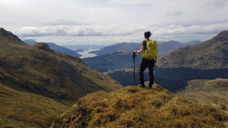
Views from the ascent of Ben Vorlich.
Credit: James Forrest
3. NN295124: It is possible to descend the craggy southern face of Ben Vorlich, but the way is steep and arduous. So the far more common approach is to simply re-trace your steps, descending the route of ascent. Head south-south-east on the well-trodden path, which serves up excellent views of isle-dotted Loch Lomond in the distance, before veering south and south-west steeply downhill. The path is stone-pitched in several places, but grassy and boggy in others. After what seems like a never-ending descent, arrive back at the dam’s service road.
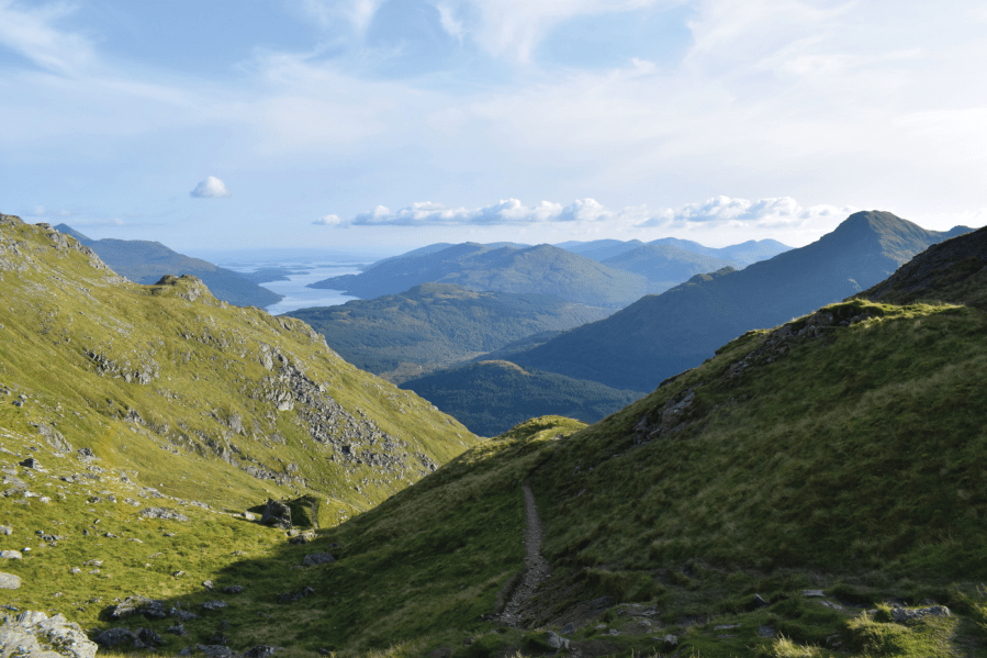
Views of a distant Loch Lomond from Ben Vorlich.
Credit: James Forrest
4. NN295103: Turn left and follow the road south-east for 850m to reach a prominent junction to the north of Coiregrogain and next to a bridge over Inveruglas Water. Fork left and head south-east and then east on the Cowal Way road, passing under pylons and next to various buildings related to the power station. Pass under the railway bridge and descend to the A82. Turn left and walk back to the car park.
Further information
PUBLIC TRANSPORT: By car take the A82 or A814, or for public transport take a ScotRail train from Glasgow to Arrochar & Tarbet, or a Scottish Citylink bus from Glasgow to Arrochar.
TOURIST INFORMATION: Visit Loch Lomond and the Trossachs, 01389 722600
Discover more walks in Scotland as mapped by The Great Outdoors’ expert contributors.


