

Do you have to travel to the far north of Scotland to experience ‘real’ wild places? James Forrest suggests the answer is no, as he battles a wonderfully rugged pathless descent of Ben Vane in the Arrochar Alps of the Southern Highlands.
Scotland is blessed with wild places. From the rugged grandeur of the Knoydart Peninsula to the farflung lands of Fisherfield, and from the trio of Torridonian leviathans to the forgotten backwaters of Assynt, you can truly escape in the Scottish hills. But the wildest, remotest places are mostly located in the far north of the Highlands, and for most people this means one thing – a mind-numbingly boring, exceptionally long drive. Assynt, for example, is a 12-hour drive from London and 9 hours from Birmingham. From Glasgow it’s still a whopping 5 hours. Perhaps there’s a better way?
For a taste of Scotland’s wildness, without such a long time in the car, the Arrochar Alps in the Loch Lomond and The Trossachs National Park are a good option – particularly if you take on this route. Complex, steep and dramatic with loads of rocky character, Ben Vane (915m) might only just be high enough for Munro status – and located only 1 hour from Glasgow – but at times if feels like you could be lost in the deepest, darkest depths of the Highlands. The views across isle-dotted Loch Lomond are superlative, and – best of all – the rough, pathless descent we’ve proposed delivers a genuine sense of Scottish adventure.
Ben Vane: route description
START/FINISH: Inveruglas car park (G83 7DP) off the A82, to the north-east of the power station (NN322098) | MAPS: OS Explorer OL39 (1:25k), OS Landranger 56 (1:50k), Harvey British Mountain Map Southern Highlands (1:40k) | DISTANCE: 13.7km / 8.5 miles | ASCENT: 928m / 3,045ft | DURATION: 5 hours
1. NN322098: Exit the Inveruglas car park, turn left on the A82 and pass the power station. Head south-west on a path running parallel to the road. Climb some steps, turn left through a vehicle barrier and turn right, continuing along the road. Just before a sharp left bend in the A82, turn right up a driveway, go through a gate next to a vehicle barrier and head under the railway bridge. Fork left on a shortcut path that bypasses the tarmac road’s wide switchback. Rejoin the road, which runs parallel to Inveruglas Water, and follow it west. Pass under electricity pylons and continue west, ignoring a turn-off to the right. At Coiregrogain, the road veers north-west to reach a junction marking the splitting of the main routes up Vane and Vorlich.
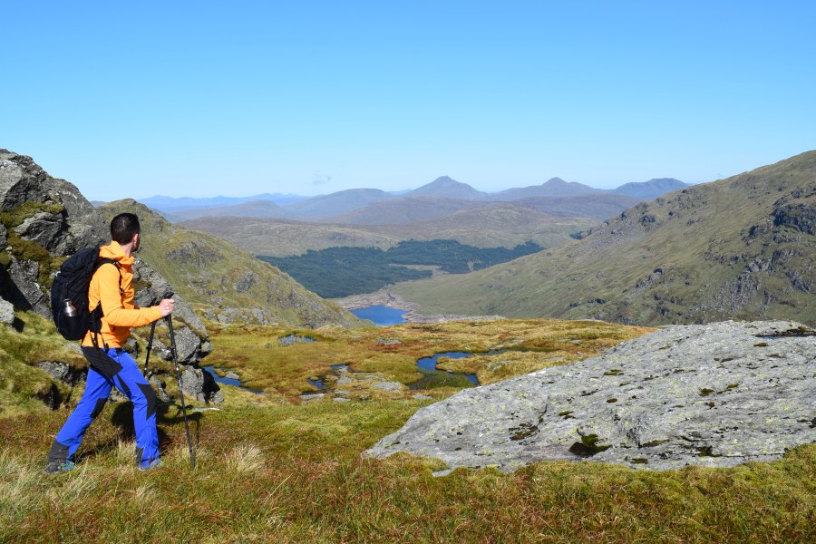
Views from the ascent of Ben Vane. Credit: James Forrest
2. NN299095: Turn left, cross a bridge over a stream and take the wide gravel track south-west for 500m. Shortly beyond a small bridge over a stream, turn right on a stone-pitched path that climbs to the left of a craggy, tree-dotted hump. Once above the craggy ground, head north-west over flat, grassy terrain to reach the base of Ben Vane.
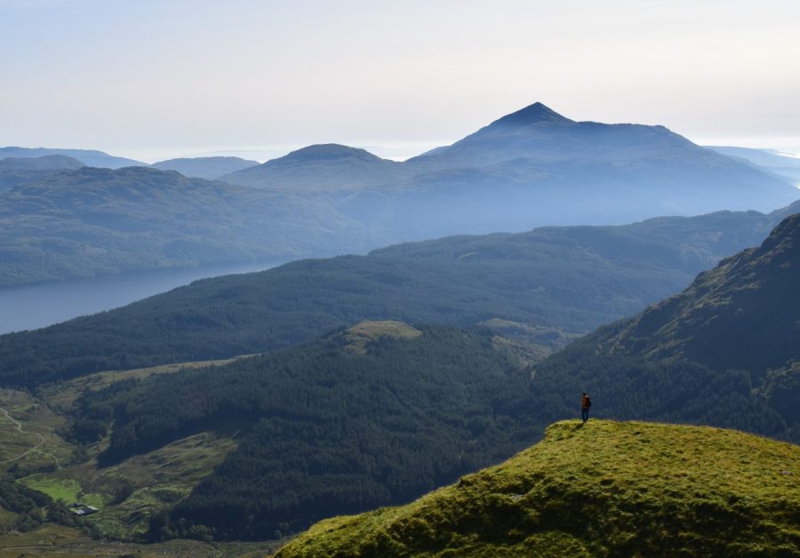
Views across Loch Lomond and The Trossachs National Park.
Credit: James Forrest
Ascend gently over sections of stone pitching and stepping stones over a bog to reach a junction with a faint, slightly indistinct path running south to north. Take the path ascending north-west up rather imposingly steep terrain. The intermittently stone-pitched path is clear underfoot and easy to follow. At the 500m contour line the path veers right below a sheer crag before ascending north-west, picking the best line through the craggy terrain. The ascent is long and steep, but there is no exposure and the rocky terrain is far from technical. Follow the good path west all the way to Ben Vane’s summit, with the final sections of ascent involving some easy scrambling.
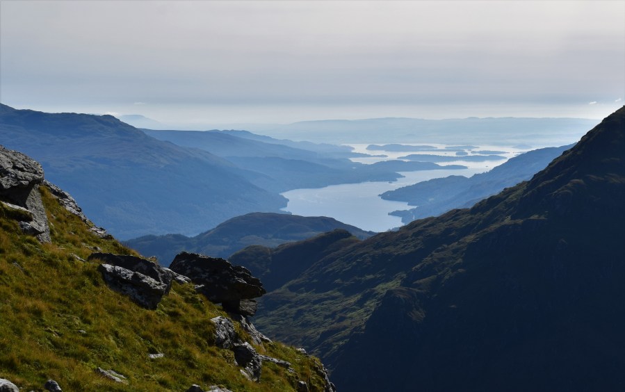
Look back at Loch Lomond from Ben Vane. Credit: James Forrest
3. NN277098: The easiest option here would be to descend the route of ascent. But a more interesting, yet challenging and pathless, choice is to create a circular by descending gently north-west. Initially the going is easy over a grassy spur. After about 400m, veer north-east down steep, grassy slopes, which provide relatively straightforward passage to flatter, boggier terrain. Follow a burn north-east and pass to the left of a lochan at NN279104. Continue alongside the burn as it veers north. From about the 650m contour line, the terrain steepens. Ahead are pathless and rugged slopes, where real caution should be taken. But the descent is not excessively difficult by Scottish standards. The simplest option is to head north-east following the same burn as before, sticking to its northern side, and taking your time to pick the best line.
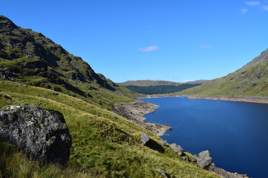
Looking across Loch Sloy near the end of the walk. Credit: James Forrest
4. NN283112: As you near the shores of Loch Sloy, pass under electricity pylons and veer right. Head south-east to the edge of the dam and pick up a 4×4 track. Go through a tunnel and follow what is now a road as it heads south before looping north and then north-east below the dam walls. Arrive at the base of Ben Vorlich’s south-western slopes. Turn right and head south-south-east on the road for 1.7km to reach the prominent junction to the north of Coiregrogain. From here you simply need to re-trace your steps. Head east on the Cowal Way road, following Inveruglas Water, and descend to the A82. Turn left and walk back to the car park.
Further information
PUBLIC TRANSPORT: By car take the A82 or A814, or for public transport take a ScotRail train from Glasgow to Arrochar & Tarbet, or a Scottish Citylink bus from Glasgow to Arrochar.
TOURIST INFORMATION: www.lochlomond-trossachs.org, 01389 722600
Discover more walks in Scotland as mapped by The Great Outdoors’ expert contributors.


