
Stefan Durkacz tackles the round of Loch Turret to summit Ben Chonzie on a route including a bonus Corbett, Auchnafree Hill, and the bold, rocky top of Carn Chòis.
Ben Chonzie, or Ben-y-Hone, isn’t quite the most southerly Munro but it’s certainly one of the most popular and accessible. Situated near the genteel Perthshire town of Crieff, it’s less than two hours from Edinburgh and Glasgow. For those bent on efficient list-ticking, it’s also one of the easiest Munros, a half-day, rather humdrum wander up and down the featureless broad back of the hill from Glen Lednock.
This hardly does it justice though. The approach from further east in Glen Turret shows Ben Chonzie in a far more flattering light, a proud, mysterious and inviting presence away at the head of the glen, often sporting a band of snow around the summit escarpment well into spring. It’s also less busy. The classic expedition is a round of upper Glen Turret, which includes a bonus Corbett, Auchnafree Hill, and the bold, rocky top of Carn Chòis. There’s a wonderful sense of space up here, and the views range from the southern lowlands to the heart of the southern Highlands, with the Ben Lawers range especially well-seen. At the end of this rugged, often boggy twelve-mile tramp you’ll be sure to have a far richer appreciation of this unpretentious tract of hill country.
Ben Chonzie: route description
Start/Finish: Car park by Loch Turret dam at the end of the single-track road from Hosh near Crieff (GR: NN821264) | Maps: OS 1:50,000 Landranger sheet 52 Pitlochry to Crieff; OS 1:25,000 Explorer sheets 379 Dunkeld, Aberfeldy & Glenalmond and OL47 Crieff, Comrie & Glen Artney | Distance: 19km/12 miles | Ascent: 1091m/3579ft | Duration: 8-10 hours
1. NN821264: Leave the car park and bear R past a vehicle barrier. Walk the short distance up the tarmacked road to a building by the east end of the dam. Turn L and walk across the dam on a firm track.
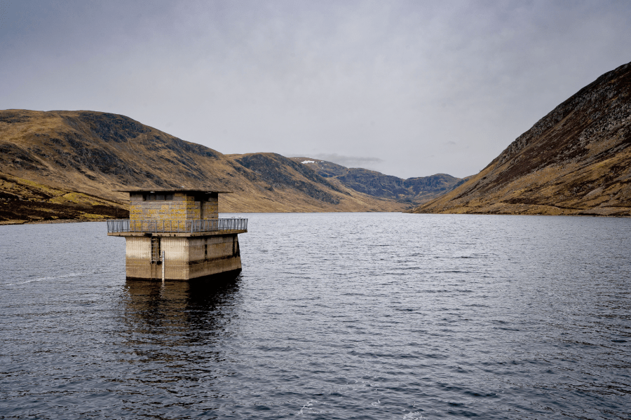
Loch Turret reservoir from the dam.
Credit: Stefan Durkacz
2. NN818265: Reaching the west end of the dam, climb a metal stile and turn R, following a rough track that climbs gradually across the slopes above Loch Turret. After about 1km the track peters out into a hikers’ path. Follow the sometimes indistinct path more directly uphill now across several small, tumbling burns into a high grassy corrie. Go through a gap (once a gate) in a dilapidated fence. Straight ahead are some minor crags; bear L up steep grass to avoid these. As you reach the crest turn R on a clearer path that crosses your way. Follow this for a short way as it skirts the top of steep crags and slopes overlooking Loch Turret. After a couple of hundred metres bear L and head NW for about 500 metres to reach the pointed summit of Carn Chòis (768m). The trig point is perched on a rock outcrop.
Carn Chòis and Ben Chonzie from the east.
Credit: Stefan Durkacz
3. NN792277: From Carn Chòis descend NW steeply at first, scrambling over big rocks, before picking up the boggy path across the moor towards the distant brow of Ben Chonzie. Dodge across the peat-hagged col (668m) NW of Carn Chòis. The path becomes drier and stonier as it crosses Meall Sèide (757m) and onto the long whaleback leading to Ben Chonzie. Follow the broad crest as it dog-legs NE where the popular route from Glen Lednock comes in from the east. Large cairns along the north edge line the final approach to the top of Ben Chonzie (931m) and its sprawling cairn and windbreak.
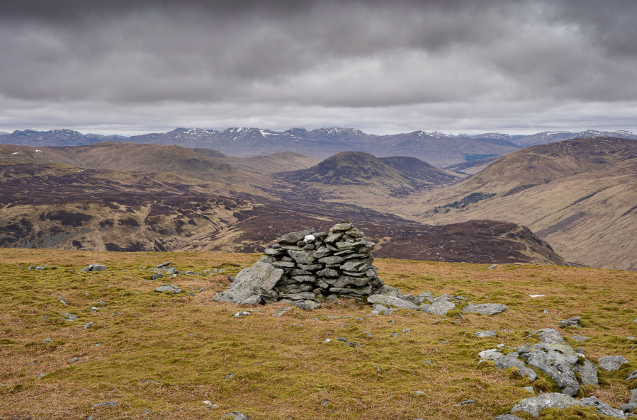
Looking north to the Lawers range from Ben Chonzie.
Credit: Stefan Durkacz
4. NN773309: Descend steeply NE for around 900 metres to reach the Bealach na Gaoith. Turn R and descend with care – the way is steep, eroded and often slippery, down a gully enclosed by crags on either side – but take time to enjoy the fine view down the length of Loch Turret. Lower down but the moss-covered debris from an ancient rockfall, stay on the path as it bears L and picks up a line of old wooden fenceposts.
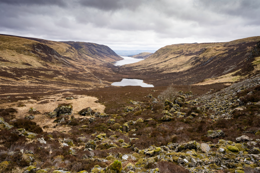
Lochan Uaine and Loch Turret from the descent into the head of Glen Turret.
Credit: Stefan Durkacz
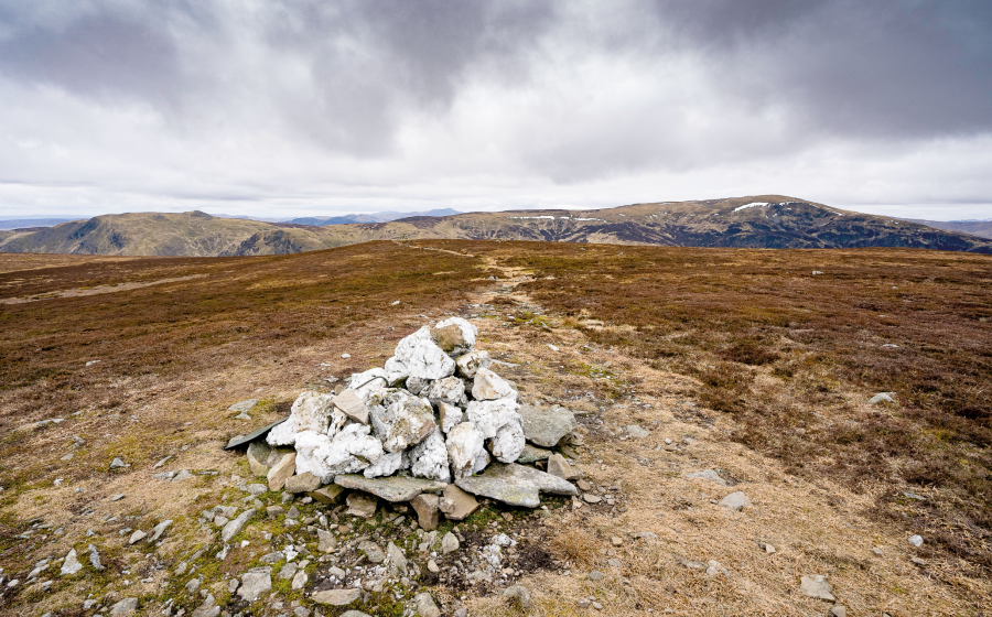
5. NN784315: Where the main path turns R towards Lochan Uaine, keep following the fenceposts towards the Mòine Bheag. Bear R away from the fenceposts at one point to avoid the worst of the peat hags. Climb the grassy, mossy hillside of A’Chairidh opposite, which appears to be home to a large colony of moles. Pass to the south of the summit then descend east below some outcrops to pick up the ruined fence again. It crosses just south of a saddle, worth the slight loss in height to avoid a maze of glutinous peat hags. Keep with the fence on the long heathery drag onto the bleak plateau of Auchnafree Hill. As you reach level ground, peel R away from the fenceposts to locate the cairn of white quartzite rocks, about 100 metres south of the fence, that marks the summit of this humblest of Corbetts.

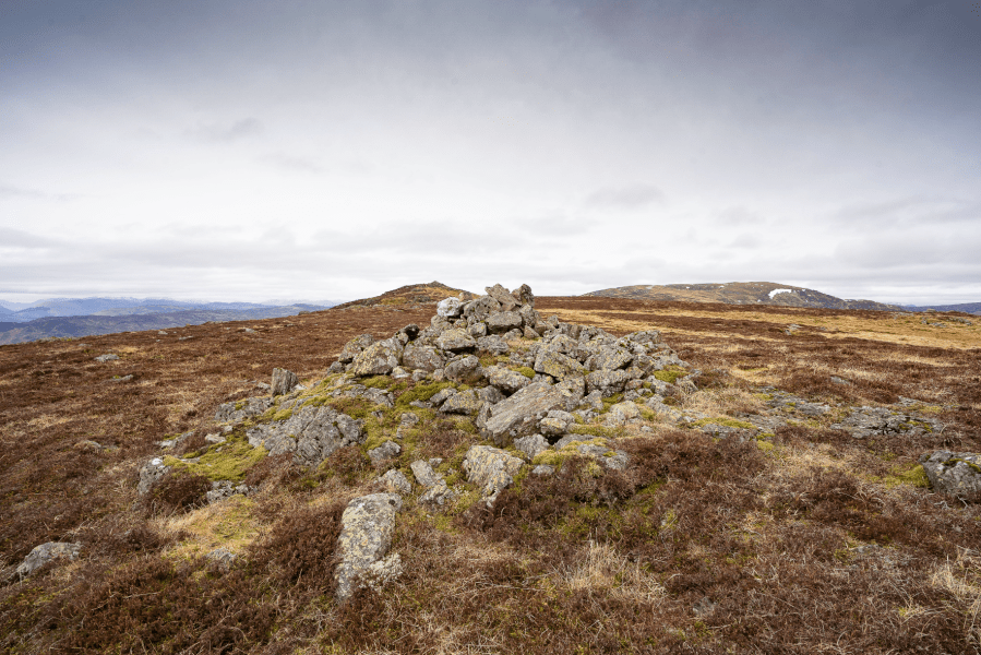
Carn Chois and Ben Chonzie from the summit of Auchnafree Hill.
Credit: Stefan Durkacz
6. NN804307: Continue south for 50 metres or so to reach a larger grey cairn. From here, a clear path heads southeast. Follow this through a boggy area to reach what looks like a vehicle turning area excavated in the peat. Follow Landrover tracks south and downhill from here. This eventually becomes a proper track that leads east to a junction.
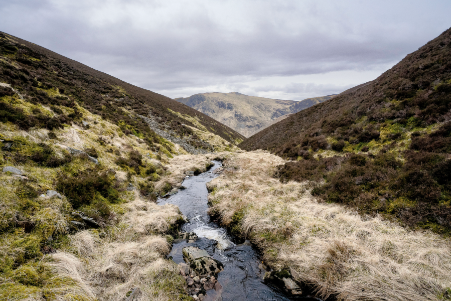
Descending to Loch Turret by the Allt Bhaltair.
Credit: Stefan Durkacz
7. NN812300: At the junction turn L. Follow the track as it contours around the headwaters of Gilbert’s Burn and over the shoulder of Tòn Eich to the ford across Allt Bhaltair (Walter’s Burn). Leave the track here, turning R and following the burn downstream. Although the little glen is narrow, the going is generally easy with the R bank of the burn giving the best going overall. After roughly 850 metres arrive at the head of a track, disused and rather overgrown by heather and bracken but still passable. Follow it downhill to join the track by Loch Turret via a couple of zigzags lower down. Turn L and follow the track for 2.5km to the dam and car park.
Further information
Public transport: None to start
Tourist information: Perth VisitScotland iCentre (Tel: 01738 450600)
Discover more walks in Scoltand as mapped by The Great Outdoors’ expert contributors.


