
Despite being perennially overshadowed by its loftier neighbour Arenig Fawr, James Forrest discovers intriguing history – and excellent rugged walking – on Arenig Fach.
Pudding-shaped Arenig Fach (689m) appears dull and boring from the south, overshadowed by its loftier brother Arenig Fawr (854m). But approach it from the north-east over wild, remote land and the mountain rewards you with craggy cliffs plunging into the hidden waters of Llyn Arenig Fach and a delightful ridge arrowing to the summit.
The Arenigs range has some intriguing history too. Arenig Fawr was the inspiration for the so-called Arenig School of artists in the 1910s, a trio of painters led by James Dickson Innes who achieved a “a genuine triumph for British modernism”, as the Guardian puts it. Fawr’s summit also has a poignant memorial plaque, paying tribute to the eight US airmen who died when their B17 Flying Fortress bomber crashed into the mountain during a training flight in 1943.
Fach is not devoid of a good tale too. At Llyn Celyn, where this walk starts, the village of Capel Celyn was drowned in 1965 as the Liverpool Corporation built the 830-acre reservoir, a move that submerged two cemeteries including an early Quaker burial place. A memorial chapel now pays tribute to those buried in perpetuity below the waters. Fach’s summit also features an ancient cairn known as Carnedd y Bachgen (Cairn of the Boy). Who was this boy? And what was his connection to Arenig Fach? Nobody really knows – and that’s fascinating in its own right.
Hike Arenig Fach: route description
START/FINISH: The car park and layby off the A4212, at the western end of Llyn Celyn (GR: SH845403) | MAPS: OS Explorer OL18 (1:25k), OS Landranger 125 (1:50k) | DISTANCE: 7.5km / 4.7 miles | ASCENT: 435m / 1,427ft | DURATION: 3 hours
1. SH845403: From the car park, which has a toilet block, head to the A4212 and turn left briefly. Turn right and take a wide track heading north past the houses at Craig-y-ronw. Continue on the track, veering north-west and arrive at the yard at Maes-y-tail. Go through a gate and head north-west along a wall. Pass through another gate to ford a stream and pick up a track ascending gently north and then west. Go through another gate and arrive at open fellside. Head west-north-west on a farm track. At SH836411 turn left on a narrow trod aiming towards a sheep fold. Arrive at a line of old wooden fence posts and follow these west to emerge next to some small but prominent crags. It’s here you’ll rejoin the outward route on the return leg.
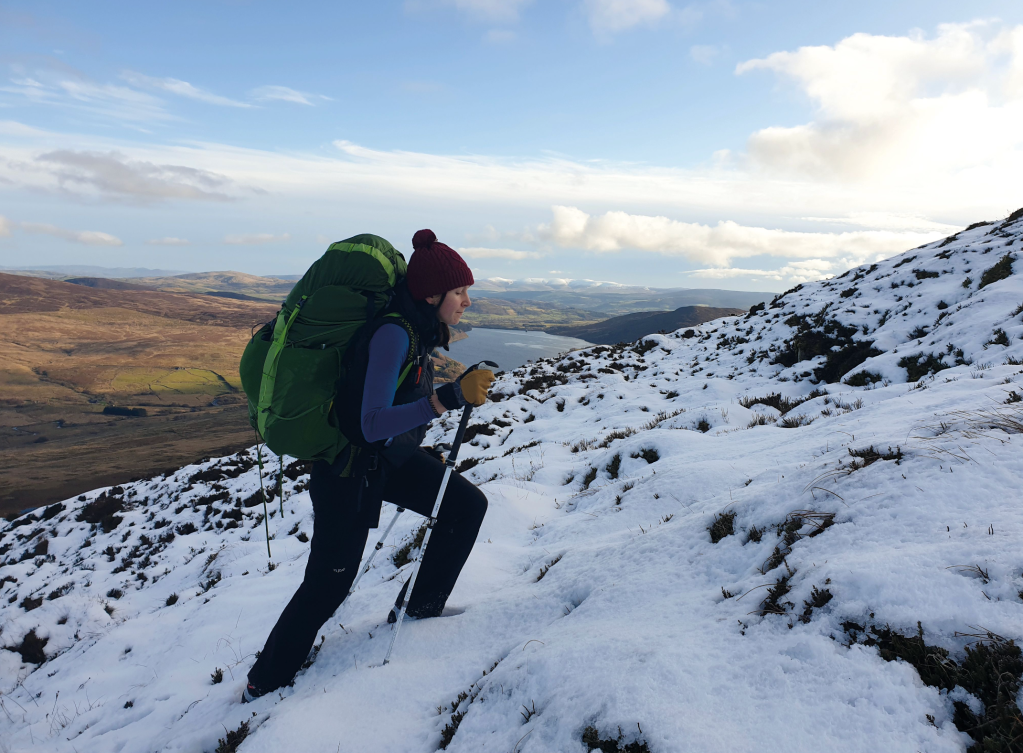
A steep wintry ascent of the northern ridge of Arenig Fach. Credit: James Forrest
2. SH830411: Veer right, away from the fence posts, and head north over pathless, heathery slopes towards Llyn Arenig Fach. Follow the eastern shoreline of the waters over rather rough ground, picking the best line you can find.
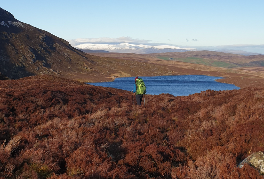
Hiking past Llyn Arenig Fach. Credit: James Forrest
Cross a stream, pass next to a small wall and cross a stile over the fence-line towards the northern tip of the tarn. Follow the zigzagging fence head, bearing north-west on a path to its right. As the fence swings left, follow it to ascend the north ridge steeply. Before the fence terminates in crags, veer slightly right away from it and follow a narrow trod picking its way up over rocky terrain. Emerge onto flatter ground and bear left to cross a stile over a fence before ascending west to the summit, which has a trig pillar and large shelter.
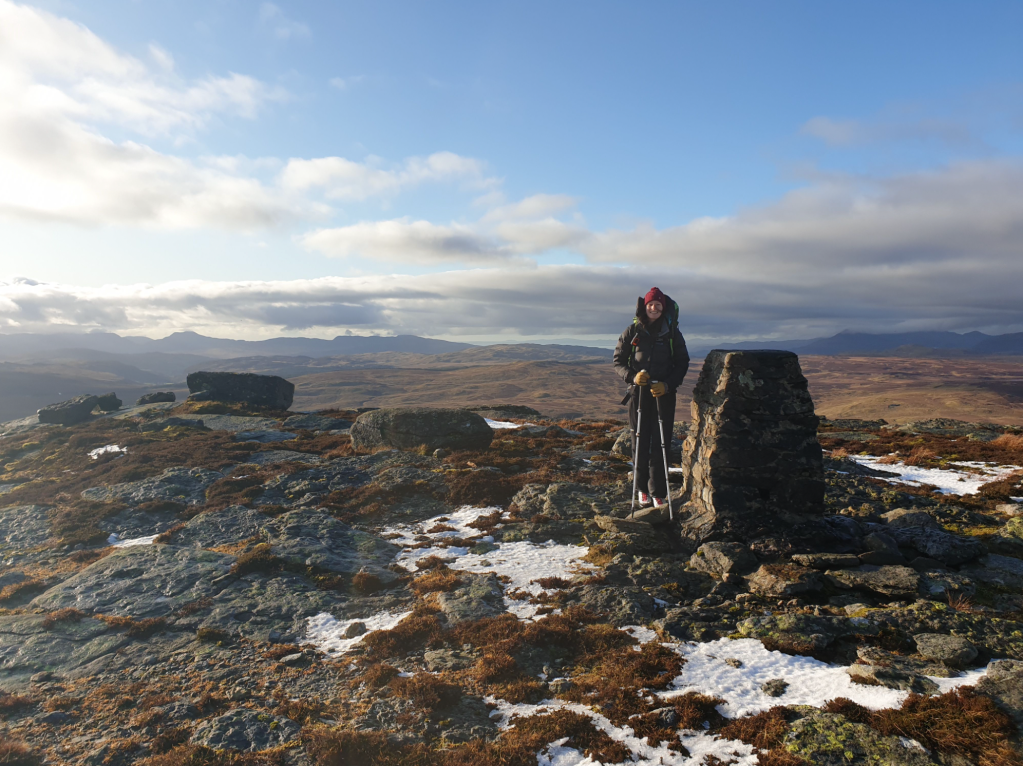
The trig pillar on the summit of Arenig Fach. Credit: James Forrest
3. SH820415: Head south to a cairned top. This ancient cairn is known as Carnedd y Bachgen (Cairn of the Boy). Who was this boy? And what was his connection to Arenig Fach? Nobody really knows – and that’s fascinating in its own right. Here, you pick up a narrow, faint path descending south-south-east. Continue over heathery slopes towards the hump of Y Foel before striking off left, aiming north-east over pathless and rather rough terrain.

Beginning the descent of Arenig Fach. Credit: James Forrest
Cross a fence at a ladder stile and aim east along a line of old fence posts to arrive back at the small crag visited during the ascent. Follow the line of old fence posts, descending gently east. Just before a sheep pen veer left on a trod and pick up the track leading through gates back to the yard at Maes-y-tail. Re-trace your steps from earlier in the walk, descending south-east and south down the track. Arrive back at the A4212 and cross the road to reach the car park at Llyn Celyn, where this circular walk started. Here, the village of Capel Celyn was drowned in 1965 as the Liverpool Corporation built the 830-acre reservoir, a move that submerged two cemeteries including an early Quaker burial place. A memorial chapel now pays tribute to those buried in perpetuity below the waters.
Further information
PUBLIC TRANSPORT: None
TOURIST INFORMATION: visitsnowdonia.info
Nearest YHA: Snowdon Bryn Gwynant
Discover more walks in North Wales as mapped by our expert contributors.


