
Fiona Barltrop enjoys a variation on a theme providing splendid views throughout and the opportunity for a wild camp at Angle Tarn.
To the south-east of Ullswater, accessible by car only along a narrow no through road from Pooley Bridge, is the quiet area of Martindale*, home to the oldest native red deer herd in England. It is a sanctuary for them, and walkers are asked to respect this and keep their distance at all times. There is some excellent crowd-free walking along the high ridges that surround the beautiful, steep-sided valleys of Martindale. The horseshoe route that starts from the Old Church taking in High Raise, Angle Tarn and Beda Fell is particularly fine.
This walk, whose starting point is the much more accessible hamlet of Hartsop (just off the A592), is an unusual variation on that horseshoe providing splendid views throughout, and the opportunity for a wild camp at Angle Tarn before the end of the walk.
*Martindale is a Red Deer Conservation Area – keep dogs under close control and heed notices.
Martindale and Angle Tarn: route description
START/FINISH: Hartsop, car park at end of lane (NY410131) | MAPS: OS Explorer OL5 (1:25k), OS Landranger 90 (1:50k) | DISTANCE: 24km/14¾ miles | ASCENT: 1348m/4422ft | DURATION: 8 hours
1. NY410131: From the parking area at the Hartsop road end follow the bridleway signed for Hayeswater.
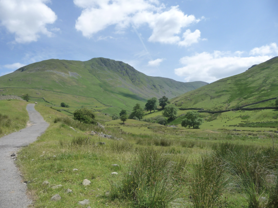
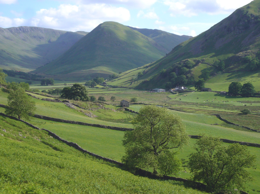
View near start of walk from Hartsop.
Credit: Fiona Barltrop
The track climbs up above Hayeswater Gill to Hayeswater itself – a natural lake now used as a reservoir serving Penrith.
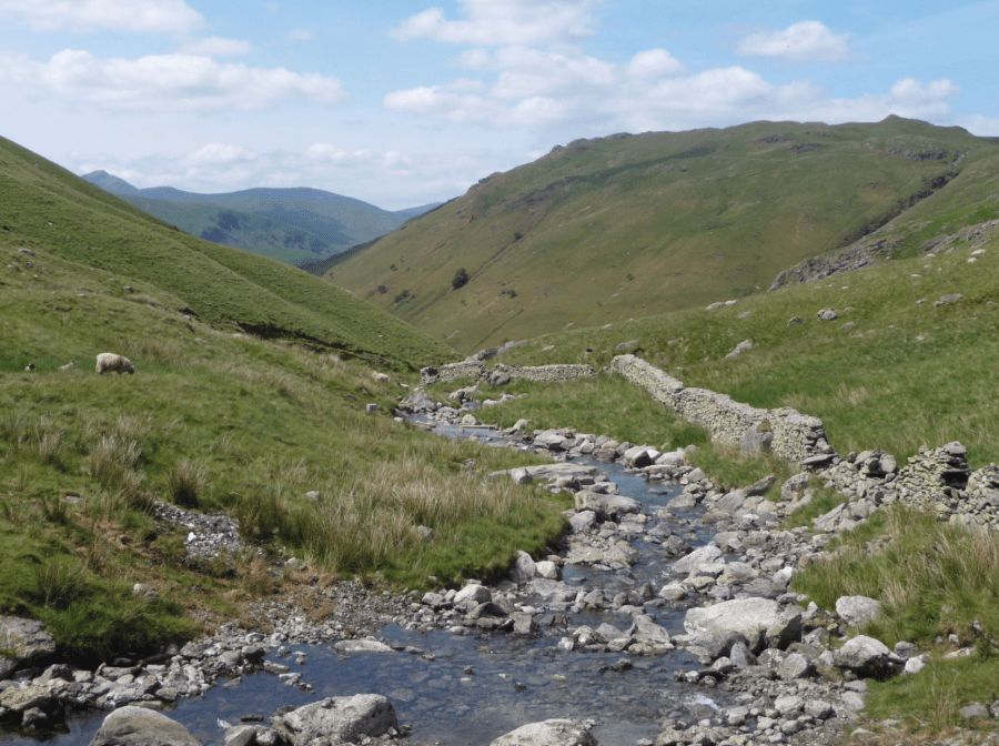
Hayeswater Gill.
Credit: Fiona Barltrop
2. NY426127: Cross a footbridge over the stream at the foot of Hayeswater and follow the well-walked path that ascends the slopes towards the conical hill called The Knott. Fine views back towards the Helvellyn range. The path climbs round its north side before heading southwards in the direction of High Street – a long broad flat ridge whose summit (828m/2718ft) is the highest point in these far eastern fells. It is named after a Roman road which once traversed this range of hills linking the forts of Brocavum near Penrith with Galava south of Ambleside. Horse racing was also held up here! If you want to ‘bag’ High Street’s summit (NY441111) continue heading south for about a mile; the trig point lies just off the path to the left.
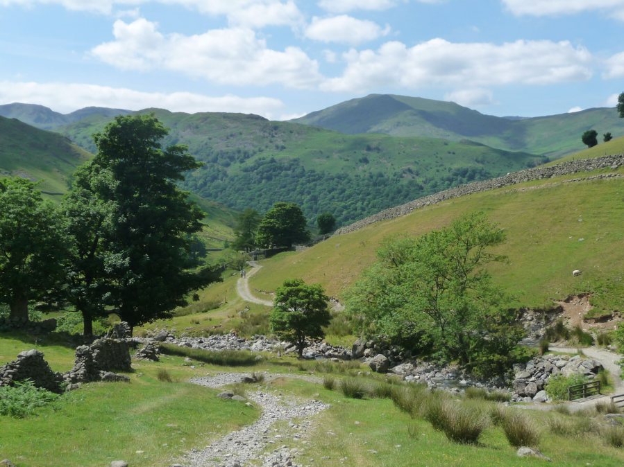
View back on ascent to Hayeswater.
Credit: Fiona Barltrop
3. NY439123: Otherwise bear left to ascend Rampsgill Head and continue north-northeast to High Raise– again the actual summit (cairn) lies just off the path (to the right). This is the second highest point (802m/2634ft) of these fells.
The Nab with Ramps Gill & Bannerdale either side.
Credit: Fiona Barltrop
4. NY448135: The walking is now easy as you continue along fairly level ground, gradually losing height, over Raven Howe and Red Crag.
5. NY452160: Descend north-west at the col between the latter and Wether Hill, passing Gowk Hill to reach the valley road at the Old Church of Martindale. The present building – which occupies the site of a former 13th century church – dates from Elizabethan times. It’s a lovely atmospheric place with an enormous old yew tree in the churchyard thought to be about 1300 years old.
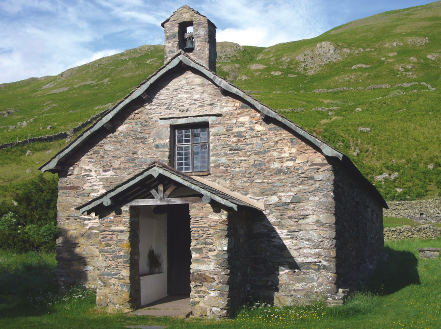
Martindale Old Church.
Credit: Fiona Barltrop
6. NY434184: From the church turn left along the lane heading south. There are more lovely views up the valley as you head towards the road end at Dale Head.
7. NY433165: Now follow the ascending bridleway up and over Beda Fell, descending to a major junction of paths at Boredale Hause. For the most direct route back to Hartsop, omitting Angle Tarn, descend south-west towards the valley, then head south/south-east back to Hartsop.
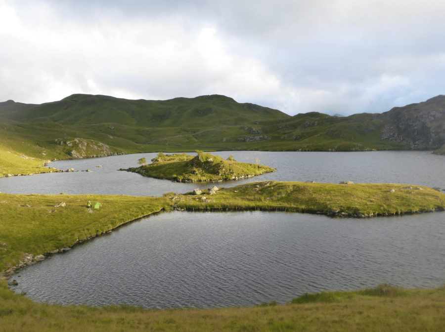
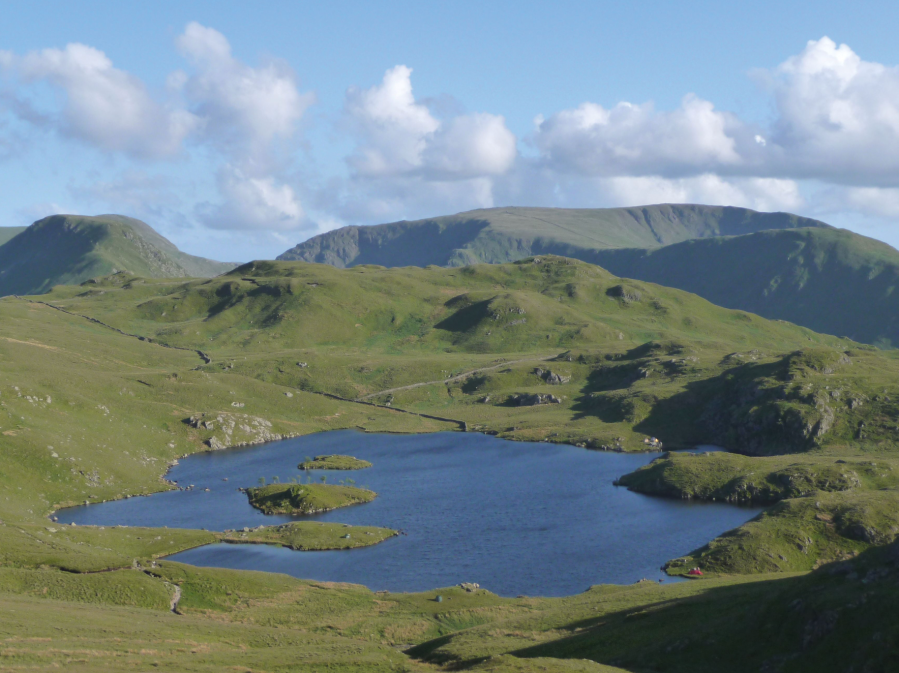
A camper pitched by Angle Tarn.
Credit: Fiona Barltrop
8. NY407158: Head southwards and follow the path that climbs steadily up the grassy slopes. At a fork keep left passing below Angletarn Pikes to reach Angle Tarn, ranked “amongst the best of Lakeland tarns” by Wainwright. On a bleak day the moorland scenery here can be somewhat sombre, but under a sunny blue sky, the tarn, with its indented shore and islets, is an attractive place and a good spot for wild camping. Continue along the path which goes round the north and east sides of the tarn and then climbs southeast towards Satura Crag. Hayeswater comes into view down to your right. You can either turn right and free-range down the slopes towards it or continue towards the Knott to a path junction, then downhill and retrace initial steps back to the start.
Further information
PUBLIC TRANSPORT: Stagecoach bus 508, Penrith to Windermere via Pooley Bridge and Hartstop , alight at ‘road end’ stop at Hartsop turning, c.0.5km/⅓ mile up lane to car park and start of walk.
TOURIST INFORMATION: Ambleside TIC (015394 68135)
NEAREST YHA: YHA Patterdale
Discover more walks in the Lake District as mapped by The Great Outdoors’ expert contributors.


