
Vivienne Crow goes off piste to climb a popular fell known for its horseshoe route from the ‘other’ side.
Most walkers climb Fairfield as part of a horseshoe, experiencing it as little more than a flat, uninspiring summit. Few come at it from the east, from Deepdale, where the head of this tranquil valley reveals the fell’s best side. Here lie secretive corries guarded by tremendous crags and buttresses, all clinging to Fairfield’s forgotten faces. It’s a striking area that will definitely appeal to walkers, like me, who love hunting out the Lake District’s hidden nooks and crannies.
Put your navigation skills to the test on route as faint footpaths lead to leg-wobblingy exciting glimpses into this formidable world of rock. To feel your heart thumping from labouring up the steep ground to the south of Greenhow End and then stand looking into this complex landscape is an exhilarating moment. The walk continues, joining the main ridge on Fairfield and then making its way along the crest of the high ground to Hart Crag and Dove Crag before descending via Little Hart Crag and down the steep nose of High Hartsop Dodd.
Fairfield via Greenhow End: route description
START/FINISH: Car park at Cow Bridge on A592 near Brothers Water, Hartsop, GR NY402133 | MAPS: OS Explorer OL5 (1:25k), OS Landranger 90 (1:50k), Harvey 1:25,000 Superwalker Lake District East | DISTANCE: 15.1km/9.4 miles | ASCENT: 896m/2,940ft | DURATION: 5½-6 hours
1. NT402133: There are two sets of gates at the end of the car park furthest from the road; go through the one leading on to the ‘Permitted path to Patterdale’. Turn right along the trail. When the stony path ends, turn left along the A592. Soon after a phone box, take the Deepdale Hall track on your left, following it round to the right for Lane Head. On reaching the buildings, turn left.
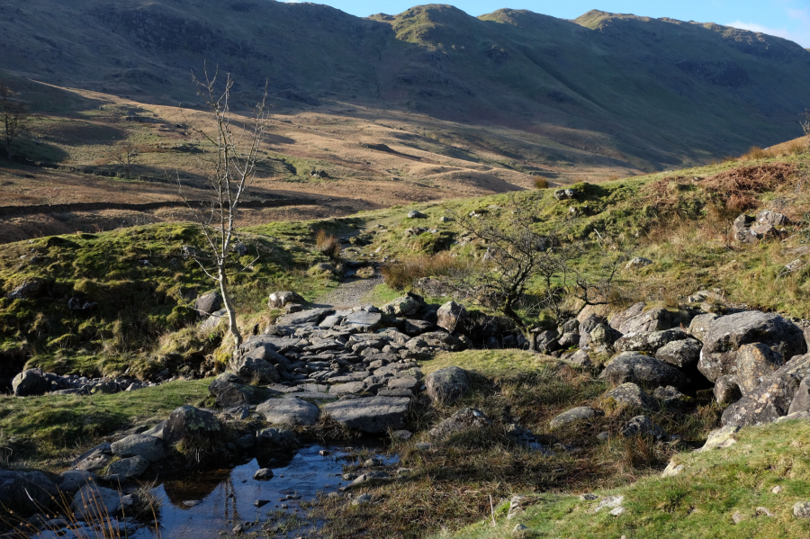
Bridge over Coldcove Beck. Credit: Vivienne Crow
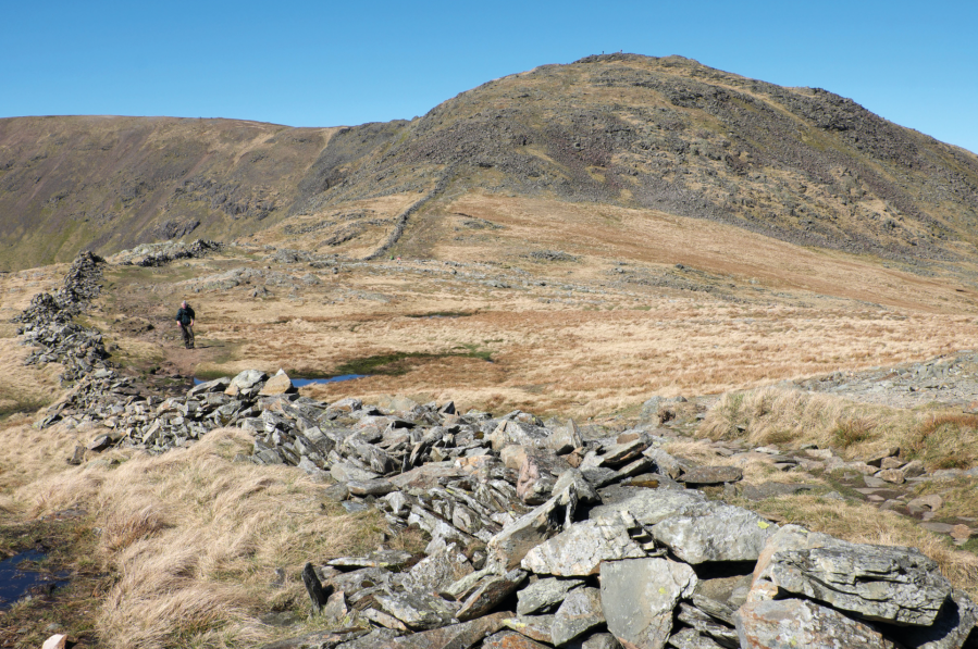
2. NT391136: Beyond the Coldcove Beck bridge, the track goes over to grass. The crags of Link Cove soon present a formidable scene at the dalehead. Our climb into the lower part of the cove will later pass beneath Greenhow End, the dome-like mass of rock on its western side. To the north-east of this are several small crags. The most prominent of these is Mart Crag, which forms the key to the ascent. For the next 2.5km though, continue on the valley path.

Link Cove and Greenhow End, right, from Deepdale. Credit: Vivienne Crow
3. NT372125: Leaving the path, ford the beck as you start drawing level with Mart Crag. Make your way to the base of the crag and then head south on a steep, rising traverse. As the gradient eases, keep close to the base of Greenhow End, steadily swinging south-west.
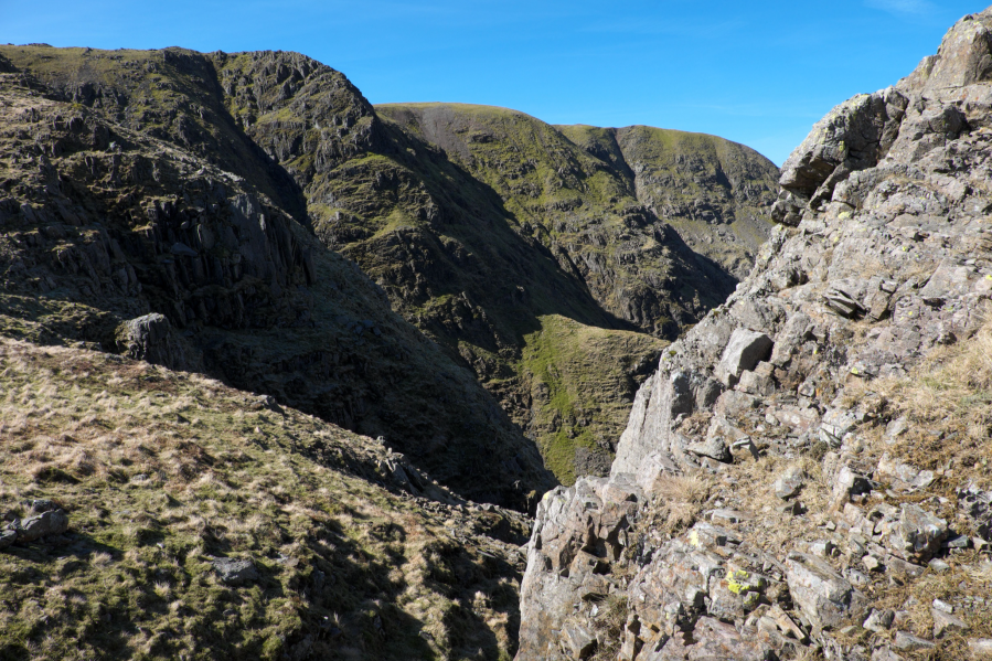
Fairfield’s north-facing coves and crags. Credit: Vivienne Crow
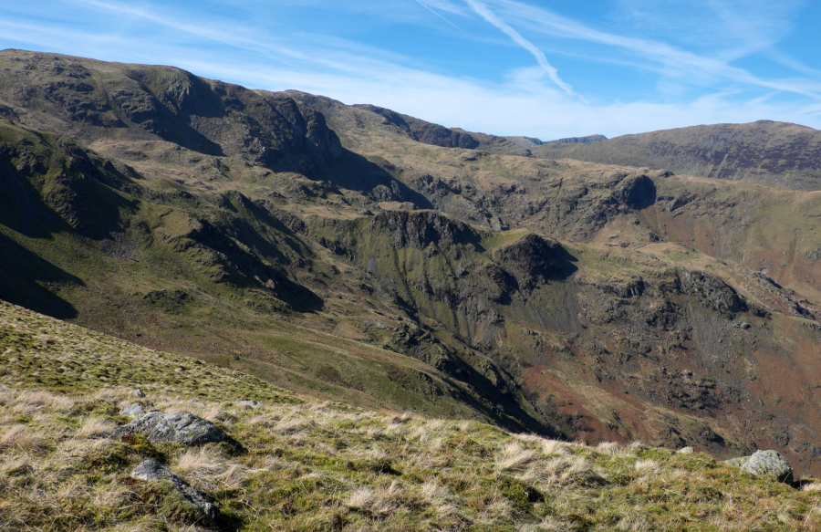
4. NT370119: Ignoring a grassy rake climbing right, swing west to keep close to the rocks on the right, ascending more steeply. When these rocks give way to grassier terrain, head north until the ground ahead suddenly drops away. Now crest the high ground (west-north-west), picking your way through rock outcrops. Eventually, you’ll again find yourself standing above an abyss. Veer south-west, soon looking down on the dramatic crags looming over Cawk Cove, including Hutable Crag and Black Buttress. For the most leg-wobblingy exciting glimpses into this formidable world of rock, keep to the high ground’s western edge. The Helvellyn range is also visible but, unusually, it pales in comparison with the scenery at your feet.
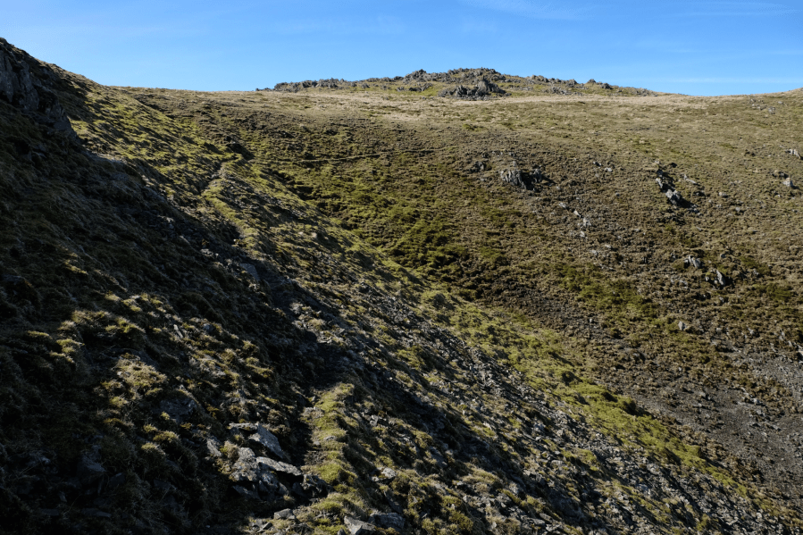
A faint trail swings west-north-west around the head of a scree-filled gully. Credit: Vivienne Crow
5. NT365117: You’ll eventually pick up a faint trail that, as it nears the high ridge, swings west-north-west around the head of a scree-filled gully. Keep to the high ground’s northern edge until you have no choice but to join the well-trodden (and well-cairned) ridge path swinging north-west up to Fairfield. The summit is a wide, flat expanse with magnificent views that include the Scafells, Bow Fell and the Coniston range to the west and the North Pennines on the eastern horizon.
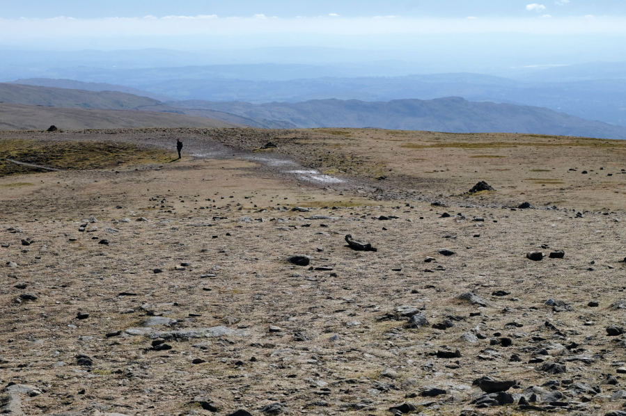
Path leading away from Fairfield’s summit. Credit: Vivienne Crow
6. NT358117: From the summit, retrace your steps, keeping to the clear ridge path when the trail you came up on goes left. The route drops into Link Hause, climbs Hart Crag and then continues to Dove Crag. About 350m beyond the latter’s summit cairn (to the left of the ridge path), turn left along a trail beside redundant fenceposts.
Hart Crag seen from the ridge leading to Dove Crag. Credit: Vivienne Crow
7. NT385100: On the far side of Bakestones Moss, the path climbs slightly and crosses to the eastern side of the posts. Ignoring a path to the right here, keep straight ahead (east-north-east) and climb Little Hart Crag. Walk east, soon dropping to join a path from the left. Follow this over High Hartsop Dodd and down its steep nose.
From Little Hart Crag, looking towards the head of Dovedale. Credit: Vivienne Crow
8. NT397116: At the foot of the ridge, go through the gate to the immediate right of the barn. Follow the path over Dovedale Beck and towards some more barns. A gate 75m to the north of the buildings leads on to a track. Turn right along this and immediately fork left to return to the car park.
Further information
PUBLIC TRANSPORT: Summer-only extension of the 508 bus between Penrith and Windermere
TOURIST INFORMATION: lakedistrict.gov.uk, 0845 9010845
Discover more walks in the Lake District as mapped by our expert contributors.


