
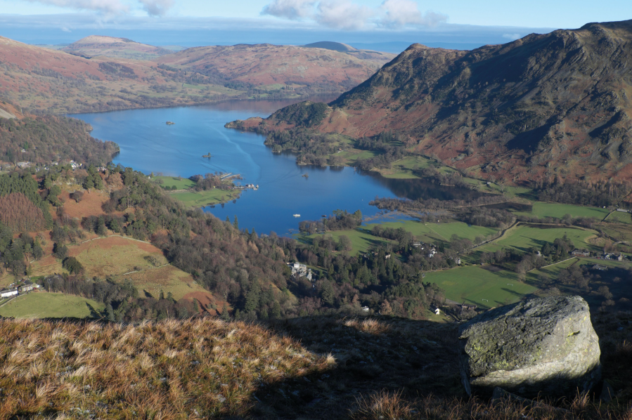
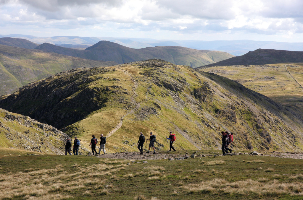
Vivienne Crow strides out on Fairfield’s alternative round – the Deepdale Horseshoe.
We’ve all heard of the Fairfield Round, haven’t we? But did you know that there’s another horseshoe that takes in Fairfield? Instead of using Ambleside as its base and approaching the 873m summit from the south, this one starts from Patterdale. It then heads south-west, climbing St Sunday Crag and Cofa Pike on the way up, briefly coinciding with the more popular round as far as Hart Crag and then descending via the long, bumpy ridge of Hartsop above How. I love the Deepdale Horseshoe.
I love the views across to the Helvellyn range from St Sunday Crag; I love the sometimes airy feel of the ridge linking St Sunday with Fairfield; I love peering down on the hidden coves and crags of Fairfield’s northern and eastern faces; and I love the ease of that final, grassy spur that Hart Crag throws out to the north-east. There’s grass, there’s rock, there’s scree. And then, of course, there’s the added bonus of a pub at the end of the day. What more could a hill-walker want?
Deepdale Horseshoe: route description
START/FINISH: White Lion Inn, Patterdale, GR NY396158 | MAPS: OS Explorer OL5 (1:25k), OS Landranger 90 (1:50k), Harvey 1:25,000 Superwalker Lake District East | DISTANCE: 14.7km/9.1 miles | ASCENT: 1050m/3444ft | DURATION: 5½-6 hours
1. NY396158: From the pub, walk south-east along the A592 for a few metres and then turn right along a rough lane rising beside a toilet block. Take the path on the left soon after a right bend, entering a patch of woodland. Bear left at the next junction. About 260m beyond the trees, pass through a gate in a wall. About 370m after fording Hag Beck, turn left at a crossing of paths to begin the climb.
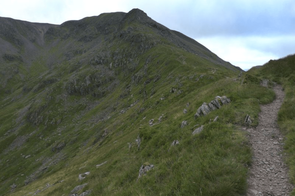
Ridge path approaching Cofa Pike. Credit: Vivienne Crow
2. NY385152: The flat, grassy area on Thornhow End, with its excellent outlook on Ullswater, provides a great spot for a breather before you go through a gate in the wall. Beyond the gate, continue on the clear path for 45m and then strike off left, heading straight up Birks’ north-east ridge. The path is vague, but it finds a route up through the rocks and then on to the grassy felltop. With the Helvellyn range to the west, continue beyond the stones marking Birks’ summit and down into the boggy saddle between Birks and St Sunday Crag.
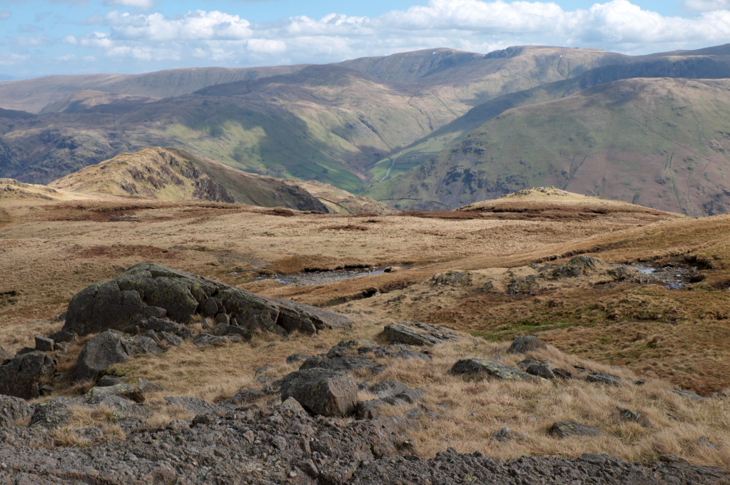
View from Hartsop above How, with High Raise the highest point on the skyline ahead. Credit: VIvienne Crow
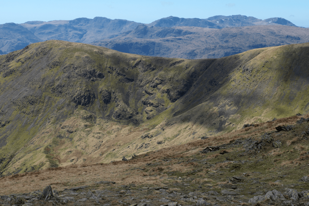
3. NY372139: As you climb out of the saddle, ignore a trail to the left; instead, follow a rough, stony path up St Sunday’s north-east ridge. Before long the fells to the west appear – Bow Fell, the Scafell group, Crinkle Crags and, finally, closer in, Fairfield. Soon after the gradient eases, head south at a faint fork to cross the rock-strewn plateau to St Sunday Crag’s highest point. Continue south-west down the other side of the ridge. The path drops into Deepdale Hause, high above the magnificent glacial valley of Grisedale, and then climbs towards Cofa Pike.
Looking across to Dollywaggon Pike from the Deepdale Hause ridge. Credit: Vivienne Crow
4. NY359122: Keep left at the base of the steepest, rockiest part of the ascent. At the top of this section, the summit cairn is just ahead on the left. You then reach another short section of rocky ridge, which can be bypassed to the right. Climbing out of the saddle between Cofa Pike and Fairfield, the path splits again. Bear left – on steep, loose ground – to reach the top of Fairfield. The summit is a wide, flat expanse with magnificent views – now including Windermere and Morecambe Bay to the south. It’s worth exploring, particularly the eastern edge of the plateau where you can look down on several large and imposing crags. Keep a careful eye on map and compass when you finally leave the summit: the onward route is on a broad, cairned route heading south-east, soon veering east. It drops into Link Hause and then climbs towards Hart Crag.
Looking across to Dollywaggon Pike from the Deepdale Hause ridge. Credit: Vivienne Crow
5. NY368113: Hart Crag’s summit cairn can be ‘bagged’ by heading up through the jumble of angular boulders to the right. The main route, though, keeps left to descend east-north-east. Choose from a horrible, scree-like path to the right of Hart Crag’s east ridge or the more enjoyable, scrambly path along the rocky apex. The two reunite in about 400m after which you make your way roughly north-east along the long, undulating ridge of Hartsop above How. Having lowered yourself down a rocky section, ignore the ladder stile on the right.
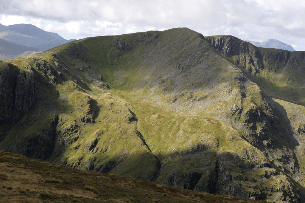
View west from Hart Crag including Bow Fell and the Scafells on the horizon. Credit: Vivienne Crow
6. NY398133: Almost 4km beyond Hart Crag’s summit, you reach a wall cutting across the fell; climb the ladder stile here. The path continues roughly parallel with the ridge wall until encountering trees. Now swing left and go through a gate. After the next gate, waymarker posts lead north-west across a field. Turn right along a track that drops to the road.
7. NY399143: Turn left along the A592 and follow it, for 1.7km, back to Patterdale where you can find refreshements after completing the Deepdale Horseshoe.
Further information
PUBLIC TRANSPORT: Bus 508 from Penrith to Patterdale, www.stagecoachbus.com
TOURIST INFORMATION: www.lakedistrict.gov.uk, 0845 9010845
Discover more walks in the Lake District as mapped by our expert contributors.


