
James Forrest climbs England’s highest peak outside the Lakes, the leviathan of the North Pennines, Cross Fell.
The leviathan of the North Pennines, Cross Fell (893m/2930ft) is England’s highest mountain outside of the Lake District. It’s a mountain of soft, smooth lines, devoid of the rocky drama of its Lakeland neighbours, but it still has charm, especially if you spend the night at Greg’s Hut, a former miners’ house turned rustic mountain bothy. Named after John ‘Greg’ Gregory, who died in a climbing accident in the Alps, Greg’s Hut is the highest bothy in England.
Cross Fell is also home to the UK’s only named wind – the fierce Helm Wind, a strong north-easterly that batters the mountain’s south-western slopes for much of the year. The route traverses the scree belt at Crossfell Well, a small spring, to emerge at the summit’s fittingly cross-shaped wind shelter, before veering south-east to Tees Head. Next comes an out-and-back on the Pennine Way’s mill flagstones to Little Dun Fell and Great Dun Fell – the latter adorned with a huge, golf ball-shaped radar dome – before looping downhill via Wildboar Scar.
Cross Fell: route guide
Start/Finish: Small car park next to Kirkland Hall (GR: NY650325) | Maps: OS Explorer OL31 (1:25k), OS Landranger 91 (1:50k) | Distance: 12.6 miles | Ascent: 2,875ft/ | Duration: 7 hours
Route description
1. NY650325 Take the lane heading north-east to the right of Kirkland Beck and go through a series of gates to enter open fellside. The wide path, which veers north as you continue, skirts to the west of High Cap and then climbs steeply north and east, including a few sharp switchbacks.
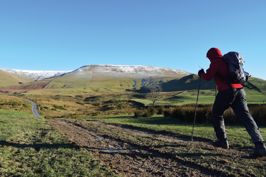
Climbing towards Cross Fell from Kirkland.
Credit: James Forrest
Pass an assortment of disused mine works as you continue east to the base of the Cross Fell summit path. But ignore the turn-off junction temporarily in favour of a quick jaunt to Greg’s Hut. From Yad Stone, head east-north-east on a good track past various shake holes to arrive at the Mountain Bothies Association hut.
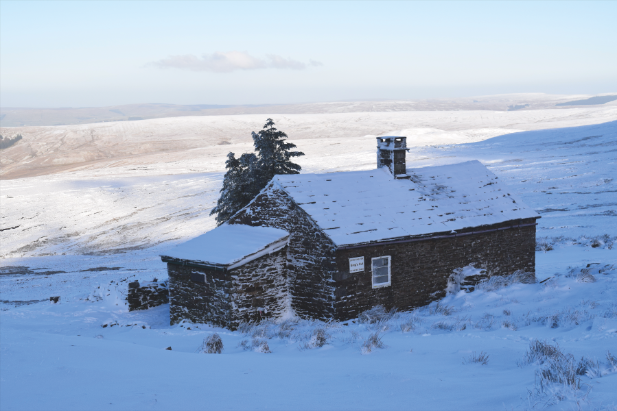
Greg’s Hut.
Credit: James Forrest
2. NY690354 Re-trace your steps west and turn left at a cairn to climb south over the scree belt towards the summit of Cross Fell. Pass Crossfell Well, a small spring, and press on south to reach the Pennines’ highest peak. The top is marked by an OS trig point and, fittingly, a huge cross-shaped wind shelter.
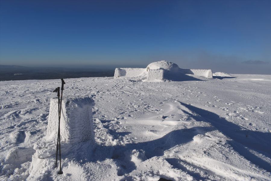
Cross Fell trig and frozen wind shelter.
Credit: James Forrest
3. NY687343 Descend south-east on the Pennine Way path to the col at Tees Head, where the River Tees begins its 75-mile journey to the North Sea. It is a short, easy climb to the 842m top of Little Dun Fell, which is marked by a cairn. Continue south-east to drop down to the next col before climbing again to Great Dun Fell and its distinctive radar dome and masts.
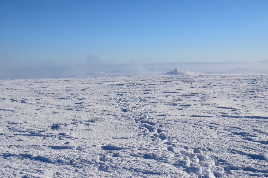
View from Cross Fell summit to radar dome on Great Dun Fell.
Credit: James Forrest
4. NY710321 There are a few options for descent. The path descending to Milburn is both intermittent underfoot and uninspiring, whilst the tarmac road to Knock – which was constructed to service GreatDun Fell’s radar dome – is dull and tough on your knees and feet. The best option is to turn back along the ridge and head north-west. Sticking to the Pennine Way path, re-visit the grassy top of Little Dun Fell and continue north-west to the crossroads 270m beyond Tees Head.
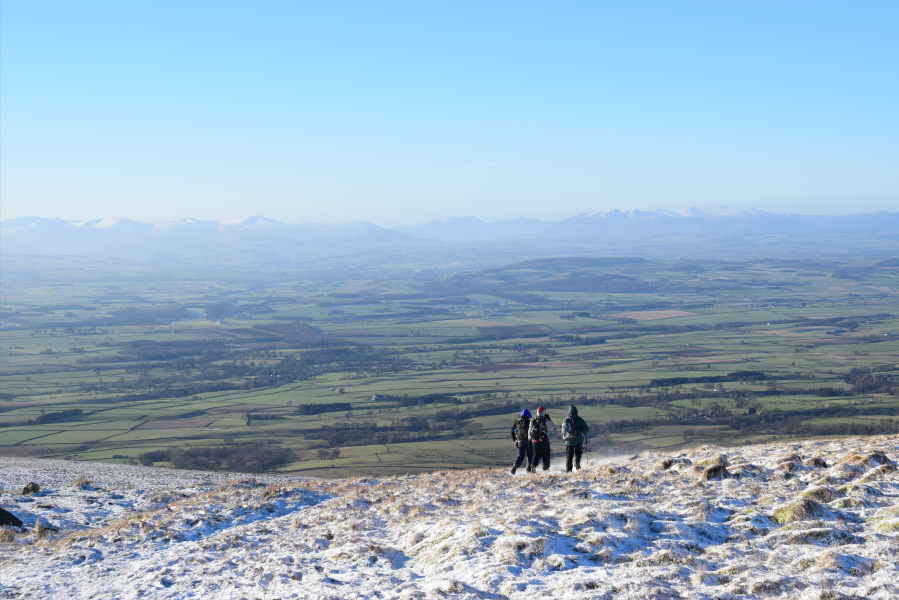
Three hikers descending Cross Fell.
Credit: James Forrest
5. NY696338 Descend steadily south-west on the path heading for Wildboar Scar, with Crowdundle Beck to your left. The route is not particularly steep and a few small cairns mark the way, but navigation can still be tricky so care and caution should be taken, particularly in poor visibility.
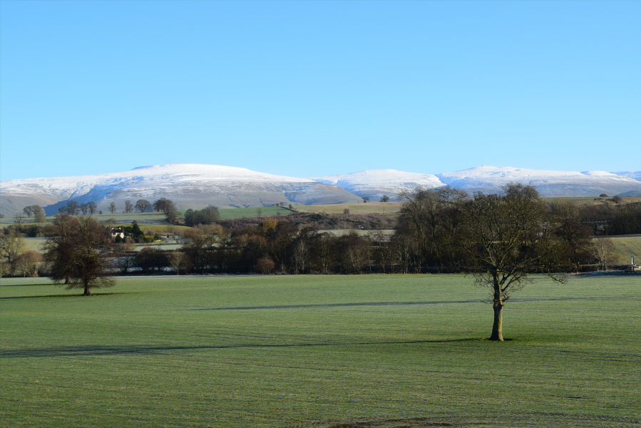
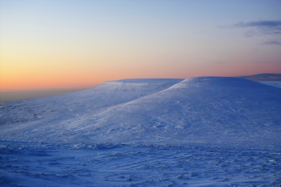
Snowy trio (L-R) of Cross Fell, Little Dun Fell and Great Dun Fell.
Credit: James Forrest
6. NY679326 Swing south as the path dramatically descends Wildboar Scar before veering west towards Littledale Beck. Pass to the right of Grumply Hill (412m) and follow the beck down to Wythwaite. Turn right on the main A Pennine Journey path and head north past the historical cultivation terraces known as the Hanging Walls of Mark Anthony before emerging back at the car park next to Kirkland Hall.
Further information
Transport: None to start
Information: Penrith TIC (01768 868000) visitcumbria.com


