
Is this England’s best long-distance walk? James Forrest is our guide to the Coast to Coast walk, Wainwright’s iconic 293km (292 mile) route across northern England through the Lake District, Yorkshire Dales and North York Moors.
“One should always have a definite objective, in a walk as in life – it is so much more satisfying to reach a target by personal effort than to wander aimlessly.” So wrote Alfred Wainwright in his guide to the Coast to Coast walk, a poetic turn of phrase that captures the magic of long-distance trails. Journeying across a landscape by foot is a beguiling experience. Not only is the sense of achievement palpable, but the mode of travel – slow, purposeful and intimate – provides a deep connection with people, place and nature.
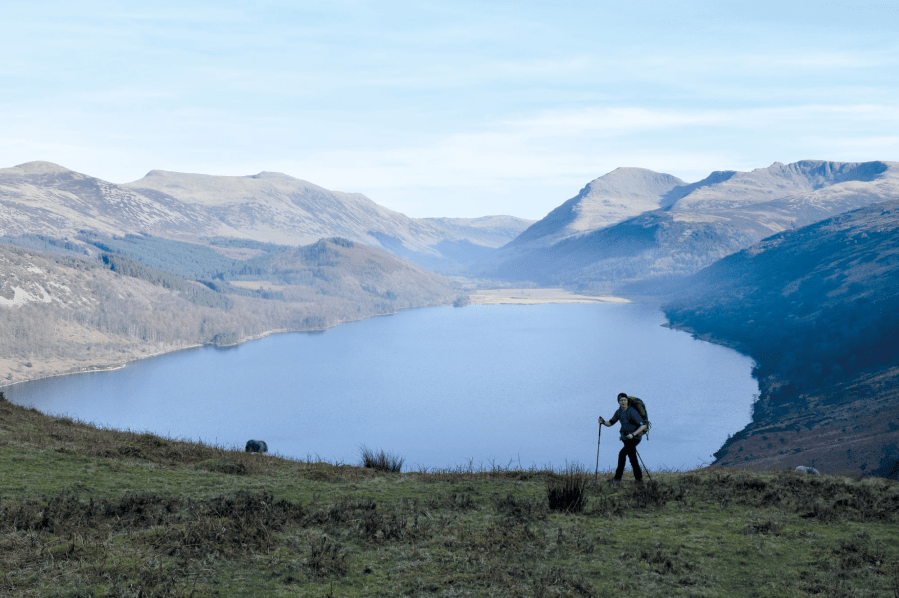
Main image: Hiking Anglers Crag on the Coast to Coast path with views across Ennerdale | Credit: James Forrest
Want to experience such a connection? This walk – which in 2022 was granted National Trail status and £5.6 million of funding for path upgrades – is the perfect way to do so. The coast to coast is a long-distance trail traversing the width of northern England from St Bees Head in the west to Robin Hood’s Bay in the east.
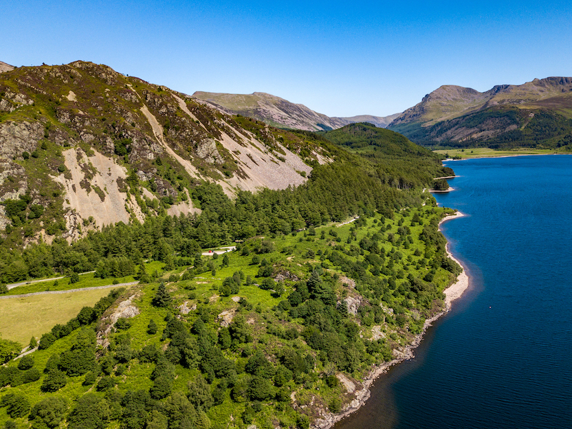
Ennerdale in the Lake District is the home of a 20-year-old ‘rewilding’ scheme. Photo: Shutterstock
Hikers start on the shores of the Irish Sea and two weeks and 182 miles later arrive at the North Sea, having travelled across the Lake District, Pennines, Yorkshire Dales and North York Moors. The countryside covered is “beautiful almost everywhere, yet extremely varied in character, with mountains and hills, valleys and rivers, heather moors and sea cliffs combining in a pageant of colourful scenery”, as Old Alf put it. For sheer diversity and drama, this walk is perhaps the UK’s best long-distance walk.
Here’s The Great Outdoors‘ guide to the Coast to Coast trail, featuring helpful tips on the following:
- Route details
- When to go
- Coast to Coast traditions
- Transport
- Accommodation and food
- Essential gear
- Further resources
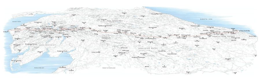
The Coast to Coast: at a glance
START: St Bees Head, Cumbria | FINISH: Robin Hood’s Bay, North Yorkshire | DISTANCE: 293km / 182 miles | ASCENT: 8,000m approx / 26,250ft approx | DURATION: Usually around two weeks | MAPS: Harvey Maps XT40 – Coast to Coast (1:40k)
The Route
In 1973 Alfred Wainwright published his book ‘A Coast to Coast Walk’, establishing the definitive route for this iconic long-distance trail. There have been minor route changes over the years – and some hikers opt for summit-bagging detours – but mostly the route remains identical 50 years later.
Commonly walked west-to-east, keeping the prevailing wind at your back, the trail can be split into three key sections: the Lake District, the Yorkshire Dales and the North York Moors. Each section has its own character, charm and challenges, and collectively the whole itinerary takes about 12 days.
The four-day Lake District section starts with a gentle(ish) hike from St Bees Head to the edge of the Lake National Park at Ennerdale Bridge. Day two explores the southern shores of Ennerdale Water before valley-hopping into Borrowdale via Black Sail Hut and Honister Slate Mine. Day three is a stunning hike from Rosthwaite to Patterdale, including Greenup Edge, Far Easedale, Grasmere and Grisedale Forest – although many walkers prefer to split this in two with an overnight stay in Grasmere. The final Lakeland leg links Patterdale with Shap via Haweswater.
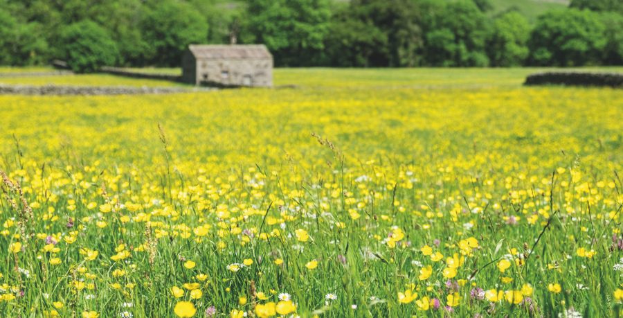
The wildflower meadows of Swaledale. Credit: Shutterstock
Next comes a four-day (or longer) stint journeying across the northern boundaries of the Yorkshire Dales National Park, depending on your speed and stamina. The normal stages are Shap to Kirkby Stephen, Kirkby Stephen to Keld, Keld to Reeth, and Reeth to Richmond, with highlights including the humongous ‘stonemen’ cairns atop Nine Standards Rigg and the rural charms of Swaledale.
As you leave the Dales, there’s a 37km slog from Richmond to Ingleby Arncliffe (often split into two stages) before you reach the North York Moors. Then you’ve only got a trio of legs through the Cleveland Hills – Ingleby Arncliffe to The Lion Inn (Blakey Ridge), The Lion Inn to Grosmont, and Grosmont to Robin Hood’s Bay – to triumphantly complete your coast to coast adventure.
When to go
Go in spring or summer for longer days, less rain (hopefully) and a marvellous wildlife spectacle on day one of your hike: from St Bees Head you’ll spot thousands of guillemots on their cliff-side breeding ledges and a 100-strong cormorant colony, as well as kittiwakes, razorbills and fulmars.

Coastal walking at St Bees at the start of the Coast to Coast route.
Credit: James Forrest
Autumn will be quieter and more colourful, while winter – for obvious reasons – is best avoided. The guidebook writers at Cicerone suggest spring and autumn are the best seasons to hike, enabling you to avoid the crowds of summer and the poor weather of winter.
Traditions
Alfred Wainwright encouraged walkers to dip a hiking boot in the Irish Sea at the start in St Bees and then – two weeks, almost 300km and one epic adventure later – to dunk it again in North Sea at Robin Hood’s Bay. Another common practice is to pick up a pebble on the beach in St Bees and to lay it to rest in Robin Hood’s Bay, in a kind of symbolic act commemorating your coast to coast odyssey.
Transport
St Bees is located on the Cumbria Coast Line railway, which runs between Carlisle and Barrow-in-Furness and is served by Northern. From London, Birmingham, Manchester or anywhere else south of Cumbria, you can take a train to St Bees via connections in Lancaster and Barrow-in-Furness. From Scotland, you’ll connect in Carlisle.
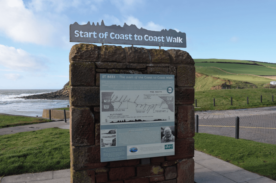
Sign in St Bees marking the start of the trail.
Credit: James Forrest
Robin Hood’s Bay does not have a train station, so onward travel will be a slow process. There are two main options: take the Arriva X93/X94 bus to the mainline railway station in Scarborough for train services south via York or Manchester; or take the X93/X94 bus to Whitby and rail connections north via Newcastle.
Accommodation and food
Some walkers go for the ‘luxury’ option, spending every night in charming rural B&Bs and comfortable hotels. This is a sensible choice if you’d prefer not to carry camping gear and just want to enjoy the walking. Services such as Coast to Coast Packhorse and Sherpa Van will even transport your bags from hotel to hotel.
Other hikers choose to rough it, wild camping wherever they can pitch a tent or lay out a bivvy. Some sections of the trail, such as the Lake District, are well-suited to sleeping wild, but other areas can be trickier due to the prevalence of farmland, villages and towns.
For specific accommodation options, check out the extensive lists published in the Coast to Coast guidebooks. Our recommendations include Black Sail YHA in Ennerdale and New Ing Lodge in Shap.
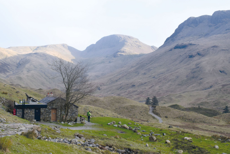
Hiking past Black Sail YHA.
Credit: James Forrest
Most walkers will carry a good supply of food in their backpacks, but this trail passes through villages and towns on a regular basis – so there are ample options to re-supply in supermarkets or eat in cafes and pubs.
Essential gear
Maximum comfort and protection for minimal weight – this is what you’re aiming for when it comes to kit and clothing for long-distance hiking. The benefits of a lighter pack are innumerable: your back and shoulders won’t ache; the strains and stresses on your hips, knees and ankles will be lessened; the miles will tick over easier; and you’ll feel more nimble, fleet-footed and happy on the trail.
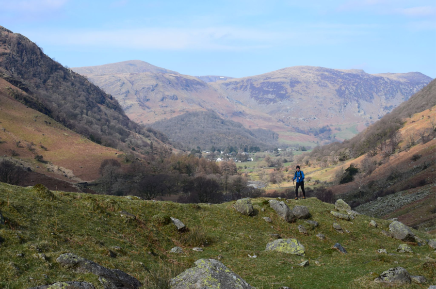
Hiking towards Greenup Edge from the Borrowdale Valley.
Credit: James Forrest
But, simultaneously, you shouldn’t cut too many corners in the name of gram-saving. Staying dry, warm and safe is obviously vital too. The ultimate goal is to find the perfect balance between weight, comfort and performance, specifically for you.
For expert advice on everything from hiking boots and waterproof jackets to tents and sleeping bags, check out The Great Outdoors‘ reviews, buying guides and recommended products.
Wainwright’s Coast to Coast: Further resources
Wainwright’s A Coast to Coast Walk (first published in 1973) is a perfect companion to your adventure.
For updated route notes, Cicerone’s Walking the Coast to Coast Walk by Terry Marsh is an in-depth guidebook for the trail, including a 1:25k Ordnance Survey map booklet.
Alternatively, Harvey Maps produce a lightweight, durable and waterproof 1:40k map covering the entire route.
Discover more long-distance trails as guided by The Great Outdoors’ expert contributors.


