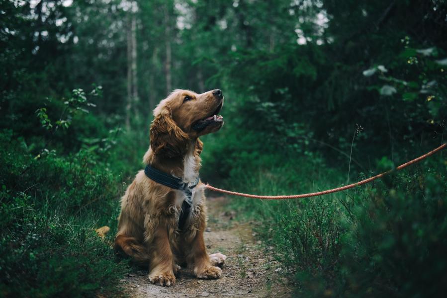
The Lake District is a wonderful place for dog-friendly walks. We walk you through our pick of the best.
Bimbles are better with Man’s Best Friend. The Lake District’s unforgettable fells and forests offer some of the best walks for four legs in the UK. Here, The Great Outdoors guides you through some of the best dog-friendly walks in the Lake District. Before you get started, take a look at what you need to know about hiking with dogs.
- Derwentwater hilltop circular
- Red Screes
- Skiddaw
- Latterbarrow
- Greendale circular via Middle Fell
- Haycock and Caw Fell
- Black Combe
As the largest national park in England, the Lake District is a mecca for mountain seekers. It’s home to Scafell Pike, England’s highest peak. But until your dog is ready for such substantial mountain fare there’s plenty more to explore. The Lakes is also home to farmers and the livestock they tend, so it’s important you take care to keep your dog under control. Likewise, leave no trace and respect this environment and its communities.
Lakeland will return the favour with new sights and smells sure to keep your four-legged friend occupied on one of many excellent walks. The landscape offers peaceful lakeside vistas and dramatic lofty crags that have inspired the likes of Wordsworth, Coleridge and Keats.
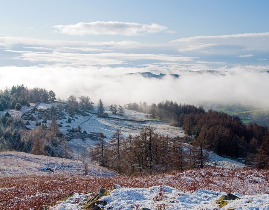
Route one: Derwentwater hilltop circular
Will Renwick walks this high route around Derwentwater from Keswick, climbing Catbells and Walla Crag.
Your dog will love this big day out with plenty of open fires to nap beside at the pubs back in Keswick.
Start/Finish: Keswick Youth Hostel (GR: NY267235) | Maps: OS Explorer Map: OL4 The English Lakes – North Western area | Distance: 18km/11.5 miles | Ascent: 658m/2158ft | Duration: 8 to 9 hours | Transport: Stagecoach bus services 78, 555, X4/5 serve Keswick
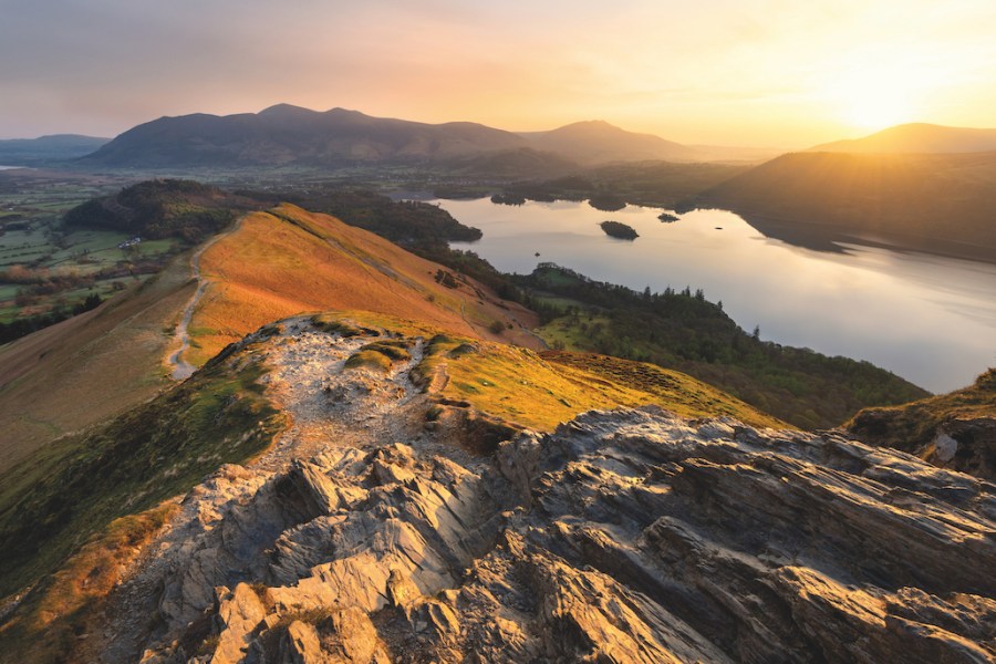
The view over Derwent Water from Cat Bells in the early morning. Credit: Shutterstock
Derwentwater: a lake with one foot in the mountains and another in the small-town ambience of Keswick, and flanked by the justifiably famous Catbells. If you’ve ever wondered about what it might be like to walk all the way around this gem of the northern Lake District, this moderate hill walk is worth considering.
This route is that it lets you see a favourite Lakeland lake from all angles, while taking in classic hillwalks along the way. After beginning in Keswick, traverse the Catbells ridge and ascend along the eastern side of the lake. This brings you to Walla Crag, a famed viewpoint. You may be able to spot climbers at play.
Here is the detailed route description for Derwentwater hilltop circular.
Route two: Red Screes
Next door to the ever-popular Fairfield Horseshoe, this Red Screes walk makes a fantastic alternative, says Paul Richardson.
You and your dog will both love the short, steep ascent up to spectacular views.
Start/Finish: Ambleside (GR: NY376045) | Maps: OS Explorer Map: OL7 The English Lakes – South-eastern area | Distance: 12km/7.5 miles | Ascent: 750m/2460ft | Duration: 5 to 6 hours | Transport: Stagecoach bus services 555, 559, 505, 516 serve Ambleside
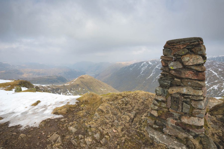
Credit: Paul Richardson
The hills that run south from the high fells of Patterdale are very conveniently situated on the northern doorstep of Ambleside. This walk is a great way to explore them. You’re spoilt for choice when picking out a route for a foray into these mountains and it’s easy to opt for the classic Fairfield Horseshoe. Head onto Red Screes via the neglected Scandale valley. Although shorter, it’s an equally spectacular route.
Red Screes is a fantastic vantage point to survey the surrounding hills. Looking north-west beyond Middle Dodd, Hartsop above How and St Sunday Crag stand out from their neighbours, while to the right of Brothers Water the peaks leading to Place Fell stand guard over Patterdale.
Here is the detailed route description for Red Screes.
Route three: Latterbarrow
Roger Butler follows a low-level Latterbarrow walk with high-level 360º panorama views across the national park.
You and your dog will love the woodland, tarns and lakeside finish on Windermere.
Start/Finish: Red Nab Car Park (GR: SD385994) | Maps: OS Explorer Map: OL7 The English Lakes – South-eastern area | Distance: 14km/8.5 miles | Ascent: 480m/1575ft | Duration: 6.5 hours | Transport: None to start
Credit: Roger Butler
The threat of black ice, particularly in somewhere like the Lake District, can mean a hasty change of plan. Twisting roads and unexpected frozen patches don’t go together very well and, combined with dollops of thick fog, the local driving conditions forced us to abandon plans for the Fairfield Horseshoe and stay closer to the cottage. In the knowledge that safe was definitely better than sorry, we quickly assessed options and agreed that every now and again there’s nothing wrong with exploring a new, albeit lower, part of the National Park. This Latterbarrow walk, with its famous viewpoint of the Coniston Fells, Langdale Pikes and the distant Howgills, is a good option in poorer weather.
Here is the detailed route description for Latterbarrow.
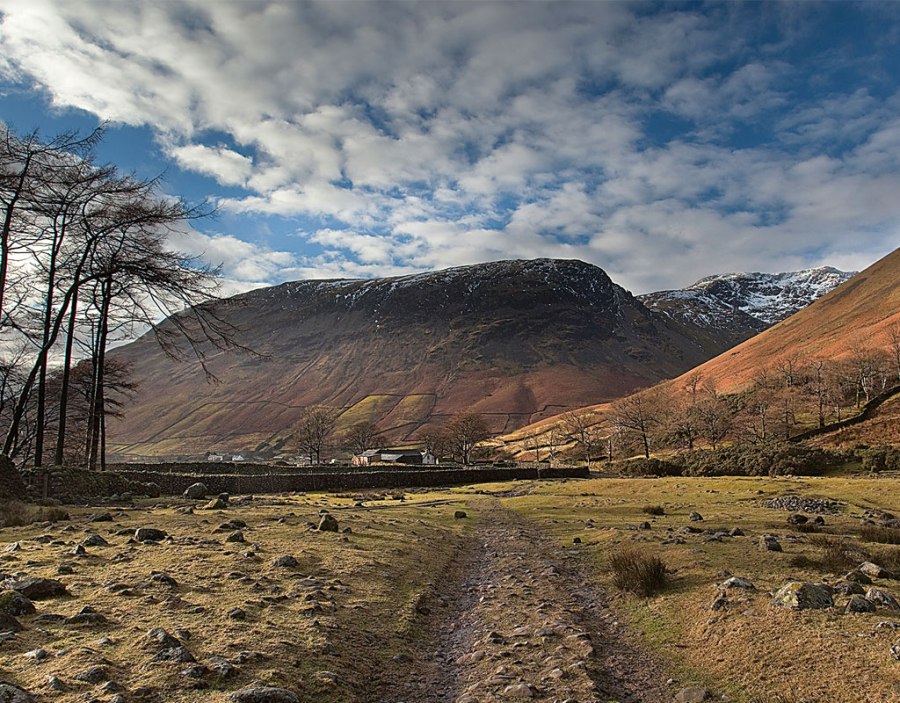
Route four: Greendale circular via Middle Fell
Mark Gilligan never tires of walking around Wasdale. Here, he skirts Scafell Pike for Middle Fell and some of the finest low-level views in England.
You and your dog will enjoy this less arduous walk and the chance to paddle at Wast Water.
Start/Finish: Greendale Car Park at the foot of Middle Fell (GR: NY144056) | Maps: OS Explorer Map: OL6 The English Lakes – South-western area | Distance: 10km/6.5 miles | Ascent: 585m/1950ft | Duration: 6.5 hours | Transport: None to start
Credit: Mark Gilligan
Wasdale is blessed with an endless array of fells, tarns and the most magnificent vistas this country has to offer. At its heart are the highest points in England and Wast Water. It is also bounded on one side by the daunting Screes that produce glorious sunrises and sunsets.
Of course, most venture out atop the lofty heights of the Scafells but moving around the perimeters of the water reveals another dimension to this area’s appeal. This route doesn’t involve ‘The Big One’ but still gives you a great sense of achievement and, just as importantly, awesome views. This is a shortened version of a mammoth 19-miler that takes in Middle Fell and fabulous views of the ‘Pikes’. It isn’t arduous but gives you a lift due to the vistas gained with a 360-degree sweep. The lower views are simply some of the best you’ll find in the whole of England as you skirt Wast Water and find yourself in its ‘hidden gem’ near the water house at the source of the River Irt.
Here is the detailed route description for Greendale circular via Middle Fell.
Route five: Haycock and Caw Fell
Tanya Oliver enjoys a lesser fell among Lakeland giants on this Haycock and Caw Fell walk.
Your dog will enjoy splashing on the shores of Ennerdale Water and walking up to the quieter fell tops close by to England’s highest peak, Scafell Pike.
Start/Finish: Bowness Knott Car Park (GR: NY109153) | Maps: OS Explorer Map: OL6 The English Lakes – South-western area | Distance: 16km/10 miles | Ascent: 701m/2300ft | Duration: 5-6 hours | Transport: None to start
Sunlight showing the route up to Haycock summit. Credit: Shutterstock.
Nestled away in the secluded valley of Ennerdale, keeping company with Pillar and Yewbarrow, is this rather more shy fell. The name doesn’t trip off the tongue when recalling wondrous walks in the Lake District for many. But, for me, Haycock is a glorious fell to climb. Standing at 782m/2,618ft, it is not a low fell but the climb feels gentle. The only really adventurous part that reminds you of the rugged nature of the area is around Little Gowder Crag. Perhaps this is why people do not turn their walking boots to it often. As I reached the summit and saw the Scafells, coast and many of the western fells, I was at a loss to understand why.
Here is the detailed route description for Haycock and Caw Fell.
Route six: Black Combe
Vivienne Crow charts a walk in little-visited coastal hills.
You and your dog will enjoy the grassy tops on these quiet fells. The views over to Morecambe Bay and the Irish Sea are also breathtaking on a clear day.
Start/Finish: St Anne’s Church, Hallthwaites (GR: SD178854) | Maps: OS Explorer Map: OL6 The English Lakes – South-western area | Distance: 14km/9 miles | Ascent: 814m/2670ft | Duration: 5 hours | Transport: None to start

Credit: Vivienne Crow
In the south-west corner of Lakeland is a small group of rounded, grassy fells with a character all of their own. Lacking the harsh outlines of the Borrowdale volcanics found in the high fells, these hills have more in common with the Northern Fells. Composed of Skiddaw slates, they are among the oldest mountains in the region, laid down by sedimentary processes almost 500 million years ago. Standing alone, isolated from their northern brethren, they have an air of distinctiveness, exclusivity even, about them. The waters of Morecambe Bay and the Irish Sea encroach on three sides.
Over the years, writers have picked up on this uniqueness, singling out the highest point, Black Combe, for particular attention. Branwell Brontë, brother to the famous literary sisters, said the fell was formed “to fight 1,000 years of struggles with a storm”. From its summit, said Wordsworth, “the amplest range of unobstructed prospect may be seen that British ground commands”. And, more recently, the local poet Norman Nicholson observed: “When you can see Black Combe, we say in Millom, it’s going to rain, when you can’t see it, it’s raining already.”
Here is the detailed route description for Black Combe.
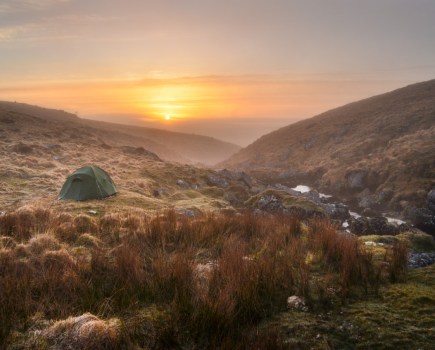
Top image: Johann/Pexels