

Norman Hadley ascends one of Lakeland’s most underestimated fells via a shy-but-brazen valley.
Woundale is a valley that Lakeland visitors will have looked up dozens of times as they’ve driven up the Kirkstone Pass, but mentioning its name to even a seasoned fellwalker is likely to elicit a blank look. Equally, when walkers gather to debate their favourite fells, I’ll wager Stony Cove Pike gets precious few votes.
This is a shame because, despite its unassuming, flat-topped appearance, it has many facets and hidden recesses. Six ridges radiate from the top; in purely numerical terms, that means it can hold its own with Blencathra. It also has some intriguing hollows that lend themselves to leisurely exploration. It’s common to disturb deer high in its recesses, especially on the southern flanks. In high summer, these hollows are jungly with bracken and richly populated with dragonflies. Be aware that Woundale – a shy but brazen valley – has a tendency towards dampness so, if you’re easily deterred by squelchy terrain, schedule your walk for drought or frost.
Stony Cove Pike: route description
START/FINISH: There’s a small pull-in on the left, with room for two carefully parked cars as you head up Kirkstone pass; NY410066. A second pull-in is another 200m further along (also on the left heading up) | MAPS: OS Explorer South-eastern Lake District OL7 (1:25k), Harvey Ultra Map Lake District East (1:40k) | DISTANCE: 8.5km / 5.3 miles | ASCENT: 453m / 1,486ft | DURATION: 3 hours
1. NY410066: Assuming you’ve arrived by car and have managed to squeeze it into the first pull-in, the start of the Woundale track is visible just uphill and across the road. Be very careful crossing the A592 as people descend quickly here and often erratically due to swerving around the dilatory sheep. A gate on the right, with a fingerpost, provides access to the valley track. This sets off on a steady nor-nor-easterly bearing by the wall. In all but the driest weather, this track soon develops a lavish string of puddles. Looking out for newts here.
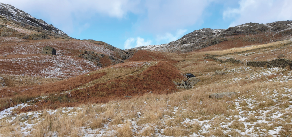
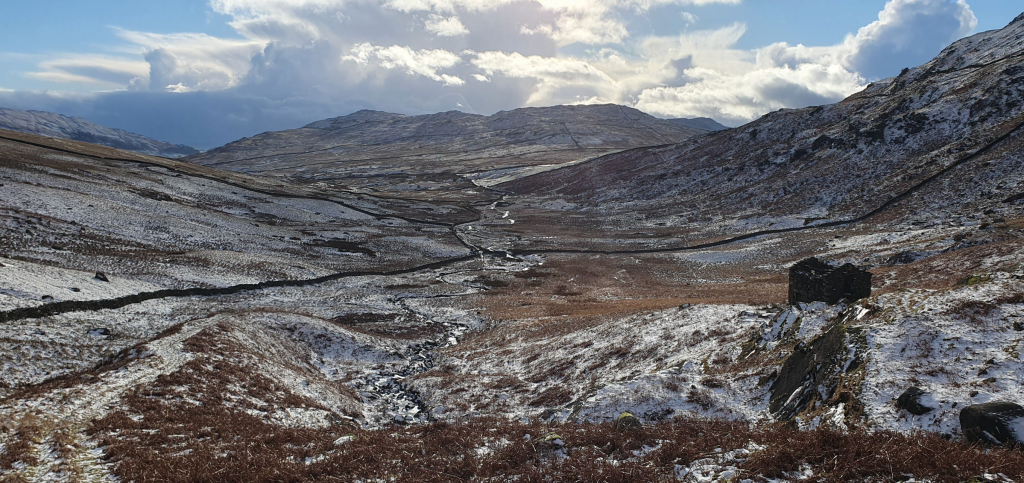
Looking up Woundale, with the romantic ruin on the left, the ascent via the tongue and col in the middle and the descent coming in via the wall on the right. Credit: Norman Hadley
2. NY412077: When the wall gives out, with an old romantic ruin across the beck to your left, ignore a quadbike track heading up to the right (you’ll be descending that way, so make a mental note) and gain a path on the crest of a bracken-clad tongue between the main beck and its tributary.
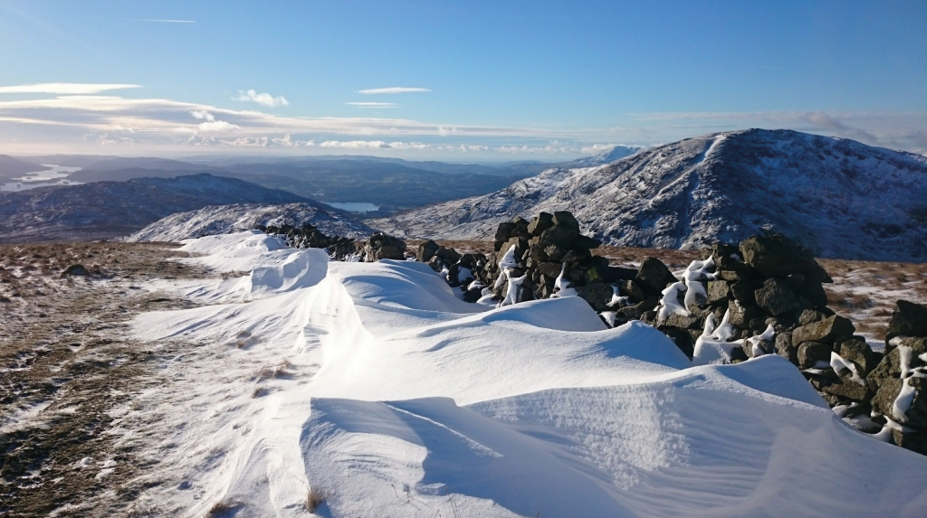
Snowy wall, Stony Cove Pike. Credit: Norman Hadley
3. NY408088: The tongue should guide you up to a shallow col where you’ll join the good path running along the wall that comes in from St Raven’s Edge and the Kirkstone Inn on your left. Turn right and follow the wall unerringly for 2 kilometres to a distinct junction of walls just south of the summit. If in mist, make a good note of this junction as you’ll need to reliably return to it and head off along the correct wall in the correct direction. At this point, you’ll doubt the fell’s claim to call itself a pike and its alternative name, Caudale Moor, will seem more apposite.
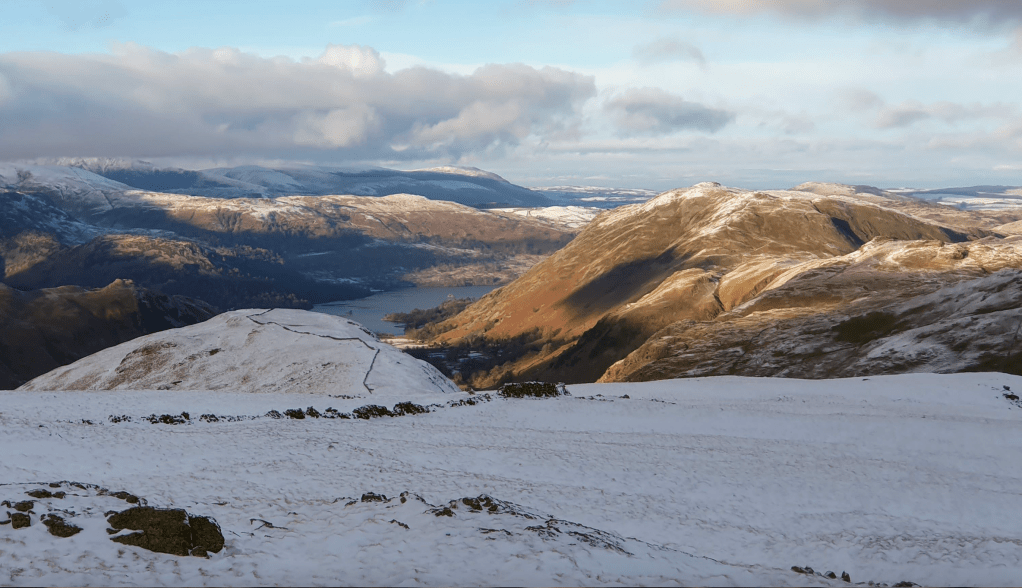
Looking north to Ullswater and Place Fell. Credit: Noman Hadley
4. NY418099: From the junction of walls, detour 100m north to the summit cairn at NY418100 and then retrace your steps to the junction. Consider a short detour to the south if the view down the length of the Troutbeck valley is clear, as it’s all the more photogenic without too much foreground. Similarly, it may be worth diverting a few paces north of the wall if the Helvellyn range is clear, because the view from the Atkinson Monument on John Bell’s Banner (where the wall curves) is particularly fine.
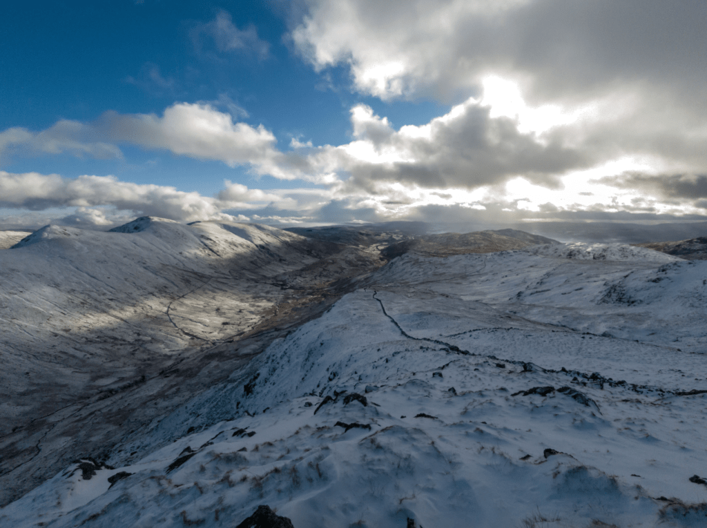
Looking down into Troutbeck from Stony Cove Pike. Credit: Norman Hadley
5. NY411093: On the return along the wall, look out for the opportunity to veer left onto the broad, grassy ridge of Hart Crag: the ridge that overlooks Woundale. A good departure point is around the 660-metre contour. Head south-south-east on initially pathless terrain towards the minor knobble of Pike How. There are a few peat hags to swerve around or vault as you see fit. This is where you’re most likely to startle deer so go softly if you can. Years ago, I put a hind to flight here as I descended in gathering dusk and the experience has stayed with me. The ridge slowly gains identity and with it, a path materialises. Follow the ridge as far as the 500m contour. You could go further along this ridge to reduce the amount of ground covered twice, but that would involve dodging fences and walls.
Looking down Woundale, past the ruin, to the distant A592 and Wansfell beyond. Credit: Norman Hadley
6. NY416081: Instead, pick up the quad-bike track mentioned at point 2. It will zigzag down the fellside to rejoin the main Woundale track just near the base of the tongue at point 2. Head back down the valley to the start. By now, you won’t mind the puddles at all – especially if the newts are out and about.
Further information
PUBLIC TRANSPORT: Trains to Windermere, then Bus 508 may be running up the pass in summer.
TOURIST INFORMATION: www.visitlakedistrict.com, 01539 822222
Discover more walks in the Lake District as mapped by our expert contributors.


