
Stefan Durkacz explores the hilly hinterland of East Ayrshire with a walk up Cairn Table.
Ayrshire, the land of Covenanters, Robert Burns and lead and coal mining, isn’t usually top of mind as a hillwalking destination. There’s often a post-industrial feel in the valleys, overlooked by a skyline of bleak, boggy moorlands and bare, humpbacked hills. It’s a landscape that feels quite reminiscent of the Welsh valleys or the Forest of Pendle, similarly touched by old industry and haunted by shadowy remains of pre-Christian cultures. Wind turbines now cluster on many hilltops whilst the lower slopes are in places littered with ruins and pocked with shafts from an earlier age of lead mining, and scarred by more recent opencast coal mining. The great, gloomy brow of Cairn Table looms over the old ‘leid toun’ of Muirkirk from the south.
It’s a popular hill walk locally, offering superb, extensive views from the top to the Galloway and Borders hills, Arran and even as far as Ben Lomond on very clear days. Rather than returning by the same route, if you don’t mind a bit of vigorous bog-bashing you can make an enjoyable circuit by traversing the adjacent moors with the prevailing wind at your back, and returning along the waymarked River Ayr Way.
Cairn Table: route description
Start/Finish: Walkers’ car park, Furnace Road, Kames (GR: NS 696 265) | Maps: OS 1:50,000 Landranger sheet 71 Lanark & Upper Nithsdale; OS 1:25,000 Explorer sheet 328 Sanquhar & New Cumnock | Distance: 14.5km/9 miles | Ascent: 436m | Duration: 6-7 hours
1. NS 696 265: Take the path from the top end of the car park by the map and information board. Almost immediately the path forks; carry on straight ahead, ignoring the right fork signed for the River Ayr Way.
Lead mining remains on the way to Cairn Table. Credit: Stefan Durkacz
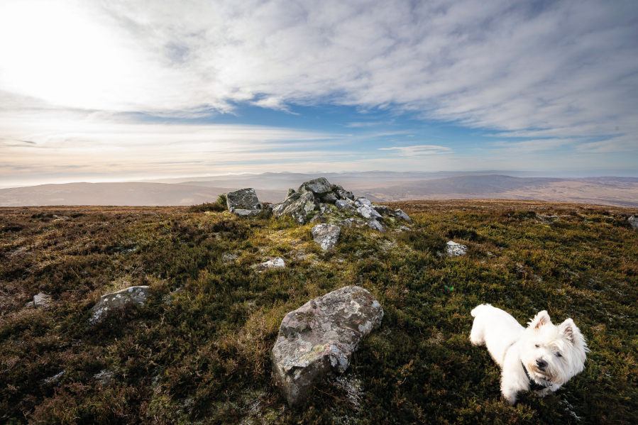
2. NS 700 269: The track forks again; this time bear R uphill towards Cairn Table. From the lower slopes, the massive conical summit cairn is visible on the distant skyline. The path initially weaves over short, sheep-cropped turf through an area of lead mine workings. Numerous ruined buildings dot the landscape. There are also mineshafts here so it’s best to stick to the path and keep your dog on a leash. Further on, the path becomes increasingly boggy as it crosses the lower moor. Some of the wettest bits are traversed by short boardwalks.

Looking bck over the boggy section of the approach to Cairn Table. Credit: Stefan Durkacz
3. NS 704 258: Now the eroded path shadows a fence uphill. Cross a fence that branches off to the right by a stile. The way gets steeper as you climb the shoulder called The Steel (413m), and the path becomes stony rather than boggy. Wide views open out across the upper River Ayr valley and the village of Muirkirk already looks far away.
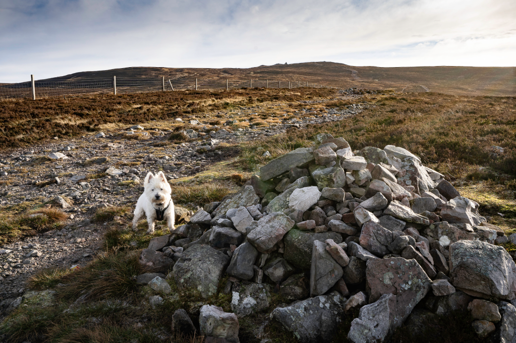
Summit cairn visible on the skyline from The Steel. Credit: Stefan Durkacz
After a brief respite, the broad path continues its upward trajectory towards the summit cairn visible again on the skyline. Soon the top of Cairn Table (593m) is reached. There’s the massive, well-built war memorial cairn that has been so visible from below, a trig point and the tumbledown remains of a much older cairn. There are a few rocky nooks around the summit to hunker down out of the wind for a brew.
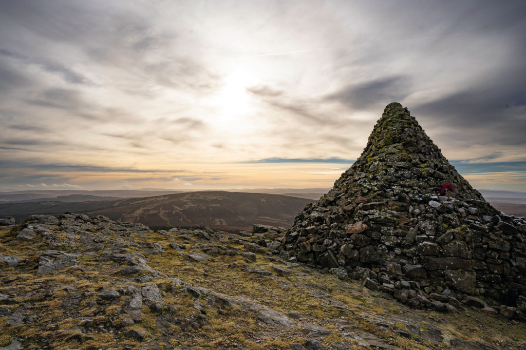
The war memorial cairn on Cairn Table. Credit: Stefan Durkacz
4. NS 724 242: After admiring the extensive summit views, descend steeply NNE down heathery slopes towards the broad, boggy saddle separating Cairn Table and the next summit, Little Cairn Table. Aim for a junction of fences.
5. NS 728 248: At the junction of fences, follow the fence heading NE. Continue down to the saddle, shadowing the fence for several kilometres as it crosses the gradually descending moors over Little Cairn Table (517m), Wee Hill (493m), Dunside Rig (402m), Ettrick Cairn (402m) and finally Brack Hill (398m). The going is rough and wet although ATV tracks somewhat ease your passage for much of the way. This is a grouse moor and estate staff will occasionally visit to replenish the medicated grit stations you’ll see dotted around.
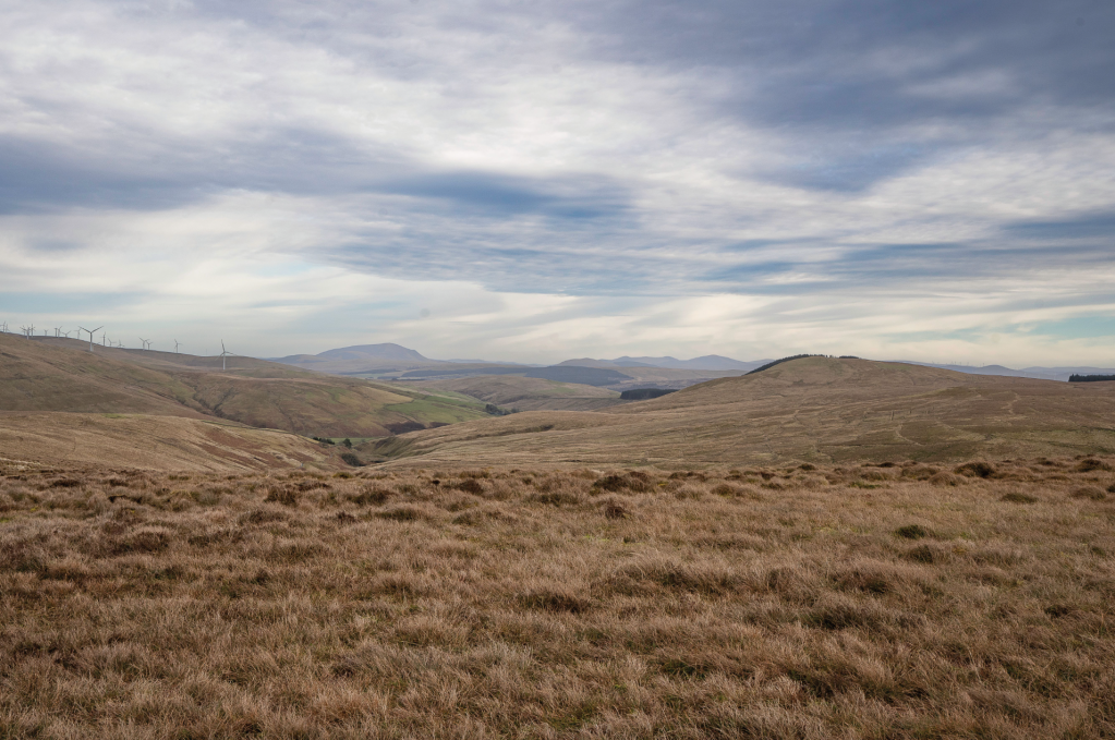
Looking north east from Wee Hill towards Tinto. Credit: Stefan Durkacz
6. NS 746 275: At Brack Hill, cross the fence (with care – it’s topped with barbed wire) and descend NW, steeply at first, to reach eventually the track from Darnhunch farm. Bear in mind again that this is lead mining country and keep a careful eye on the ground in front as you cross the lower moor. Turn L and follow the farm track for around 500 metres. Just before meeting the A70 road, the track passes through an old railway embankment. This now carries the River Ayr Way, a long distance walking route between Ayr and the source of the river at nearby Glenbuck Loch.
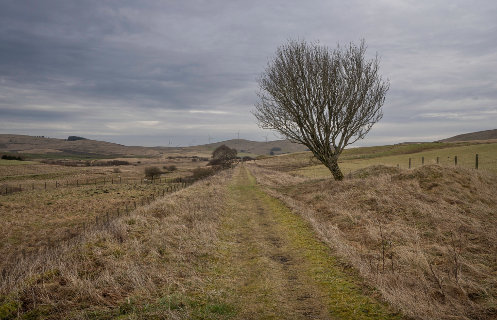
09_On the River Ayr Way
7. NS 735 285: Turn L onto the embankment and follow the River Ayr Way for 4.5km back to the car park. The route mostly follows the line of the railway. This is a walkers’ rather than cyclists’ path so the surface is a mixture of grass and hardcore rather than tarmac, nice and easy on the feet. Around 1.5km from the end of the walk, the route detours around a house, taking to a tarmacked narrow lane for a short distance. Look out for the wooden River Ayr Way finger posts that clearly signpost the way.
Further information
Public transport: Stagecoach service 42 between Ayr and Muirkirk. From Muirkirk Main Street walk down Furnace Road (signposted for Kames motorsports circuit) S for 750 metres to reach the walkers’ car park.
Tourist information: Glasgow VisitScotland iCentre (Tel: 0141 566 4083)
Discover more walks in Scotland as mapped by our expert contributors.


