
Ian Battersby crams waterfalls, mini scrambles, big views and superlative limestone surroundings into a few short winter daylight hours on his favourite ascent of Buckden Pike.
Buckden Pike is a popular climb in the Yorkshire Dales. The focal path appears to head unswervingly for its crown, but Buckden Beck is even more direct, not celebrated, and not conspicuously mapped. Its feeble trail feels like a voyage of discovery. There are unimagined charms to enthrall the adventurous, including waterfalls, scrambles, and crags, on the way up to a ramshackle mine. Escape from the spell of the gill for a stage over some of the national park’s most distinctive mountains.
The bridleway back delivers a rapid return for when the day draws down a dismal shroud. On good days the head of Wharfedale beckons from across Cray Gill. Here an enchanting path skirts above broadleaf woodland, where pioneering trees flourish on precipitous slopes, safe from nibbling sheep. Beyond the branches, the immense width of Wharfedale competes with flocks of goldfinches for awe-inspiring wonder.
Buckden Pike via Bucken Beck: route guide
START/FINISH: Car park by the B6160 at Buckden (GR: SD942775) | Maps: OS Explorer OL30 (1:25k) | Distance: 12km/7.5 miles | Ascent: 560m/1,840ft | Duration: 4 hours
Route Description
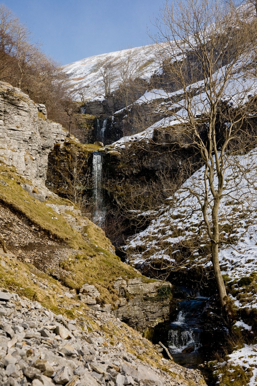
1. START/FINISH: Car park by the B6160 at Buckden (GR: SD942775) Head N through a gate to exit the car park, turning immediately SE along a path signposted to Buckden Lead Mine and Starbotton. Climb above the campsite to reach Buckden Beck after 200m. Head NE, past the stone hut. Head upstream along a grassy path with the beck on the right cascading between slow pools and limestone slides. The craggy flanks of the gill close in as the path climbs.
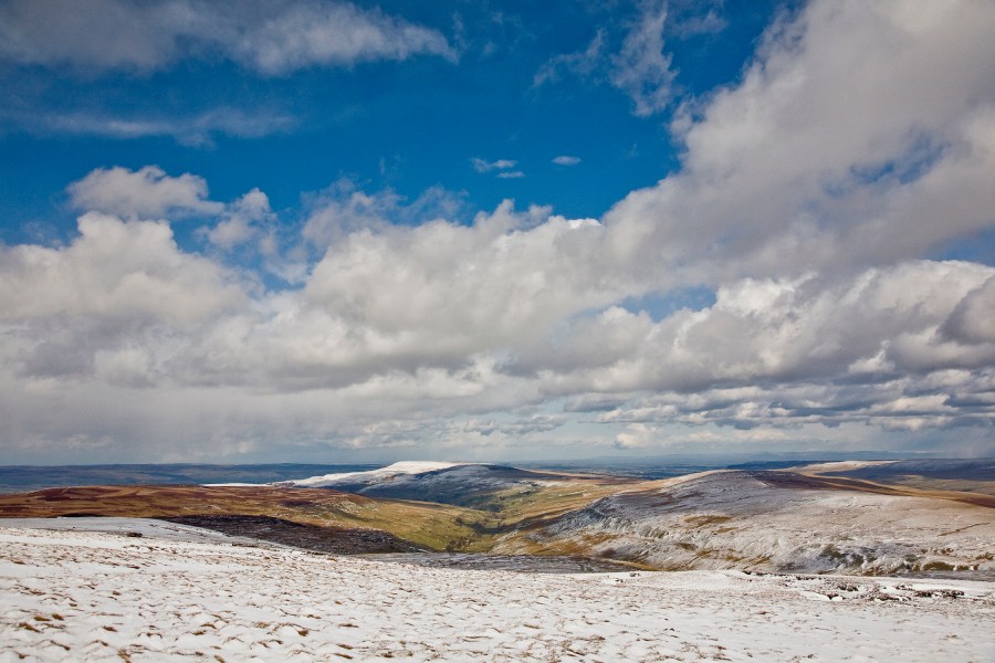
Snow lies in Buckden Gill
Credit: Ian Battersby
2. SD946776 At a high waterfall zigzag left, scrambling up through a narrow cleft in the limestone crag, then right, threading a narrow line above the vertical crag to reach the top of the fall, seen crashing far below. Continue NE to a double-tiered waterfall. Above the first tier, the path again zigzags left then right, this time passing through an easier weakness in the limestone crags. As the beck dwindles, limestone crags recede and the gradient diminishes.
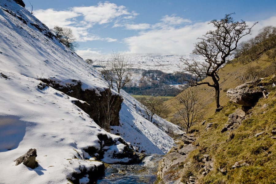
Firth Fell from Buckden Gill
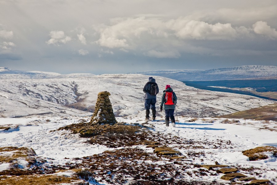
Subsequent waterfalls are passed with ease, and the path shadows the beck to a spoil heap at Buckden Lead Mine. Climb the heap then follow the permissive path N then E to a wall corner. Here the path heads N before climbing NE to Buckden Pike. The Three Peaks stand proud in the west, as does Great Whernside in the SE. Cross the ladder stile and follow paving slabs N to the trig point.
Great Whernside from Buckden Pike
3. SD961788 A good path descends NW with a wall on the right. At 570m the path turns W, dropping past a limestone outcrop, turning SW through gates, before dropping W to a gated grassy bridleway at Buckden Rake.
4. SD941785 Contour NNE along the bridleway, signposted Cray High Bridge. Cray hamlet appears among trees below, and a path, signposted Cray, turns W dropping away from the bridleway, turning N at the bottom to reach stepping stones crossing Cray Gill into Cray.
5. SD942792 Follow the track, signposted Stubbing Bridge and Yockenthwaite, passing right of the White Lion Inn to reach open pasture at a gate. The path contours along a limestone terrace above trees covering the steep flanks of Cray Gill. Continue SW gradually turning NW to a footbridge at Crook Gill. Cross the bridge, and continue along the path to Scar House, using the same limestone terrace now contouring above Todd’s Wood. Gaps in trees reveal the wide expanse of Wharfedale.
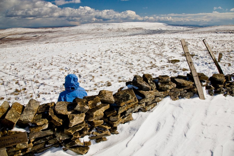
Penhill and Brown Haw from Buckden Pike
Credit: Ian Battersby
6. SD921789 Follow the track dropping left of Scar House and join a concrete lane that wriggles SE past woods and pastures to reach the church at Hubberholme.
7. SD926782 Cross the road bridge at Hubberholme to reach The George Inn. Turn left heading E, then SE along Dubb’s Lane. The River Wharfe veers away, hidden by trees, and Kirk Gill Moor Wood climbs steep slopes on the right. After 500m the footpath veers left, signposted Buckden Bridge, through a gate heading E to rejoin the Wharfe.
Here the river alternates between shallow running rapids. Go through several gates as the path turns SE and eventually leaves the river to cut across to Dubb’s Lane again. Head E over the arched bridge into Buckden, turning left along a track by the green. The village shop stands out white against the natural stone of surrounding cottages. Head N along B6160 a few metres to return to the car park.
Further information
Public Transport: None to start
Tourist Information: Yorkshire Dales National Park Authority
There are plenty more Yorkshire Dales walks to explore, handpicked by The Great Outdoors.


