

Ian Battersby picks out a safer route to hike Blencathra when formidable winds, ice and swirling spindrift make Plan A a risk too far.
Blencathra offers a multitude of approaches and retreats with a bountiful assortment of challenges, which can be selected based upon mood, fitness or confidence levels on the day. But, as is always the case in the mountains, the weather must have the final say. So, if you set out and conditions to hike Blencathra are more arduous than imagined, it’s easy to modify plans and still be guaranteed a dazzling day out.
The scrambles on Halls Fell, and more so Sharp Edge, may be avoided by many when winter takes hold, but even the easier looking paths sometimes teeter briefly alongside drops that may see an unlucky icy step go further than ideal. Without winter gear these concerns will at best etch new worry lines into concerned brows and spoil the day, whereas an ice axe for balance or brake and crampons for firm control over packed snow and ice permit a more skilful and confident adventure yielding thrilling tales for the pub banter later.
Hike Blencathra with no edges: route description
START/FINISH: Small layby on A66 just west of Scales; NY340268 | MAPS: OS Explorer OL5 (1:25k), OS Landranger 90 (1:50k), Harvey British Mountain Map Lake District (1:40k) | DISTANCE: 10.6km / 6.6 miles | ASCENT: 770m / 2,525ft | DURATION: 4.5 hours
1. NY340268: There is a larger layby with more parking 100m west of the small layby by the house that marks the start of this route. Follow the signposted footpath north through trees to a gate. After the gate the path veers east north-east alongside the intake wall and past pine trees, with a stunning view across the valley to Red Screes on Clough Head which dominates the scene. The path and wall curve gently north to reach a fork in the path after 500m. Veer Left, and left again at the next fork, heading north to reach the steep edge of Mousthwaite Comb. The path follows the edge north-west then north past the drop, before veering north-west into the Glenderamackin River valley with Brunt Knott and Sharp Edge coming into view on the left. After 900m the path forks left, climbing west alongside Scales Beck to reach Scales Tarn surrounded by an amphitheatre of towering crags with Sharp Edge on the right climbing with gritted teeth to Blencathra.
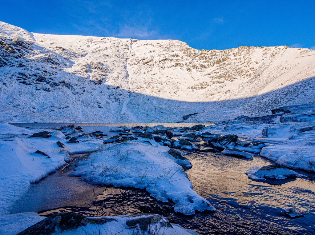
Sharp Edge and Scales Tarn. Credit: Ian Battersby
2. NY330281: Cross Scales Beck and follow the path climbing south, then south-west, to reach the crest of the ridge ahead. As Scales Tarn diminishes the view expands beyond Bannerdale Crags, crossing the vast vale, to find Cross Fell in the distant chain of Pennine hills. At the crest the gradient gets steeper, but zigzags lessen the effort, and sanction superb views down the crest of Scales Fell.
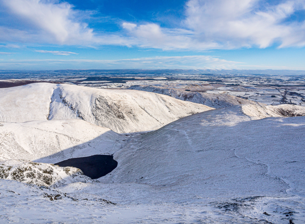
Scales Tarn and Bannerdale Crags. Credit: Ian Battersby
On a good day it’s worth sauntering north along the edge of Tarn Crags to the top of Sharp Edge to watch the steady stream of gratified scramblers survive the adrenaline jitters. From the top of the zigzags climb steadily south-west to reach the small concrete ground marker for the OS Trigonometrical Station at Hallsfell Top.
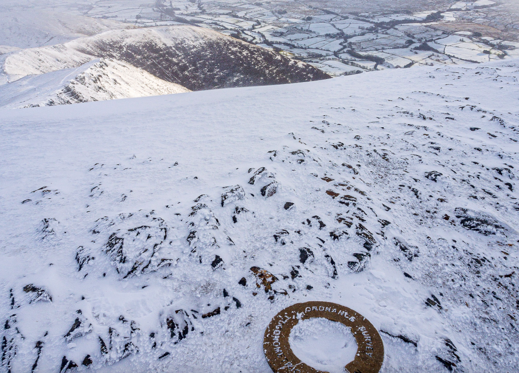
Hallsfell Top. Credit: Ian Battersby
3. NY323277: The path drops gently west, soon turning west south-west, following the edge past Middle Tongue and Gategill Fell to reach Know Crags around 1km away. It’s easy walking and from this position and elevation in the far north of Lakeland the relaxed pace is accompanied by outstanding views beyond the immediate abyss to the many Lake District fells further south and west, as well as Skiddaw and the fells of the Back o’ Skiddaw north-west and north. From the summit of Know Crags at 804m the path begins to descend more steeply south-west over Blease Fell to 675m, at which point zigzags drop very steeply south to a fork in the path at 690m.
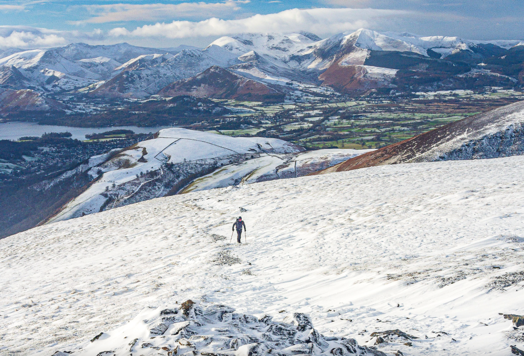
Grasmoor from Blease Fell. Credit: Ian Battersby
4. NY307264: Take the left fork, continuing to drop south to a path junction at 410m. Turn left, dropping more gently, heading east south-east, and slowly turning east north-east to reach a wall corner. The path drops very steeply south-east through bracken to arrive at a gate above Blease Farm, with Threlkeld close by for those needing a bus.
Return path above Blease Farm and Threlkeld. Credit: Ian Battersby
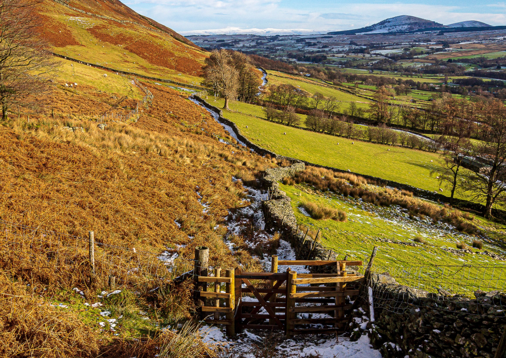
5. NY314260: Through the gate the path runs alongside a wall for most of its length, keeping parallel with the vale. Follow it east north-east crossing Blease Gill, Gate Gill and Doddick Gill. At Doddick Gill the path climbs north very steeply after the beck, then continues in an east north-easterly direction to Scaley Beck where the route holds a final surprise for those who thought this route was easy, with an awkward scramble down to and up from the beck. Continue to contour alongside the wall for another 300m to a junction of paths. Turn right, dropping south to the first path of the route at the gate. Drop south to return.
Further information
PUBLIC TRANSPORT: No public transport to start to hike Blencathra, however Stagecoach buses X4 and X5 stop at Threlkeld only a short distance from the route
TOURIST INFORMATION: Keswick, 0845 9010845
Discover more walks in the Lake District as mapped by our expert contributors.


