Ronald Turnbull reviews this comprehensive ‘coffee-table’ collection from specialist walking map-makers Harvey Maps.
The world of walking up hills is divided into those who like a bobblehats and those who like a Buff. Those who wear gaiters and those with wet legs. And those who follow the Ordnance Survey versus those whose mapping is Harvey.
Me, I’ve been a Harvey person ever since their 1:25,000 map of the Cuillin (with a ‘zoomed-in’ map of the ridge) came out, the first intelligible one of that super- complex bit of mountain ground.
Harvey maps have advantages even beyond not getting lost on Sgurr na Banachdich. They are printed on waterproof paper – except that nowadays they’re printed on even more waterproof plastic, tough enough that one lightweight fanatic doubles up his map as his groundsheet. They mark paths where they actually are, rather than in some conceptual Platonic world of historic wayleaves. They don’t obliterate crucial contour detail with little marks like midge corpses on all the more interesting bits of ridge. For handy bagging, Munros are named in red and Corbetts in orange.
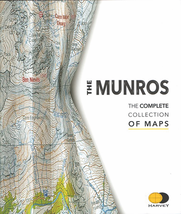
Harvey Maps was founded 40 years ago by two orienteers called Sue and Robin. The company still lives behind a Georgian shopfront in the small town of Doune, just south of the Highland Line. They have celebrated 40 years mainly at the useful 1:40,000 scale (as well as Sir Hugh Munro’s hundredth anniversary) with this handsome coffee-table book mapping every one of the 282 Munros.
Given that most of us do not carry a coffee table up Sgurr na Ciche, this book is not intended for the hill. Unlike the mapping it’s based on, it is neither waterproof nor lightweight. Its purpose is planning and reminiscence – perhaps with the evening cocoa or glass of whisky rather more than the coffee as such. It thus saves the effort, after a long hill day, of constantly leaping up from the sofa to pull down yet another map.
The book does reinforce the practice of climbing only the Munros, and only by the shortest route from the most convenient car park. It can at times be a little frustrating – if, like me, your main interest is tracing out unusual ways up from different directions altogether. What’s west of Schiehallion, or north of Beinn Eighe? For that you need the actual map. Even so, the book has just shown me an intriguing pathline onto Beinn Bhuidhe that’s undisclosed on any other mapping. (The old stalker’s path above Inverchorachan, if you’re interested.)
This book celebrates 40 years of intelligent and helpful Harvey’s mapmaking. Which, in my book, is something well worth celebrating.