
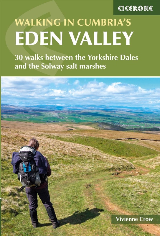
Walking in Cumbria’s Eden Valley by Vivienne Crow (Cicerone Press) describes 30 walks between the Yorkshire Dales and the Solway salt marshes. In this extract, we’ve shared Walk 3 – Nine Standards.
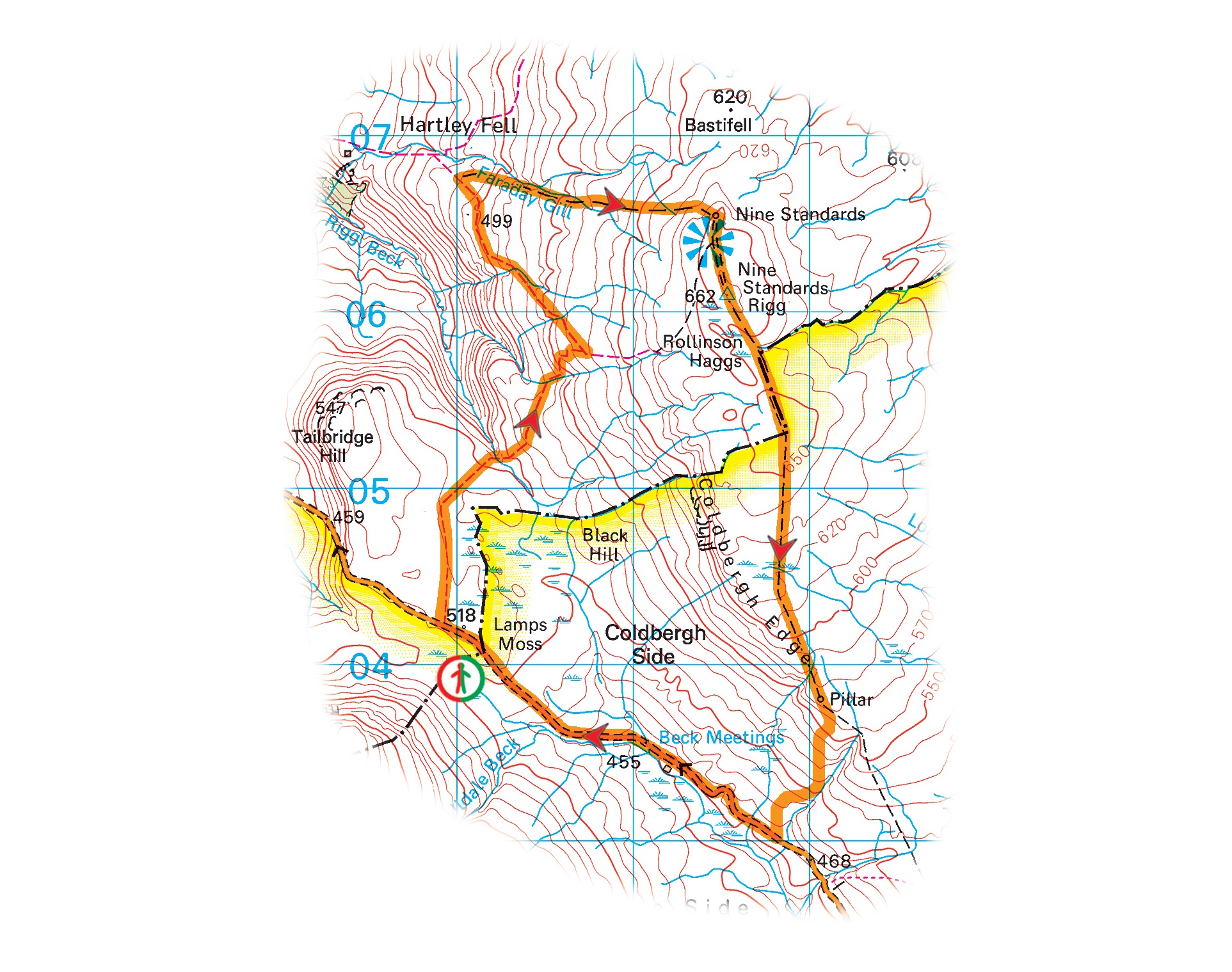
- Start/finish: Large layby at Cumbria’s border with North Yorkshire on the B6270 (NY 811 040)
- Distance: 7 miles (11.5km)
- Total ascent: 384m (1260ft)
- Time: 3¾hr
- Terrain: Open moorland, boggy in places; section on road
- Maps: OS Explorer OL19 or OS Landranger 91
- Transport: None
- Facilities: Nateby Inn nearby Nateby
© Crown copyright 2018 OS PU100012932
The walk
Nine Standards Rigg, high above the Upper Eden Valley, is crowned by a group of mysterious ‘stone men’. Located close to the 662m (2171ft) summit of the hill, these tall cairns can be seen for miles around. Likewise, the view from this windswept spot is extensive in all directions. Nine Standards is usually climbed from Kirkby Stephen in the valley below, but this walk makes use of a substantial layby located more than 500m above sea level to reduce the amount of climbing. It passes through attractive limestone country before climbing to the summit, where a toposcope provides details of the hills that can be seen. A peaty path, part of Wainwright’s popular Coast to Coast route, then heads south across this vast area of moorland.
From the layby on the county border, walk northwest along the B6270 for about 320m – until you see a sign on the right explaining the various seasonal routes used by Wainwright’s Coast to Coast. Take the broad, grassy path heading roughly north – the Coast to Coast’s December-to-April option and bad-weather alternative. Bear right when this forks in a short while.
The 190-mile Coast to Coast long-distance walk was devised by the guidebook writer Alfred Wainwright in 1972. Starting in St Bees in Cumbria and ending in Robin Hood’s Bay in North Yorkshire, it crosses three National Parks: the Lake District, the Yorkshire Dales and the North York Moors.

Dukerdale
© Vivienne Crow
Go through a gate and walk across a fenced area of exposed limestone. After the next gate, bear left to walk beside the fence. Then, at the next gate, swing right on a reasonably clear path crossing Lamps Moss.
Near the head of the impressive limestone gorge of Dukerdale, you’ll see some huge holes, like bomb craters, beside the path. These are shake holes, a common feature of limestone areas. They are formed when rainwater washes the sub-surface soil down into cracks in the underlying rock. Eventually the ground collapses, leaving a small depression.
As another path joins from the left, drop to cross the beck feeding into Dukerdale. Climbing the slope on the other side, bear right at a fork. This path gradually swings away from the wall. After crossing Rollinson Gill, it zig-zags up a grassy slope to a small stone construction on the high ground. Pass to the left of this and keep straight ahead (east) to reach a fingerpost. Turn left here – along a narrow, grassy path that heads northwest at first.
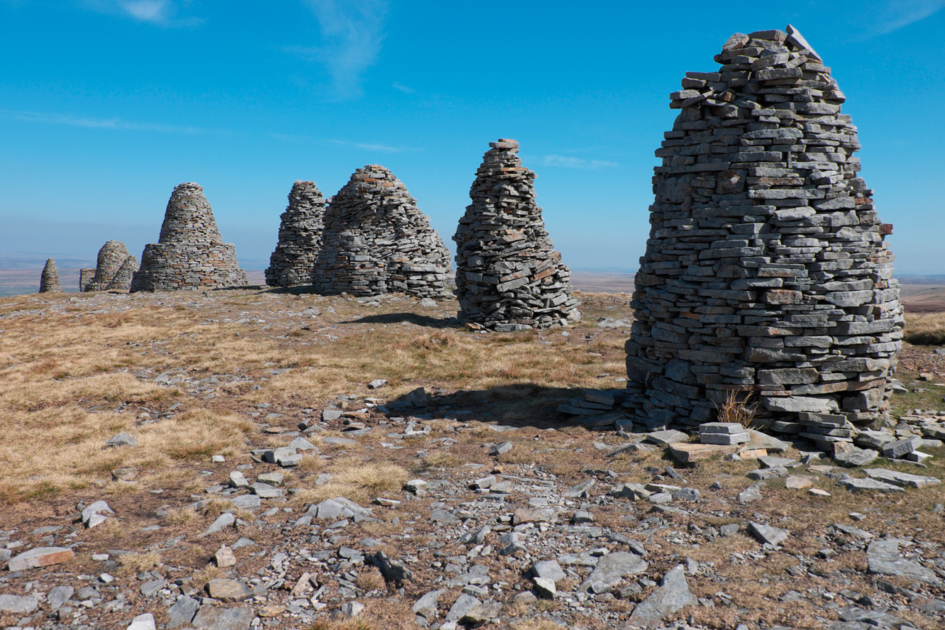
Nine Standards
© Vivienne Crow
Pay particularly close attention to the path and the walk description for the next few hundred metres; it’s easy to go wrong here, especially if you’re distracted by the beautiful views of the Lake District and the North Pennines that are starting to open out.
“The march of tens of thousands of Coast to Coast walkers’ boots have created a path of sorts continuing from the trig pillar”
You’ll soon reach a fingerpost beside a tiny beck. It’s very tempting here to keep straight on, but you need to bear left, heading downhill. Soon after the next waymarker, as the path becomes less distinct, you encounter a very soggy gill. Bear left here, heading downstream, and you’ll quickly hit a clearer path. Turn right, quickly crossing the beck.
This relatively dry, grassy path – with a wall to the left – makes for easy walking. When you reach a fingerpost in a few hundred metres, turn sharp right – signposted Nine Standards.
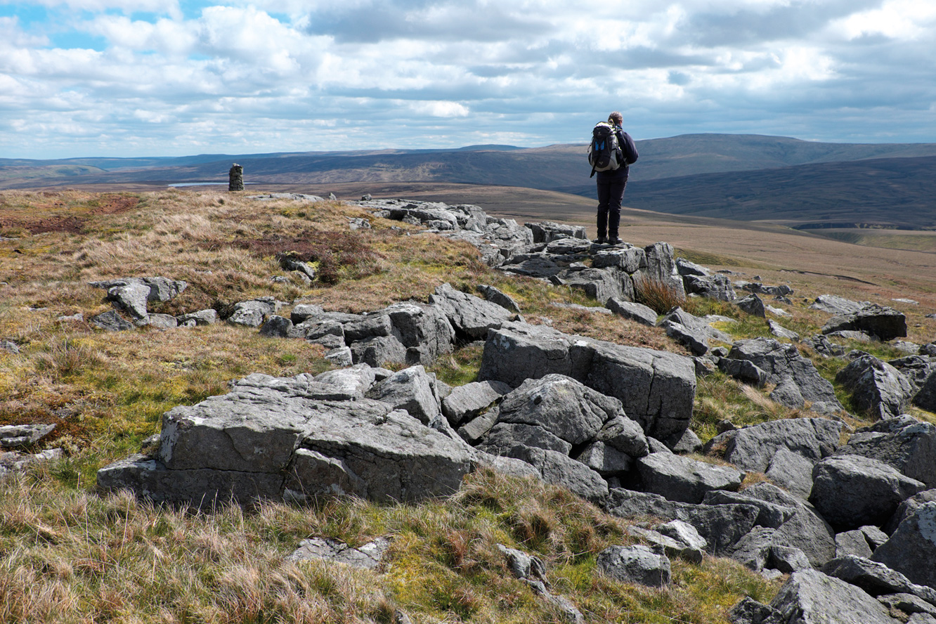
Enjoying the view from Coldbergh Edge
© Vivienne Crow
Having wound your way uphill for a short while, you’ll see Faraday Gill to the left: a rocky and steep-sided trench cutting into the grassy moorland. The path leads directly to the Nine Standards themselves.
The origin of the ‘stone men’ or tall cairns on Nine Standards Rigg is a mystery. One claim is that they were constructed by the Romans to look like troops from a distance; others say they are boundary markers. Major repairs on some of the cairns were carried out in 2005. There is a tremendous view from the top, taking in the Lake District fells, Cross Fell – the highest point in the Pennines – and countless other hills stretching far into the distance.
For a detailed breakdown of exactly what it is you’re looking at, head roughly south-southwest for about 90m to reach the toposcope, or view indicator. From here, the faint path continues south-southeast to the trig pillar.
The march of tens of thousands of Coast to Coast walkers’ boots have created a path of sorts continuing from the trig pillar. It drops, via a fingerpost, to cross the new flagstones over the boggy ground at Cumbria’s border with North Yorkshire. Before flagstones were laid, this section of the Coast to Coast was notoriously tricky. Mountain rescue volunteers had even been called out to pull walkers from the bog. The new path was opened in 2017.
 Another fingerpost marks the point at which the seasonal Coast to Coast routes split. Having started the walk on the green route, we’re now following the red route, which keeps straight on. Although it weaves about, the general direction is slightly east of south. The path is little more than a worn line through the moorland vegetation, so it’s easy to lose sight of it, particularly where it crosses boggy sections.
About 2.6km beyond Nine Standards, the route passes to the left of a pile of stones near Coldbergh Edge. From here, it continues south-southeast towards a tall cairn close to some rock outcrops.
About 90m beyond the cairn, leave the Coast to Coast as it heads left at a faint path fork. Our route takes the more pleasant-looking grassy track that swings right. This later joins up with a more solid track that descends to the road. Turn right. There’s now about 2.2km of road-walking back to the layby where the walk started.
Walking in Cumbria’s Eden Valley by Vivienne Crow is a guidebook to 30 graded walks in Cumbria’s Eden Valley. The routes, which range from 3 to 15 miles and are best from bases such as Kirkby Stephen and Appleby, explore the region’s diverse landscapes and offer dramatic views, either of the Pennines, Lake District or the Scottish hills. Linear routes link with the Settle-Carlisle railway. (Cicerone Press, £11.66)


