
When Kat Young set out to hike the South Island section of the Te Araroa through New Zealand, she didn’t anticipate that dodging cyclones would be on the list of hazards…
By Kat Young
Sweat trickled from my forehead, down my nose, and onto the clay soil. I shortened my steps to try and ease the ache in my calves as I shuffled up the hill, and I shifted my pack to soften the scream of my shoulders. A parting in the jungle trees coincided with a respite from the climb. I threw my bag onto the ground and sat down, spluttering as I tried to get my breath back at the same time as drinking water. I looked at my watch. I was 15 minutes into day one of a journey that would last two or three months. Ah.
The Te Araroa (TA) is a 3,000km (1,864 mile) walking trail running the length of New Zealand, from Cape Reinga at the top of the North Island, down to Bluff at the bottom of the South Island. Officially it is only seven years old, making it one of the newest long-distance trails around. Due to a combination of the extensive road-walking sections on the North Island, and finding three months off work easier to come by than six months, I set the South Island portion of the trail (around 1,300km / 807 miles) as my goal.
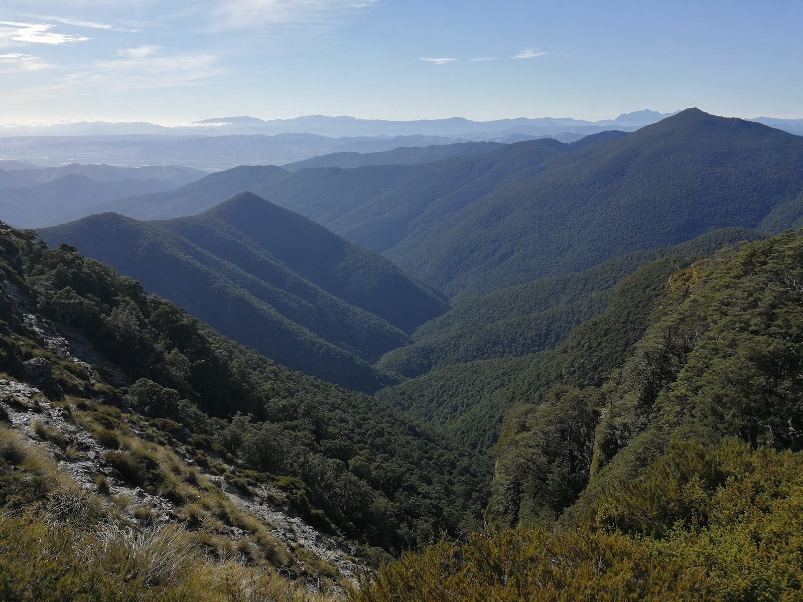
Heading east over the Richmond Ranges
I’d done a few two-week long hikes by myself before, so didn’t consider myself a total novice, but they weren’t nearly as remote or as wild as the Te Araroa. Setting foot onto the jetty at Ship Cove as the taxi boat motored away, I was a bundle of excitement, nerves, anticipation and trepidation. In New Zealand there are no bears, snakes or poisonous spiders – which for me is one of its attractions. It’s not the wildlife that you need to be careful of, it’s the wilderness. The rivers are so dangerous that drowning is known as the ‘New Zealand death’. I didn’t mention this to Mum.
There’s no comparing the beauty of the outdoors. Each new mountain range is magnificently unique, and filed away in my memory for perennial appreciation
On the South Island, Te Araroa starts with the Queen Charlotte Track, a popular 70km trail in the Marlborough Sounds. It’s a beautiful, well-graded and wide path with picnic benches, and you could stay in beach-side hotels if you wanted. The sandflies were vicious but the steep, forested hills and sparkling blue waters were gorgeous. The hikers I met that had done the North Island trail laughed when I groaned about how hard it was. I would soon discover why. Leaving the manicured tourist path behind, I headed into the Richmond Ranges.
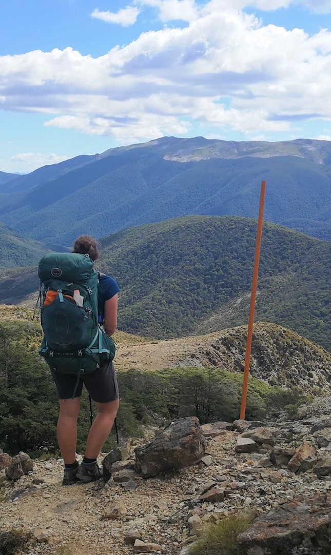
Trying to spot Hunters Hut in the Richmonds
You know that scene in Wild where she can’t lift her backpack off the ground? It wasn’t quite as bad as that, but it’ll give you some idea. From the Pelorus campground I was carrying nine days of food, plus some emergency backup, which meant my pack weighed around 18kg. The plan was to do the Richmonds in eight days, but as there were a lot of river crossings it was important to take extra food in case I had to wait for them to go down. Apart from one swollen creek right at the beginning, they all turned out to be manageable.
I got used to the fact that wet feet are a daily part of life on Te Araroa. It seemed a small price to pay for being surrounded by such beautiful mountains and wilderness. I often use previous experiences to get myself through hiking ordeals, such as “Oh, it’s a hail storm? Well it’s not as bad as that time in x or y…” but there’s no comparing the beauty of the outdoors. Each new mountain range is magnificently unique, and filed away in my memory for perennial appreciation.
New Zealand basked in a heatwave in January. In 30˚C heat, walking up and down rugged mountains with a heavy pack was tough. I got heatstroke. It was really tough. I was nauseous, and eating or drinking anything made me retch. Every step felt like a herculean task. Couldn’t I just lie down for a while? I was in the middle of the Richmonds, four days’ walk from anywhere and I was getting weaker and couldn’t stay hydrated. Only I could get myself out. Luckily the hikers I met were amazing people, and in our group there happened to be a doctor and a nurse, which was useful. I adopted a strategy of dunking my hat in every stream to try and keep myself from overheating, and being disciplined about sipping water. I was a bit over-zealous with the dunking and for a couple of days I perpetually looked like I’d just gone for a swim. But it seemed to work, and I made it out to the beacon of civilisation that was St Arnaud, population 500.
I recovered (I emptied the café of donuts) in time to start the next section with my trail friends, which was more important to me than I expected. I usually relish my solitude in the mountains and on the trail, so it took a bit of self-exploration to understand the change. Without being too melodramatic, I think it was a mix of facing my own mortality and the feeling of powerlessness in the wild, along with being comforted by having something constant when everything else changed every day as I was on the move. That, and having someone to squeal “How awesome was that?” with at the end of the day.
This was one eventuality I hadn’t prepared for. What are you meant to do when in a massive forest with trees falling around you?
The mountains of the Nelson Lakes were perhaps even more stunning than the Richmonds – and thankfully the temperatures were slightly less sizzling. After 3 days of walking I reached Blue Lake, the clearest natural body of freshwater in the world, with visibility down to over 70m. It was gorgeous, and our small trail family were the only ones there. In Europe there would probably be a car park and an ice-cream van.
After (slowly) conquering the sketchy scree traverse and climb over the Waiau Pass, the terrain levelled out for a day or two. With about 10km of beech forest to go to the trailhead, a morning of heavy rain gave way to an afternoon of strong winds. The beech trees were tall and thin and swayed easily in the gusts, creaking and groaning. I heard a faint crash. Was that…? Out of the corner of my eye I saw a tree I had just passed uproot and topple over behind me. Well. This was one eventuality I hadn’t prepared for. What are you meant to do when in a massive forest with trees falling around you? I kept one eye on the swaying trees above and one eye on the uneven path, and practically ran, my heart pounding. It’s remarkable how adrenaline can make a heavy backpack feel much lighter.
There were a few more close calls – one tree came down right across the path in front of me – but I fell out unscathed to Boyle Village. After a tense wait for my friends to come out, we hitched to a nearby town for a couple of days of rest and resupply. We later learned we’d walked through the edge of Cyclone Gita.
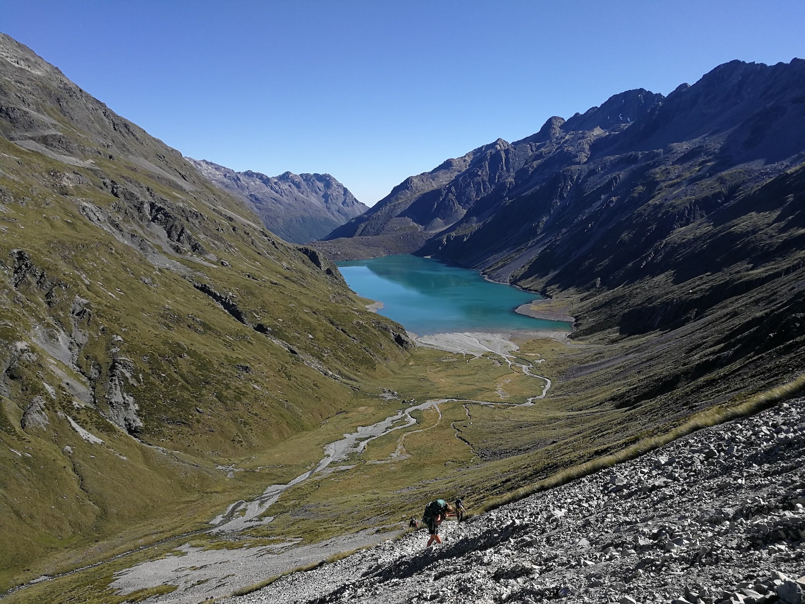
Looking back at Lake Constance from the Waiau Pass
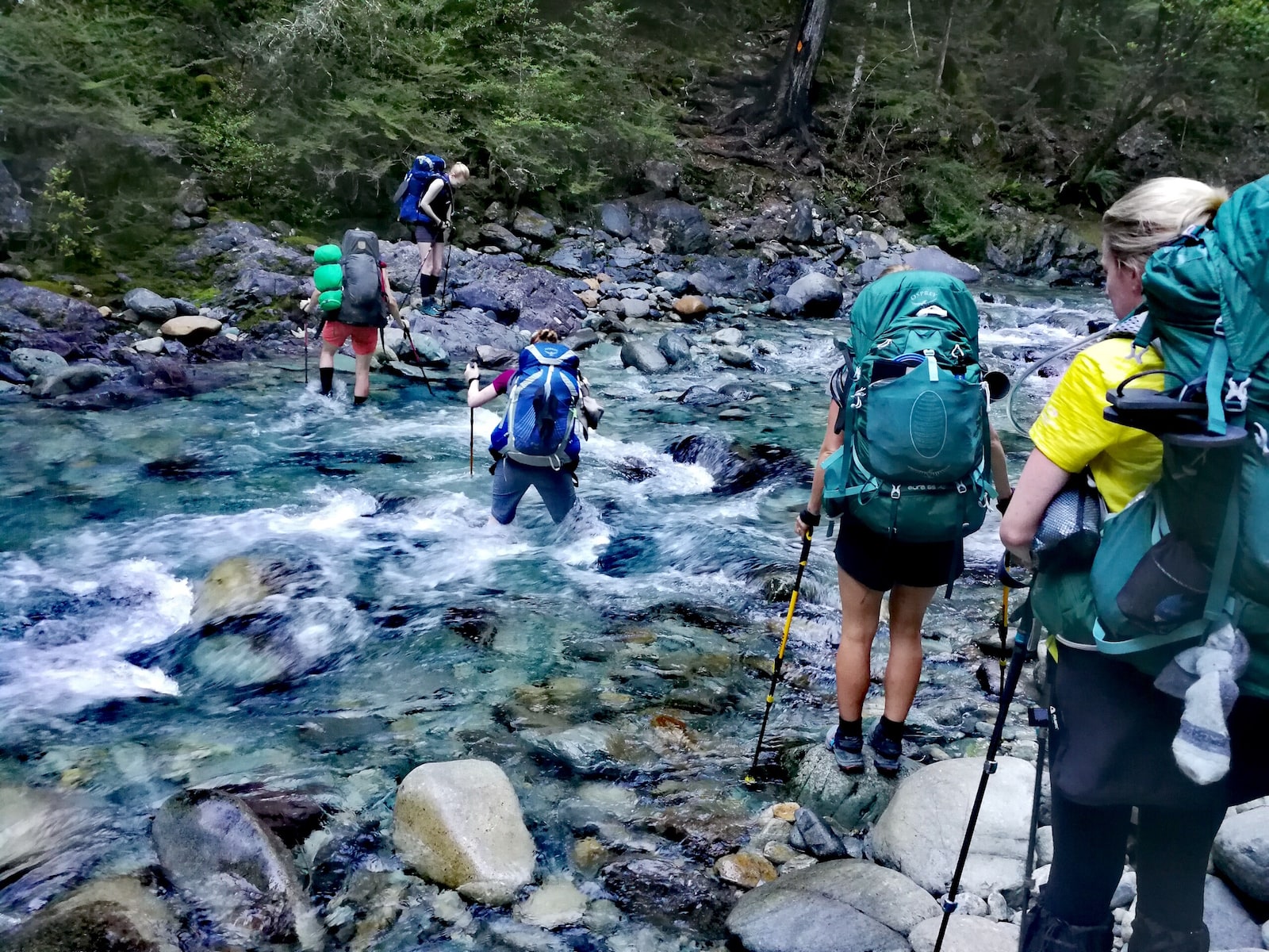
Crossing rivers: a team activity
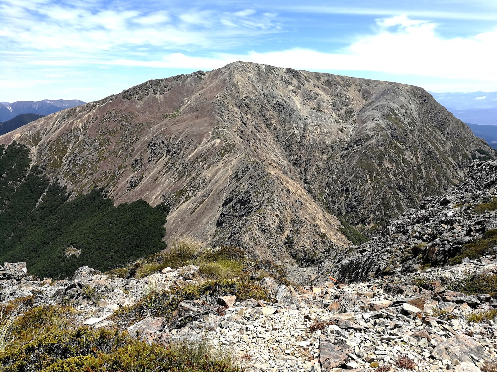
The imposing east face of Mt Rintoul, viewed from Little Rintoul
In Arthur’s Pass National Park I met my first braided river, the Taramakau. The comforting orange triangles or poles that frequently signposted the trail had disappeared, as no path could be set. The river had many shingle-bed strands that shifted position each year, rendering maps useless. Thankfully the weather had been more settled post-cyclone and the deepest channels only went slightly over my knees.
In the days heading towards the Rakaia – a river deemed too hazardous to cross by the Te Araroa Trust – I began to feel nauseous and lost my appetite again. When we hitched out to a town to get around the river I decided to stay behind until I recovered from a stomach bug. Again, it surprised me that I would rather miss a few days of the trail than fall behind my friends, but hitching down the trail to meet back up with them on the south side of the Rangitata River was a decision I was happy with.
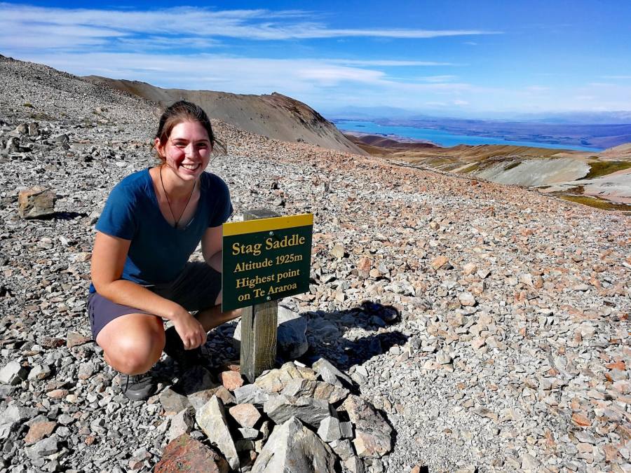
I might not have been as fully recovered as I’d convinced myself. As I climbed up to Stag Saddle, it felt like it kept moving up out of reach. I eventually made it, and the views from the top of the highest point on the trail were incredible; a long ridge drew the eyes down to the opal blue of Lake Tekapo, with a wall of mountains as the backdrop, including Mount Cook. I grinned the whole way down. In fact, I found myself spontaneously grinning to myself every day on the walk. I was just reminding myself each day how lucky I was to be there, and appreciating the moment.
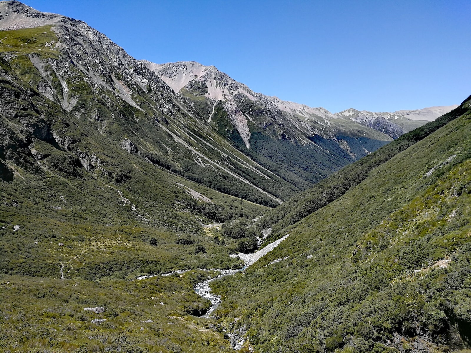
Following the river out of the valley, Nelson Lakes
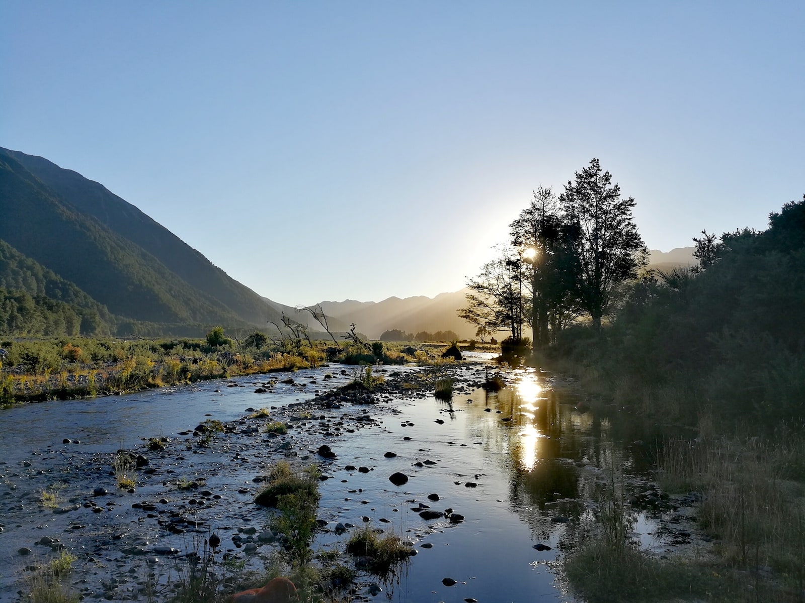
Sunrise from camp in Arthur’s Pass National Park
The aftermath of Cyclone Gita on the East Ahuriri Track
Tekapo was a shock to the senses – it was packed out for Chinese New Year. We stayed the night, then pedalled out on hired bikes to Twizel, a change in pace from walking. Tekapo is a dark sky area, known for wonderful night skies. It was beautiful and I could easily see the Milky Way, but I’d argue that the clear nights I’d witnessed on the trail, three days from any light pollution from town, were more remarkable. There’s nothing like staring up at a twinkle in the sky to be reminded of your own fantastic insignificance.
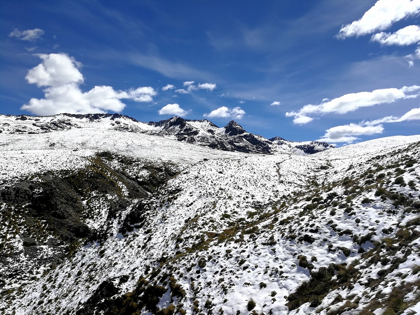
A second cyclone was inbound. At least this time we knew about it beforehand, and hunkered down in a lakeside cabin for a couple of days. When we emerged, the mountains were blanketed in snow – over a metre in some places, in the middle of summer. I was worried the snow would make the path more unsafe than usual, as none of us had crampons or proper winter gear, but it turned out to be fine and great fun, even if my feet were rather cold.
It’s one of the things that I love about walking; it’s a middle finger to a world obsessed by ridiculous beauty standards, it’s prioritising what my body can do and how it makes me feel over how it looks
Phone reception was rare on the trail. I used my Garmin InReach Explorer+ to get a weather forecast when needed. On the stretch towards Wanaka the satellite device gave such a different forecast than our old one that we stopped walking earlier than planned, spending a stormy night in a rat-infested dirt hut rather than facing the squall on the peaks. The next day we were rewarded with clear skies and stunning views from Breast Hill with a spectacular ridge walk down to Lake Hawea.
After a rollercoaster of remote mountain cols and valley lows from Wanaka, Queenstown was a whirlwind of tourist activity. I had a rest day, ate a Fergberger (amongst 3,000 other calories that day as Hiker Hunger had arrived), and got a shuttle around Lake Wakatipu, another natural break in the TA trail. The trail mellowed out a bit, and I marvelled at what two months of walking does to the human body. Whilst the days never became ‘easy’, I felt like my body was working with me rather than against me. My aerobic capacity had adapted to the long days, my calves and thighs to the long climbs. It’s one of the things that I love about walking; it’s a middle finger to a world obsessed by ridiculous beauty standards, it’s prioritising what my body can do and how it makes me feel over how it looks. It’s the amazement I feel every time I stand on the mountain top that looked so unreachable from the bottom – my own two legs got me up there. And quite a bit of Nutella.
Moving on from the sparkling Mavora Lakes, the TA wound to a close with a mix of everything encountered so far – farmland, rivers, dense forests, marshy tussock plains, beach and road. The Longwood Forest was ethereally silent, and the moss-covered podocarp and beech trees were hundreds of years old. I wondered what the world looked like when these were saplings.
- Interested to learn how her gear choices held up over the length of the trail? Kat has recently published a very interesting gear debrief.
Currently the Te Araroa finishes with a rather uninspiring road walk along State Highway 1. I believe by next year a cycle and footpath will have been developed, but I spent the last day of my 68-day trip walking inches from logging trucks, whilst singing at the top of my lungs in the rain. I waited for my friends when I got to Bluff (and stopped singing) and we strolled the last few kilometres to Stirling Point together in the sun, until the Southern Ocean meant we could walk no further. My shoes were shredded, my legs hairy and scratched, my hips bruised, my hair windswept, and I felt incredible.
Kat Young is an environmental consultant, mountain lover and backpacker who regularly eats Nutella out of the jar. You can find out more on her website, Attitude Over Ability. Follow her on Twitter.


